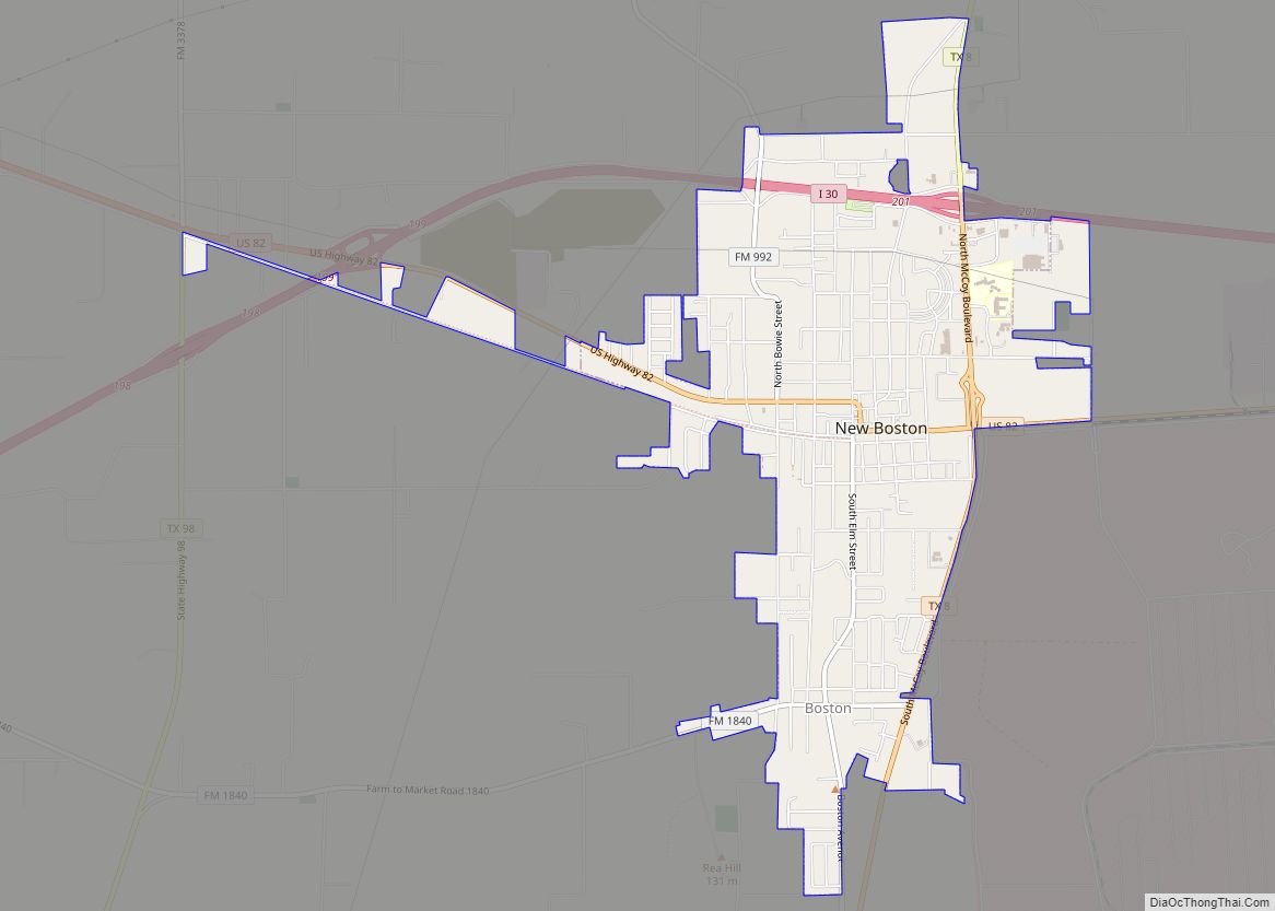
New Boston is a city in Bowie County, Texas, United States. Boston was named for an early storekeeper in the settlement, W.J. Boston. The coming of the railroads led to the location of two more Bostons. A depot was built about four miles north of Boston and was named New Boston. The original Boston then became Old Boston. The courthouse was moved to Texarkana in the early 1880s but a later election carried to move the courthouse back to the geographic center of the county. This location was between the Bostons. The Post Office Department named this location Boston, so Bowie County has claim to three Bostons: New Boston, Boston, and Old Boston. The population was 4,550 at the 2010 census, and 4,612 in 2020.
| Name: | New Boston city |
|---|---|
| LSAD Code: | 25 |
| LSAD Description: | city (suffix) |
| State: | Texas |
| County: | Bowie County |
| Elevation: | 358 ft (109 m) |
| Total Area: | 4.03 sq mi (10.44 km²) |
| Land Area: | 4.00 sq mi (10.36 km²) |
| Water Area: | 0.03 sq mi (0.08 km²) |
| Total Population: | 4,612 |
| Population Density: | 1,100/sq mi (440/km²) |
| ZIP code: | 75570 |
| Area code: | 903 |
| FIPS code: | 4850808 |
| GNISfeature ID: | 1363692 |
| Website: | www.nbcity.org |
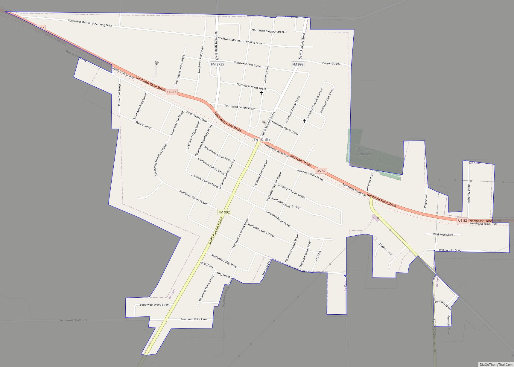
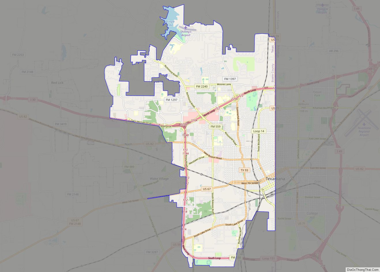
Online Interactive Map
Click on ![]() to view map in "full screen" mode.
to view map in "full screen" mode.
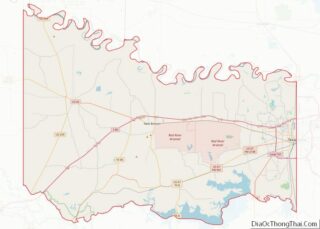
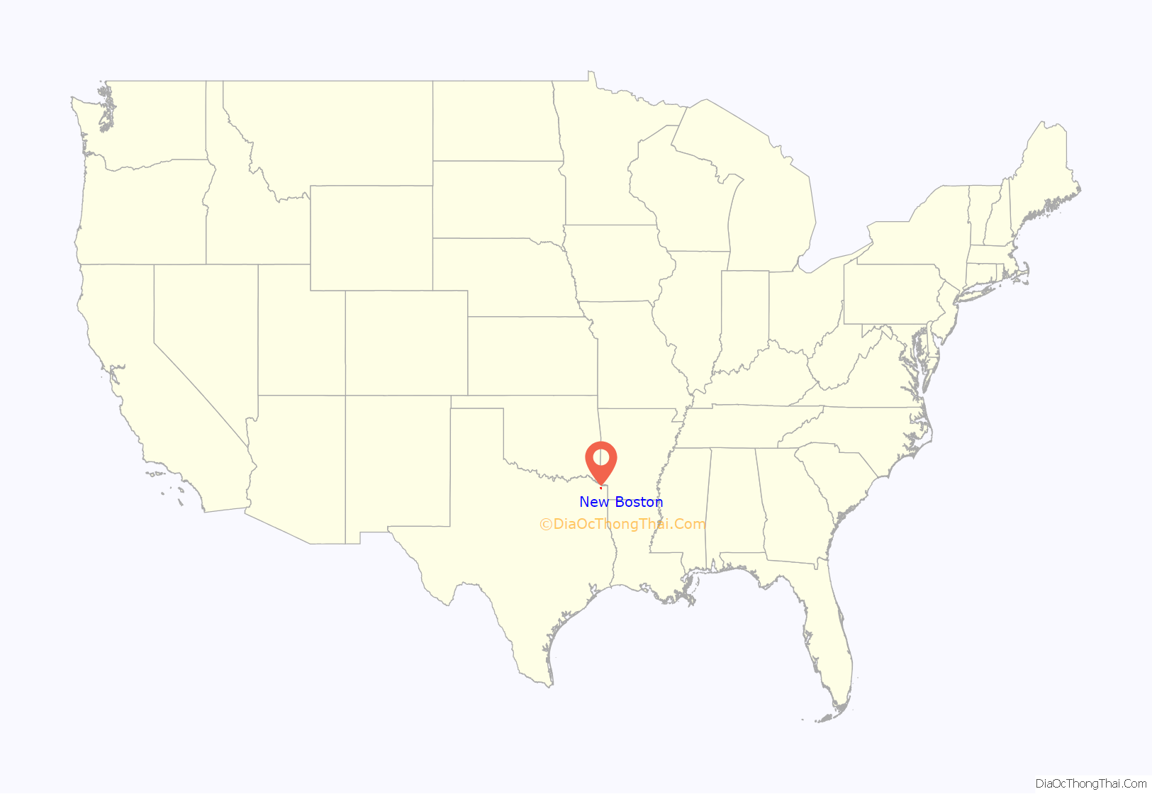
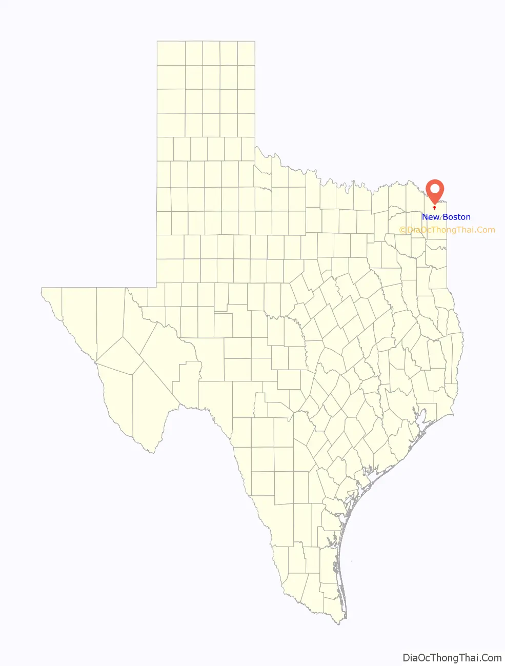
New Boston location map. Where is New Boston city?
History
The Red River Expedition (1806) was stopped by the Spanish in the vicinity of the town.
When the Missouri Pacific Railroad was being constructed 4 miles (6 km) north of the village of Boston (now Old Boston) in the summer of 1876, it was clear to many businessmen in the town that it would suffer a serious decline as a result of its distance from the line. At a mass meeting, J. H. Smelser, a local resident and surveyor for the railroad, was selected to meet with railroad officials to secure the location of a depot at a point on the line nearest to Boston. The negotiations were successful, and in September 1876, lots were laid out and put up for sale on 100 acres (0.40 km) that the railroad had purchased. Because most of those engaged in the project were from Boston, the new town was named New Boston.
A post office was established in 1877 with L. C. DeMorse as postmaster. The town grew rapidly, and by 1884, it had 400 residents, two churches, a school, several mills and gins, and a newspaper, the New Boston Herald, edited by W. W. West. A furniture factory and another newspaper, the Bowie County Populist, were added in the 1890s.
By 1900, the town had a population of 762. It grew slowly until the late 1920s, when a short-lived boom raised the population from 869 in 1925 to 1,300 in 1929. The population fell to 949 by 1931. During World War II, the Lone Star Army Ammunition Plant and the Red River Army Depot were constructed just southeast of New Boston. The two massive military installations were probably responsible for the town’s rapid growth in the 1940s. The population grew from 1,111 in 1940, then to 2,688 in 1950. In 1980, it reached 4,628. Although an International Paper mill, the Barry Telford state prison and a few smaller factories provided some industrial base for the town, New Boston depends heavily on the two military installations for its continued prosperity. The town had 5,057 residents in 1990 and 4,550 residents in 2010.
New Boston is known for its Pioneer Days Festival and Rodeo. The townfolk gather at the T&P Trailhead Park for entertainment such as carnival rides, street dances, and live musical and comedy presentations.
On the evening of November 4, 2022, an EF3 tornado hit the western outskirts of the city, causing minor damage.
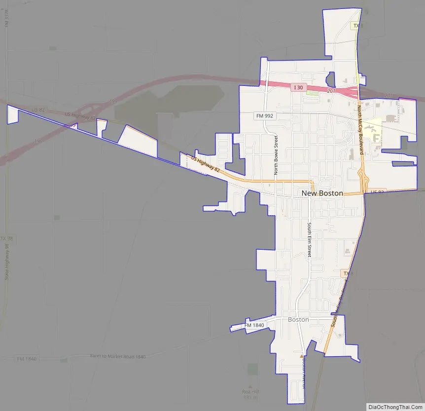
New Boston Road Map
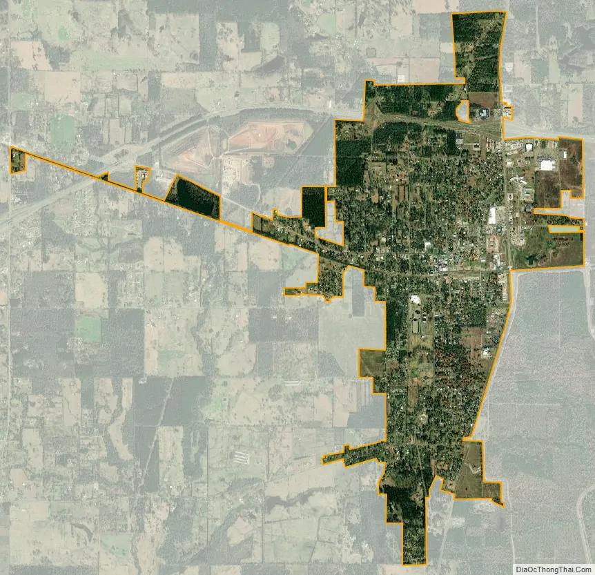
New Boston city Satellite Map
Geography
New Boston is located near the center of Bowie County at 33°27′38″N 94°25′2″W / 33.46056°N 94.41722°W / 33.46056; -94.41722 (33.460551, –94.417246). U.S. Route 82 passes through the center of the city, and Interstate 30 runs through the northern part of the city, with access from Exits 199 and 201. By either route, it is 22 miles (35 km) east to Texarkana. I-30 leads southwest 40 miles (64 km) to Mount Pleasant, and US 82 leads west-northwest 70 miles (110 km) to Paris. Texas State Highway 8 leads south 4 miles (6.4 km) to Old Boston, the site of original town settlement in the 1800s, and north 7 miles (11 km) to the Red River and the border with the state of Arkansas continuing into Arkansas as Arkansas State Highway 41 to De Queen and junction US Routes 70 and 71. The Red River Army Depot borders the southeastern edge of New Boston.
According to the United States Census Bureau, the city has a total area of 3.3 square miles (8.5 km), all of it land.
Climate
The climate in this area is characterized by hot, humid summers and generally mild to cool winters. According to the Köppen climate classification system, New Boston has a humid subtropical climate, Cfa on climate maps.
See also
Map of Texas State and its subdivision:- Anderson
- Andrews
- Angelina
- Aransas
- Archer
- Armstrong
- Atascosa
- Austin
- Bailey
- Bandera
- Bastrop
- Baylor
- Bee
- Bell
- Bexar
- Blanco
- Borden
- Bosque
- Bowie
- Brazoria
- Brazos
- Brewster
- Briscoe
- Brooks
- Brown
- Burleson
- Burnet
- Caldwell
- Calhoun
- Callahan
- Cameron
- Camp
- Carson
- Cass
- Castro
- Chambers
- Cherokee
- Childress
- Clay
- Cochran
- Coke
- Coleman
- Collin
- Collingsworth
- Colorado
- Comal
- Comanche
- Concho
- Cooke
- Coryell
- Cottle
- Crane
- Crockett
- Crosby
- Culberson
- Dallam
- Dallas
- Dawson
- Deaf Smith
- Delta
- Denton
- Dewitt
- Dickens
- Dimmit
- Donley
- Duval
- Eastland
- Ector
- Edwards
- El Paso
- Ellis
- Erath
- Falls
- Fannin
- Fayette
- Fisher
- Floyd
- Foard
- Fort Bend
- Franklin
- Freestone
- Frio
- Gaines
- Galveston
- Garza
- Gillespie
- Glasscock
- Goliad
- Gonzales
- Gray
- Grayson
- Gregg
- Grimes
- Guadalupe
- Hale
- Hall
- Hamilton
- Hansford
- Hardeman
- Hardin
- Harris
- Harrison
- Hartley
- Haskell
- Hays
- Hemphill
- Henderson
- Hidalgo
- Hill
- Hockley
- Hood
- Hopkins
- Houston
- Howard
- Hudspeth
- Hunt
- Hutchinson
- Irion
- Jack
- Jackson
- Jasper
- Jeff Davis
- Jefferson
- Jim Hogg
- Jim Wells
- Johnson
- Jones
- Karnes
- Kaufman
- Kendall
- Kenedy
- Kent
- Kerr
- Kimble
- King
- Kinney
- Kleberg
- Knox
- La Salle
- Lamar
- Lamb
- Lampasas
- Lavaca
- Lee
- Leon
- Liberty
- Limestone
- Lipscomb
- Live Oak
- Llano
- Loving
- Lubbock
- Lynn
- Madison
- Marion
- Martin
- Mason
- Matagorda
- Maverick
- McCulloch
- McLennan
- McMullen
- Medina
- Menard
- Midland
- Milam
- Mills
- Mitchell
- Montague
- Montgomery
- Moore
- Morris
- Motley
- Nacogdoches
- Navarro
- Newton
- Nolan
- Nueces
- Ochiltree
- Oldham
- Orange
- Palo Pinto
- Panola
- Parker
- Parmer
- Pecos
- Polk
- Potter
- Presidio
- Rains
- Randall
- Reagan
- Real
- Red River
- Reeves
- Refugio
- Roberts
- Robertson
- Rockwall
- Runnels
- Rusk
- Sabine
- San Augustine
- San Jacinto
- San Patricio
- San Saba
- Schleicher
- Scurry
- Shackelford
- Shelby
- Sherman
- Smith
- Somervell
- Starr
- Stephens
- Sterling
- Stonewall
- Sutton
- Swisher
- Tarrant
- Taylor
- Terrell
- Terry
- Throckmorton
- Titus
- Tom Green
- Travis
- Trinity
- Tyler
- Upshur
- Upton
- Uvalde
- Val Verde
- Van Zandt
- Victoria
- Walker
- Waller
- Ward
- Washington
- Webb
- Wharton
- Wheeler
- Wichita
- Wilbarger
- Willacy
- Williamson
- Wilson
- Winkler
- Wise
- Wood
- Yoakum
- Young
- Zapata
- Zavala
- Alabama
- Alaska
- Arizona
- Arkansas
- California
- Colorado
- Connecticut
- Delaware
- District of Columbia
- Florida
- Georgia
- Hawaii
- Idaho
- Illinois
- Indiana
- Iowa
- Kansas
- Kentucky
- Louisiana
- Maine
- Maryland
- Massachusetts
- Michigan
- Minnesota
- Mississippi
- Missouri
- Montana
- Nebraska
- Nevada
- New Hampshire
- New Jersey
- New Mexico
- New York
- North Carolina
- North Dakota
- Ohio
- Oklahoma
- Oregon
- Pennsylvania
- Rhode Island
- South Carolina
- South Dakota
- Tennessee
- Texas
- Utah
- Vermont
- Virginia
- Washington
- West Virginia
- Wisconsin
- Wyoming