Map of Antimony town

Map of Antimony town

Antimony is a town in Garfield County, Utah, United States. The population was 122 at the 2010 census, the same as the 2000 census. Antimony town overview: Name: Antimony town LSAD Code: 43 LSAD Description: town (suffix) State: Utah County: Garfield County Incorporated: 1934 Elevation: 6,453 ft (1,967 m) Total Area: 9.82 sq mi (25.44 km²) Land Area: 9.82 sq mi (25.44 km²) … Read more

Map of Annabella town

Map of Annabella town

Annabella is a town in Sevier County, Utah, United States. The population was 795 at the 2010 census, an increase over the 2000 figure of 603. Annabella town overview: Name: Annabella town LSAD Code: 43 LSAD Description: town (suffix) State: Utah County: Sevier County Elevation: 5,292 ft (1,613 m) Total Area: 0.65 sq mi (1.69 km²) Land Area: 0.65 sq mi (1.69 km²) … Read more

Map of Aneth CDP

Map of Aneth CDP

Aneth (Navajo: Tʼáá Bííchʼį́įdii) is a census-designated place (CDP) in San Juan County, Utah, United States. The population was 598 at the 2000 census. The origin of the name Aneth is obscure. Aneth CDP overview: Name: Aneth CDP LSAD Code: 57 LSAD Description: CDP (suffix) State: Utah County: San Juan County Elevation: 4,511 ft (1,375 m) Total … Read more

Map of American Fork city

Map of American Fork city

American Fork is a city in north-central Utah County, Utah, United States, at the foot of Mount Timpanogos in the Wasatch Range, north from Utah Lake. This city is thirty-two miles southeast of Salt Lake City. It is part of the Provo–Orem Metropolitan Statistical Area. The population was 33,337 in 2020. The city has grown … Read more

Map of Amalga town

Map of Amalga town

Amalga (/əˈmælɡə/ ə-MAL-gə) is a town in Cache County, Utah, United States. The population was 488 at the 2010 census. It is included in the Logan, Utah–Idaho (partial) Metropolitan Statistical Area. Many of the town’s population are dairy farmers, with many families owning their own herds. The town contains the Cache Valley Cheese plant. Nearby … Read more

Map of Alton town, Utah

Map of Alton town, Utah

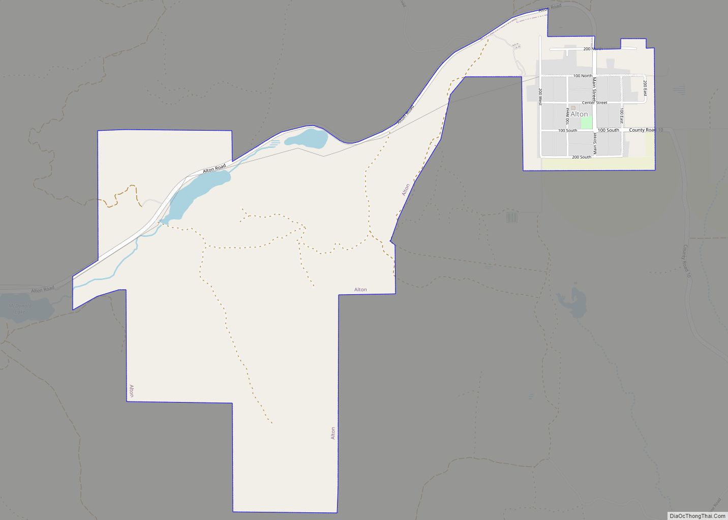
Alton is a town in northwest Kane County, Utah, United States. The population was 119 at the 2010 census, a decrease from the 2000 figure of 134. Alton town overview: Name: Alton town LSAD Code: 43 LSAD Description: town (suffix) State: Utah County: Kane County Founded: 1907 Incorporated: 1935 Elevation: 7,041 ft (2,146 m) Total Area: 2.33 sq mi … Read more

Map of Beryl Junction CDP

Map of Beryl Junction CDP

Beryl Junction (/ˈbɜːrəl/ BUR-əl) is a census-designated place (CDP) in Iron County, Utah, United States. The population was 197 at the 2010 census. Beryl Junction Airport, a small, private airport, is located here. Beryl Junction CDP overview: Name: Beryl Junction CDP LSAD Code: 57 LSAD Description: CDP (suffix) State: Utah County: Iron County Founded: 1909 … Read more

Map of Benson CDP, Utah

Map of Benson CDP, Utah

Benson is a census-designated place (CDP) in Cache County, Utah, United States. It is immediately south of Amalga, across State Route 218, and is west of the Logan-Cache Airport. The population was 1,485 at the 2010 census. It is included in the Logan, Utah-Idaho Metropolitan Statistical Area. The Benson Elementary School is listed on the … Read more

Map of Benjamin CDP, Utah

Map of Benjamin CDP, Utah

Benjamin is a census-designated place (CDP) in Utah County, Utah, United States. It is part of the Provo–Orem Metropolitan Statistical Area. The population was 1,145 at the 2010 census. Benjamin CDP overview: Name: Benjamin CDP LSAD Code: 57 LSAD Description: CDP (suffix) State: Utah County: Utah County Founded: 1860 Elevation: 4,534 ft (1,382 m) Total Area: 12.3 sq mi … Read more

Map of Beaver city, Utah

Map of Beaver city, Utah

Beaver is a city in, and county seat of, Beaver County in southwestern Utah, United States. The population was 3,592 at the 2020 census, up from the 2010 figure of 3,112. Beaver city overview: Name: Beaver city LSAD Code: 25 LSAD Description: city (suffix) State: Utah County: Beaver County Incorporated: January 10, 1867 Elevation: 5,902 ft … Read more

Map of Bear River City city

Map of Bear River City

Bear River City is a city in Box Elder County, Utah, United States. The population was 877 at the 2020 census, up from the 2010 figure of 853. Bear River became a city under state law near the end of 2000. Although current state law requires a minimum population of 1000 for cities, Bear River … Read more

Map of Bluff town

Map of Bluff town

Bluff is a town in San Juan County, Utah, United States. The population was 320 at the 2000 census. Bluff incorporated in 2018. Ann Leppanen is currently the mayor. Bluff town overview: Name: Bluff town LSAD Code: 43 LSAD Description: town (suffix) State: Utah County: San Juan County Founded: April 6, 1880 Incorporated: August 31, … Read more