Beaver is a city in, and county seat of, Beaver County in southwestern Utah, United States. The population was 3,592 at the 2020 census, up from the 2010 figure of 3,112.
| Name: | Beaver city |
|---|---|
| LSAD Code: | 25 |
| LSAD Description: | city (suffix) |
| State: | Utah |
| County: | Beaver County |
| Incorporated: | January 10, 1867 |
| Elevation: | 5,902 ft (1,799 m) |
| Total Area: | 6.68 sq mi (17.30 km²) |
| Land Area: | 6.68 sq mi (17.30 km²) |
| Water Area: | 0.00 sq mi (0.00 km²) |
| Total Population: | 3,592 |
| Population Density: | 540/sq mi (210/km²) |
| ZIP code: | 84713 |
| Area code: | 435 |
| FIPS code: | 4904060 |
| GNISfeature ID: | 1438510 |
| Website: | www.beaverutah.net |
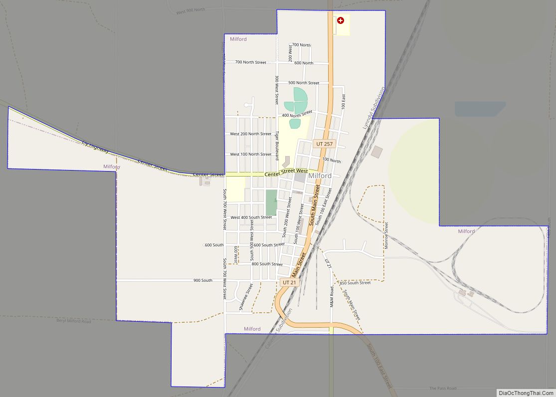
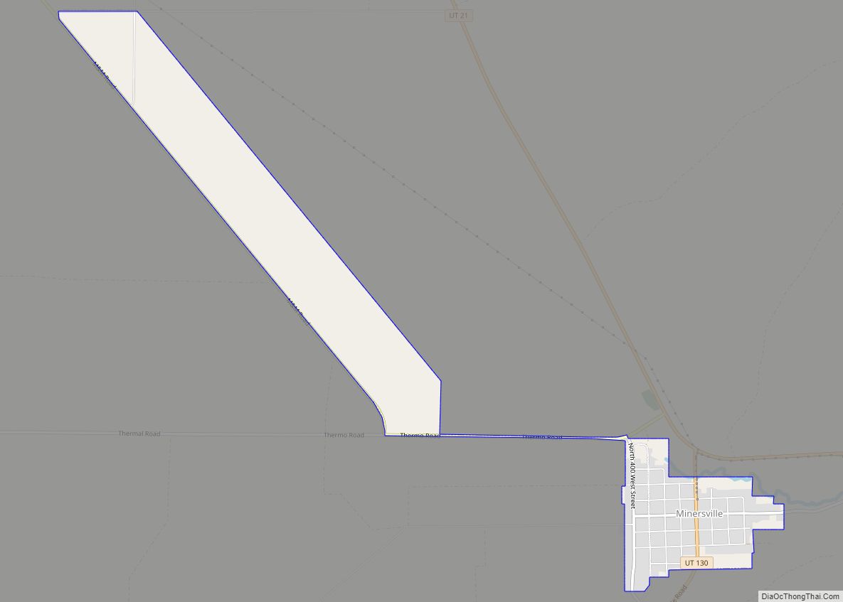
Online Interactive Map
Click on ![]() to view map in "full screen" mode.
to view map in "full screen" mode.
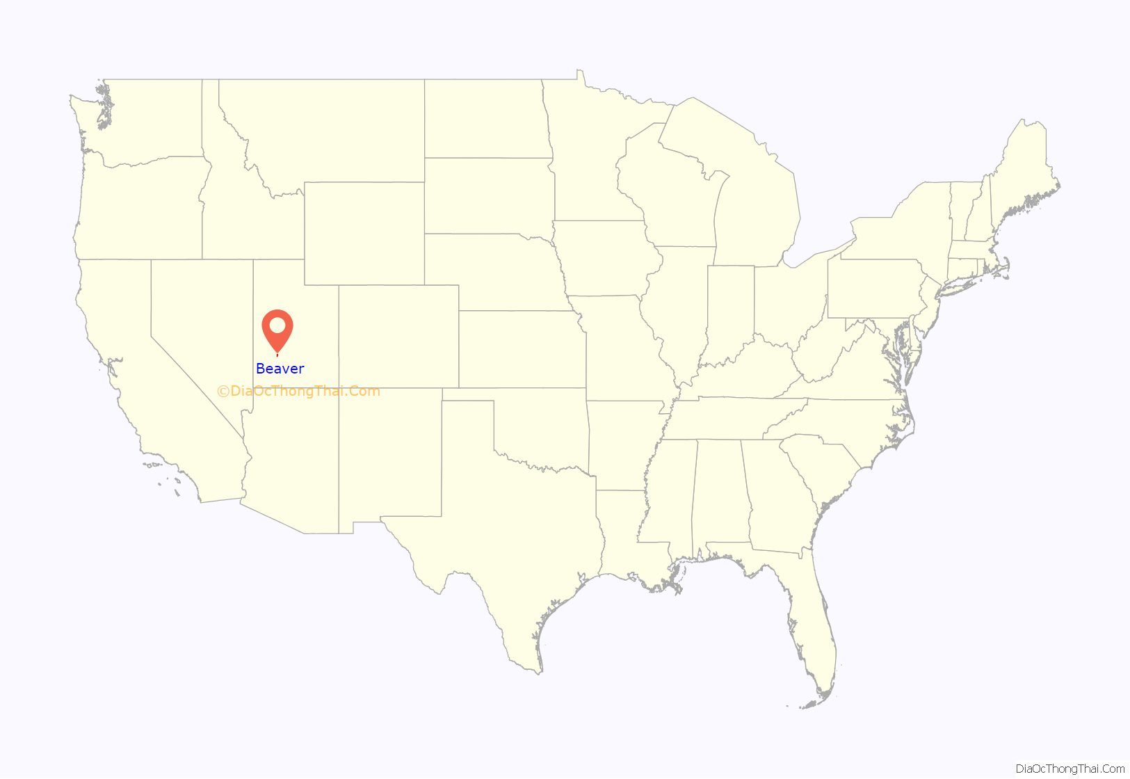
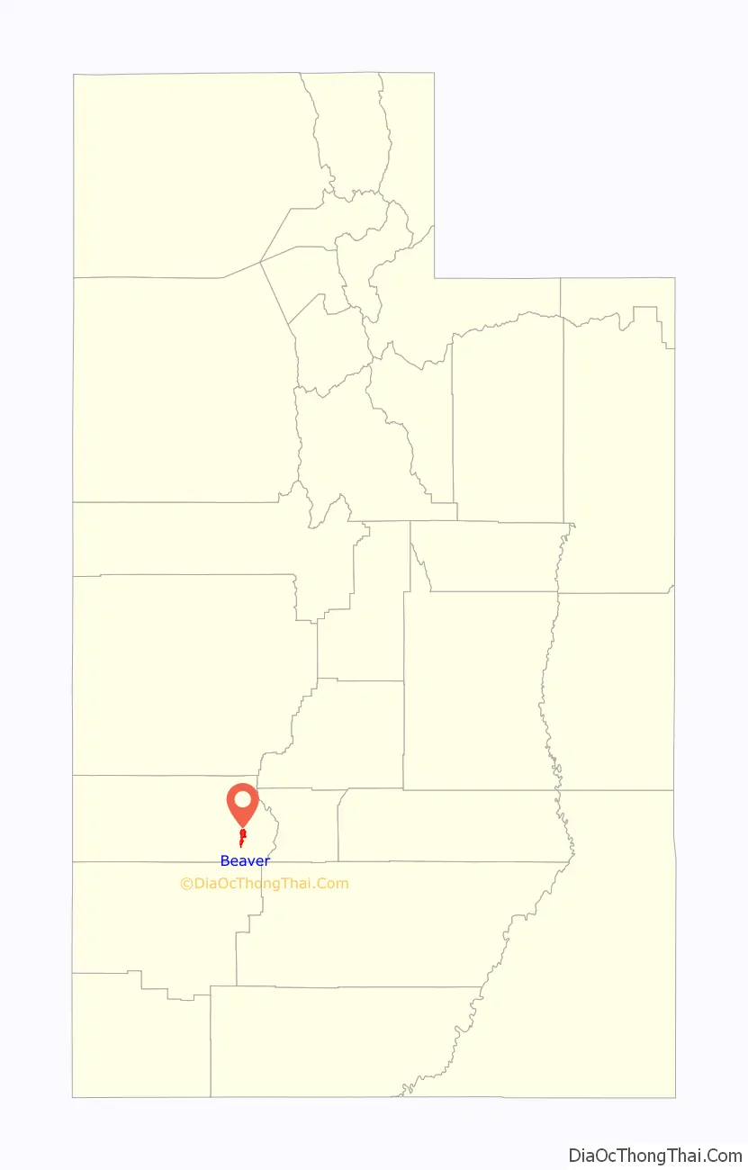
Beaver location map. Where is Beaver city?
History
Indigenous peoples lived in this area for thousands of years, as shown by archeological evidence. A number of identified prehistoric sites have been found in Beaver County, dating to the Archaic and Sevier Fremont periods. A prehistoric obsidian quarry site has been identified in the nearby Mineral Mountains.
The historic Southern Paiute inhabited the region well before encountering the first European explorers. The 1776 Dominguez–Escalante Expedition is the first known European exploration in this area.
In 1847–1848, Mormons from the United States developed a trade route through the Beaver River valley between their new settlements at Salt Lake City in the Utah Territory and Los Angeles, which was still part of Alta California, Mexico. The original route crossed the river three miles downstream from Beaver at the site that later was developed as Greenville. This route became known during the California Gold Rush as the Southern Route of the California Trail. Later called the Mormon Road or California Road, it passed over the Black Mountains between the crossing and Muley Point. Following the United States’ victory in the Mexican–American War (1846–1848), it took over California and the Southwest.
In 1855, as part of improvements, the Mormon Road over the Black Mountains was realigned eastward. It was routed from the site that developed as Beaver to Muley Point through more wagon-friendly terrain in Nevershine Hollow and over Beaver Ridge into the canyon of Fremont Wash, rejoining the original road above Muley Point. This road became a winter commercial wagon road, known in California as the Los Angeles – Salt Lake Road, and in Mormon settlements in Utah and Arizona Territory (now southern Nevada) as the California Road.
Beaver was settled in 1856 by Mormon pioneers traveling this road; it was one of a string of Mormon settlements along the road through Utah. By design, these settlements were located a day’s ride on horseback apart, which explains the regularity of their spacing. They were generally 30 miles (48 km) apart. Where intervening settlements failed or were absorbed, they became 60 miles (97 km) apart. Beaver was developed between the settlements in the Pahvant Valley and those in the Parowan Valley.
In 1873 the US Army established Fort Cameron, two miles from Beaver, because of Indian raids on the area Mormon settlements. To serve this isolated area, the territorial government placed the Second Judicial Court of the Utah Territory in Beaver from 1870 until 1896, when Utah became a state. Also included in this court’s jurisdiction were Iron, Washington, Kane, Garfield, and Piute counties.
In 1856, Mormons migrated to the Beaver Valley from Parowan to the south. George A. Smith called a council meeting in February 1856, and the men elected Simeon F. Howd as presiding elder and Edward W. Thompson, clerk. In 1858, numerous migrants from San Bernardino, California, settled here. In December 1859, W. W. Willis and P. K. Smith were authorized by the council to build a sawmill and gristmill on North Creek, and given control of all water on the mill site. By 1869, the Mormon settlers in Beaver were numerous enough to organize a stake. The first stake president was John Murdock.
During the 1870s, settlers made an effort to establish a woolen mill, a tannery, and a dairy industry. Most were engaged in stock raising.
Beaver was the first town in Utah to be electrified. A hydroelectric generation plant was constructed on the Beaver River early in the 20th century. The plant continues to provide a large part of Beaver’s power requirements today. Although, contrary to popular belief, it is not locally referred to as “Beaver Dam!”
In 2006, Beaver won a contest for best tasting rural water in the United States. In 2010, Beaver took top honors in the world for best tasting water. Its welcome billboards along I-15 highlight the water quality.
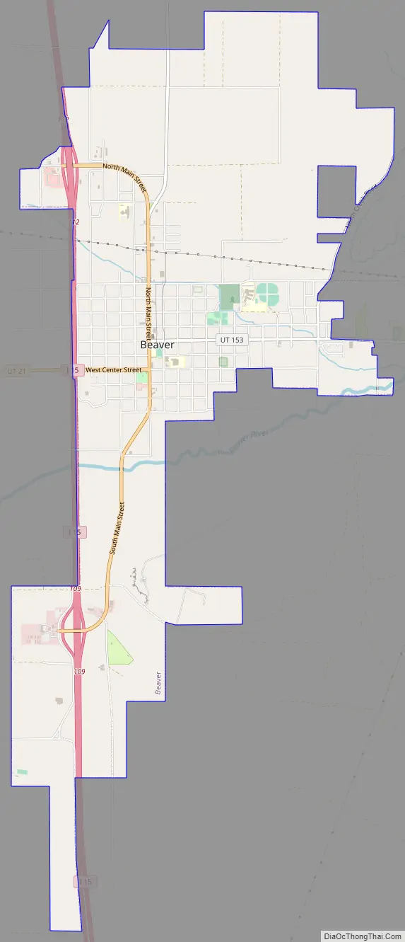
Beaver Road Map
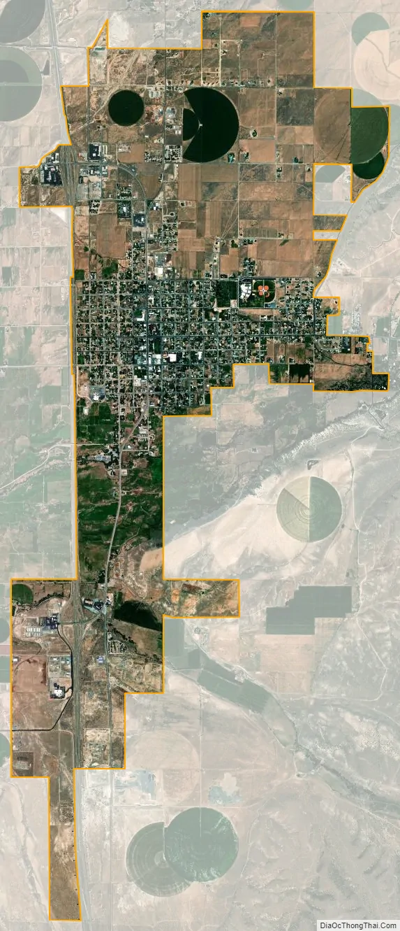
Beaver city Satellite Map
Geography
Beaver is located in eastern Beaver County, along Interstate 15, the main artery for the state. To the east of Beaver lie the Tushar Mountains. The peaks in these mountains rise to over 12,000 ft (3,700 m). The Beaver River flows out of the mountains and through the city of Beaver, passing south of downtown before continuing west towards Minersville and the Escalante Desert basin. The Mineral Mountains rise to the west of Beaver, and the South Hills are to the south.
Interstate 15 runs along the western edge of Beaver, with access from exits 109 and 112. I-15 leads north 22 mi (35 km) to the western end of Interstate 70 at Cove Fort, 55 mi (89 km) to Fillmore, and 199 mi (320 km) to Salt Lake City and south 53 mi (85 km) to Cedar City, 104 mi (167 km) to St George, and 223 mi (359 km) to Las Vegas. Utah State Route 153 heads east from Beaver across the Tushar Mountains 40 mi (64 km) to Junction, and Utah State Route 21 runs west through the Beaver River Valley 17 mi (27 km) to Minersville.
The American Discovery Trail runs through Beaver.
An important Beaver landmark is the hillside letter B, which is visible from the freeway (38°15′52.26″N 112°34′57.2″W / 38.2645167°N 112.582556°W / 38.2645167; -112.582556 (B for Beaver)).
According to the United States Census Bureau, the city has a total area of 6.5 sq mi (16.8 km), all land.
Climate
Beaver has a typical Intermountain Region cool semi-arid climate (Köppen BSk), bordering on a humid continental climate (Dfb), with summers characterized by hot days and chilly nights, and cold winters with moderate snowfall.
During the summer, days are hot and usually dry, though on occasions, as in July 1936 – the wettest month on record with 5.76 inches or 146.3 millimetres – monsoonal weather can bring heavy thunderstorms from the Gulf of California. Owing to the absence of cloudiness caused by the Great Salt Lake, nights are much cooler than in Salt Lake City or Ogden during this season. The hottest recorded temperature in Beaver is 102 °F or 38.9 °C, which has occurred twice on June 21, 1913, and July 26, 1931, and 23.3 days will on average top 90 °F or 32.2 °C, although the hottest monthly mean minimum is only 62.0 °F or 16.7 °C in July 1968.
Winters are cold, though not severe, and generally dry, with the city’s intermountain valley location making it sufficiently dry that only 34.1 inches or 0.87 metres of snowfall can be expected each winter. Typically temperatures fall below freezing on all but six nights during winter and on 193.7 nights during an entire year; however maxima will top freezing on all but 14.3 afternoons. Temperatures below 0 °F or −17.8 °C occur on 9.8 nights per winter, and the coldest temperature on record is −34 °F or −36.7 °C on February 9, 1933, during an exceptionally cold western winter. The most snowfall has been at least 80.50 inches (2.045 m) between July 1948 and June 1949, and the most in a month 33.5 inches (0.85 m) during the notoriously cold January 1949 which averaged a record low 9.9 °F or −12.3 °C with mean minimum as low as −2.1 °F or −18.9 °C; by way of contrast, no measurable snow fell during the mild, dry winter of 1962–63. The wettest calendar year has been 1936 with 20.78 inches (527.8 mm) and the driest 1956 with 5.82 inches (147.8 mm); the most in one day being 2.17 inches (55.1 mm) on September 20, 1911.
See also
Map of Utah State and its subdivision: Map of other states:- Alabama
- Alaska
- Arizona
- Arkansas
- California
- Colorado
- Connecticut
- Delaware
- District of Columbia
- Florida
- Georgia
- Hawaii
- Idaho
- Illinois
- Indiana
- Iowa
- Kansas
- Kentucky
- Louisiana
- Maine
- Maryland
- Massachusetts
- Michigan
- Minnesota
- Mississippi
- Missouri
- Montana
- Nebraska
- Nevada
- New Hampshire
- New Jersey
- New Mexico
- New York
- North Carolina
- North Dakota
- Ohio
- Oklahoma
- Oregon
- Pennsylvania
- Rhode Island
- South Carolina
- South Dakota
- Tennessee
- Texas
- Utah
- Vermont
- Virginia
- Washington
- West Virginia
- Wisconsin
- Wyoming