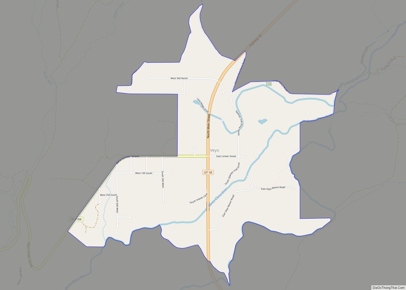
Map of Washington Terrace city
Washington Terrace, is a city in Weber County, Utah, United States. The population was 9,067 at the 2010 census. It is part of the Ogden–Clearfield, Utah Metropolitan Statistical Area. Washington Terrace had its foundings when it was developed in 1948 from a war time housing project. George Herman Van Leeuwen was instrumental in securing the ... Read more
Map of Washington Terrace city
Map of Wanship CDP
Wanship (/ˈwɑːnʃɪp/ WAHN-ship) is a census-designated place in Summit County, Utah, United States. The population was 400 at the 2010 census. Wanship is located at the intersection of Interstate 80 and Utah State Route 32, at the junction of Silver Creek and the Weber River. It is 37 miles (60 km) from Salt Lake City, and ... Read more
Map of Wanship CDP
Map of Wallsburg town
Wallsburg is a town in Wasatch County, Utah, United States. It is part of the Salt Lake City metropolitan area. The population was 250 at the 2010 census. Wallsburg was established in 1861, and was named for William Madison Wall. Wallsburg town overview: Name: Wallsburg town LSAD Code: 43 LSAD Description: town (suffix) State: Utah ... Read more
Map of Wallsburg town
Map of Wales town, Utah
Wales is a town in Sanpete County, Utah, United States. The population was 219 at the 2000 census. The town is governed by a mayor and several council members. As of December 2008, Wales had no stores, gas stations nor stop lights. It does have a park, fire station, library and cemetery. Wales town overview: ... Read more
Map of Wales town, Utah
Map of White City metro township, Utah
White City is a metro township in Salt Lake County, Utah, United States. The township is an enclave of the City of Sandy. The population was 5,407 at the 2010 census, a modest decrease from the 2000 population of 5,988. White City metro township overview: Name: White City metro township LSAD Code: 35 LSAD Description: ... Read more
Map of White City metro township, Utah
Map of West Wood CDP
West Wood is a census-designated place (CDP) in Carbon County, Utah, United States. The population was 844 at the 2010 census. West Wood CDP overview: Name: West Wood CDP LSAD Code: 57 LSAD Description: CDP (suffix) State: Utah County: Carbon County Elevation: 5,617 ft (1,712 m) Total Area: 1.0 sq mi (2.7 km²) Land Area: 1.0 sq mi (2.7 km²) Water Area: 0.0 sq mi ... Read more
Map of West Wood CDP
Map of West Point city, Utah
West Point is a city in Davis County, Utah, United States. It is part of the Ogden–Clearfield, Utah Metropolitan Statistical Area. The population was 9,511 at the 2010 census, up from 6,033 in 2000. The estimated population in 2019 was 10,957. The city has experienced quick growth centered primarily around single-family residential construction. West Point ... Read more
Map of West Point city, Utah
Map of West Mountain CDP
West Mountain is a census-designated place (CDP) in Utah County, Utah, United States. It is part of the Provo–Orem Metropolitan Statistical Area. As of the 2010 census, the CDP population was 1,186. The town is at the base of West Mountain (site of the West Mountain Observatory) and bears its name. West Mountain CDP overview: ... Read more
Map of West Mountain CDP
Map of West Haven city, Utah
West Haven is a city in Weber County, Utah, United States. The population was 10,272 at the 2010 census. It was incorporated on July 1, 1991, combining the unincorporated communities of Kanesville and Wilson. West Haven is located approximately 35 miles (56 km) north of Salt Lake City, west of the Wasatch Mountains in northern Utah. ... Read more
Map of West Haven city, Utah
Map of West Bountiful city
West Bountiful is a city in Davis County, Utah, United States. It is part of the Ogden–Clearfield, Utah Metropolitan Statistical Area. The population was 5,265 at the 2010 census, with an estimated population of 5,731 in 2018. West Bountiful city overview: Name: West Bountiful city LSAD Code: 25 LSAD Description: city (suffix) State: Utah County: ... Read more
Map of West Bountiful city
Map of Wendover city
Wendover is a city on the western edge of Tooele County, Utah, United States. The population was 1,115 at the 2020 census. Wendover city overview: Name: Wendover city LSAD Code: 25 LSAD Description: city (suffix) State: Utah County: Tooele County Founded: 1908 Elevation: 4,291 ft (1,308 m) Total Area: 8.93 sq mi (23.12 km²) Land Area: 8.93 sq mi (23.12 km²) Water Area: ... Read more
Map of Wendover city
Map of Wellsville city, Utah
Wellsville is a city in Cache County, Utah, United States. The population was 3,432 at the 2010 census, with an estimated population of 3,849 in 2018. It is included in the Logan, Utah-Idaho Metropolitan Statistical Area. Wellsville was laid out in 1856, and named after Daniel H. Wells, a Mormon leader. Wellsville city overview: Name: ... Read more
Map of Wellsville city, Utah