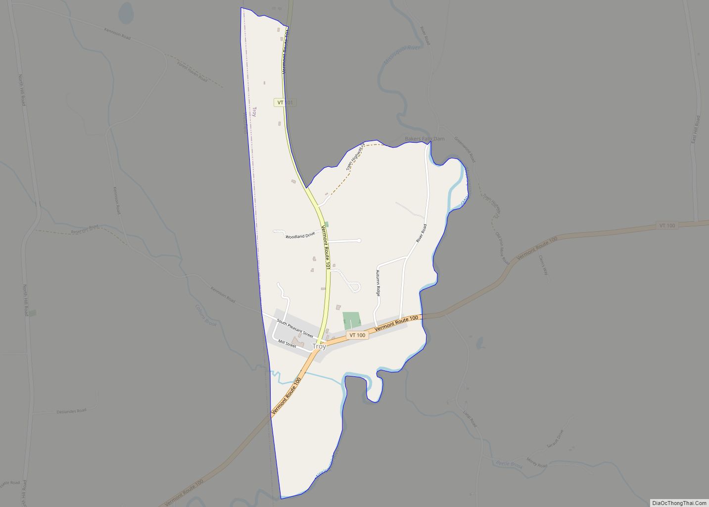
Map of Waitsfield CDP
Waitsfield is a census-designated place (CDP) in the town of Waitsfield, Washington County, Vermont, United States. The population of the CDP was 164 at the 2010 census. Waitsfield CDP overview: Name: Waitsfield CDP LSAD Code: 57 LSAD Description: CDP (suffix) State: Vermont County: Washington County Elevation: 700 ft (200 m) Total Area: 0.40 sq mi (1.03 km²) Land Area: 0.39 sq mi ... Read more
Map of Waitsfield CDP
Map of Vergennes city, Vermont
Vergennes city overview: Name: Vergennes city LSAD Code: 25 LSAD Description: city (suffix) State: Vermont County: Addison County FIPS code: 5074650 Online Interactive Map Vergennes online map. Source: Basemap layers from Google Map, Open Street Map (OSM), Arcgisonline, Wmflabs. Boundary Data from Database of Global Administrative Areas. Vergennes location map. Where is Vergennes city? Vergennes ... Read more
Map of Vergennes city, Vermont
Map of White River Junction CDP
White River Junction is an unincorporated village and census-designated place (CDP) in the town of Hartford in Windsor County, Vermont, United States. The population was 2,528 at the 2020 census, up from 2,286 in 2010, making it the largest community within the town of Hartford. The village includes the White River Junction Historic District, a ... Read more
Map of White River Junction CDP
Map of Westminster village, Vermont
Westminster is a town in Windham County, Vermont, United States. The population was 3,016 at the 2020 census. It is also the first capital of the Republic of Vermont. It borders the state of New Hampshire. Westminster village overview: Name: Westminster village LSAD Code: 47 LSAD Description: village (suffix) State: Vermont County: Windham County Elevation: ... Read more
Map of Westminster village, Vermont
Map of West Rutland CDP
West Rutland is the central village and a census-designated place (CDP) in the town of West Rutland, Rutland County, Vermont, United States. As of the 2020 census, it had a population of 1,898, out of 2,214 in the entire town of West Rutland. The CDP is in central Rutland County, in the southern part of ... Read more
Map of West Rutland CDP
Map of West Burke village
West Burke village overview: Name: West Burke village LSAD Code: 47 LSAD Description: village (suffix) State: Vermont County: Caledonia County FIPS code: 5079150 Online Interactive Map West Burke online map. Source: Basemap layers from Google Map, Open Street Map (OSM), Arcgisonline, Wmflabs. Boundary Data from Database of Global Administrative Areas. West Burke location map. Where ... Read more
Map of West Burke village
Map of West Brattleboro CDP
West Brattleboro is a census-designated place (CDP) in the town of Brattleboro, Vermont, United States. The population was 3,222 at the 2000 census. West Brattleboro CDP overview: Name: West Brattleboro CDP LSAD Code: 57 LSAD Description: CDP (suffix) State: Vermont County: Windham County Elevation: 482 ft (147 m) Total Area: 10.0 sq mi (25.9 km²) Land Area: 9.9 sq mi (25.8 km²) Water ... Read more
Map of West Brattleboro CDP
Map of Wells CDP, Vermont
Wells is the central village and a census-designated place (CDP) in the town of Wells, Rutland County, Vermont, United States. As of the 2020 census, it had a population of 386, out of 1,214 in the entire town. The CDP is in southwestern Rutland County, in the southwest part of the town of Wells. It ... Read more
Map of Wells CDP, Vermont
Map of Wells River village
Wells River village overview: Name: Wells River village LSAD Code: 47 LSAD Description: village (suffix) State: Vermont County: Orange County FIPS code: 5078025 Online Interactive Map Wells River online map. Source: Basemap layers from Google Map, Open Street Map (OSM), Arcgisonline, Wmflabs. Boundary Data from Database of Global Administrative Areas. Wells River location map. Where ... Read more
Map of Wells River village
Map of Websterville CDP
Websterville is a census-designated place (CDP) in the town of Barre, Washington County, Vermont, United States. The population of the CDP was 550 at the 2010 census. Prior to 2010, it was part of the Graniteville-East Barre CDP, which consisted of three unincorporated villages in the town: Graniteville, East Barre, and Websterville. Websterville CDP overview: ... Read more
Map of Websterville CDP
Map of Waterbury CDP, Vermont
Waterbury is a town in Washington County in central Vermont, United States. Although the town is still home to the Waterbury Village Historic District, the village sharing the name of the town officially dissolved as a municipality in 2018. As of the 2020 census, the population was 5,331. Waterbury CDP overview: Name: Waterbury CDP LSAD ... Read more
Map of Waterbury CDP, Vermont
Map of Wallingford CDP, Vermont
Wallingford is a census-designated place (CDP) in Rutland County, Vermont, United States. The population was 830 at the 2010 census. Wallingford CDP overview: Name: Wallingford CDP LSAD Code: 57 LSAD Description: CDP (suffix) State: Vermont County: Rutland County Elevation: 607 ft (185 m) Total Area: 1.7 sq mi (4.4 km²) Land Area: 1.7 sq mi (4.4 km²) Water Area: 0.0 sq mi (0.0 km²) Total Population: ... Read more
Map of Wallingford CDP, Vermont