Map of Rivanna CDP
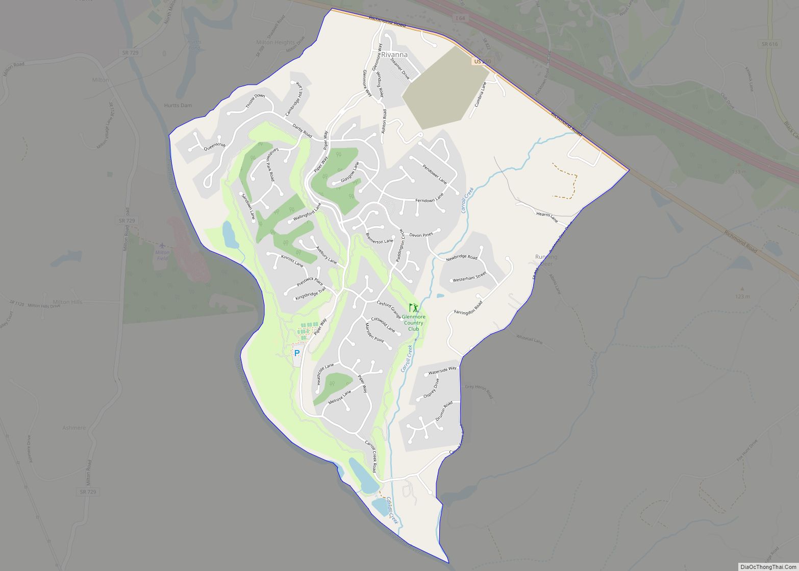
Rivanna is a census-designated place (CDP) in Albemarle County, Virginia, just east of Shadwell. The population as of the 2010 Census was 1,860. It consists mainly of the Glenmore gated community. Rivanna CDP overview: Name: Rivanna CDP LSAD Code: 57 LSAD Description: CDP (suffix) State: Virginia County: Albemarle County Total Area: 2,174 ZIP code: 22947 ... Read more
Map of Rivanna CDP
Map of Riner CDP
Riner is a census-designated place in Montgomery County, Virginia, United States. The population as of the 2020 Census was 1,196. The Howard-Bell-Feather House and Riner Historic District are listed on the National Register of Historic Places. Auburn Elementary School, Auburn Middle School, and Auburn High School are all located in Riner. Camp Carysbrook is the ... Read more
Map of Riner CDP
Map of Ridgeway town, Virginia
Ridgeway is a town in Henry County, Virginia, United States. The population was 742 at the 2010 census. It is part of the Martinsville Micropolitan Statistical Area. Martinsville Speedway, a NASCAR racetrack, is located between Ridgeway and the Martinsville city limits. Ridgeway town overview: Name: Ridgeway town LSAD Code: 43 LSAD Description: town (suffix) State: ... Read more
Map of Ridgeway town, Virginia
Map of Richlands town, Virginia
Richlands is a town in Tazewell County, Virginia, United States. The population was 5,261 at the 2020 census. It is part of the Bluefield, WV-VA micropolitan area which has a population of 107,578. Richlands town overview: Name: Richlands town LSAD Code: 43 LSAD Description: town (suffix) State: Virginia County: Tazewell County Incorporated: 1892 Elevation: 1,933 ft ... Read more
Map of Richlands town, Virginia
Map of Rich Creek town
Rich Creek is a town in Giles County, Virginia, United States. The population was 774 as per the 2010 census, up from 665 as per the 2000 census. It is part of the Blacksburg–Christiansburg Metropolitan Statistical Area. Rich Creek town overview: Name: Rich Creek town LSAD Code: 43 LSAD Description: town (suffix) State: Virginia County: ... Read more
Map of Rich Creek town
Map of Reston CDP
Reston is a census-designated place in Fairfax County, Virginia, and a principal city of the Washington metropolitan area. As of the 2020 U.S. Census, Reston’s population was 63,226. Founded in 1964, Reston was influenced by the Garden City movement that emphasized planned, self-contained communities that intermingled green space, residential neighborhoods, and commercial development. The intent ... Read more
Map of Reston CDP
Map of Ravensworth CDP
Ravensworth is a census-designated place in Fairfax County, Virginia, United States. Its name reflects Ravensworth plantation, farmed since the 18th century and manor house which burned under mysterious circumstances on August 1, 1926. The Ravensworth Farm subdivision was developed in the early 1960s. The 2010 census lists the area’s population as 2,466. It is part ... Read more
Map of Ravensworth CDP
Map of Quinby CDP, Virginia
Quinby is a census-designated place (CDP) in Accomack County, Virginia, United States. It was first listed as a CDP in 2010. Per the 2020 census, the population was 285. Quinby CDP overview: Name: Quinby CDP LSAD Code: 57 LSAD Description: CDP (suffix) State: Virginia County: Accomack County Elevation: 7 ft (2 m) Total Area: 285 FIPS code: ... Read more
Map of Quinby CDP, Virginia
Map of Rockwood CDP, Virginia
Rockwood is a census-designated place in Chesterfield County, Virginia. The population as of the 2010 Census was 8,431. Rockwood CDP overview: Name: Rockwood CDP LSAD Code: 57 LSAD Description: CDP (suffix) State: Virginia County: Chesterfield County Total Area: 8,431 ZIP code: 23236 Area code: 804 FIPS code: 5168470 GNISfeature ID: 2584911 Online Interactive Map Rockwood ... Read more
Map of Rockwood CDP, Virginia
Map of Riverview CDP, Virginia
Riverview is a census-designated place in Wise County, Virginia, southwest of Coeburn. The population as of the 2010 Census was 782. Riverview CDP overview: Name: Riverview CDP LSAD Code: 57 LSAD Description: CDP (suffix) State: Virginia County: Wise County Total Area: 782 ZIP code: 24230 FIPS code: 5167704 GNISfeature ID: 2629844 Online Interactive Map Riverview ... Read more
Map of Riverview CDP, Virginia
Map of Rustburg CDP
Rustburg CDP overview: Name: Rustburg CDP LSAD Code: 57 LSAD Description: CDP (suffix) State: Virginia County: Campbell County FIPS code: 5169536 Online Interactive Map Rustburg online map. Source: Basemap layers from Google Map, Open Street Map (OSM), Arcgisonline, Wmflabs. Boundary Data from Database of Global Administrative Areas. Rustburg location map. Where is Rustburg CDP? Rustburg ... Read more
Map of Rustburg CDP
Map of Rushmere CDP
Rushmere is a census-designated place (CDP) in Isle of Wight County, Virginia, United States. The population was 1,018 at the 2010 census. Rushmere CDP overview: Name: Rushmere CDP LSAD Code: 57 LSAD Description: CDP (suffix) State: Virginia County: Isle of Wight County Elevation: 72 ft (22 m) Total Area: 8.4 sq mi (21.8 km²) Land Area: 8.3 sq mi (21.4 km²) Water Area: ... Read more
Map of Rushmere CDP