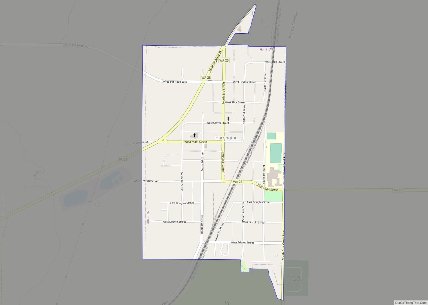
Map of Herron Island CDP
Herron Island is an island in central Case Inlet in the southern part of Puget Sound in the U.S. state of Washington. The Pierce County island has a land area of 1.2326 km² (304.57 acres) and a population of 151 persons as of the 2010 census. Herron Island is one of the few privately owned islands ... Read more
Map of Herron Island CDP
Map of Hazel Dell CDP
Hazel Dell is an unincorporated area and census-designated place (CDP) in Clark County, Washington, United States, located north and west of Vancouver. As of the 2010 census the population was 19,435. Previous censuses divided the community into two areas, Hazel Dell North and Hazel Dell South. Hazel Dell CDP overview: Name: Hazel Dell CDP LSAD ... Read more
Map of Hazel Dell CDP
Map of Hatton town, Washington
Hatton town overview: Name: Hatton town LSAD Code: 43 LSAD Description: town (suffix) State: Washington County: Adams County FIPS code: 5330060 Online Interactive Map Hatton online map. Source: Basemap layers from Google Map, Open Street Map (OSM), Arcgisonline, Wmflabs. Boundary Data from Database of Global Administrative Areas. Hatton location map. Where is Hatton town? Hatton ... Read more
Map of Hatton town, Washington
Map of Index town
Index town overview: Name: Index town LSAD Code: 43 LSAD Description: town (suffix) State: Washington County: Snohomish County FIPS code: 5333175 Online Interactive Map Index online map. Source: Basemap layers from Google Map, Open Street Map (OSM), Arcgisonline, Wmflabs. Boundary Data from Database of Global Administrative Areas. Index location map. Where is Index town? Index ... Read more
Map of Index town
Map of Ilwaco city
Ilwaco (/ɪlˈwɑːkoʊ/ il-WAH-koh) is a city in Pacific County, Washington, United States. The population was 936 at the 2010 census. Founded in 1890, the city was home to the Ilwaco Railway and Navigation Company along the Long Beach Peninsula, with its core economy based on logging and timber rafting. The city is located on the ... Read more
Map of Ilwaco city
Map of Hunts Point town
Hunts Point town overview: Name: Hunts Point town LSAD Code: 43 LSAD Description: town (suffix) State: Washington County: King County FIPS code: 5332755 Online Interactive Map Hunts Point online map. Source: Basemap layers from Google Map, Open Street Map (OSM), Arcgisonline, Wmflabs. Boundary Data from Database of Global Administrative Areas. Hunts Point location map. Where ... Read more
Map of Hunts Point town
Map of Humptulips CDP
Humptulips is a census-designated place (CDP) in Grays Harbor County, Washington, United States. The population of the CDP was 255 according to the 2010 census. Humptulips CDP overview: Name: Humptulips CDP LSAD Code: 57 LSAD Description: CDP (suffix) State: Washington County: Grays Harbor County Elevation: 161 ft (49 m) Total Area: 9.5 sq mi (24.5 km²) Land Area: 9.5 sq mi (24.5 km²) ... Read more
Map of Humptulips CDP
Map of Hoquiam city
Hoquiam (/ˈhoʊkwiəm/ HOH-kwee-əm) is a city in Grays Harbor County, Washington, United States. It borders the city of Aberdeen at Myrtle Street, with Hoquiam to the west. The two cities share a common economic history in lumbering and exporting, but Hoquiam has maintained its independent identity. It shares a long rivalry with its more populated ... Read more
Map of Hoquiam city
Map of Home CDP, Washington
Home is a census-designated place in Pierce County, Washington, United States. The 2010 Census placed the population at 1,377. The community lies on the Key Peninsula and borders the waters of Carr Inlet, an extension of Puget Sound. Home is now primarily a town of beach homes, although around the turn of the twentieth century, ... Read more
Map of Home CDP, Washington
Map of Hogans Corner CDP
Hogans Corner is a census-designated place (CDP) in Grays Harbor County, Washington, United States. The population was 85 at the 2010 census. Prior to 2010 it was part of the combined Oyehut-Hogan’s Corner CDP. Hogans Corner CDP overview: Name: Hogans Corner CDP LSAD Code: 57 LSAD Description: CDP (suffix) State: Washington County: Grays Harbor County ... Read more
Map of Hogans Corner CDP
Map of Hockinson CDP
Hockinson is a census-designated place (CDP) in Clark County, Washington, United States. The population was 4,771 at the 2010 census. Based on per capita income, one of the more reliable measures of affluence, Hockinson ranks 86th of 522 areas in the state of Washington to be ranked. Hockinson CDP overview: Name: Hockinson CDP LSAD Code: ... Read more
Map of Hockinson CDP
Map of Indianola CDP, Washington
Indianola is a census-designated place (CDP) in Kitsap County, Washington, United States, located on the north shore of Port Madison on the Port Madison Indian Reservation, home of the Suquamish Indian Tribe. The population was 3,500 at the 2010 census. It was originally established as a summer community and was a stop for Mosquito Fleet ... Read more
Map of Indianola CDP, Washington