Map of Sisco Heights CDP
Sisco Heights is a census-designated place (CDP) in Snohomish County, Washington, United States. It is located between Arlington and Marysville along State Route 9. As of the 2020 U.S. census, it had a population of 3,140 people. A post office called Sisco was established in 1902, and remained in operation until 1918. The community has ... Read more
Map of Sisco Heights CDP
Map of Spanaway CDP
Spanaway is a census-designated place (CDP) in Pierce County, Washington, United States. The population was 35,476 at the 2020 census, up from 27,227 in 2010. Spanaway is an unincorporated area near Tacoma, and is often identified together with the more urban, less wealthy Parkland. Spanaway’s main business thoroughfare is Pacific Avenue South, which is a ... Read more
Map of Spanaway CDP
Map of Silverdale CDP, Washington
Silverdale is a census-designated place (CDP) in Kitsap County, Washington, in the United States. The population was 20,733 at the 2020 census. Despite many attempts at incorporation, Silverdale remains an unincorporated community. Silverdale ranks 158th among 522 areas in Washington for which per capita income data is collected. Silverdale CDP overview: Name: Silverdale CDP LSAD ... Read more
Map of Silverdale CDP, Washington
Map of Southworth CDP
Southworth is an unincorporated community and census-designated place (CDP) on Puget Sound in Kitsap County, Washington, United States. It is best known for being the west end of the Fauntleroy-Vashon Island-Southworth Washington State Ferries run. Landmarks include Southworth Grocery, a US Post Office, ferry terminal, clay cliffs and a private beach on the point. Next ... Read more
Map of Southworth CDP
Map of Silver Firs CDP
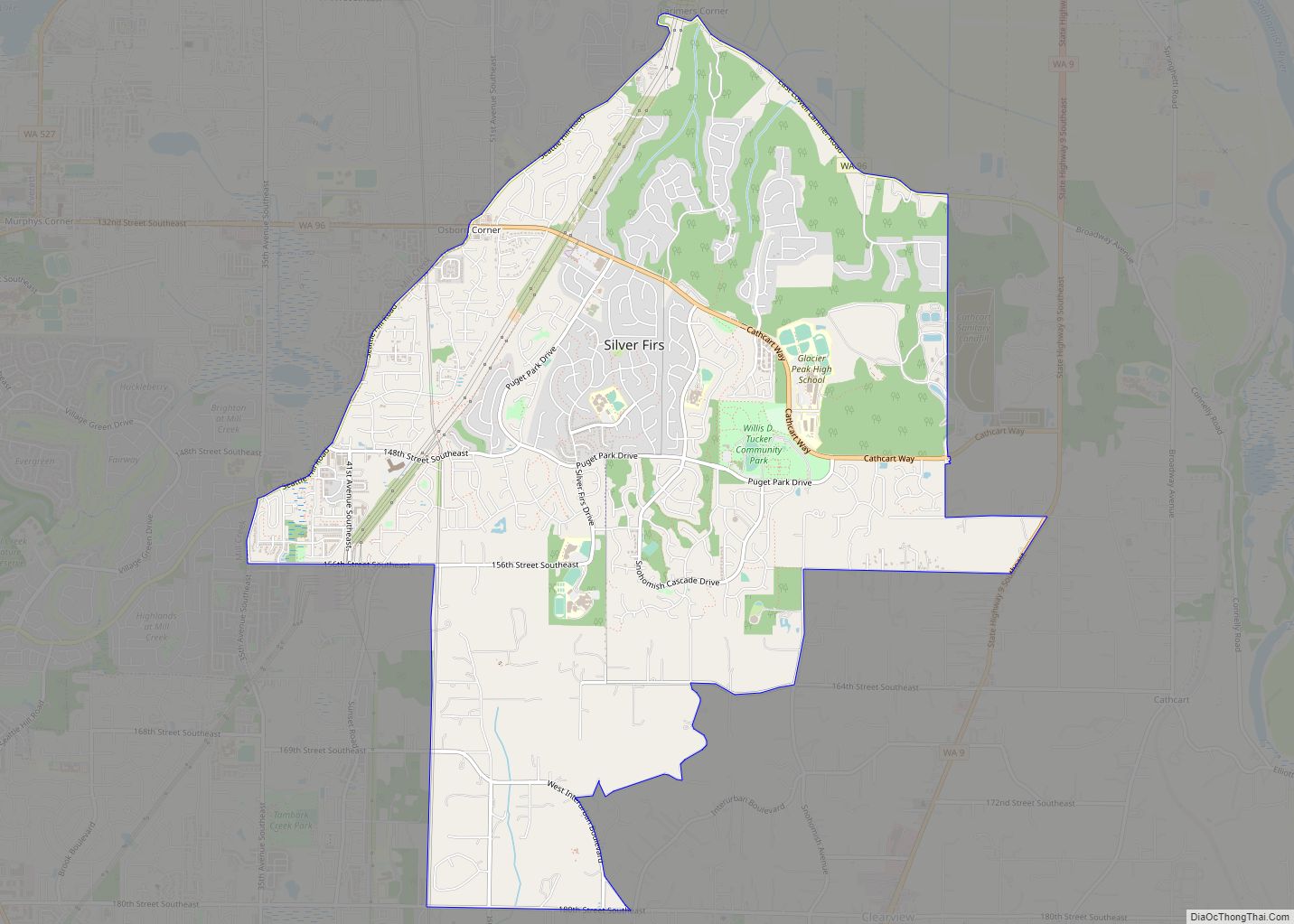
Silver Firs is a census-designated place (CDP) in Snohomish County, Washington, United States. The population was 22,174 at the 2020 census. It lies northeast of the city of Mill Creek. Silver Firs is one of two CDPs that were created out of the former Seattle Hill-Silver Firs CDP in 2010, the other being Eastmont. Silver ... Read more
Map of Silver Firs CDP
Map of Sumas city
Sumas (SOO-mas) is a city in Whatcom County, Washington, United States. It had a population of 1,307 as of the 2010 census. Sumas is located adjacent to the Canada–U.S. border and borders the city of Abbotsford, British Columbia. The Sumas-Huntingdon port of entry at the north end of State Route 9 operates 24 hours a ... Read more
Map of Sumas city
Map of Sultan city
Sultan is a city in Snohomish County, Washington, United States. It is located approximately 23 miles (37 km) east of Everett at the confluence of the Skykomish River and the Sultan River, a minor tributary. The city had a population of 4,651 at the 2010 census. The city was founded in 1880 at the site of ... Read more
Map of Sultan city
Map of Sudden Valley CDP
Sudden Valley is a census-designated place (CDP) just outside of Bellingham in Whatcom County, Washington. Sudden Valley is the second-largest homeowner association in western Washington, with over 7,000 residents. There are eleven neighborhood parks, miles of hiking trails in woodlands and along Lake Whatcom, beaches, two pools, sports fields, tennis courts, a basketball court, a ... Read more
Map of Sudden Valley CDP
Map of Stevenson city, Washington
Stevenson is a city in the Columbia River Gorge National Scenic Area along the Columbia River in Skamania County, Washington, United States. It is the county seat of Skamania County and home to the Skamania County Court House and Sheriff’s Office. The population was 1,465 at the 2010 census, a 22% increase over 2000. Stevenson ... Read more
Map of Stevenson city, Washington
Map of Steptoe CDP
Steptoe is a small unincorporated rural town in Whitman County, Washington, United States. Steptoe is 11 miles north of the county seat, Colfax and is 43 miles south of Spokane. A post office called Steptoe was established in 1875. The community is named after Colonel Edward Steptoe for a battle located north of Steptoe near ... Read more
Map of Steptoe CDP
Map of Steilacoom town
Steilacoom town overview: Name: Steilacoom town LSAD Code: 43 LSAD Description: town (suffix) State: Washington County: Pierce County FIPS code: 5367770 Online Interactive Map Steilacoom online map. Source: Basemap layers from Google Map, Open Street Map (OSM), Arcgisonline, Wmflabs. Boundary Data from Database of Global Administrative Areas. Steilacoom location map. Where is Steilacoom town? Steilacoom ... Read more
Map of Steilacoom town
Map of Startup CDP
Startup is a census-designated place (CDP) in Snohomish County, Washington, United States. The population was 676 at the 2010 census. Startup CDP overview: Name: Startup CDP LSAD Code: 57 LSAD Description: CDP (suffix) State: Washington County: Snohomish County Elevation: 148 ft (45 m) Total Area: 4.0 sq mi (10.3 km²) Land Area: 3.9 sq mi (10.1 km²) Water Area: 0.1 sq mi (0.2 km²) Total Population: ... Read more
Map of Startup CDP