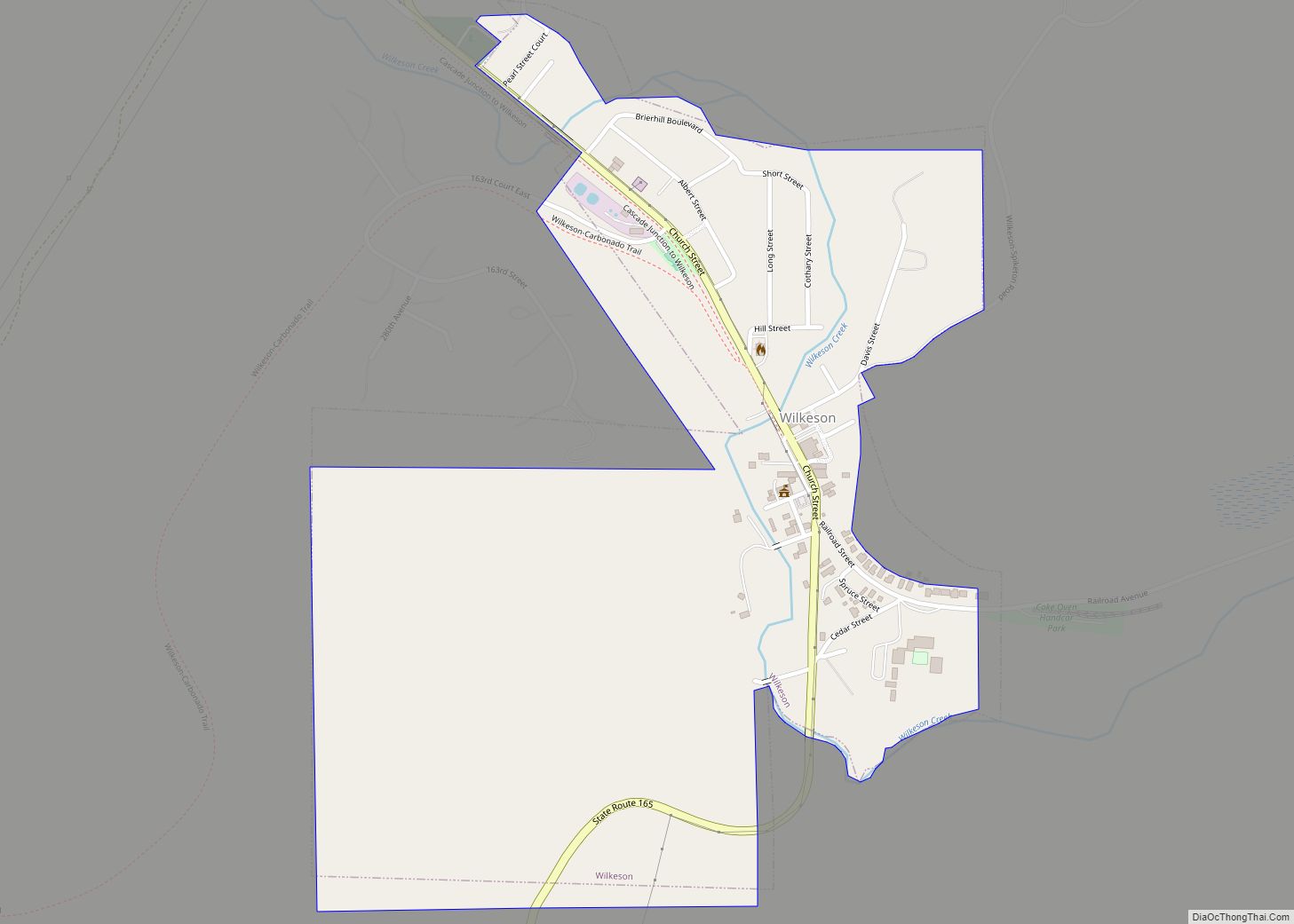
Woodland is a city in Clark and Cowlitz counties in Washington, United States. Most residents live within Cowlitz County, in which the majority of the city lies. It is part of the ‘Longview, Washington Metropolitan Statistical Area’. The population was 6,531 at the 2020 census. Woodland city overview: Name: Woodland city LSAD Code: 25 LSAD ... Read more
Washington Cities and Places
Woodinville is a city in King County, Washington, United States. It is a part of the Seattle metropolitan area. There is also a much larger population with Woodinville mailing addresses in adjacent unincorporated areas of King (Cottage Lake) and Snohomish (Maltby) counties. Woodinville has waterfront parks on the Sammamish River, sweeping winery and brewery grounds, ... Read more
Krupp (Marlin) town overview: Name: Krupp (Marlin) town LSAD Code: 43 LSAD Description: town (suffix) State: Washington County: Grant County FIPS code: 5336395 Online Interactive Map Krupp (Marlin) online map. Source: Basemap layers from Google Map, Open Street Map (OSM), Arcgisonline, Wmflabs. Boundary Data from Database of Global Administrative Areas. Krupp (Marlin) location map. Where ... Read more
Acme is a rural village in Whatcom County, Washington, United States. There is a general store, post office, gas station, diner, elementary school and two churches located there. Acme is also included in, and the source-name for, a larger census-designated place (CDP). The Census Bureau no longer tracks the population for the village itself, but ... Read more
Aberdeen (/ˈæbərdiːn/) is a city in Grays Harbor County, Washington, United States. The population was 17,013 at the 2020 census. The city is the economic center of Grays Harbor County, bordering the cities of Hoquiam and Cosmopolis. Aberdeen is occasionally referred to as the “Gateway to the Olympic Peninsula”. Aberdeen city overview: Name: Aberdeen city ... Read more
Alderwood Manor is a census-designated place (CDP) in Snohomish County, Washington, United States. The population was 10,198 at the 2020 census. Prior to the 2000 census, Alderwood Manor was counted as part of the Alderwood Manor-Bothell North CDP. Alderwood Manor CDP overview: Name: Alderwood Manor CDP LSAD Code: 57 LSAD Description: CDP (suffix) State: Washington ... Read more
Alderton is a census-designated place (CDP) in Pierce County, Washington, United States. The population was 2,893 at the 2010 census. The community is located in the Puyallup River Valley between the cities of Sumner and Orting. Alderton CDP overview: Name: Alderton CDP LSAD Code: 57 LSAD Description: CDP (suffix) State: Washington County: Pierce County Total ... Read more
Alder is a census-designated place (CDP) in Pierce County, Washington, United States. The population was 227 at the 2010 census. The community is located along the shore of Alder Lake on State Route Highway 7 near the entrance to Mount Rainier National Park. A post office called Alder was established in 1902, and remained in ... Read more
Albion town overview: Name: Albion town LSAD Code: 43 LSAD Description: town (suffix) State: Washington County: Whitman County FIPS code: 5301010 Online Interactive Map Albion online map. Source: Basemap layers from Google Map, Open Street Map (OSM), Arcgisonline, Wmflabs. Boundary Data from Database of Global Administrative Areas. Albion location map. Where is Albion town? Albion ... Read more
Airway Heights is a city in Spokane County, Washington, United States, just west of Spokane. The population was 10,757 at the 2020 census. The city’s name was taken from its close proximity to the runways at Fairchild Air Force Base and Spokane International Airport. Airway Heights city overview: Name: Airway Heights city LSAD Code: 25 ... Read more
Ahtanum (/əˈtɛnəm/) is a census-designated place (CDP) in Yakima County, Washington. The population was 3,601 at the time of the 2010 census. Ahtanum CDP overview: Name: Ahtanum CDP LSAD Code: 57 LSAD Description: CDP (suffix) State: Washington County: Yakima County Elevation: 1,247 ft (380 m) Total Area: 9.7 sq mi (25.1 km²) Land Area: 9.7 sq mi (25.1 km²) Water Area: 0.0 sq mi (0.0 km²) ... Read more
Addy is an unincorporated community and census-designated place in Stevens County, Washington, United States. It is located on the Colville River (Washington) and U.S. Route 395 between Colville to the north and Chewelah to the south. Addy CDP overview: Name: Addy CDP LSAD Code: 57 LSAD Description: CDP (suffix) State: Washington County: Stevens County Elevation: ... Read more