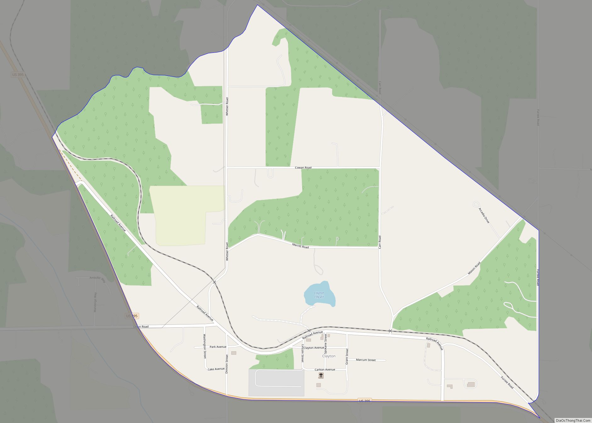
Map of South Creek CDP

Map of South Creek CDP

South Creek is a census-designated place located in Pierce County, Washington, United States. The population was 2,519 at the 2020 census. South Creek CDP overview: Name: South Creek CDP LSAD Code: 57 LSAD Description: CDP (suffix) State: Washington County: Pierce County Elevation: 394 ft (120 m) Total Area: 7.68 sq mi (19.89 km²) Land Area: 7.68 sq mi (19.89 km²) Water Area: 0.0 sq mi … Read more

Map of South Cle Elum town

Map of South Cle Elum town

South Cle Elum town overview: Name: South Cle Elum town LSAD Code: 43 LSAD Description: town (suffix) State: Washington County: Kittitas County FIPS code: 5365765 Online Interactive Map South Cle Elum online map. Source: Basemap layers from Google Map, Open Street Map (OSM), Arcgisonline, Wmflabs. Boundary Data from Database of Global Administrative Areas. South Cle … Read more

Map of South Bend city, Washington

Map of South Bend city, Washington

South Bend is a city in and the county seat of Pacific County, Washington, United States. The population was 1,637 as of the 2010 census. The town is widely-known for its oyster production and scenery. South Bend city overview: Name: South Bend city LSAD Code: 25 LSAD Description: city (suffix) State: Washington County: Pacific County … Read more

Map of Soap Lake city

Map of Soap Lake city

Soap Lake is a city in Grant County, Washington, on the shores of Soap Lake. The population was 1,691 at the 2020 census. Soap Lake city overview: Name: Soap Lake city LSAD Code: 25 LSAD Description: city (suffix) State: Washington County: Grant County Elevation: 1,106 ft (337 m) Total Area: 1.61 sq mi (4.16 km²) Land Area: 1.54 sq mi (3.98 km²) Water … Read more

Map of Snoqualmie city

Map of Snoqualmie city

Snoqualmie (/snoʊˈkwɔːlmi/ snoh-KWAWL-mee) is a city next to Snoqualmie Falls in King County, Washington, United States. It is 28 miles (45 km) east of Seattle. Snoqualmie city is home to the Northwest Railway Museum. The population was 10,670 at the 2010 census and an estimated 13,622 in 2019. Many of the exterior shots for David Lynch’s … Read more

Map of Snoqualmie Pass CDP

Map of Snoqualmie Pass CDP

Snoqualmie Pass is a census-designated place (CDP) in Kittitas County, Washington, United States. It includes the unincorporated community of Hyak. The population was 311 at the 2010 census. The CDP is named for the mountain pass that carries Interstate 90 across the Cascade Range, which itself is named for the Snoqualmie tribe, a Native American … Read more

Map of Snohomish city

Map of Snohomish city

Snohomish is a city in Snohomish County, Washington, United States. The population was 9,098 at the 2010 census. It is located on the Snohomish River, southeast of Everett and northwest of Monroe. Snohomish lies at the intersection of U.S. Route 2 and State Route 9. The city’s airport, Harvey Airfield, is located south of downtown … Read more

Map of Skykomish town

Map of Skykomish town

Skykomish town overview: Name: Skykomish town LSAD Code: 43 LSAD Description: town (suffix) State: Washington County: King County FIPS code: 5364855 Online Interactive Map Skykomish online map. Source: Basemap layers from Google Map, Open Street Map (OSM), Arcgisonline, Wmflabs. Boundary Data from Database of Global Administrative Areas. Skykomish location map. Where is Skykomish town? Skykomish … Read more

Map of Skokomish CDP

Map of Skokomish CDP

Skokomish is a census-designated place (CDP) in Mason County, Washington, United States. The population was 617 at the 2010 census. The town is the headquarters of the Skokomish Indian Tribe. Skokomish CDP overview: Name: Skokomish CDP LSAD Code: 57 LSAD Description: CDP (suffix) State: Washington County: Mason County Elevation: 30 ft (9 m) Total Area: 6.9 sq mi (17.8 km²) … Read more

Map of Sumner city, Washington

Map of Sumner city, Washington

Sumner is a city in northern Pierce County, Washington, United States. The population was 10,621 at the 2020 census. Nearby cities include Puyallup to the west, Auburn to the north, and Bonney Lake to the east. Sumner city overview: Name: Sumner city LSAD Code: 25 LSAD Description: city (suffix) State: Washington County: Pierce County Elevation: … Read more

Map of Sprague city, Washington

Map of Sprague city, Washington

Sprague is a small city in Lincoln County, Washington, United States. The population was 446 at the 2010 census. The city was platted in 1880 and named for former American Civil War Union general John Wilson Sprague. Sprague city overview: Name: Sprague city LSAD Code: 25 LSAD Description: city (suffix) State: Washington County: Lincoln County … Read more

Map of Summitview CDP

Map of Summitview CDP

Summitview is a census-designated place (CDP) in Yakima County, Washington, United States. The population was 967 at the 2010 census. Based on per capita income, Summitview ranks 18th of 522 areas in the state of Washington to be ranked. It is also the highest rank achieved in Yakima County. Summitview CDP overview: Name: Summitview CDP … Read more