Colfax is the county seat of Whitman County, Washington, United States. The population was 2,805 at the 2010 census. The population is estimated at 2,911 per the State of Washington Office of Financial Management in 2018 making Colfax the second largest city in Whitman County behind Pullman. It is situated amidst wheat-covered hills in a valley at the confluence of the north and south forks of the Palouse River. U.S. Route 195, which forms the town’s main street, intersects with State Route 26 at the north end of town; in the past, Colfax also lay at the junction of three major railway lines. It was named after Schuyler Colfax, the vice president from 1869–73.
| Name: | Colfax city |
|---|---|
| LSAD Code: | 25 |
| LSAD Description: | city (suffix) |
| State: | Washington |
| County: | Whitman County |
| Elevation: | 1,972 ft (601 m) |
| Total Area: | 3.78 sq mi (9.79 km²) |
| Land Area: | 3.78 sq mi (9.79 km²) |
| Water Area: | 0.00 sq mi (0.01 km²) |
| Total Population: | 2,805 |
| Population Density: | 759.99/sq mi (293.44/km²) |
| ZIP code: | 99111 |
| Area code: | 509 |
| FIPS code: | 5313785 |
| GNISfeature ID: | 1533329 |
| Website: | http://www.colfaxwa.org/ |
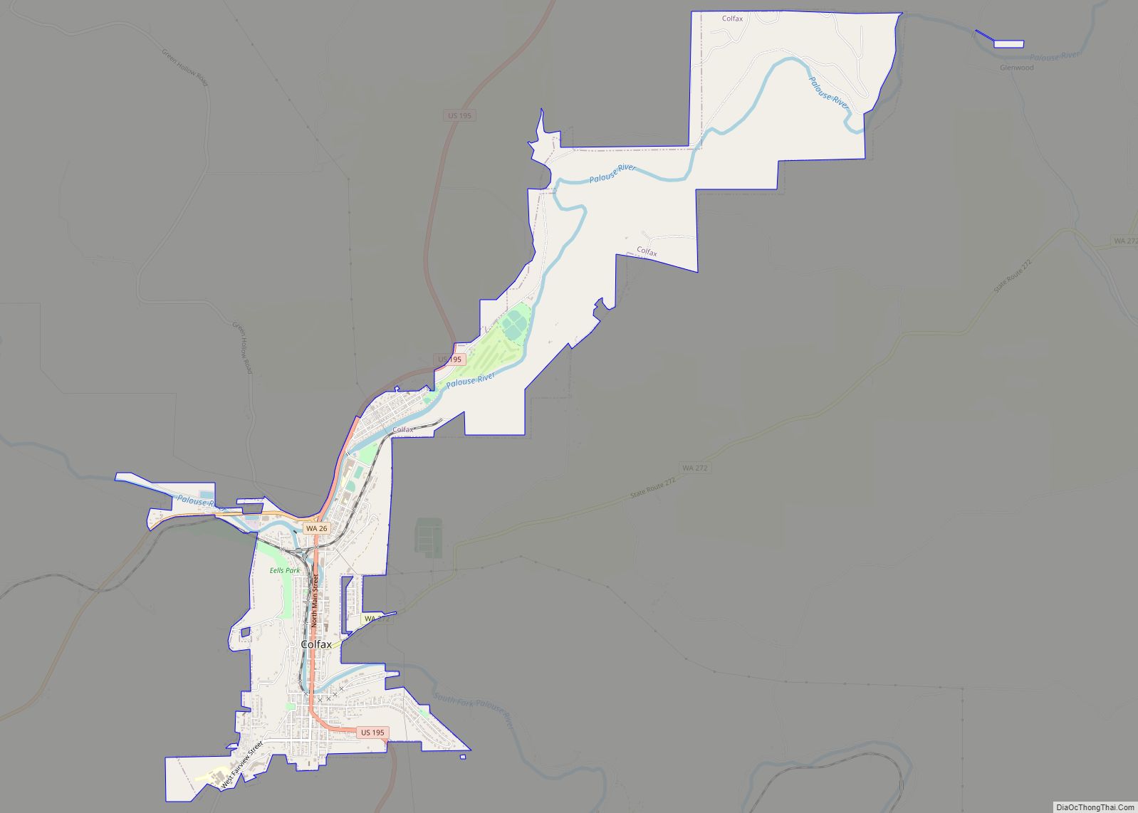
Online Interactive Map
Click on ![]() to view map in "full screen" mode.
to view map in "full screen" mode.
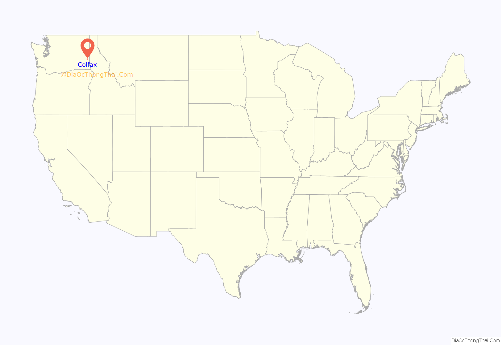
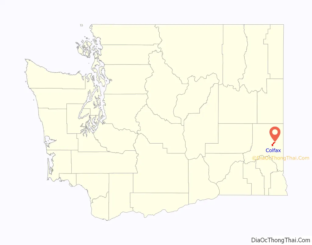
Colfax location map. Where is Colfax city?
History
Palouse Indians were the first known human inhabitants of the Colfax area. White settlers arrived in the summer of 1870, and soon built a sawmill. A flour mill and other businesses followed, and Colfax soon grew into a prosperous town. Originally, pioneer citizen James Perkins called the settlement “Belleville” in honor of his girlfriend; when he found a new love, he changed the town’s name to Colfax, for vice president Schuyler Colfax.
Colfax was officially incorporated on November 29, 1873. In 1889–90, the town vied with several other finalists to become the site of a new state agricultural college, present-day Washington State University. The honor ultimately fell to nearby Pullman, fifteen miles (25 km) southeast.
The early history of Colfax was marred by prominent lynchings in 1894 and 1898. The city incurred significant flooding in 1910 in early March.
Until passed by Pullman at the 1930 census, Colfax was the largest city in the county.
Colfax Road Map
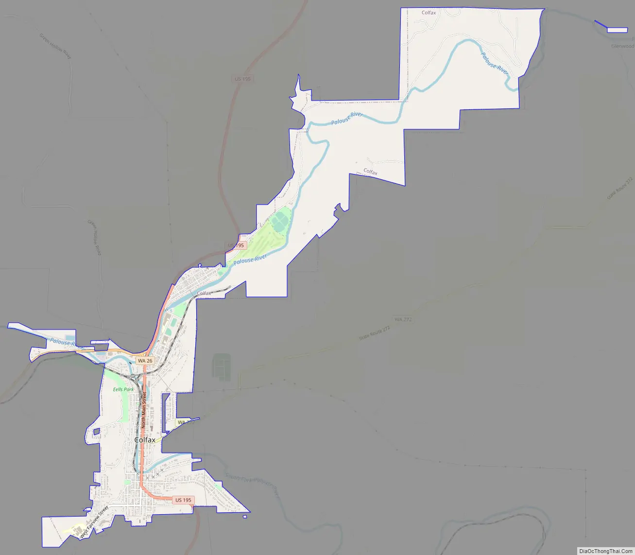
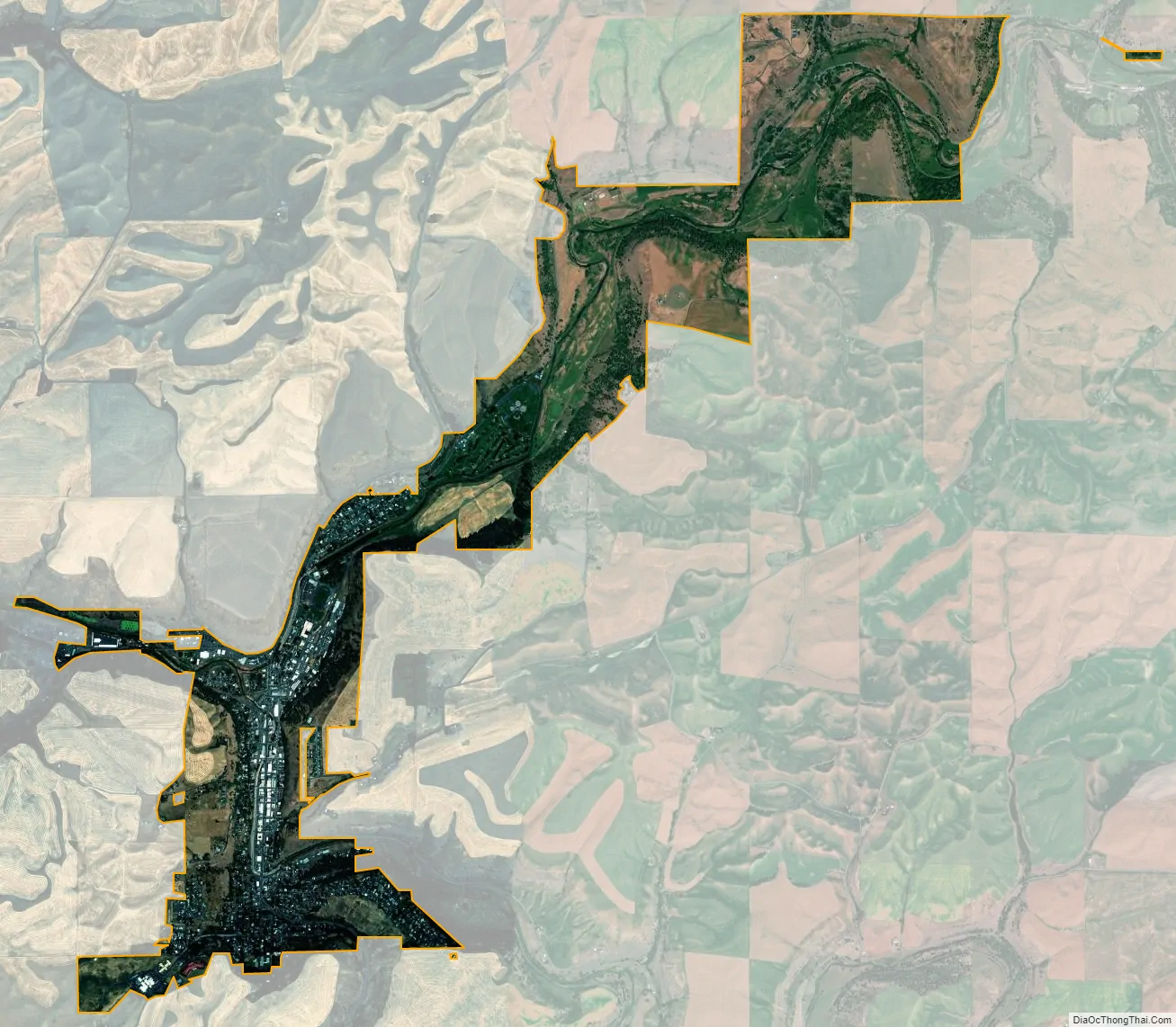
Colfax city Satellite Map
Geography
Colfax is located in southeastern Washington at 46°53′3″N 117°21′49″W / 46.88417°N 117.36361°W / 46.88417; -117.36361 (46.884033, -117.363668), at an elevation of 1,962 feet (598 m). The nearest cities are Spokane, Pullman, Moscow, and Lewiston/Clarkston. The area is geologically interesting, lying in the midst of the fertile Palouse country in the middle of the Columbia River Plateau, with the Rocky Mountains to the east, the Channeled Scablands to the west, and the Snake River to the south.
According to the United States Census Bureau, the city has a total area of 3.79 square miles (9.82 km), all of it land. The Palouse River, confined for flood control to a concrete bed that reduces it to an eighteen-inch-wide stream during the dry season, runs through the middle of town, parallel to Main Street.
Colfax has a four-season continental climate (Köppen Dsb), with hot, dry summers, cold winters, and a rainy season that generally runs from autumn til spring. The annual rainfall averages less than 20 inches (510 mm) a year. This climate, together with the deep, rich Palouse topsoil, makes for near-ideal wheat growing conditions.
See also
Map of Washington State and its subdivision:- Adams
- Asotin
- Benton
- Chelan
- Clallam
- Clark
- Columbia
- Cowlitz
- Douglas
- Ferry
- Franklin
- Garfield
- Grant
- Grays Harbor
- Island
- Jefferson
- King
- Kitsap
- Kittitas
- Klickitat
- Lewis
- Lincoln
- Mason
- Okanogan
- Pacific
- Pend Oreille
- Pierce
- San Juan
- Skagit
- Skamania
- Snohomish
- Spokane
- Stevens
- Thurston
- Wahkiakum
- Walla Walla
- Whatcom
- Whitman
- Yakima
- Alabama
- Alaska
- Arizona
- Arkansas
- California
- Colorado
- Connecticut
- Delaware
- District of Columbia
- Florida
- Georgia
- Hawaii
- Idaho
- Illinois
- Indiana
- Iowa
- Kansas
- Kentucky
- Louisiana
- Maine
- Maryland
- Massachusetts
- Michigan
- Minnesota
- Mississippi
- Missouri
- Montana
- Nebraska
- Nevada
- New Hampshire
- New Jersey
- New Mexico
- New York
- North Carolina
- North Dakota
- Ohio
- Oklahoma
- Oregon
- Pennsylvania
- Rhode Island
- South Carolina
- South Dakota
- Tennessee
- Texas
- Utah
- Vermont
- Virginia
- Washington
- West Virginia
- Wisconsin
- Wyoming