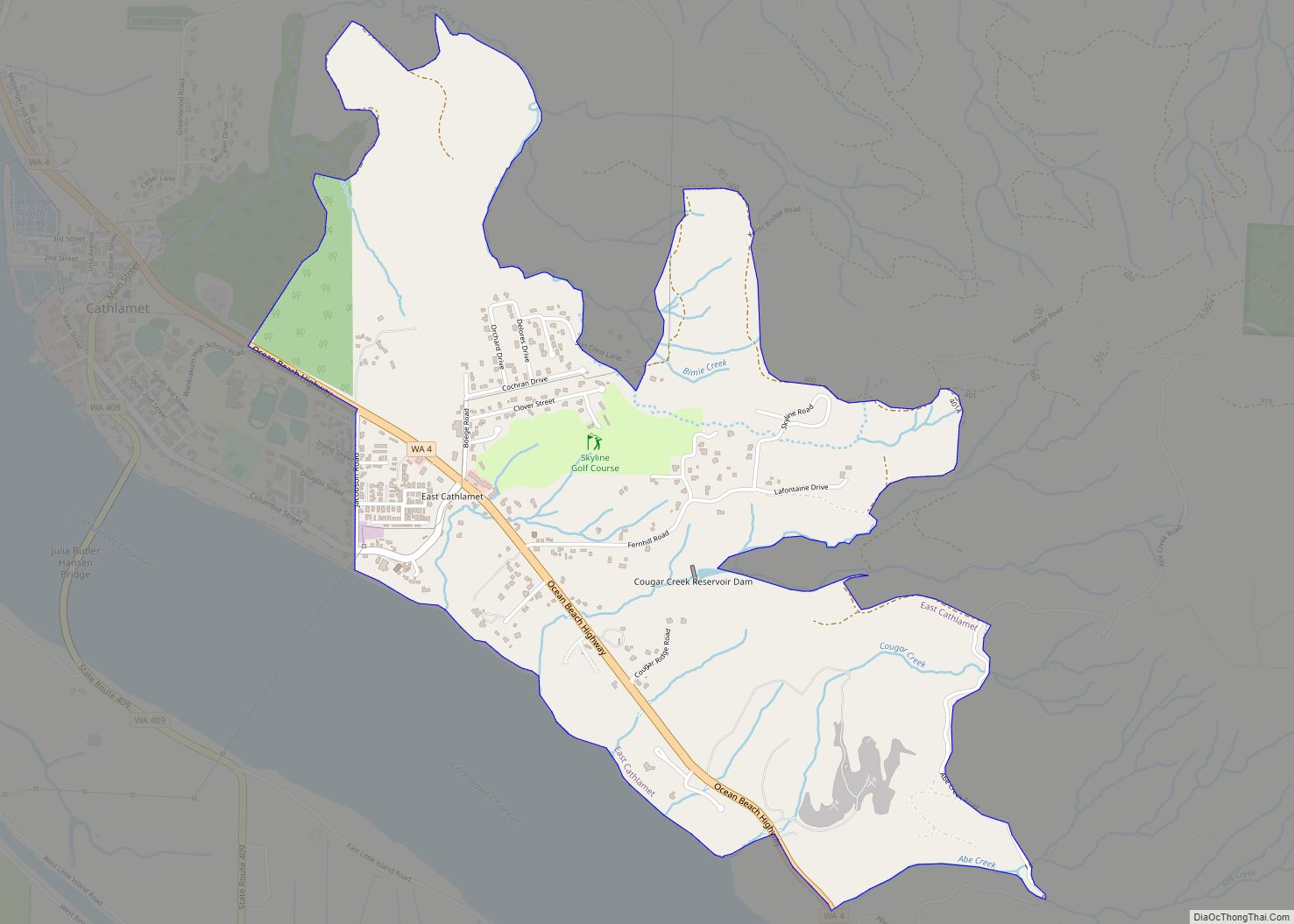
Map of Duvall city
Duvall is a city in King County, Washington, United States, located on SR 203 halfway between Monroe and Carnation. The population was 8,034 at the 2020 census. Duvall city overview: Name: Duvall city LSAD Code: 25 LSAD Description: city (suffix) State: Washington County: King County Elevation: 89 ft (27 m) Total Area: 2.47 sq mi (6.40 km²) Land Area: 2.45 sq mi ... Read more
Map of Duvall city
Map of DuPont city, Washington
DuPont is a city in Pierce County, Washington, United States. The population was 10,151 at the 2020 census. Originally a company town, the city is named after the DuPont chemical company which operated an explosives manufacturing plant in the area from 1909 to 1975. DuPont city overview: Name: DuPont city LSAD Code: 25 LSAD Description: ... Read more
Map of DuPont city, Washington
Map of Disautel CDP
Disautel is a census-designated place (CDP) in Okanogan County, Washington, United States, within the Greater Omak Area. The population was 78 at the 2010 census. Established in 1919, the community is located approximately 15 miles (24 km) east of Omak, along what is now Washington State Route 155. It was formerly a logging town that was ... Read more
Map of Disautel CDP
Map of Des Moines city, Washington
Des Moines (/dəˈmɔɪnz/ də-MOYNZ) is a city in King County, Washington, United States. The population was 32,888 as of the 2020 census. The city is located on the east shore of Puget Sound, near the center of the Seattle metropolitan area. It is bordered by the suburbs of Federal Way to the south, Kent to ... Read more
Map of Des Moines city, Washington
Map of Elbe CDP
Elbe (/ˈɛlbiː/) is a census-designated place (CDP) in Pierce County, Washington, United States. The population was 29 at the 2010 census. Elbe CDP overview: Name: Elbe CDP LSAD Code: 57 LSAD Description: CDP (suffix) State: Washington County: Pierce County Elevation: 1,214 ft (370 m) Total Population: 54 Population Density: 818.2/sq mi (315.9/km²) ZIP code: 98330 Area code: 360 ... Read more
Map of Elbe CDP
Map of Edmonds city
Edmonds is a city in Snohomish County, Washington, United States. It is located in the southwest corner of the county, facing Puget Sound and the Olympic Mountains to the west. The city is part of the Seattle metropolitan area and is located 15 miles (24 km) north of Seattle and 18 miles (29 km) southwest of Everett. ... Read more
Map of Edmonds city
Map of Edgewood city, Washington
Edgewood is a city in Pierce County, Washington, United States. The population was 12,327 at the 2020 census. Neighboring towns include Fife to the west, Milton to the northwest, Federal Way to the north, Sumner to the east, and Puyallup to the south. Edgewood city overview: Name: Edgewood city LSAD Code: 25 LSAD Description: city ... Read more
Map of Edgewood city, Washington
Map of Eatonville town, Washington
Eatonville town overview: Name: Eatonville town LSAD Code: 43 LSAD Description: town (suffix) State: Washington County: Pierce County FIPS code: 5320260 Online Interactive Map Eatonville online map. Source: Basemap layers from Google Map, Open Street Map (OSM), Arcgisonline, Wmflabs. Boundary Data from Database of Global Administrative Areas. Eatonville location map. Where is Eatonville town? Eatonville ... Read more
Map of Eatonville town, Washington
Map of Eastmont CDP
Eastmont is a census-designated place (CDP) in Snohomish County, Washington, United States. The population was 20,101 at the 2010 census. Eastmont is one of two CDPs that were created out of the former Seattle Hill-Silver Firs CDP in 2010, the other being Silver Firs. Eastmont is the location of Community Transit’s Eastmont Park & Ride, ... Read more
Map of Eastmont CDP
Map of East Renton Highlands CDP
East Renton Highlands is a census-designated place (CDP) in King County, Washington, United States, located between Issaquah and Renton. The population was 11,937 at the 2020 census. East Renton Highlands CDP overview: Name: East Renton Highlands CDP LSAD Code: 57 LSAD Description: CDP (suffix) State: Washington County: King County Elevation: 525 ft (160 m) Total Area: 11.4 sq mi ... Read more
Map of East Renton Highlands CDP
Map of Endicott town, Washington
Endicott town overview: Name: Endicott town LSAD Code: 43 LSAD Description: town (suffix) State: Washington County: Whitman County FIPS code: 5321730 Online Interactive Map Endicott online map. Source: Basemap layers from Google Map, Open Street Map (OSM), Arcgisonline, Wmflabs. Boundary Data from Database of Global Administrative Areas. Endicott location map. Where is Endicott town? Endicott ... Read more
Map of Endicott town, Washington
Map of Elma city, Washington
Elma is a city in Grays Harbor County, Washington, United States. The population was 3,438 at the 2020 census. Elma city overview: Name: Elma city LSAD Code: 25 LSAD Description: city (suffix) State: Washington County: Grays Harbor County Elevation: 49 ft (15 m) Total Area: 2.58 sq mi (6.69 km²) Land Area: 2.55 sq mi (6.60 km²) Water Area: 0.03 sq mi (0.08 km²) Total Population: ... Read more
Map of Elma city, Washington