Edmonds is a city in Snohomish County, Washington, United States. It is located in the southwest corner of the county, facing Puget Sound and the Olympic Mountains to the west. The city is part of the Seattle metropolitan area and is located 15 miles (24 km) north of Seattle and 18 miles (29 km) southwest of Everett. With a population of 39,709 residents in the 2010 U.S. census, Edmonds is the third most populous city in the county. The estimated population in 2019 was 42,605.
Edmonds was established in 1876 by logger George Brackett, who bought the land claim of an earlier settler. It was incorporated as a city in 1890, shortly before the arrival of the Great Northern Railway. Early residents of the city were employed by the shingle mills and logging companies that operated in the area until the 1950s. The hills surrounding Edmonds were developed into suburban bedroom communities in the mid-to-late 20th century and subsequently annexed into the city. Edmonds is a regional hub for the arts, with museums, specialized facilities, and major annual festivals within the city’s downtown area.
The city is connected to nearby areas by two state highways and the state ferry system, which operates a ferry route to Kingston on the Kitsap Peninsula. Public transit service in Edmonds is centered around the downtown train station, served by Amtrak and Sounder commuter trains, and includes several Community Transit bus routes that travel through outlying neighborhoods.
| Name: | Edmonds city |
|---|---|
| LSAD Code: | 25 |
| LSAD Description: | city (suffix) |
| State: | Washington |
| County: | Snohomish County |
| Incorporated: | August 14, 1890 |
| Elevation: | 66 ft (20 m) |
| Total Area: | 10.01 sq mi (25.92 km²) |
| Land Area: | 8.92 sq mi (23.09 km²) |
| Water Area: | 1.09 sq mi (2.82 km²) 51.68% |
| Total Population: | 39,709 |
| Population Density: | 4,778.49/sq mi (1,844.90/km²) |
| ZIP code: | 98020, 98026 |
| Area code: | 425 |
| FIPS code: | 5320750 |
| GNISfeature ID: | 1512180 |
| Website: | edmondswa.gov |
Online Interactive Map
Click on ![]() to view map in "full screen" mode.
to view map in "full screen" mode.
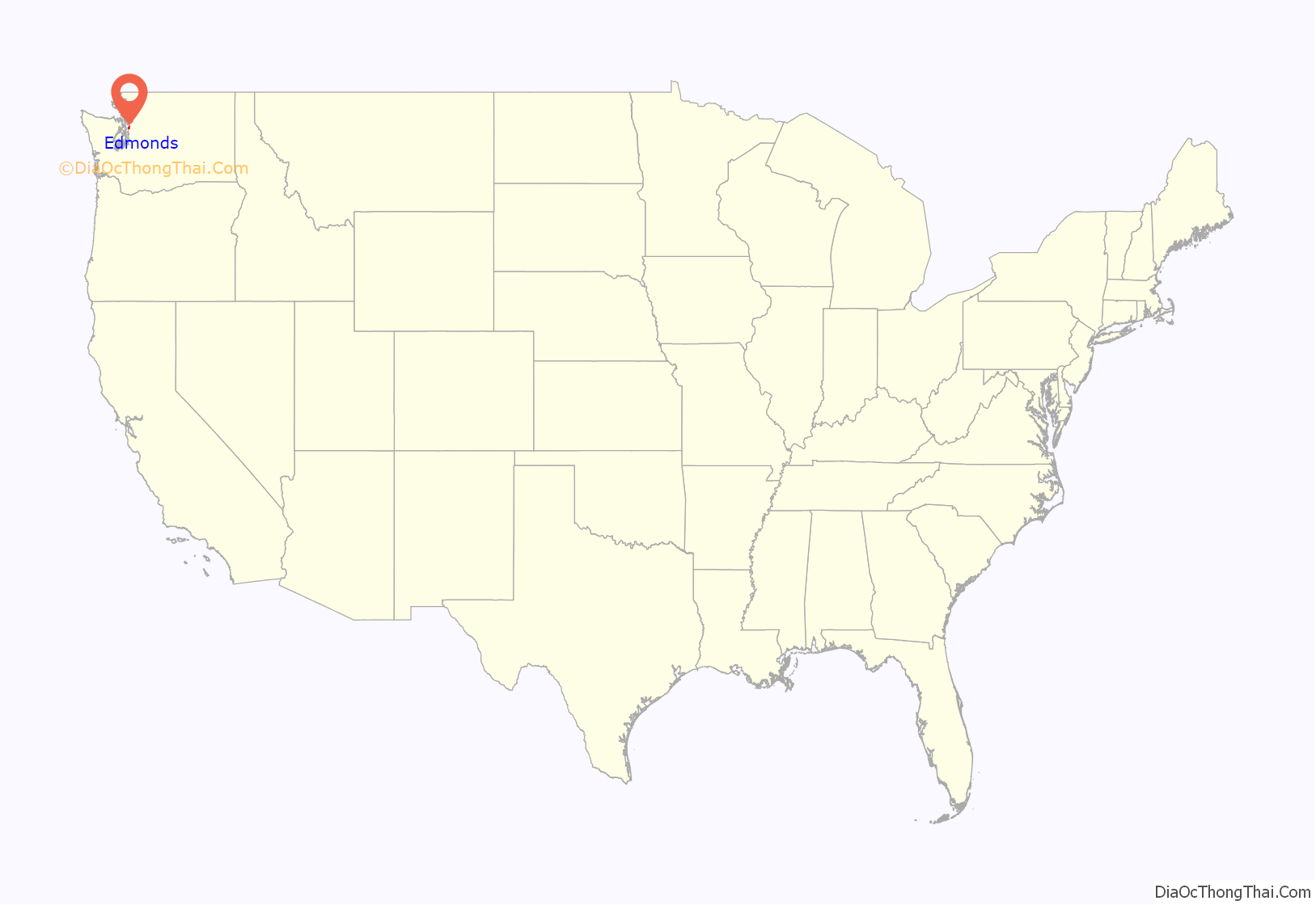
Edmonds location map. Where is Edmonds city?

History
19th and early 20th centuries
Prior to the 19th century, the Edmonds area was inhabited by the Suquamish tribe, who foraged and fished near the flat beach forming modern-day downtown. No archaeological evidence of a permanent settlement in Edmonds has been found, despite claims that a fishing village had existed near the modern-day downtown.
An exploratory expedition of Puget Sound led by Charles Wilkes charted the Edmonds area in 1841, naming “Point Edmund” (now Point Edwards) to the southwest of the modern-day downtown. A 147-acre (59 ha) land claim for the area was filed by Pleasant Ewell in 1866 and was sold to various landowners before being eventually purchased by Canadian-born logger George Brackett in 1872 for $650. Brackett had allegedly found the future site of Edmonds in 1870 while searching for potential logging areas on his canoe, which was blown ashore during a storm. Brackett and his family moved from Ballard to Point Edmund in 1876, intent on creating a town. He drained a marshland near the waterfront and began logging the area, then known as “Brackett’s Landing”. Additional settlers arrived over the next few years, necessitating the construction of a wharf and general store by 1881. In 1884, the settlement was platted and gained its first post office, christened with the name “Edmonds”, either a misspelling of Point Edmund or the name of George Franklin Edmunds, a U.S. Senator from Vermont who Brackett admired.
By the end of the decade, Edmonds had gained its first schoolhouse, sawmill, hotel, and drug store. The Town of Edmonds was formally incorporated as a fourth-class village of 600 acres (240 ha) on August 14, 1890, following an election by residents on August 7. To meet the minimum population of 300 residents required for incorporation, a popular legend states that Brackett added the names of his two oxen to the census conducted prior to the election. Edmonds is the oldest incorporated city in Snohomish County. Brackett was elected as the town’s mayor for several months, and the new town council passed ordinances to regulate or ban saloons, gambling establishments, and boarding houses. The same year, Edmonds was selected as a stop on the Seattle and Montana Railroad (later absorbed into the Great Northern Railway), sparking interest from real estate investors. The Minneapolis Realty and Investment Company bought 455 acres (1.84 km) of the townsite from Brackett for $36,000,and built a new hotel and wharf. The railway arrived in 1891, but failed to spark a land rush and the investment plan fell apart during the Panic of 1893, leaving Brackett to foreclose on the land.
Edmonds was supported by four shingle mills that prospered in the 1890s, along with an iron foundry that manufactured steel plates for shingles. By 1908, the town had gained its own water system, electricity, paved streets, and telephone service. In September 1908, Edmonds voted to become a third-class city, with a reported population of 1,546 residents. The city unsuccessfully lobbied for a branch of the interurban line from Everett to Seattle, which would have supplemented passenger steamships on the Mosquito fleet and passenger trains operated by Great Northern. A major fire on July 8, 1909, destroyed one block of buildings on Main Street and caused $20,000 in damage. After the fire, the destroyed buildings were bought by a member of the city council, and replaced by a two-story concrete building.
The first automobile owned by an Edmonds resident arrived in 1911 and was followed by the completion of the North Trunk Road through modern-day Lynnwood. A branch road to Edmonds was completed in 1915 and stagecoach lines were extended to the city. Automobile ferry service began in 1923, with the inauguration of the Kingston ferry, which would be acquired by the Puget Sound Navigation Company and continue to serve the city after the decline of the Mosquito fleet. During the 1920s, Edmonds expanded its wharf and ferry dock, while a site on the south end of the waterfront was acquired by the Union Oil Company (later Unocal) for the construction of an oil terminal in 1922. A second major fire struck downtown Edmonds on April 11, 1928, damaging several buildings on the same block of Main Street as the 1909 fire. Despite the increasing scarcity of local timber, the sawmills on the Edmonds waterfront remained the city’s main industry in the 1920s. During the Great Depression, all but two mills continued to operate and were supplemented by local improvement projects organized by the federal Works Progress Administration, including regraded streets, new parks, and the addition of an auditorium and sportsfields to the high school.
Late 20th and early 21st centuries
The popularity of new materials for roof shingles and scarcity of available timber in the state forced most of Edmonds’ mills to close by 1951. New companies were established in place of the mills, including an aluminum fabricator and an asphalt refinery at the Unocal terminal. The now vacated waterfront was redeveloped under the direction of the Port of Edmonds, established in 1948 by a public referendum. During the 1950s and 1960s, the Port constructed a breakwater, marina, public beach, and a new ferry terminal for the Washington State Ferries system. The hills surrounding downtown Edmonds to the north and east were developed into suburban subdivisions, centered around small commercial centers, and were annexed by the city. Edmonds reached its present eastern boundary along State Route 99 in May 1959, a few weeks after the incorporation of Lynnwood as a city. By 1963, the city had completed its largest annexations and petitioned to become a first-class city, with a population of 19,000 that placed it second among cities in Snohomish County. Despite population growth, Edmonds restricted the construction of multi-family dwellings in an effort to keep the downtown area and older neighborhoods “rural-like” and low density. By the end of the 1960s, Edmonds had also gained a new hospital, a community college, and civic center campus.
In the 1970s, the number of businesses in downtown Edmonds declined as suburban shopping centers lured away customers. After a number of buildings in the downtown area were demolished and replaced with condominiums and office buildings, a movement to preserve and restore historic buildings emerged with the support of the city government. The “Main Street Project”, funded by local businesses, restored empty storefronts and attracted restaurants to the city in the late 1980s, fueling a downtown revival. Portions of the waterfront were acquired by the city and redeveloped into a public beach, named Brackett’s Landing Park, and a public fishing pier was opened in 1979 as the first saltwater fishing pier in the state. Edmonds celebrated its centennial in 1990 with a series of events and the dedication of the Centennial Plaza. Several neighborhoods in southern Edmonds were annexed between 1995 and 1997, forming the city’s southern boundary at the King County line.
The Point Edwards oil terminal on the city’s waterfront was closed by Unocal in 1991 and the 53-acre (21 ha) site was sought by Edmonds and Snohomish County for redevelopment. The city favored the construction of a new multimodal transportation hub at the site, including a ferry terminal and commuter rail station, while the county proposed the construction of a sewage treatment plant to be used by King and Snohomish counties. The sewage treatment plant was opposed by the city government and citizen groups, and was ultimately moved to an alternative site near Woodinville in 2003. The transportation plan was put on hold after costs increased and the state ferry system diverted funding to other projects. The hilltop portion of the site was cleaned up in the 2000s and redeveloped into condominiums that opened between 2007 and 2008.
Edmonds Road Map
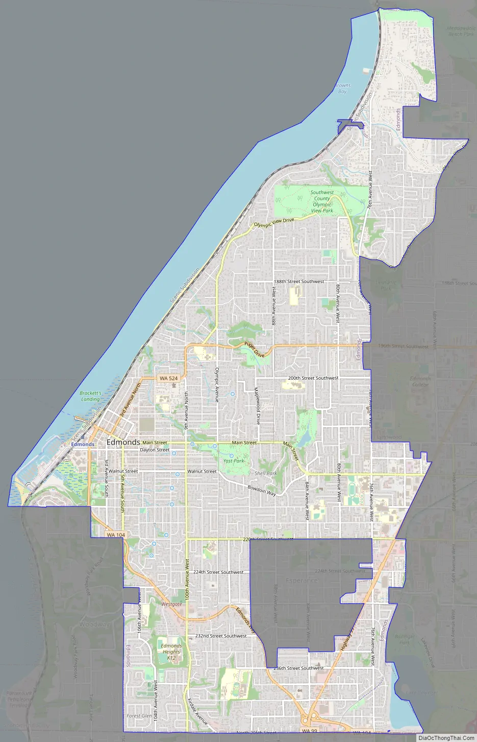
Edmonds city Satellite Map

Geography
Edmonds is located in the southwest corner of Snohomish County in Western Washington, and is considered a suburb of Seattle, located 15 miles (24 km) to the south. The city is bordered to the west by Puget Sound and the city of Woodway, which lies south of Pine Street and west of 5th Avenue South. To the south of the county boundary at 244th Street Southwest is Shoreline in King County. The city’s southeastern border with Mountlake Terrace is defined by the Interurban Trail, while the eastern and northern borders with Lynnwood run along 76th Avenue West, Olympic View Drive, and Lund’s Gulch. The unincorporated area of Esperance, located in the southeast corner of the city, is an enclave of Edmonds and has resisted several attempts at annexation. According to the United States Census Bureau, the city has a total area of 18.42 square miles (47.71 km), of which 8.90 square miles (23.05 km) is land and 9.52 square miles (24.66 km) is water.
Edmonds has 5 miles (8.0 km) of shoreline, which is crossed by several small streams. The Puget Sound makes up 86 percent of the city’s drainage basin, with other streams flowing into Lake Ballinger to the southeast. The city’s main commercial districts are Downtown Edmonds, situated in a valley known as the “bowl”, and the State Route 99 corridor at its east end. The downtown area and “bowl” have views of Puget Sound and the Olympic Mountains. The city has several outlying suburban neighborhood with their own commercial centers, including Firdale, Five Corners, Perrinville, Seaview, Sherwood, and Westgate.
See also
Map of Washington State and its subdivision:- Adams
- Asotin
- Benton
- Chelan
- Clallam
- Clark
- Columbia
- Cowlitz
- Douglas
- Ferry
- Franklin
- Garfield
- Grant
- Grays Harbor
- Island
- Jefferson
- King
- Kitsap
- Kittitas
- Klickitat
- Lewis
- Lincoln
- Mason
- Okanogan
- Pacific
- Pend Oreille
- Pierce
- San Juan
- Skagit
- Skamania
- Snohomish
- Spokane
- Stevens
- Thurston
- Wahkiakum
- Walla Walla
- Whatcom
- Whitman
- Yakima
- Alabama
- Alaska
- Arizona
- Arkansas
- California
- Colorado
- Connecticut
- Delaware
- District of Columbia
- Florida
- Georgia
- Hawaii
- Idaho
- Illinois
- Indiana
- Iowa
- Kansas
- Kentucky
- Louisiana
- Maine
- Maryland
- Massachusetts
- Michigan
- Minnesota
- Mississippi
- Missouri
- Montana
- Nebraska
- Nevada
- New Hampshire
- New Jersey
- New Mexico
- New York
- North Carolina
- North Dakota
- Ohio
- Oklahoma
- Oregon
- Pennsylvania
- Rhode Island
- South Carolina
- South Dakota
- Tennessee
- Texas
- Utah
- Vermont
- Virginia
- Washington
- West Virginia
- Wisconsin
- Wyoming


