Des Moines (/dəˈmɔɪnz/ də-MOYNZ) is a city in King County, Washington, United States. The population was 32,888 as of the 2020 census. The city is located on the east shore of Puget Sound, near the center of the Seattle metropolitan area. It is bordered by the suburbs of Federal Way to the south, Kent to the east, SeaTac to the northeast, Burien to the north, and Normandy Park to the northwest.
Des Moines is one of the few points along this shoreline where the topography facilitates access to the water, and a recreational marina operated by the city, with moorage, boat launching and pier fishing facilities, is located there. Forested Saltwater State Park on a steep ravine between the Zenith and Woodmont neighborhoods is the most-used state park on the Sound. Near the border of Federal Way, Redondo has a board-walk complete with a Salty’s restaurant and a pay parking lot.
| Name: | Des Moines city |
|---|---|
| LSAD Code: | 25 |
| LSAD Description: | city (suffix) |
| State: | Washington |
| County: | King County |
| Elevation: | 92 ft (28 m) |
| Total Area: | 7.41 sq mi (19.19 km²) |
| Land Area: | 6.41 sq mi (16.61 km²) |
| Water Area: | 1.00 sq mi (2.58 km²) |
| Total Population: | 32,888 |
| Population Density: | 5,044.92/sq mi (1,947.98/km²) |
| ZIP code: | 98148, 98198 |
| Area code: | 206 |
| FIPS code: | 5317635 |
| GNISfeature ID: | 1512145 |
| Website: | desmoineswa.gov |
Online Interactive Map
Click on ![]() to view map in "full screen" mode.
to view map in "full screen" mode.
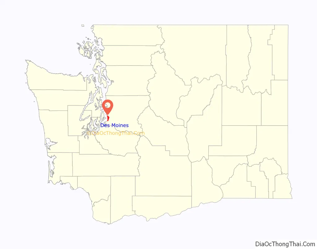
Des Moines location map. Where is Des Moines city?

History
There is no evidence that Native American tribes had permanent settlements in Des Moines. However, there is ample evidence that the Duwamish and Muckleshoot Indian tribes came to Des Moines for fishing and clamming.
What was to become Des Moines was first explored by Europeans on May 26, 1792, during the exploration of British naval Captain George Vancouver on his flagship HMS Discovery. The first Americans to visit the area were part of Charles Wilkes’ Expedition.
The first known settler was John Moore, who probably arrived about 1867. His homestead claim certificate (#285) was granted on July 2, 1872.
In 1887 F.A. Blasher persuaded some friends in his home city of Des Moines, Iowa, to help finance the development of a town on Puget Sound. The work was done by the Des Moines Improvement Company. In 1889 the area was platted into lots and sold by the Des Moines Improvement Company, which had been incorporated by F. A. Blasher, Orin Watts Barlow, Charles M. Johnson, and John W. Kleeb. Lumber mills provided the community with its primary employment.
Early transportation to Des Moines was by water. The mosquito fleet provided access to Seattle, Tacoma, and Vashon Island. The first road, the Brick Highway, was completed in May 1916. The first cross-Puget Sound automobile ferry started service from Des Moines to Portage on November 13, 1916. This ferry service continued until September 1921. Before World War II farming fueled the local economy.
Following the war, suburbanization of the community occurred. With increased population, the county government was unable to supply the level of service and local control desired by Des Moines residents. In response to this, Des Moines was officially incorporated on June 17, 1959.
On December 12, 1969, an F3 tornado injured one person near Saltwater State Park. The city’s most visible asset is its 838-berth small boat marina that was opened on May 10, 1970. In 1980, a 670-foot (200 m) concrete and aluminum fishing pier was built at the north end of the marina.
Property within the city has been the subject of land buyouts because of noise from aircraft landing or taking off from the Seattle–Tacoma International Airport, which is located 2 miles (3.2 km) north of Des Moines.
On November 22, 1982, Des Moines annexed the nearby community of Zenith, a farming community founded in 1906 that later became a bedroom community for Boeing workers.
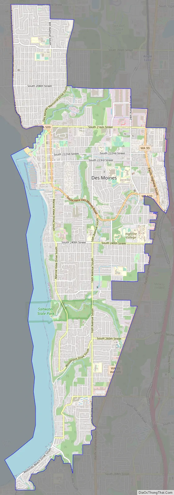
Des Moines Road Map
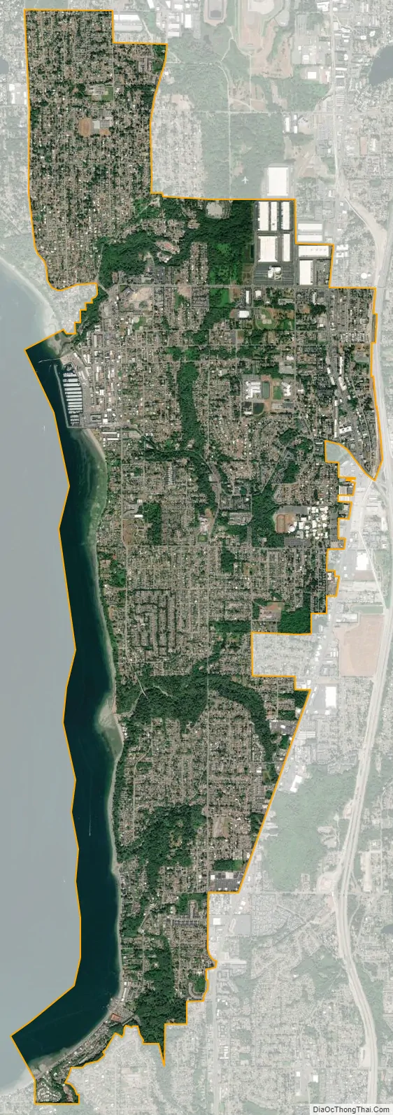
Des Moines city Satellite Map
Geography
Des Moines is located at 47°23′39″N 122°19′5″W / 47.39417°N 122.31806°W / 47.39417; -122.31806 (47.394120, −122.317983).
According to the United States Census Bureau, the city has a total area of 6.50 square miles (16.83 km), all of it land.
Most of the city rolls gently down to the waters of Puget Sound from an elevation of about 400 feet (120 m) along the eastern city boundary on Pacific Highway, allowing many homes to enjoy an unobstructed view of the sound and Vashon Island. The ravines of Des Moines Creek and Massey Creek deeply incise this broad slope.
Surrounding cities
See also
Map of Washington State and its subdivision:- Adams
- Asotin
- Benton
- Chelan
- Clallam
- Clark
- Columbia
- Cowlitz
- Douglas
- Ferry
- Franklin
- Garfield
- Grant
- Grays Harbor
- Island
- Jefferson
- King
- Kitsap
- Kittitas
- Klickitat
- Lewis
- Lincoln
- Mason
- Okanogan
- Pacific
- Pend Oreille
- Pierce
- San Juan
- Skagit
- Skamania
- Snohomish
- Spokane
- Stevens
- Thurston
- Wahkiakum
- Walla Walla
- Whatcom
- Whitman
- Yakima
- Alabama
- Alaska
- Arizona
- Arkansas
- California
- Colorado
- Connecticut
- Delaware
- District of Columbia
- Florida
- Georgia
- Hawaii
- Idaho
- Illinois
- Indiana
- Iowa
- Kansas
- Kentucky
- Louisiana
- Maine
- Maryland
- Massachusetts
- Michigan
- Minnesota
- Mississippi
- Missouri
- Montana
- Nebraska
- Nevada
- New Hampshire
- New Jersey
- New Mexico
- New York
- North Carolina
- North Dakota
- Ohio
- Oklahoma
- Oregon
- Pennsylvania
- Rhode Island
- South Carolina
- South Dakota
- Tennessee
- Texas
- Utah
- Vermont
- Virginia
- Washington
- West Virginia
- Wisconsin
- Wyoming


