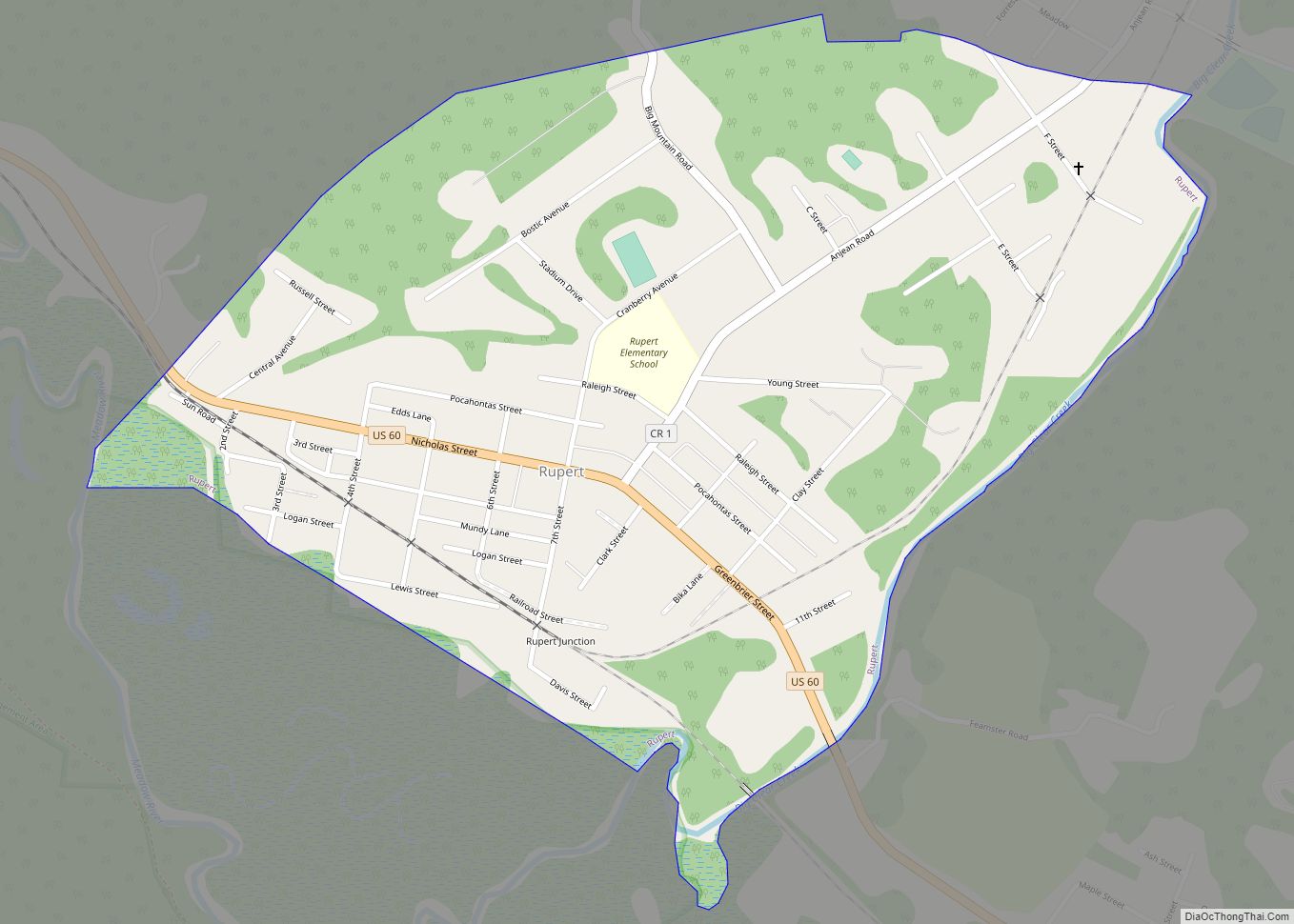
Map of Williamstown city, West Virginia

Map of Williamstown city, West Virginia

Williamstown is a city in Wood County, West Virginia, United States, along the Ohio River. It is part of the Parkersburg–Vienna metropolitan area. The population was 2,997 at the 2020 census. The now closed Fenton Art Glass Company was located in the city. Williamstown city overview: Name: Williamstown city LSAD Code: 25 LSAD Description: city … Read more

Map of Weirton city

Map of Weirton city

Weirton (/ˈwɪərtən/) is a city in Hancock and Brooke counties in the U.S. state of West Virginia. Located along the Ohio River in the state’s Northern Panhandle, the city’s population was 19,163 as of the 2020 census, making it the sixth-largest city in the state. It is a principal city of the Weirton–Steubenville metropolitan area, … Read more

Map of Williamson city, West Virginia

Map of Williamson city, West Virginia

Williamson is a city in Mingo County, West Virginia, United States, situated along the Tug Fork River. The population was 3,191 at the 2010 census. It is the county seat of Mingo County, and is the county’s largest and most populous city. Williamson is home to Southern West Virginia Community and Technical College. The Tug … Read more

Map of Wayne town, West Virginia

Map of Wayne town, West Virginia

Wayne is a town in and the county seat of Wayne County, West Virginia, United States. The population was 1,441 at the 2020 census. It is part of the Huntington–Ashland metropolitan area. Wayne town overview: Name: Wayne town LSAD Code: 43 LSAD Description: town (suffix) State: West Virginia County: Wayne County Elevation: 696 ft (212 m) Total … Read more

Map of Worthington town, West Virginia

Map of Worthington town, West Virginia

Worthington is a town in Marion County, West Virginia, United States. The population was 158 at the 2010 census. Worthington was incorporated in 1893 and named for Colonel George Worthington, an early settler. U.S. Route 19 passes through the town. Worthington town overview: Name: Worthington town LSAD Code: 43 LSAD Description: town (suffix) State: West … Read more

Map of Womelsdorf (Coalton) town

Map of Womelsdorf (Coalton) town

Womelsdorf (Coalton) is a town in Randolph County, West Virginia, United States. The population was 190 at the 2020 census. Womelsdorf was the name of a mining official; the variant name of Coalton was given on account of local mining operations. Womelsdorf (Coalton) town overview: Name: Womelsdorf (Coalton) town LSAD Code: 43 LSAD Description: town … Read more

Map of Wolf Summit CDP

Map of Wolf Summit CDP

Wolf Summit is a census-designated place and coal town in Harrison County, West Virginia, United States. Its population was 272 as of the 2010 census. The community was named after the surname Wolf and its being the highest point on the railroad between Grafton and Parkersburg. Wolf Summit CDP overview: Name: Wolf Summit CDP LSAD … Read more

Map of Winfield town, West Virginia

Map of Winfield town, West Virginia

Winfield is a city in and the county seat of Putnam County, West Virginia, United States, located along the Kanawha River. The population was 2,397 at the 2020 census. It is part of the Huntington–Ashland metropolitan area. Winfield town overview: Name: Winfield town LSAD Code: 43 LSAD Description: town (suffix) State: West Virginia County: Putnam … Read more