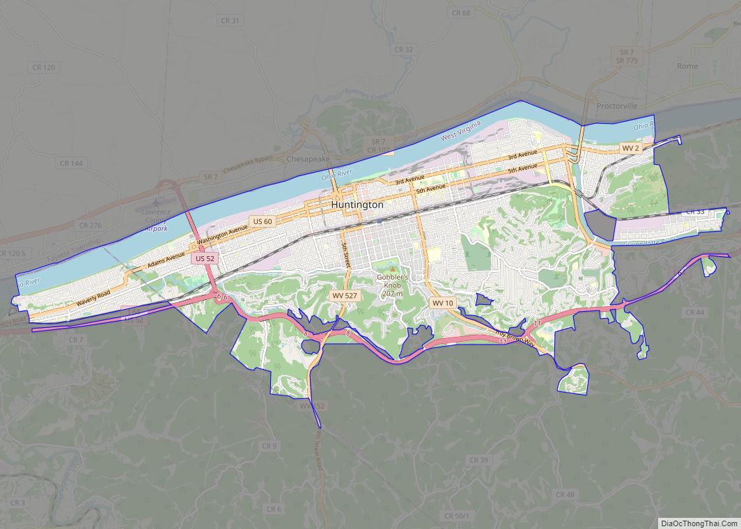
Map of Anmoore town

Map of Anmoore town

Anmoore is a town in Harrison County, West Virginia, United States. It is located at the intersection of WV 58 and Interstate 79. The population was 514 at the 2020 census. The town derives its name from nearby Ann Moore Run. Anmoore town overview: Name: Anmoore town LSAD Code: 43 LSAD Description: town (suffix) State: … Read more

Map of Anawalt town

Map of Anawalt town

Anawalt is a town in McDowell County, West Virginia, United States. At one time it was known as Jeanette. It is named in honor of James White Anawalt, who was then manager of Union Supply Company, a subsidiary of the United States Steel Company. The population was 186 at the 2020 census. Coal mining was … Read more

Map of Amherstdale CDP

Map of Amherstdale CDP

Amherstdale is a census-designated place (CDP) in Logan County, West Virginia, United States, situated along Buffalo Creek. The CDP includes the unincorporated communities of Amherstdale, Becco, Fanco, and Braeholm. The CDP population was 350 as of the 2010 census. Prior to 2010, Amherstdale was part of the Amherstdale-Robinette CDP. Amherstdale has a post office with … Read more

Map of Alum Creek CDP

Map of Alum Creek CDP

Alum Creek is a census-designated place (CDP) in Kanawha and Lincoln counties along the Coal River in the U.S. state of West Virginia. It includes the unincorporated communities of Alum Creek, Forks of Coal, and Priestley. The CDP had a population of 1,749 at the 2010 census, down from 1,839 at the 2000 census. The … Read more

Map of Alderson town, West Virginia

Map of Alderson town, West Virginia

Alderson is a town in Greenbrier and Monroe counties in the U.S. state of West Virginia, on both sides of the Greenbrier River. The population was 975 at the 2020 census. Alderson town overview: Name: Alderson town LSAD Code: 43 LSAD Description: town (suffix) State: West Virginia County: Greenbrier County, Monroe County Elevation: 1,549 ft (472 m) … Read more

Map of Albright town

Map of Albright town

Albright is a town in central Preston County, West Virginia, United States, along the Cheat River. The population was 260 at the 2020 census. A former coal town, it is part of the Morgantown metropolitan area. Albright town overview: Name: Albright town LSAD Code: 43 LSAD Description: town (suffix) State: West Virginia County: Preston County … Read more

Map of Addison (Webster Springs) town

Map of Addison (Webster Springs) town

Addison (Webster Springs) town overview: Name: Addison (Webster Springs) town LSAD Code: 43 LSAD Description: town (suffix) State: West Virginia County: Webster County FIPS code: 5400364 Online Interactive Map Addison (Webster Springs) online map. Source: Basemap layers from Google Map, Open Street Map (OSM), Arcgisonline, Wmflabs. Boundary Data from Database of Global Administrative Areas. Addison … Read more