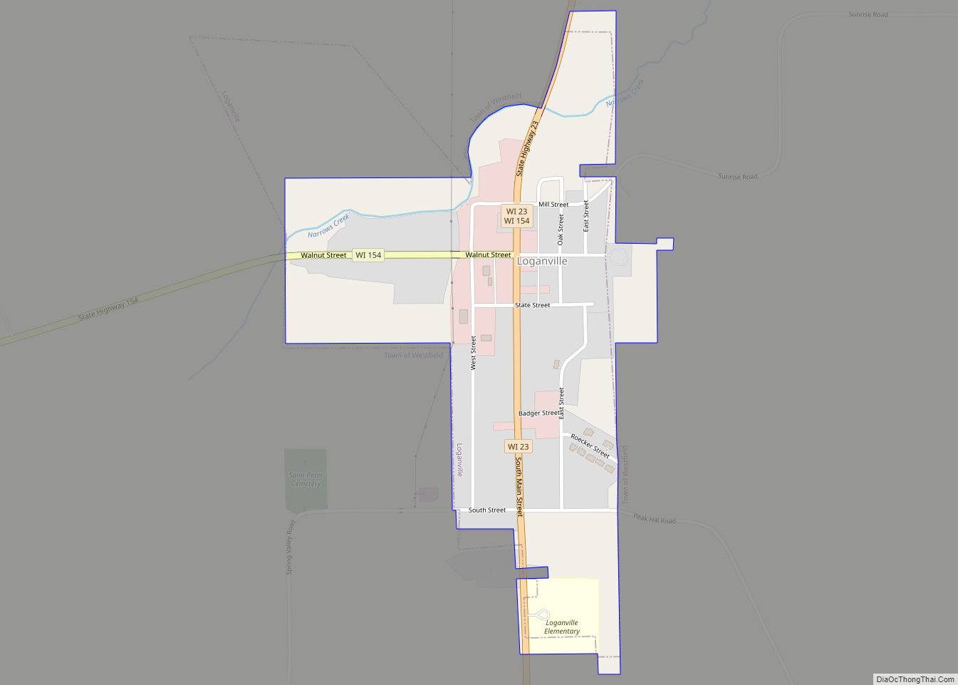
Map of Little Round Lake CDP
Little Round Lake is a census-designated place (CDP) in the town of Bass Lake, Sawyer County, Wisconsin, United States. The population was 1,081 at the 2010 census. It is the largest community on the reservation of the federally recognized tribe of the Lac Courte Oreilles Band of Lake Superior Chippewa Indians. Little Round Lake CDP ... Read more
Map of Little Round Lake CDP
Map of Lynxville village
Lynxville is a village in Crawford County, Wisconsin, United States. The population was 132 at the 2010 census. Lynxville village overview: Name: Lynxville village LSAD Code: 47 LSAD Description: village (suffix) State: Wisconsin County: Crawford County Elevation: 636 ft (194 m) Total Area: 1.37 sq mi (3.54 km²) Land Area: 1.35 sq mi (3.51 km²) Water Area: 0.01 sq mi (0.04 km²) Total Population: 132 Population ... Read more
Map of Lynxville village
Map of Lyndon Station village
Lyndon Station is a village in Juneau County, Wisconsin, United States. The population was 500 at the 2010 census. Lyndon Station village overview: Name: Lyndon Station village LSAD Code: 47 LSAD Description: village (suffix) State: Wisconsin County: Juneau County Elevation: 902 ft (275 m) Total Area: 2.11 sq mi (5.47 km²) Land Area: 2.11 sq mi (5.47 km²) Water Area: 0.00 sq mi (0.00 km²) Total ... Read more
Map of Lyndon Station village
Map of Luxemburg village, Wisconsin
Luxemburg is a town in Kewaunee County, Wisconsin, United States. The population was 1,469 at the 2010 census. The village of Luxemburg, a separate municipality, is surrounded by the town. The unincorporated communities of Walhain and Casco Junction are in the town, and Neuern, Frog Station, and Tonet are partially in the town. Luxemburg village ... Read more
Map of Luxemburg village, Wisconsin
Map of Marshall village, Wisconsin
Marshall is a village in Dane County, Wisconsin, United States, along the Maunesha River. The population was 3,862 at the 2010 census. It is part of the Madison Metropolitan Statistical Area. Marshall village overview: Name: Marshall village LSAD Code: 47 LSAD Description: village (suffix) State: Wisconsin County: Dane County Total Area: 2.29 sq mi (5.93 km²) Land Area: ... Read more
Map of Marshall village, Wisconsin
Map of Luck village
Luck is a town in Polk County, Wisconsin, United States. The population was 881 at the 2000 census. The village of Luck is located within the town. The unincorporated community of West Denmark is located in the town. The unincorporated community of Pole Cat Crossing is also located partially in the town. Luck village overview: ... Read more
Map of Luck village
Map of Marquette village, Wisconsin
Marquette is a town in Green Lake County, Wisconsin, United States. The population was 481 at the 2000 census. The Village of Marquette is located within the town. Marquette village overview: Name: Marquette village LSAD Code: 47 LSAD Description: village (suffix) State: Wisconsin County: Green Lake County Elevation: 797 ft (243 m) Area code: 920 FIPS code: ... Read more
Map of Marquette village, Wisconsin
Map of Lublin village
Lublin is a village in Taylor County, Wisconsin, United States. The population was 118 at the 2010 census. Lublin village overview: Name: Lublin village LSAD Code: 47 LSAD Description: village (suffix) State: Wisconsin County: Taylor County Elevation: 1,286 ft (392 m) Total Area: 1.52 sq mi (3.95 km²) Land Area: 1.52 sq mi (3.95 km²) Water Area: 0.00 sq mi (0.00 km²) Total Population: 118 Population ... Read more
Map of Lublin village
Map of Markesan city
Markesan is a city in Green Lake County, Wisconsin, United States. The population was 1,476 at the 2010 census. The center of population of Wisconsin is located in Markesan. Markesan city overview: Name: Markesan city LSAD Code: 25 LSAD Description: city (suffix) State: Wisconsin County: Green Lake County Elevation: 853 ft (260 m) Total Area: 2.34 sq mi (6.06 km²) ... Read more
Map of Markesan city
Map of Loyal city, Wisconsin
Loyal is a city in Clark County in the U.S. state of Wisconsin. The population was 1,261 at the 2010 census. The city is located within the Town of Loyal, though it is politically independent. Its name comes from the 1860s, when so many of its patriotic pioneers went to fight in the Civil War. ... Read more
Map of Loyal city, Wisconsin
Map of Lowell village, Wisconsin
Lowell is a town in Dodge County, Wisconsin, United States. The population was 1,169 at the 2000 census. The Village of Lowell and the unincorporated community of North Lowell are located in the town. Lowell village overview: Name: Lowell village LSAD Code: 47 LSAD Description: village (suffix) State: Wisconsin County: Dodge County FIPS code: 5545950 ... Read more
Map of Lowell village, Wisconsin
Map of Maribel village
Maribel is a village in Manitowoc County, Wisconsin, United States. The population was 351 at the 2010 census. Maribel village overview: Name: Maribel village LSAD Code: 47 LSAD Description: village (suffix) State: Wisconsin County: Manitowoc County Elevation: 860 ft (262 m) Total Area: 1.15 sq mi (2.97 km²) Land Area: 1.14 sq mi (2.96 km²) Water Area: 0.00 sq mi (0.01 km²) Total Population: 351 Population ... Read more
Map of Maribel village