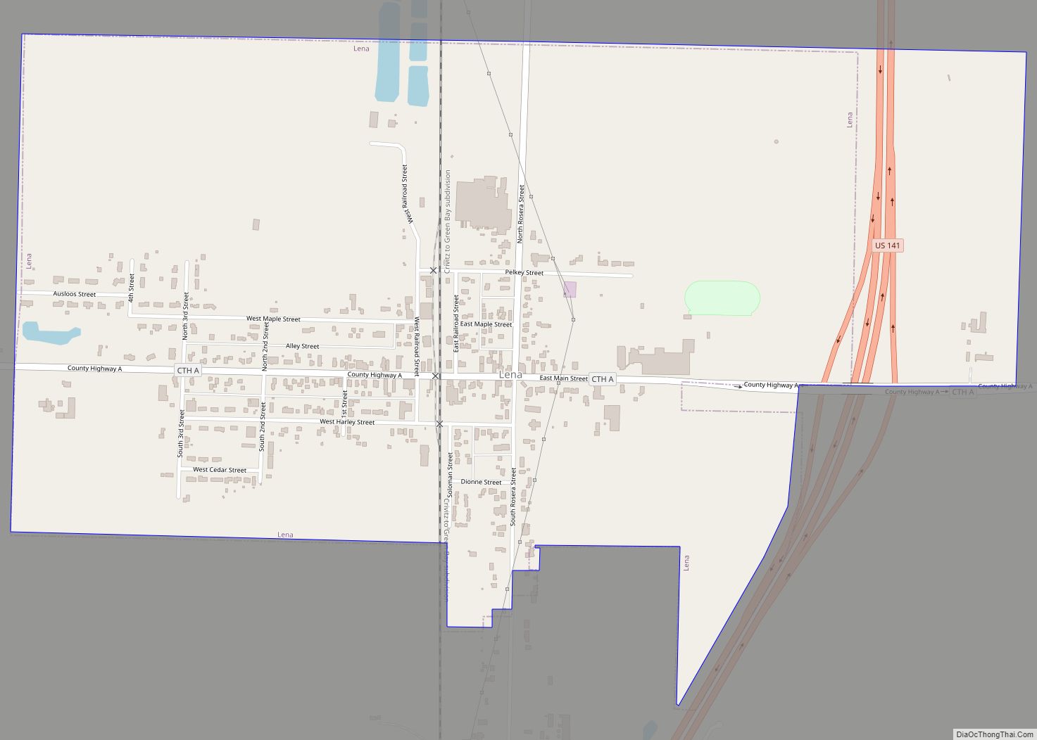
Map of Lohrville village, Wisconsin
Lohrville is a village in Waushara County, Wisconsin, United States. The population was 402 at the 2010 census. Lohrville village overview: Name: Lohrville village LSAD Code: 47 LSAD Description: village (suffix) State: Wisconsin County: Waushara County Elevation: 804 ft (245 m) Total Area: 1.22 sq mi (3.17 km²) Land Area: 1.21 sq mi (3.14 km²) Water Area: 0.01 sq mi (0.03 km²) Total Population: 402 Population ... Read more
Map of Lohrville village, Wisconsin
Map of Laona CDP
Laona is an unincorporated census-designated place in the town of Laona in Forest County, Wisconsin, United States. U.S. Route 8 travels east–west through the community and Wisconsin Highway 32 travels south and west of the community. The community park has a sign stating that the community donated the 1979 Christmas tree at the nation’s capitol. ... Read more
Map of Laona CDP
Map of Loganville village, Wisconsin
Loganville is a village in Sauk County, Wisconsin, United States. The population was 300 at the 2010 census. The village was named for Chauncey P. Logan who built the first house in 1853. Loganville village overview: Name: Loganville village LSAD Code: 47 LSAD Description: village (suffix) State: Wisconsin County: Sauk County Elevation: 935 ft (285 m) Total ... Read more
Map of Loganville village, Wisconsin
Map of Lodi city, Wisconsin
Lodi (/ˈloʊ.daɪ/ LOH-dye) is a city in Columbia County, Wisconsin, United States. The population was 3,189 at the 2020 census. Lodi is part of the Madison Metropolitan Statistical Area. Lodi city overview: Name: Lodi city LSAD Code: 25 LSAD Description: city (suffix) State: Wisconsin County: Columbia County Founded: 1846 Total Area: 1.73 sq mi (4.48 km²) Land Area: ... Read more
Map of Lodi city, Wisconsin
Map of Livingston village, Wisconsin
Livingston is a village in Grant and Iowa Counties in the U.S. state of Wisconsin. The population was 664 at the 2010 census. Of this, 657 were in Grant County, and only 7 were in Iowa County. The Iowa County portion of Livingston is part of the Madison Metropolitan Statistical Area, while the Grant County ... Read more
Map of Livingston village, Wisconsin
Map of Little Sturgeon CDP
Little Sturgeon is an unincorporated census-designated place located on the Little Sturgeon Bay, in the town of Gardner, in Door County, Wisconsin. As of the 2010 census, its population was 136. Little Sturgeon has an annual festival known as “Little Sturgeon Days” that features a parade and other live entertainment. Little Sturgeon CDP overview: Name: ... Read more
Map of Little Sturgeon CDP
Map of Little Round Lake CDP
Little Round Lake is a census-designated place (CDP) in the town of Bass Lake, Sawyer County, Wisconsin, United States. The population was 1,081 at the 2010 census. It is the largest community on the reservation of the federally recognized tribe of the Lac Courte Oreilles Band of Lake Superior Chippewa Indians. Little Round Lake CDP ... Read more
Map of Little Round Lake CDP
Map of Little Chute village
Little Chute is a village in Outagamie County, Wisconsin, United States. The population was 10,449 at the 2010 census. It is immediately east of the city of Appleton, Wisconsin and runs along the Fox River. The town was originally established as a trading post by French explorers who called it “Le Petite Chute” (Little Chute). ... Read more
Map of Little Chute village
Map of Linden village, Wisconsin
Linden is a town in Iowa County, Wisconsin, United States. The population was 873 at the 2000 census. The Village of Linden is located within the town. The unincorporated community of Edmund is located in the town. Linden village overview: Name: Linden village LSAD Code: 47 LSAD Description: village (suffix) State: Wisconsin County: Iowa County ... Read more
Map of Linden village, Wisconsin
Map of Lime Ridge village, Wisconsin
Lime Ridge is a village in Sauk County, Wisconsin, United States. The population was 162 at the 2010 census. Lime Ridge village overview: Name: Lime Ridge village LSAD Code: 47 LSAD Description: village (suffix) State: Wisconsin County: Sauk County Elevation: 1,181 ft (360 m) Total Area: 1.00 sq mi (2.59 km²) Land Area: 1.00 sq mi (2.59 km²) Water Area: 0.00 sq mi (0.00 km²) Total ... Read more
Map of Lime Ridge village, Wisconsin
Map of Lewis CDP, Wisconsin
Lewis is an unincorporated census-designated place in the town of Clam Falls, Polk County, Wisconsin, United States. Lewis is located on Wisconsin Highway 35 4.5 miles (7.2 km) northeast of Frederic. As of the 2010 census, its population is 164. Lewis CDP overview: Name: Lewis CDP LSAD Code: 57 LSAD Description: CDP (suffix) State: Wisconsin County: ... Read more
Map of Lewis CDP, Wisconsin
Map of Leopolis CDP
Leopolis is an unincorporated census-designated place in Shawano County, Wisconsin, United States. The community is located on County Highway D, between the towns of Herman, and Pella, Wisconsin. As of the 2010 census, its population is 87. Leopolis CDP overview: Name: Leopolis CDP LSAD Code: 57 LSAD Description: CDP (suffix) State: Wisconsin County: Shawano County ... Read more
Map of Leopolis CDP