Map of Tomahawk city
Tomahawk is a city in Lincoln County, Wisconsin, United States. The population was 3,441 at the 2020 census. The city is located to the northeast of the Town of Tomahawk and is not contiguous with it. Tomahawk city overview: Name: Tomahawk city LSAD Code: 25 LSAD Description: city (suffix) State: Wisconsin County: Lincoln County Total ... Read more
Map of Tomahawk city
Map of Superior village, Wisconsin
The Village of Superior is a village in Douglas County, Wisconsin, United States. The population was 664 at the 2010 census. The village is located within the Town of Superior and is located immediately south of and adjacent to the City of Superior. Superior village overview: Name: Superior village LSAD Code: 47 LSAD Description: village ... Read more
Map of Superior village, Wisconsin
Map of Sun Prairie city, Wisconsin
Sun Prairie is a city in Dane County in the U.S. state of Wisconsin. A suburb of Madison, it is part of the Madison Metropolitan Statistical Area. The city’s population was 35,967 at the 2020 U.S. Census. It is the second-most populous city in Dane County after Madison. Sun Prairie city overview: Name: Sun Prairie ... Read more
Map of Sun Prairie city, Wisconsin
Map of Tilleda CDP
Tilleda is an unincorporated census-designated place in the town of Seneca in Shawano County, Wisconsin, United States. The community is located on County Highway A less than one mile (one kilometer) north of Wisconsin Highway 29. The community uses the 54978 ZIP code. As of the 2010 census, its population is 91. Tilleda pond on ... Read more
Map of Tilleda CDP
Map of Tigerton village
Tigerton is a village in Shawano County, Wisconsin, United States. The population was 741 at the 2010 census. Tigerton village overview: Name: Tigerton village LSAD Code: 47 LSAD Description: village (suffix) State: Wisconsin County: Shawano County Elevation: 1,030 ft (314 m) Total Area: 1.85 sq mi (4.79 km²) Land Area: 1.82 sq mi (4.72 km²) Water Area: 0.03 sq mi (0.06 km²) Total Population: 741 Population ... Read more
Map of Tigerton village
Map of Summit Lake CDP
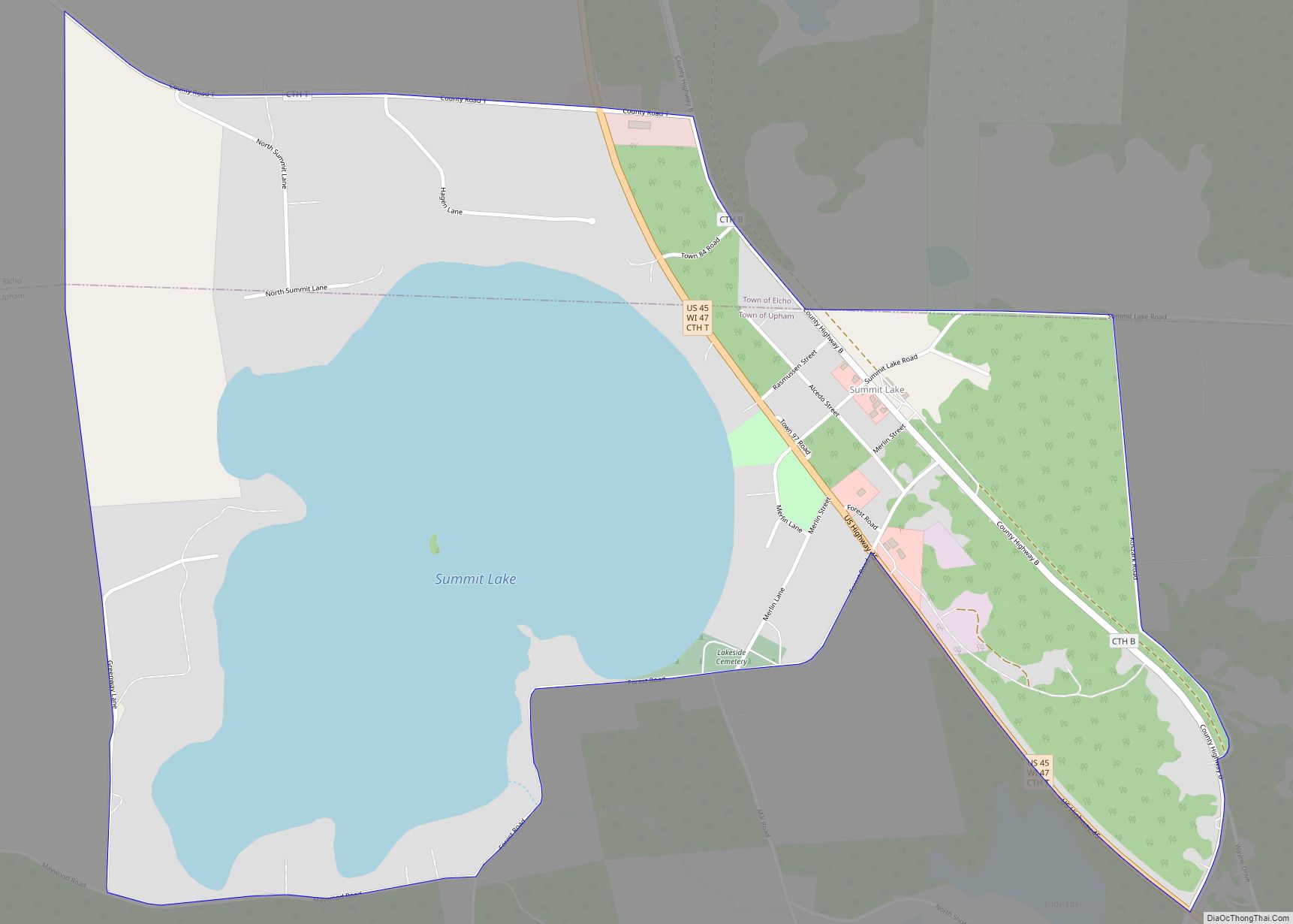
Summit Lake is an unincorporated community and census-designated place (CDP) in Langlade County, Wisconsin, United States. Summit Lake is located along U.S. Route 45 17 miles (27 km) north of Antigo, in the towns of Upham and Elcho. Summit Lake has a post office with ZIP code 54485. As of the 2010 census its population was ... Read more
Map of Summit Lake CDP
Map of Tichigan CDP
Tichigan (formerly known as Waterford North) is a census-designated place (CDP) in Racine County, Wisconsin, United States. The population was 5,277 at the 2020 census. Tichigan CDP overview: Name: Tichigan CDP LSAD Code: 57 LSAD Description: CDP (suffix) State: Wisconsin County: Racine County Elevation: 794 ft (242 m) Total Area: 13.270 sq mi (34.37 km²) Land Area: 11.225 sq mi (29.07 km²) Water ... Read more
Map of Tichigan CDP
Map of Thorp city, Wisconsin
Thorp is a city in Clark County in the U.S. state of Wisconsin. The population was 1,621 at the 2010 census. The city is located partially within the Town of Thorp and partially within the Town of Withee. Thorp city overview: Name: Thorp city LSAD Code: 25 LSAD Description: city (suffix) State: Wisconsin County: Clark ... Read more
Map of Thorp city, Wisconsin
Map of Two Rivers city, Wisconsin
Two Rivers is a city in Manitowoc County, Wisconsin, United States. The population was 11,712 at the 2010 census. It is the birthplace of the ice cream sundae (though other cities, such as Ithaca, New York, make the same claim). The city’s advertising slogan is “Catch our friendly waves” as it is located along Lake ... Read more
Map of Two Rivers city, Wisconsin
Map of Twin Lakes village, Wisconsin
Twin Lakes is a village in Kenosha County, Wisconsin, United States, along the Illinois–Wisconsin border east of U.S. Highway 12, incorporated in 1937. With nearly 1000 acres of surface water, the twin lakes of Mary and Elizabeth have drawn vacationers to numerous resorts as well as ice harvesters in the days of icebox refrigeration. Today, ... Read more
Map of Twin Lakes village, Wisconsin
Map of Turtle Lake CDP, Wisconsin
Turtle Lake is a census-designated place in the town of Richmond, Walworth County, Wisconsin, United States. Its population was 348 as of the 2020 census. Turtle Lake is 141 acres and has a maximum depth of 30 feet. Visitors have access to the lake from a public boat landing. Fish include panfish, largemouth bass, and ... Read more
Map of Turtle Lake CDP, Wisconsin
Map of Waldo village, Wisconsin
Waldo is a village along the Onion River in Sheboygan County, Wisconsin, United States. The population was 503 at the 2010 census. It has a post office with ZIP code 53093. It is included in the Sheboygan, Wisconsin Metropolitan Statistical Area. Waldo village overview: Name: Waldo village LSAD Code: 47 LSAD Description: village (suffix) State: ... Read more
Map of Waldo village, Wisconsin