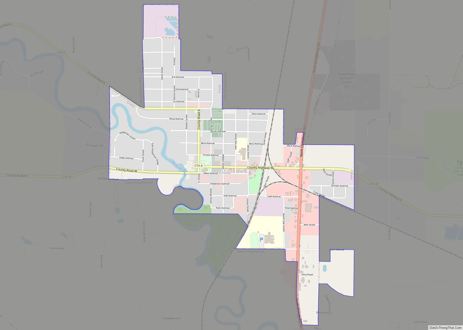
Map of Berlin city, Wisconsin

Map of Berlin city, Wisconsin

Berlin is a city in Green Lake and Waushara counties in the U.S. state of Wisconsin. The population was 5,571 at the 2020 census. Of this, 5,435 were in Green Lake County, and only 89 were in Waushara County. The city is located mostly within the Town of Berlin in Green Lake County, with a … Read more

Map of Baraboo city

Map of Baraboo city

Baraboo is a city in the Midwest and the county seat of Sauk County, Wisconsin, United States. The largest city in the county, Baraboo is the principal city of the Baraboo Micropolitan Statistical Area which comprises a portion of the Madison Combined Statistical area. Its 2020 population was 12,556. It is situated on the Baraboo … Read more

Map of Benton village, Wisconsin

Map of Benton village, Wisconsin

Benton is a town in Lafayette County, Wisconsin, United States. The population was 504 at the 2010 census, up from 469 at the 2000 census. The village of Benton is located within the town. The unincorporated communities of Jenkinsville and Strawbridge are also located in the town. Benton village overview: Name: Benton village LSAD Code: … Read more

Map of Bangor village, Wisconsin

Map of Bangor village, Wisconsin

Bangor is a town in La Crosse County, Wisconsin, United States. It is part of the La Crosse, Wisconsin Metropolitan Statistical Area. The population was 570 at the 2010 census. The Village of Bangor is located partially within the town. Bangor village overview: Name: Bangor village LSAD Code: 47 LSAD Description: village (suffix) State: Wisconsin … Read more

Map of Beloit city, Wisconsin

Map of Beloit city, Wisconsin

Beloit is a city in Rock County, Wisconsin, United States. As of the 2020 census, the city had a population of 36,657 people. Beloit is a principal city of the Janesville-Beloit Metropolitan Statistical Area and is included in the Madison Combined Statistical Area. Beloit city overview: Name: Beloit city LSAD Code: 25 LSAD Description: city … Read more

Map of Belmont village, Wisconsin

Map of Belmont village, Wisconsin

Belmont is a town in Lafayette County, Wisconsin, United States. The population was 767 at the 2010 census, up from 676 at the 2000 census. The village of Belmont is located in the southeastern part of the town. The unincorporated community of Leslie close to the center of the town. Belmont village overview: Name: Belmont … Read more

Map of Bellevue village, Wisconsin

Map of Bellevue village, Wisconsin

Bellevue is a village in Brown County, Wisconsin. It was a town until incorporating as a village on February 14, 2003. The population was 14,570 at the time of the 2010 census. Bellevue is part of the Green Bay metropolitan area. Bellevue sits around 4.34 miles (6.99km) east from central Green Bay. Bellevue village overview: … Read more

Map of Belleville village, Wisconsin

Map of Belleville village, Wisconsin

Belleville is a village in Dane and Green counties in the U.S. state of Wisconsin. The population was 2,491 at the 2020 census. Of this, 1,909 were in Dane County, and 582 were in Green County. The Dane County portion of Belleville is part of the Madison Metropolitan Statistical Area, while the Green County portion … Read more

Map of Bell Center village

Map of Bell Center village

Bell Center is a village in Crawford County, Wisconsin, United States. The population was 117 at the 2010 census. Bell Center village overview: Name: Bell Center village LSAD Code: 47 LSAD Description: village (suffix) State: Wisconsin County: Crawford County Elevation: 719 ft (219 m) Total Area: 5.59 sq mi (14.47 km²) Land Area: 5.55 sq mi (14.37 km²) Water Area: 0.04 sq mi (0.10 km²) Total … Read more

Map of Black River Falls city

Map of Black River Falls city

Black River Falls is a city in and the county seat of Jackson County, Wisconsin, United States. The population was 3,523 at the 2020 census. It is home to the administrative center of the Ho-Chunk Nation. Black River Falls city overview: Name: Black River Falls city LSAD Code: 25 LSAD Description: city (suffix) State: Wisconsin … Read more

Map of Black Earth village

Map of Black Earth village

The Town of Black Earth is located in Dane County, Wisconsin, United States. The population was 510 at the 2020 census. Black Earth village overview: Name: Black Earth village LSAD Code: 47 LSAD Description: village (suffix) State: Wisconsin County: Dane County FIPS code: 5507800 Online Interactive Map Black Earth online map. Source: Basemap layers from … Read more

Map of Black Creek village, Wisconsin

Map of Black Creek village, Wisconsin

Black Creek is a town in Outagamie County, Wisconsin, United States. The population was 1,251 at the 2020 census. The Village of Black Creek (governed separately) and the unincorporated community of Binghamton are located in the town. The unincorporated community of Five Corners is also located partially in the town. Black Creek village overview: Name: … Read more