Map of Ogema CDP, Wisconsin
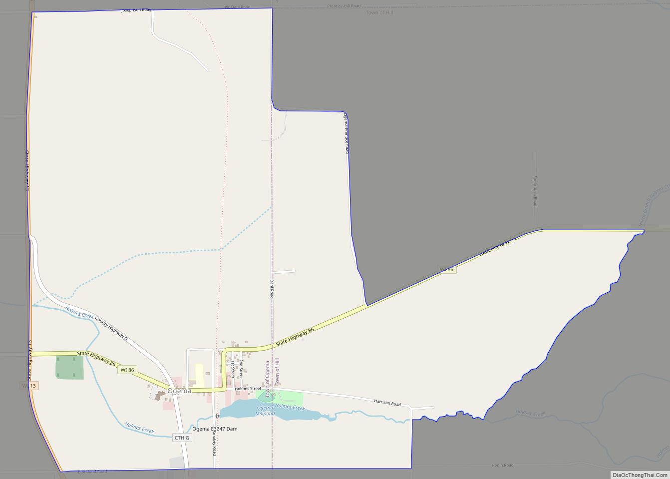
Ogema is an unincorporated census-designated place located in the town of Ogema, Price County, Wisconsin, United States. Ogema is located on Wisconsin Highway 86 near its junction with Wisconsin Highway 13, 7 miles (11 km) south of Prentice. Ogema has a post office with ZIP code 54459. As of the 2010 census, its population is 186. ... Read more
Map of Ogema CDP, Wisconsin
Map of Oconto city, Wisconsin
Oconto is a city in Oconto County, Wisconsin, United States. The population was 4,609 at the 2020 census. It is part of the Green Bay Metropolitan Statistical Area. The city is located partially within the town of Oconto. Oconto city overview: Name: Oconto city LSAD Code: 25 LSAD Description: city (suffix) State: Wisconsin County: Oconto ... Read more
Map of Oconto city, Wisconsin
Map of Oconto Falls city
Oconto Falls is a city in Oconto County, Wisconsin, United States. The population was 2,891 at the 2010 census. It is part of the Green Bay Metropolitan Statistical Area. Oconto Falls city overview: Name: Oconto Falls city LSAD Code: 25 LSAD Description: city (suffix) State: Wisconsin County: Oconto County Total Area: 2.93 sq mi (7.59 km²) Land Area: ... Read more
Map of Oconto Falls city
Map of Osseo city, Wisconsin
Osseo is a city located in Trempealeau County, Wisconsin, at the confluence of the North and South Forks of the Buffalo River. The population was 1,701 at the 2010 census. Osseo city overview: Name: Osseo city LSAD Code: 25 LSAD Description: city (suffix) State: Wisconsin County: Trempealeau County Elevation: 958 ft (292 m) Total Area: 2.07 sq mi (5.36 km²) ... Read more
Map of Osseo city, Wisconsin
Map of Pine River CDP, Wisconsin
Pine River is a census-designated place in Waushara County, Wisconsin, United States. The community is located at the intersection of County H and County E, in the town of Leon. As of the 2010 census, its population is 147. Pine River CDP overview: Name: Pine River CDP LSAD Code: 57 LSAD Description: CDP (suffix) State: ... Read more
Map of Pine River CDP, Wisconsin
Map of Oxford village, Wisconsin
Oxford is a town in Marquette County, Wisconsin, United States. The population was 859 at the 2000 census. The Village of Oxford is located within the town. Oxford village overview: Name: Oxford village LSAD Code: 47 LSAD Description: village (suffix) State: Wisconsin County: Marquette County FIPS code: 5560875 Online Interactive Map Oxford online map. Source: ... Read more
Map of Oxford village, Wisconsin
Map of Pigeon Falls village
Pigeon Falls is a village in Trempealeau County, Wisconsin, United States. The population was 411 at the 2010 census. Pigeon Falls village overview: Name: Pigeon Falls village LSAD Code: 47 LSAD Description: village (suffix) State: Wisconsin County: Trempealeau County Elevation: 866 ft (264 m) Total Area: 0.43 sq mi (1.12 km²) Land Area: 0.43 sq mi (1.12 km²) Water Area: 0.00 sq mi (0.00 km²) Total ... Read more
Map of Pigeon Falls village
Map of Phillips city, Wisconsin
Phillips is a city and the county seat of Price County, Wisconsin, United States. The population was 1,478 at the 2010 census. Phillips city overview: Name: Phillips city LSAD Code: 25 LSAD Description: city (suffix) State: Wisconsin County: Price County Elevation: 1,444 ft (440 m) Total Area: 3.34 sq mi (8.64 km²) Land Area: 2.63 sq mi (6.81 km²) Water Area: 0.71 sq mi (1.84 km²) ... Read more
Map of Phillips city, Wisconsin
Map of Peshtigo city
Peshtigo (/ˈpɛʃtɪɡoʊ/ PESH-ti-go) is a city in Marinette County, Wisconsin, United States. The population was 3,420 at the 2020 census The city is surrounded by the Town of Peshtigo. It is part of the Marinette, WI–MI Micropolitan Statistical Area. Peshtigo is known for being the site of the Peshtigo fire of 1871, in which more ... Read more
Map of Peshtigo city
Map of Plum City village
Plum City is a village in Pierce County, Wisconsin, United States. The population was 599 at the 2010 census. Plum City village overview: Name: Plum City village LSAD Code: 47 LSAD Description: village (suffix) State: Wisconsin County: Pierce County Elevation: 817 ft (249 m) Total Area: 1.04 sq mi (2.70 km²) Land Area: 1.04 sq mi (2.70 km²) Water Area: 0.00 sq mi (0.00 km²) Total ... Read more
Map of Plum City village
Map of Poy Sippi CDP
Poy Sippi is an unincorporated census-designated place in the town of Poy Sippi in Waushara County, Wisconsin, United States. It is located at the intersection of Wisconsin Highway 49 and County H. As of the 2010 census, its population is 371. Poy Sippi CDP overview: Name: Poy Sippi CDP LSAD Code: 57 LSAD Description: CDP ... Read more
Map of Poy Sippi CDP
Map of Powers Lake CDP, Wisconsin
Powers Lake is a census-designated place (CDP) in the towns of Randall and Wheatland, in Kenosha County in the U.S. state of Wisconsin. As of the 2020 census, the CDP had a population of 1,401. Part of the Powers Lake CDP was in Walworth County, but on December 20, 2011, it became part of the ... Read more
Map of Powers Lake CDP, Wisconsin