South Greeley is a census-designated place (CDP) in Laramie County, Wyoming, United States. It is part of the Cheyenne, Wyoming Metropolitan Statistical Area. The population was 4,733 at the 2020 census. The population was 4,217 at the 2010 census. South Greeley CDP overview: Name: South Greeley CDP LSAD Code: 57 LSAD Description: CDP (suffix) State: ... Read more
Wyoming Cities and Places
Smoot is a census-designated place (CDP) in Lincoln County, Wyoming, United States. The population was 195 at the 2010 census. Smoot CDP overview: Name: Smoot CDP LSAD Code: 57 LSAD Description: CDP (suffix) State: Wyoming County: Lincoln County Elevation: 6,611 ft (2,015 m) Total Area: 1.7 sq mi (4.4 km²) Land Area: 1.7 sq mi (4.4 km²) Water Area: 0.0 sq mi (0.0 km²) Total Population: ... Read more
Sleepy Hollow is a census-designated place (CDP) in Campbell County, Wyoming, United States. The population was 1,308 at the 2010 census. Sleepy Hollow CDP overview: Name: Sleepy Hollow CDP LSAD Code: 57 LSAD Description: CDP (suffix) State: Wyoming County: Campbell County Elevation: 4,561 ft (1,390 m) Total Area: 0.42 sq mi (1.08 km²) Land Area: 0.42 sq mi (1.08 km²) Water Area: 0.0 sq mi ... Read more
Slater is a census-designated place (CDP) in Platte County, Wyoming, United States. The population was 80 at the 2010 census. Slater CDP overview: Name: Slater CDP LSAD Code: 57 LSAD Description: CDP (suffix) State: Wyoming County: Platte County Elevation: 4,997 ft (1,523 m) Total Area: 74.0 sq mi (191.6 km²) Land Area: 74.0 sq mi (191.6 km²) Water Area: 0.0 sq mi (0.0 km²) Total Population: ... Read more
Sinclair is a town in Carbon County, Wyoming, United States. Sinclair town overview: Name: Sinclair town LSAD Code: 43 LSAD Description: town (suffix) State: Wyoming County: Carbon County Elevation: 6,588 ft (2,008 m) Total Area: 2.43 sq mi (6.30 km²) Land Area: 2.43 sq mi (6.30 km²) Water Area: 0.00 sq mi (0.00 km²) Total Population: 433 Population Density: 162.48/sq mi (62.73/km²) ZIP code: 82334 Area code: ... Read more
Shoshoni is a town in Fremont County, Wyoming, United States. The population was 471 at the 2020 census, down from 649 at the 2010 census. The town is named for the Shoshone Indian tribe, most of whom live on the nearby Wind River Indian Reservation. Shoshoni town overview: Name: Shoshoni town LSAD Code: 43 LSAD ... Read more
Sheridan is a town in the U.S. state of Wyoming and the county seat of Sheridan County. The town is located halfway between Yellowstone Park and Mount Rushmore by U.S. Route 14 and 16. It is the principal town of the Sheridan, Wyoming, Micropolitan Statistical Area which encompasses all of Sheridan County. The 2010 census ... Read more
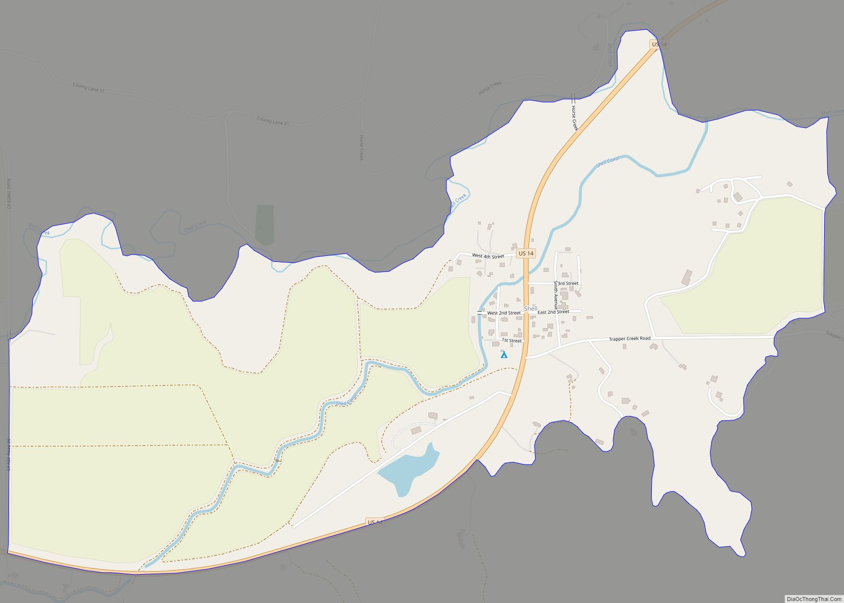
Shell is a census-designated place (CDP) in Big Horn County, Wyoming, United States. The population was 83 at the 2010 Census. The community is named for the abundance of fossil shells located in the area. Nearby exposed formations such as the Cloverly Formation and the Morrison Formation have yielded numerous fossils of dinosaurs and other ... Read more
Ten Sleep is a town in Washakie County, Wyoming, United States. It is located in the Bighorn Basin in the western foothills of the Bighorn Mountains, approximately 26 miles (42 km) east of Worland and 59 miles (95 km) west of Buffalo. The population was 206 at the 2020 census. Ten Sleep town overview: Name: Ten Sleep ... Read more
Saratoga is a town in Carbon County, Wyoming, United States. The population was 1,690 at the 2010 census. Saratoga is the home of the Steinley Cup microbrew festival and competition, usually held in August at Veterans Island Park, a playground and picnic facility on a small island in the North Platte River, which is designated ... Read more
Taylor is a census-designated place (CDP) in Lincoln County, Wyoming, United States. The population was 90 at the 2010 census. Taylor CDP overview: Name: Taylor CDP LSAD Code: 57 LSAD Description: CDP (suffix) State: Wyoming County: Lincoln County Total Area: 2.6 sq mi (6.6 km²) Land Area: 2.6 sq mi (6.6 km²) Water Area: 0.0 sq mi (0.0 km²) Total Population: 90 Population Density: ... Read more
Ryan Park is a census-designated place (CDP) in Carbon County, Wyoming, United States, that is located within the Medicine Bow–Routt National Forest. “Ryan Park” is designated as an acceptable place name by the United States Postal Service for mailing addresses and is assigned the ZIP code (82331) of Saratoga, the nearest incorporated town. The population ... Read more