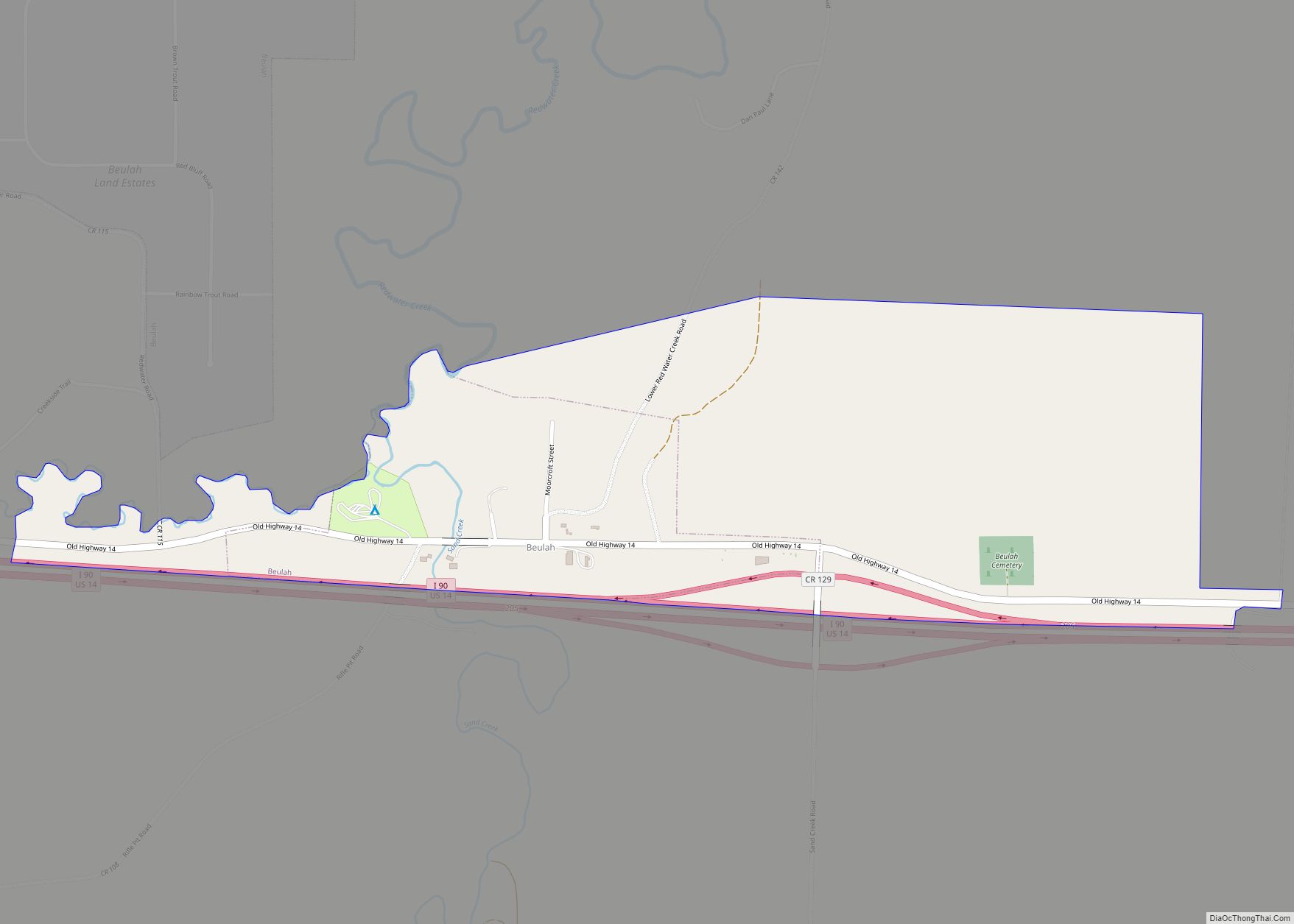
Map of Burns town, Wyoming
Burns is a town in Laramie County, Wyoming, United States. It is part of the Cheyenne, Wyoming Metropolitan Statistical Area. The population was 301 at the 2010 census. Burns town overview: Name: Burns town LSAD Code: 43 LSAD Description: town (suffix) State: Wyoming County: Laramie County Elevation: 5,518 ft (1,682 m) Total Area: 3.05 sq mi (7.91 km²) Land Area: ... Read more
Map of Burns town, Wyoming
Map of Baggs town
Baggs is a town in Carbon County, Wyoming, United States. The population was 411 at the 2020 census. Baggs is home to the Outlaw Stop, a branch of the Little Snake River Museum, which is headquartered in Savery. Baggs town overview: Name: Baggs town LSAD Code: 43 LSAD Description: town (suffix) State: Wyoming County: Carbon ... Read more
Map of Baggs town
Map of Burlington town, Wyoming
Burlington is a town in Big Horn County, Wyoming, United States. The population was 288 at the 2010 census. Burlington town overview: Name: Burlington town LSAD Code: 43 LSAD Description: town (suffix) State: Wyoming County: Big Horn County Elevation: 4,436 ft (1,352 m) Total Area: 1.01 sq mi (2.62 km²) Land Area: 1.01 sq mi (2.62 km²) Water Area: 0.00 sq mi (0.00 km²) Total Population: ... Read more
Map of Burlington town, Wyoming
Map of Bondurant CDP, Wyoming
Bondurant is a census-designated place (CDP) in Sublette County, Wyoming, United States. The population was 93 at the 2010 census. The town was named after B. F. Bondurant. Bondurant CDP overview: Name: Bondurant CDP LSAD Code: 57 LSAD Description: CDP (suffix) State: Wyoming County: Sublette County Elevation: 6,611 ft (2,015 m) Total Area: 52.8 sq mi (137 km²) Land Area: ... Read more
Map of Bondurant CDP, Wyoming
Map of Big Piney town
Big Piney is a town in Sublette County, Wyoming, United States. The population was 552 at the 2010 census. Big Piney town overview: Name: Big Piney town LSAD Code: 43 LSAD Description: town (suffix) State: Wyoming County: Sublette County Elevation: 6,824 ft (2,080 m) Total Area: 0.51 sq mi (1.32 km²) Land Area: 0.51 sq mi (1.32 km²) Water Area: 0.00 sq mi (0.00 km²) Total ... Read more
Map of Big Piney town
Map of Clearmont town, Wyoming
Clearmont is a town in Sheridan County, Wyoming, United States. The population was 142 at the 2010 census. Clearmont town overview: Name: Clearmont town LSAD Code: 43 LSAD Description: town (suffix) State: Wyoming County: Sheridan County Elevation: 3,918 ft (1,194 m) Total Area: 0.17 sq mi (0.43 km²) Land Area: 0.17 sq mi (0.43 km²) Water Area: 0.00 sq mi (0.00 km²) Total Population: 142 Population ... Read more
Map of Clearmont town, Wyoming
Map of Eden CDP, Wyoming
Eden is a census-designated place (CDP) in Sweetwater County, Wyoming, United States. The population was 281 at the 2010 census. Eden CDP overview: Name: Eden CDP LSAD Code: 57 LSAD Description: CDP (suffix) State: Wyoming County: Sweetwater County Elevation: 6,614 ft (2,016 m) Total Area: 13.5 sq mi (35 km²) Land Area: 13.5 sq mi (35 km²) Water Area: 0.0 sq mi (0 km²) Total Population: ... Read more
Map of Eden CDP, Wyoming
Map of Chugwater town
Chugwater is a town in Platte County, Wyoming, United States. As of the 2020 census, the town population was 175. Chugwater town overview: Name: Chugwater town LSAD Code: 43 LSAD Description: town (suffix) State: Wyoming County: Platte County Elevation: 5,295 ft (1,614 m) Total Area: 3.06 sq mi (7.93 km²) Land Area: 3.06 sq mi (7.93 km²) Water Area: 0.00 sq mi (0.00 km²) Total Population: ... Read more
Map of Chugwater town
Map of East Thermopolis town
East Thermopolis is a town in Hot Springs County, Wyoming, United States. The population was 229 at the 2020 census. East Thermopolis town overview: Name: East Thermopolis town LSAD Code: 43 LSAD Description: town (suffix) State: Wyoming County: Hot Springs County Elevation: 4,341 ft (1,323 m) Total Area: 0.18 sq mi (0.47 km²) Land Area: 0.18 sq mi (0.47 km²) Water Area: 0.00 sq mi ... Read more
Map of East Thermopolis town
Map of Chugcreek CDP
Chugcreek is a census-designated place (CDP) in Platte County, Wyoming, United States. The population was 156 at the 2010 census. Chugcreek CDP overview: Name: Chugcreek CDP LSAD Code: 57 LSAD Description: CDP (suffix) State: Wyoming County: Platte County Elevation: 4,757 ft (1,450 m) Total Area: 1.9 sq mi (5.0 km²) Land Area: 1.9 sq mi (5.0 km²) Water Area: 0.0 sq mi (0.0 km²) Total Population: ... Read more
Map of Chugcreek CDP
Map of Dubois town, Wyoming
Dubois is a town in Fremont County, Wyoming, United States. The population was 971 at the 2010 census, but dropped to 911 in the 2020 census. The population nearly doubles in the summer with many part-time residents. While the Town of Dubois includes 3.49 mi² within the Town Limits which constitutes a population density of ... Read more
Map of Dubois town, Wyoming
Map of Centennial CDP, Wyoming
Centennial is a small mountain-town in Albany County, Wyoming, United States. It serves a fairly large surrounding landscape, along with a few ranches, located along a gently sloping hillside traversed by a highway. Because it has been, since 1980 or later, included in a census-designated place (CDP), bearing the town’s name, specific demographics characterizing the ... Read more
Map of Centennial CDP, Wyoming