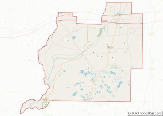
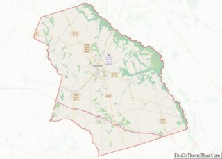
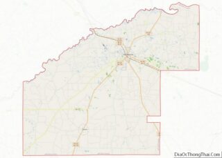
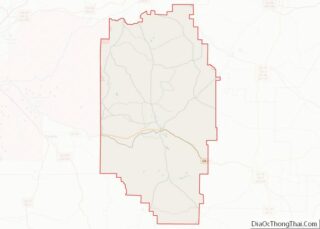
Map of Wetzel County

Map of Wetzel County, West Virginia

Wetzel County is a county in the U.S. state of West Virginia. As of the 2020 census, the population was 14,442. Its county seat is New Martinsville. The county, founded in 1846, is named for Lewis Wetzel, a famous frontiersman and Indian fighter. Its northern border aligns with the Mason-Dixon line, but is to the … Read more

Map of Dane County

Map of Dane County, Wisconsin

Dane County is a county in the U.S. state of Wisconsin. As of the 2020 census, the population was 561,504, making it the second-most populous county in Wisconsin. The county seat is Madison, which is also the state capital. Dane County is the central county of the Madison, Wisconsin, Metropolitan Statistical Area, as well as … Read more

Map of Juneau County

Map of Juneau County, Wisconsin

Juneau County is a county located in the U.S. state of Wisconsin. As of the 2020 census, the population was 26,718. Its county seat is Mauston. Juneau County overview: Name: Juneau County FIPS code: 55-057 State: Wisconsin Founded: 1857 Named for: Solomon Juneau Seat: Mauston Largest city: Mauston Total Area: 804 sq mi (2,080 km²) Land Area: 767 sq mi … Read more

Map of Oconto County

Map of Oconto County, Wisconsin

Oconto County overview: Name: Oconto County FIPS code: 55-083 State: Wisconsin Founded: 1854 Named for: Oconto River Seat: Oconto Largest city: Oconto Total Area: 1,149 sq mi (2,980 km²) Land Area: 998 sq mi (2,580 km²) Total Population: 38,965 Population Density: 39.1/sq mi (15.1/km²) Oconto County location map. Where is Oconto County? History First visited by French explorers in the 17th century, … Read more

Map of Shawano County

Map of Shawano County, Wisconsin

Shawano County (pronounced SHAW-no) (originally Shawanaw County) is a county located in the U.S. state of Wisconsin. As of the 2020 census, the population was 40,881. Its county seat is Shawano. Shawano County is included in the Shawano, WI Micropolitan Statistical Area, which is also included in the Green Bay-Shawano, WI Combined Statistical Area. Shawano … Read more

Map of Campbell County

Map of Campbell County, Wyoming

Campbell County is a county in the U.S. state of Wyoming. As of the 2020 United States Census, the population was 47,026, making it the third-most populous county in Wyoming. Its county seat is Gillette. Campbell County comprises the Gillette, WY Micropolitan Statistical Area. Campbell County overview: Name: Campbell County FIPS code: 56-005 State: Wyoming … Read more

Map of Sweetwater County

Map of Sweetwater County, Wyoming

Sweetwater County is a county in southwestern Wyoming, United States. As of the 2020 United States Census, the population was 42,272, making it the fourth-most populous county in Wyoming. Its county seat is Green River. By area, it is the largest county in Wyoming. Its southern boundary line abuts the north lines of the states … Read more

Map of Calhoun County

Map of Calhoun County, Alabama

Calhoun County is a county in the east central part of the U.S. state of Alabama. As of the 2020 census, the population was 116,441. Its county seat is Anniston. It was named in honor of John C. Calhoun, noted politician and US Senator from South Carolina. Calhoun County is included in the Anniston-Oxford Metropolitan … Read more

Map of Dallas County

Map of Dallas County, Alabama

Dallas County is a county located in the central part of the U.S. state of Alabama. As of the 2020 census, its population was 38,462. The county seat is Selma. Its name is in honor of United States Secretary of the Treasury Alexander J. Dallas, who served from 1814 to 1816. Dallas County comprises the … Read more

Map of Lawrence County

Map of Lawrence County, Alabama

Lawrence County is a county in the northern part of the U.S. state of Alabama. As of the 2020 census, the population was 33,073. The county seat is Moulton. The county was named after James Lawrence, a captain in the United States Navy from New Jersey. Lawrence County is included in the Decatur, AL Metropolitan … Read more

Map of Randolph County

Map of Randolph County, Alabama

Randolph County is a county on the central eastern border of the U.S. state of Alabama. As of the 2020 census, the population was 21,967. Its county seat is Wedowee. Its name is in honor of John Randolph, a member of the United States Senate from Virginia. Randolph County was a prohibition or dry county … Read more

Map of Bristol Bay Borough

Map of Bristol Bay Borough, Alaska

Bristol Bay Borough is a borough of the U.S. state of Alaska on Bristol Bay. As of the 2020 census the borough population was 844, down from 997 in 2010, the second-least populated borough in Alaska. The borough seat is Naknek. There are no incorporated settlements. Incorporated in 1962, Bristol Bay was the first of … Read more