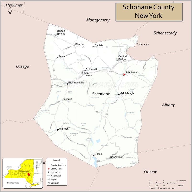
Schoharie County (/skoʊˈhɛəriː/ skoh-HAIR-ee) is a county in the U.S. state of New York. As of the 2020 census, the population was 29,714, making it the state’s fifth-least populous county. The county seat is Schoharie. “Schoharie” comes from a Mohawk word meaning “floating driftwood.” Schoharie County is part of the Albany–Schenectady–Troy, NY Metropolitan Statistical Area.
| Name: | Schoharie County |
|---|---|
| FIPS code: | 36-095 |
| State: | New York |
| Founded: | 1795 |
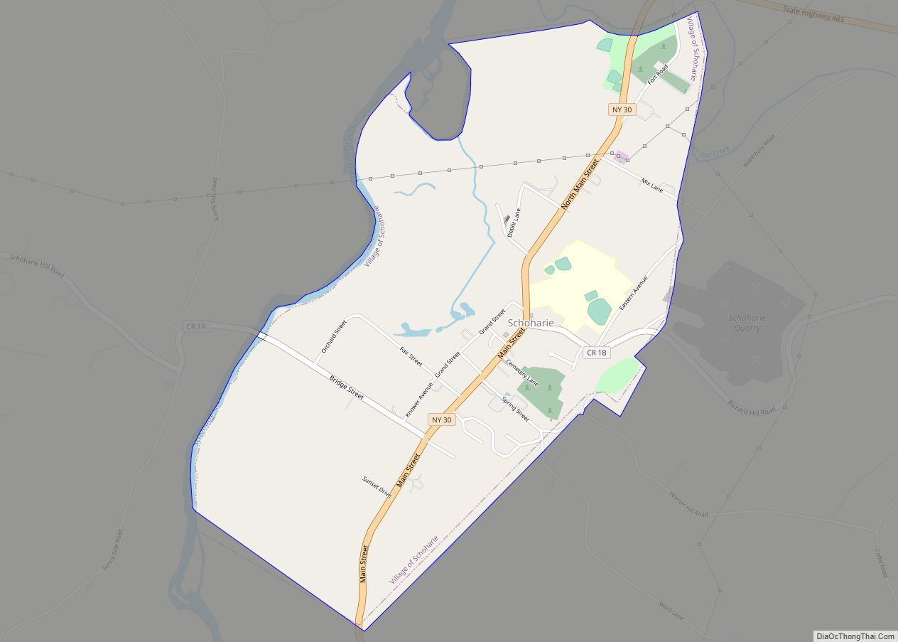
| Seat: | Schoharie |
| Total Area: | 626 sq mi (1,620 km²) |
| Land Area: | 622 sq mi (1,610 km²) |
| Total Population: | 29,714 |
| Population Density: | 47.5/sq mi (18.3/km²) |
| Time zone: | UTC−5 (Eastern) |
| Summer Time Zone (DST): | UTC−4 (EDT) |
| Website: | www.schohariecounty-ny.gov |
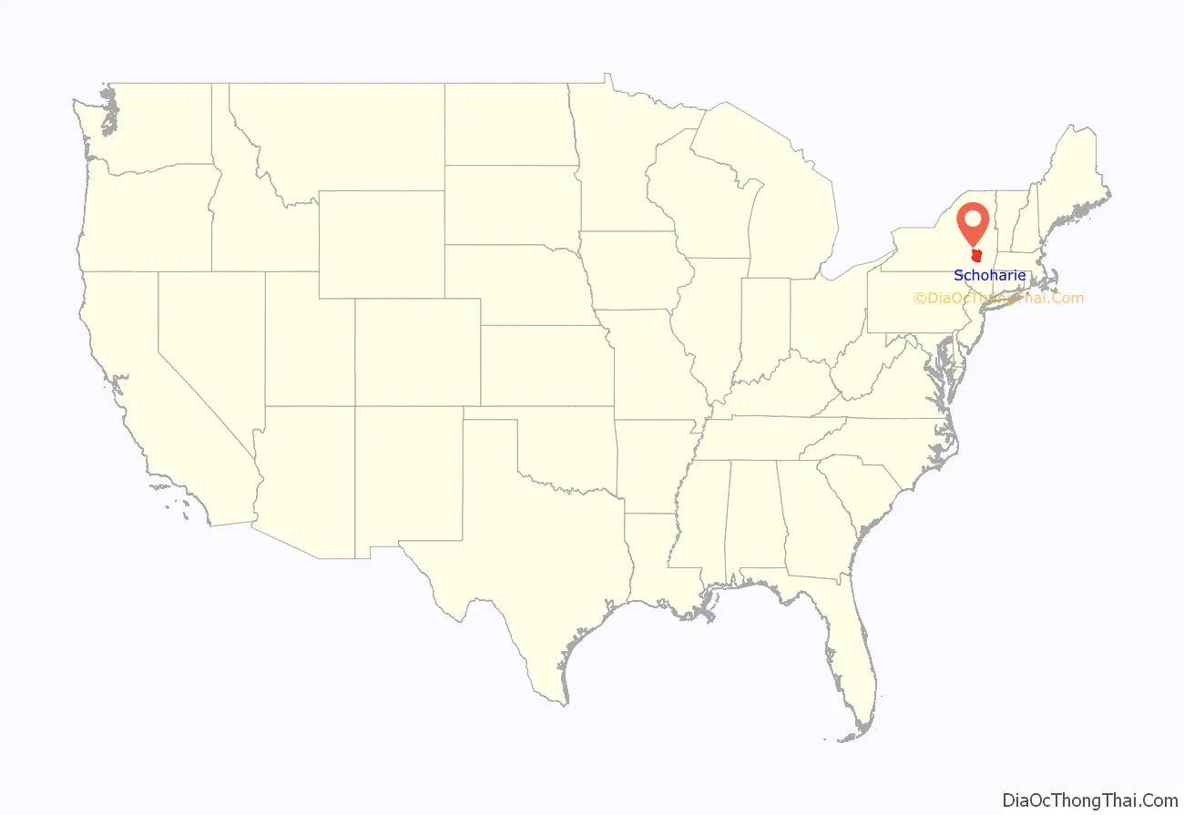
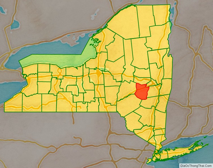
Schoharie County location map. Where is Schoharie County?
History
The large territory of the county (much of upstate and western New York) was long occupied by the Mohawk Nation and, to the west, the other four tribes of the Haudenosaunee Confederacy (increased to six with the migration of the Tuscarora from the South to New York in 1722). After European colonization of the Northeast started, the Mohawk had a lucrative fur trade with the French coming down from Canada, as well as the early Dutch colonists, and later British and German colonists.
Some Palatine Germans, who worked in camps on the Hudson to pay off their passage in 1710, later settled in this county in the 1720s and 30s. In addition, Scots-Irish immigrants settled in the present Schoharie County area before the American Revolutionary War, especially near Cherry Creek.
Political organization
After Great Britain defeated the Dutch and took over their colony in 1664, they began to establish counties in the New York territory in 1683. The present Schoharie County was first part of Albany County. This was an enormous county, including the northern part of New York State as well as all of the present State of Vermont. In theory, it extended westward to the Pacific Ocean, as the colonists wanted to keep their options open. This county was reduced in size on July 3, 1766, by the creation of Cumberland County, and further on March 16, 1770, by the creation of Gloucester County, both containing territory now part of Vermont.
On March 12, 1772, what was left of Albany County was split into three parts, one retaining the name Albany County. Tryon County was formed from the western portion of the territory (and thus, since no western boundary was specified, theoretically still extended west to the Pacific). The eastern boundary of Tryon County was approximately five miles west of the present city of Schenectady, and the county included the western part of the Adirondack Mountains and the area west of the West Branch of the Delaware River. The area then designated Tryon County was eventually organized into what are now 37 counties of New York State. The county was named for William Tryon, colonial governor of New York.
In the years preceding 1776, as social and political tensions rose in the colony, most of the Loyalists in Tryon County, then on the frontier, fled to Canada. In 1784, after the peace treaty that ended the Revolutionary War and the establishment of states, the new government changed Tryon County’s name to Montgomery County to honor United States General Richard Montgomery, who had captured several places in Canada and died trying to capture the city of Quebec.
The state continued to organize new counties. In 1789, Montgomery County was reduced in size by the splitting off of Ontario County. It was originally much larger than the present county, including present-day Allegany, Cattaraugus, Chautauqua, Erie, Genesee, Livingston, Monroe, Niagara, Orleans, Steuben, Wyoming, Yates, and part of Schuyler and Wayne counties.
In 1791, Otsego County was one of three counties split off from Montgomery (the other two being Herkimer and Tioga County).
In 1795, Schoharie County was created by joining portions of Otsego and Albany counties.
Revolutionary War
This was an area of fighting during the American Revolutionary War. On the frontier, colonists were subject to raids by British and their Iroquois allies. Four of the six tribes allied with the British, hoping to repel the colonists from their territory.
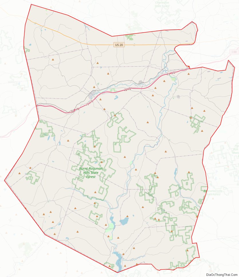
Schoharie County Road Map
Geography
According to the U.S. Census Bureau, the county has a total area of 626 square miles (1,620 km), of which 622 square miles (1,610 km) is land and 4.5 square miles (12 km) (0.7%) is water.
Schoharie County is in central New York State, west of Albany and southeast of Utica.
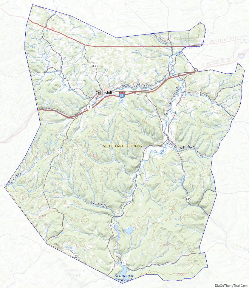
Much of the southern portion of the county lies within the Catskill Mountains. Land rises in both directions quite rapidly from Schoharie Creek in the middle of the county. In contrast, the northern part of the county is predominately small hills and valleys. More than 75% of the county’s population lives in the north, closer to the Mohawk River, the historic transportation route east and west through the state. Schoharie Creek is a northward-flowing tributary of the Mohawk River. The Schoharie Creek watershed spans an area of approximately 950 square miles (2,500 km). The course of Schoharie Creek includes two reservoir-dam systems.
The Gilboa Dam and the Schoharie Reservoir are part of the New York City Water Supply System. The New York Power Authority operates the Blenheim-Gilboa Dam and its reservoir to produce hydroelectric power. The headwaters of the Delaware River are located in the Town of Jefferson. Tributaries of the Susquehanna River are located in the Towns of Jefferson and Summit.
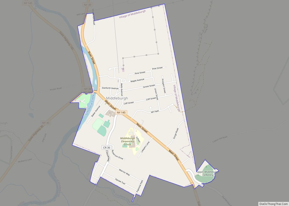
The highest point is at the summit of Huntersfield Mountain on the southern boundary with Greene County, at 3,423 feet (1,043 m) above sea level. The lowest point is where the Montgomery County line meets Schoharie Creek, 520 feet (158 m) above sea level. The most prominent geological feature is Vroman’s Nose, near the village of Middleburgh in the Town of Fulton.
Adjacent counties
- Albany County – east
- Delaware County – southwest
- Greene County – southeast
- Montgomery County – north
- Otsego County – west
- Schenectady County – northeast
Schoharie County Topographic Map
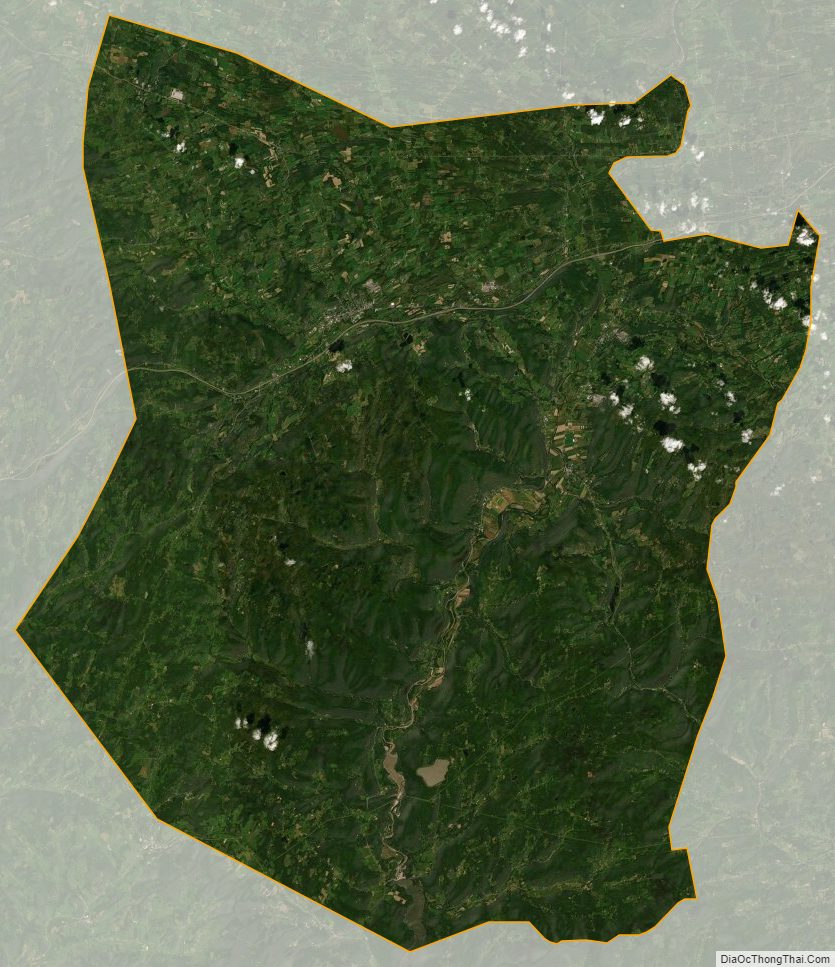
Schoharie County Satellite Map
Schoharie County Outline Map