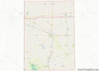
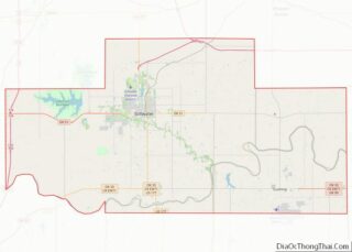
Map of Langlade County, Wisconsin
Langlade County is a county located in the U.S. state of Wisconsin. As of the 2020 census, the population was 19,491. Its county seat is Antigo. Langlade County overview: Name: Langlade County FIPS code: 55-067 State: Wisconsin Named for: Charles Michel de Langlade Seat: Antigo Largest city: Antigo Total Area: 888 sq mi (2,300 km²) Land Area: 871 sq mi ... Read more
Map of Langlade County, Wisconsin
Map of Portage County, Wisconsin
Portage County is a county in the U.S. state of Wisconsin. As of the 2020 census, the population was 70,377. Its county seat is Stevens Point. Portage County comprises the Stevens Point, WI Micropolitan Statistical Area and is included in the Wausau-Stevens Point-Wisconsin Rapids, WI Combined Statistical Area. Portage County overview: Name: Portage County FIPS ... Read more
Map of Portage County, Wisconsin
Map of Washburn County, Wisconsin
Washburn County is a county in the U.S. state of Wisconsin. It is named after Governor Cadwallader C. Washburn. As of the 2020 census, the population was 16,623. Its county seat is Shell Lake. The county was created in 1883. Washburn County overview: Name: Washburn County FIPS code: 55-129 State: Wisconsin Founded: 1883 Named for: ... Read more
Map of Washburn County, Wisconsin
Map of Johnson County, Wyoming
Johnson County is a county in the north central part of the U.S. state of Wyoming. At the 2020 United States Census, the population was 8,447. The county seat is Buffalo. Kaycee is the only other incorporated town in the county. Johnson County lies to the southeast of the Bighorn Mountains along Interstate 25 and ... Read more
Map of Johnson County, Wyoming
Map of Cleburne County, Alabama
Cleburne County is a county located in the east central portion of the U.S. state of Alabama. As of the 2020 census, the population was 15,056. Its county seat is Heflin. Its name is in honor of Patrick R. Cleburne of Arkansas who rose to the rank of major general in the Confederate States Army. ... Read more
Map of Cleburne County, Alabama
Map of Geneva County, Alabama
Geneva County is a county located in the southeastern part of the U.S. state of Alabama. As of the 2020 census, the population was 26,659. Its county seat is Geneva. The county was named after its county seat, which in turn was named after Geneva, New York which was named after Geneva, Switzerland, by Walter ... Read more
Map of Geneva County, Alabama
Map of Marion County, Alabama
Marion County is a county of the U.S. state of Alabama. As of the 2020 census the population was 29,341. The county seat is Hamilton. The county was created by an act of the Alabama Territorial General Assembly on February 13, 1818. The county seat was originally established in Pikeville in 1820, and moved to ... Read more
Map of Marion County, Alabama
Map of Tuscaloosa County, Alabama
Tuscaloosa County is a county in the northwest-central portion of the U.S. state of Alabama and is the center of commerce, education, industry, health care, and entertainment for the region. The county’s population was 227,036 as of the 2020 census. The county seat and largest city is Tuscaloosa. Tuscaloosa County is part of the Tuscaloosa, ... Read more
Map of Tuscaloosa County, Alabama
Map of Ketchikan Gateway Borough, Alaska
Ketchikan Gateway Borough is a borough located in the U.S. state of Alaska. As of the 2020 census its population was 13,948, up from 13,477 in 2010. The borough seat is Ketchikan. The borough is the second most populous borough in Southeast Alaska, the first being Juneau Borough. Ketchikan Gateway Borough comprises the Ketchikan, AK ... Read more
Map of Ketchikan Gateway Borough, Alaska
Map of Cochise County, Arizona
Cochise County (/koʊˈtʃiːs/) is a county in the southeastern corner of the U.S. state of Arizona. It is named after the Native American chief Cochise. The population was 125,447 at the 2020 census. The county seat is Bisbee and the most populous city is Sierra Vista. Cochise County includes the Sierra Vista–Douglas, Arizona Metropolitan Statistical ... Read more
Map of Cochise County, Arizona
Map of Baxter County, Arkansas
Baxter County is a county in the U.S. state of Arkansas. As of the 2020 census, the county’s population was 41,627. The county seat is Mountain Home. It is Arkansas’s 66th county, formed on March 24, 1873, and named for Elisha Baxter, the tenth governor of Arkansas. The Mountain Home, AR, Micropolitan Statistical Area includes ... Read more
Map of Baxter County, Arkansas
Map of Cross County, Arkansas
Cross County is a rural Northeast Arkansas county in the Arkansas Delta. Created as Arkansas’s 53rd county on November 15, 1862, Cross County contains four incorporated municipalities, including Wynne, the county seat and most populous city. It is named for Confederate Colonel David C. Cross, a political leader in the area. The county is largely ... Read more
Map of Cross County, Arkansas