Steele County is a county in the U.S. state of North Dakota. As of the 2020 census, the population was 1,798, making it the fifth-least populous county in North Dakota. Its county seat since 1919 is Finley.
| Name: | Steele County |
|---|---|
| FIPS code: | 38-091 |
| State: | North Dakota |
| Founded: | 1883 |
| Named for: | Edward H. Steele |
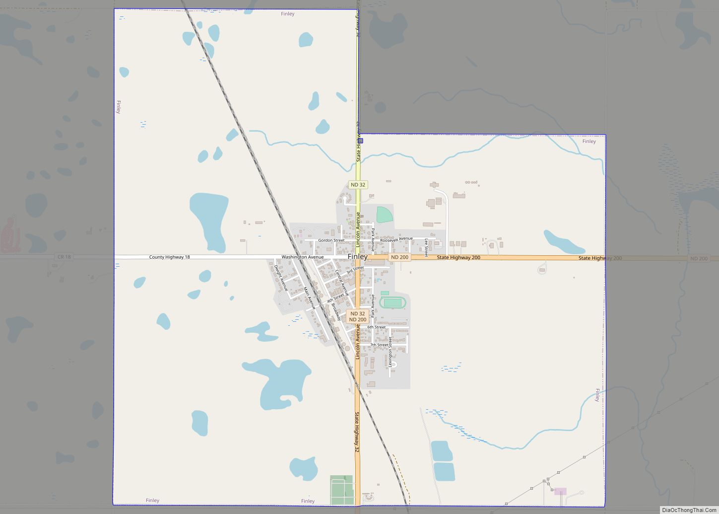
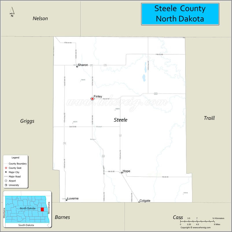
| Seat: | Finley |
| Largest city: | Finley |
| Total Area: | 715 sq mi (1,850 km²) |
| Land Area: | 712 sq mi (1,840 km²) |
| Total Population: | 1,798 |
| Population Density: | 2.5/sq mi (0.97/km²) |
| Time zone: | UTC−6 (Central) |
| Summer Time Zone (DST): | UTC−5 (CDT) |
| Website: | www.co.steele.nd.us |
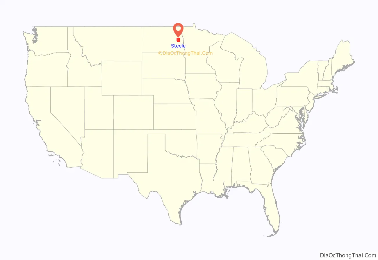
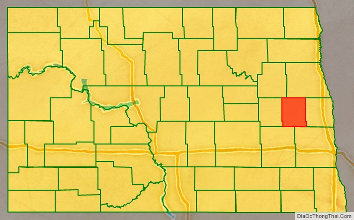
Steele County location map. Where is Steele County?
History
The Dakota Territory legislature created the county on June 2, 1883, with territories partitioned from Griggs and Traill counties. It was not organized at that time, but was attached to Traill for administrative and judicial purposes. It was named for businessman Edward H. Steele, who had pushed for its creation.
On July 13, 1883, the county organization was effected and Steele County was detached from Traill County; Sherbrooke, North Dakota was chosen as the county seat. In 1897 the town of Finley was founded, and by 1919 its growth had eclipsed Sherbrooke to the point that the county seat was transferred to Finley. The county’s boundaries have been unchanged since its creation.
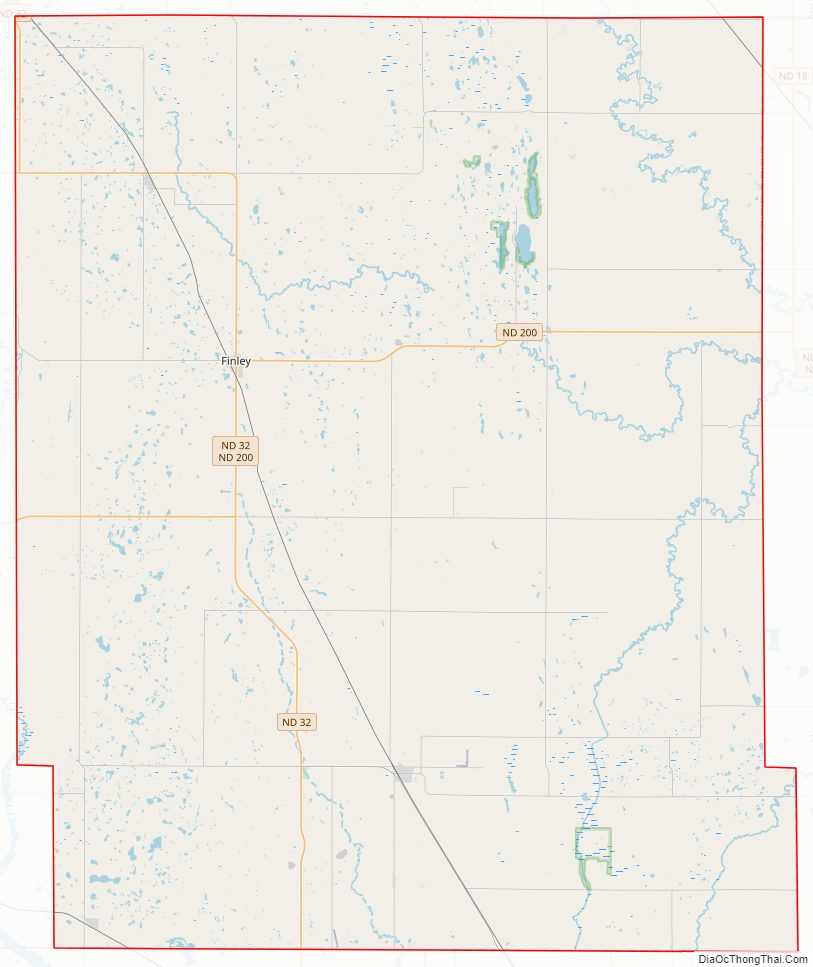
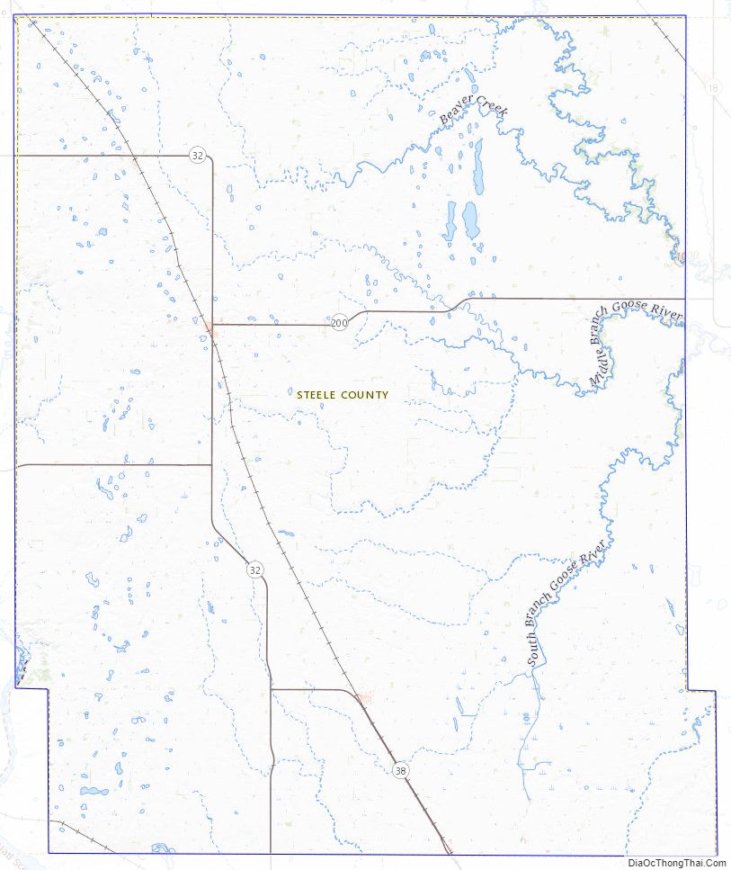
Steele County Road Map
Geography
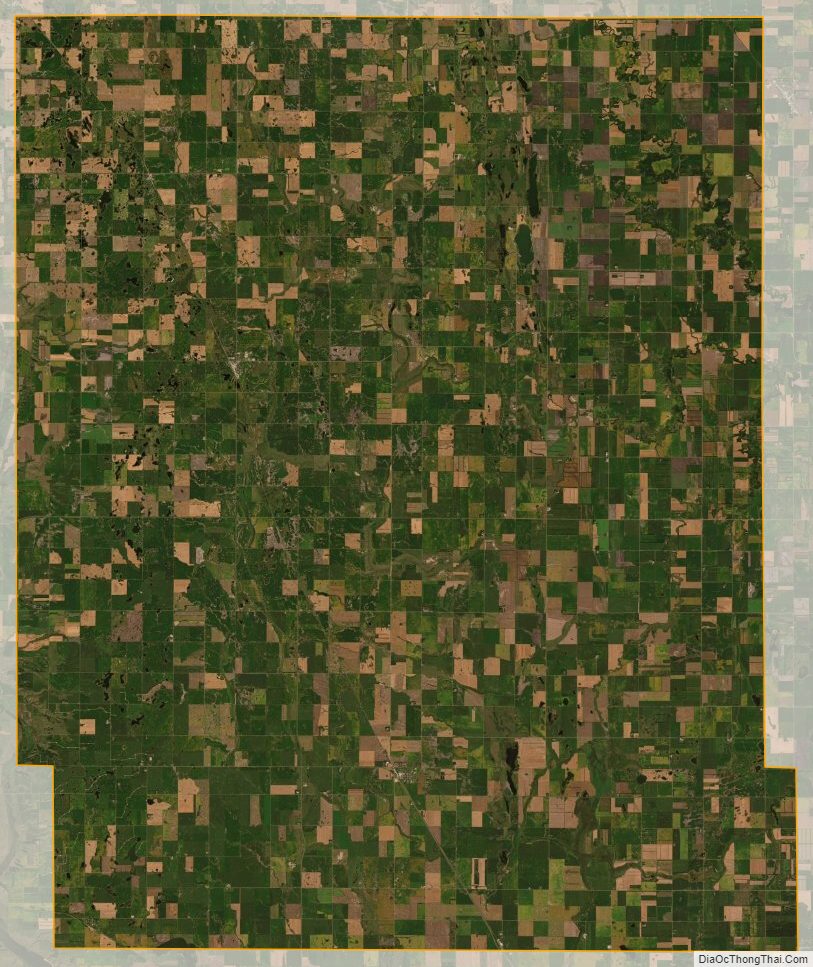
The Sheyenne River flows south near and into the county’s west boundary line. The Goose River flows southeast through the northeastern part of the county. The terrain consists of rolling hills dotted with lakes and ponds. The area is devoted to agriculture. The terrain slopes to the south and east; its highest point is near its northwestern corner, at 1,562′ (464m) ASL. The county has an area of 715 square miles (1,850 km), of which 712 square miles (1,840 km) is land and 3.2 square miles (8.3 km) (0.5%) is water.
Major highways
- North Dakota Route 32
- North Dakota Route 38
- North Dakota Route 200
Adjacent counties
- Grand Forks County – north
- Traill County – east
- Cass County – southeast
- Barnes County – southwest
- Griggs County – west
- Nelson County – northwest
Lakes
- Golden Lake
- Golden Rush Lake
- Lake Tobiason
- Lone Tree Lake
- North Golden Lake
- Stony Lake
- Willow Lake
Steele County Topographic Map
Steele County Satellite Map
Steele County Outline Map