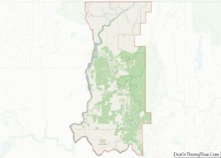
Adams County is a county in the U.S. state of Washington. As of the 2020 census, the population was 20,613. The county seat is at Ritzville, and its largest city is Othello. The county was formed out of Whitman County in November 1883 and is named after John Adams, the second President of the United ... Read more
King County is located in the U.S. state of Washington. The population was 2,269,675 in the 2020 census, making it the most populous county in Washington, and the 13th-most populous in the United States. The county seat is Seattle, also the state’s most populous city. King County is one of three Washington counties that are ... Read more
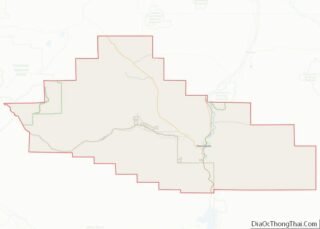
Stevens County is a county located in the U.S. state of Washington along the Canada–US border. At the 2020 census, its population was 46,445. As of July 2021, the population was estimated to be 47,426. The county seat and largest city is Colville. The county was created in 1863 and named after Isaac Stevens, the ... Read more
Fayette County overview: Name: Fayette County FIPS code: 54-019 State: West Virginia Founded: February 28, 1831 Named for: Marquis de la Fayette Seat: Fayetteville Largest city: Oak Hill Total Area: 668 sq mi (1,730 km²) Land Area: 662 sq mi (1,710 km²) Total Population: 40,488 Population Density: 61/sq mi (23/km²) Fayette County location map. Where is Fayette County? History Fayette County—originally Fayette ... Read more
Mason County is a county in the U.S. state of West Virginia. As of the 2020 census, the population was 25,453. Its county seat and largest city is Point Pleasant. The county was founded in 1804 and named for George Mason, delegate to the U.S. Constitutional Convention. Before the Civil War, the county was in ... Read more
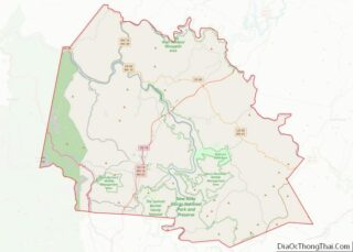
Randolph County is a county located in the U.S. state of West Virginia. As of the 2020 census, the population was 27,932. Its county seat is Elkins. The county was founded in 1787 and is named for Edmund Jennings Randolph. Randolph County comprises the Elkins, West Virginia, Micropolitan Statistical Area. Randolph County overview: Name: Randolph ... Read more
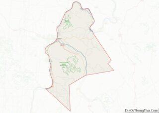
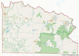
Barron County is a county located in the U.S. state of Wisconsin. As of the 2020 census, the population was 46,711. Its county seat is Barron. The county was created in 1859 and later organized in 1874. Barron County overview: Name: Barron County FIPS code: 55-005 State: Wisconsin Founded: 1874 Named for: Henry D. Barron ... Read more
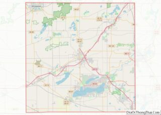
Florence County is a county located in the U.S. state of Wisconsin. As of the 2020 census, the population was 4,558, making it the second-least populous county in Wisconsin after Menominee County. Its county seat is Florence. Florence County is part of the Iron Mountain, MI–WI Micropolitan Statistical Area. Florence County overview: Name: Florence County ... Read more
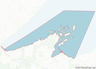
Lake Superior Water body overview: Name: Lake Superior Water body State: Wisconsin Lake Superior Water body location map. Where is Lake Superior Water body? Lake Superior Water body Road Map Lake Superior Water body Topographic Map Lake Superior Water body Satellite Map Lake Superior Water body Outline Map
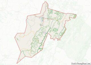
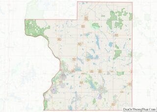
Polk County is a county in the U.S. state of Wisconsin. As of the 2020 census, the population was 44,977. Its county seat is Balsam Lake. The county was created in 1853. Polk County overview: Name: Polk County FIPS code: 55-095 State: Wisconsin Founded: 1853 Named for: James K. Polk Seat: Balsam Lake Largest city: ... Read more
Walworth County is a county located in the U.S. state of Wisconsin. As of the 2020 census, the population was 106,478. Its county seat is Elkhorn. The county was created in 1836 from Wisconsin Territory and organized in 1839. It is named for Reuben H. Walworth. Walworth County comprises the Whitewater-Elkhorn, WI Micropolitan Statistical Area ... Read more
Hot Springs County is a county in the U.S. state of Wyoming. As of the 2020 United States Census, the population was 4,696, making it the second-least populous county in Wyoming. Its county seat is Thermopolis. The county is named for the hot springs located in Hot Springs State Park. Hot Springs County overview: Name: ... Read more