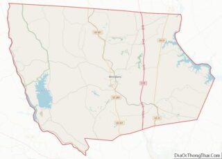
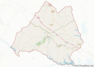
Map of Howard County, Arkansas
Howard County is a county located in the U.S. state of Arkansas. As of the 2020 census, the population was 12,785. The county seat is Nashville. Howard County is Arkansas’s 74th county, formed on April 17, 1873, and named for James Howard, a state senator. It is a dry county. Howard County overview: Name: Howard ... Read more
Map of Howard County, Arkansas
Map of Mississippi County, Arkansas
Mississippi County is the easternmost county in the U.S. state of Arkansas. As of the 2020 census, the population was 40,685. There are two county seats, Blytheville and Osceola. The county was formed on November 1, 1833, and named for the Mississippi River which borders the county to the east. Mississippi County is part of ... Read more
Map of Mississippi County, Arkansas
Map of Saline County, Arkansas
Saline County (/ˈsʌ.liːn/ suh-LEAN) is located in the U.S. state of Arkansas. As of the 2020 census, the population was 123,416. Its county seat and largest city is Benton. Saline County was formed on November 2, 1835, and named for the salt water (brine) springs in the area, despite a differing pronunciation from saline. Until ... Read more
Map of Saline County, Arkansas
Map of Butte County, California
Butte County (/ˈbjuːt/ (listen)) is a county located in the northern part of the U.S. state of California. In the 2020 census, its population was 211,632. The county seat is Oroville. Butte County comprises the Chico, CA metropolitan statistical area. It is in the California Central Valley, north of the state capital of Sacramento. Butte ... Read more
Map of Butte County, California
Map of Madera County, California
Madera County (/məˈdɛərə/ (listen)), officially the County of Madera, is a county at the geographic center of the U.S. state of California. As of the 2020 census, the population was 156,255. The county seat is Madera. Madera County comprises the Madera, CA Metropolitan Statistical Area, which is included in the Fresno-Madera, CA Combined Statistical Area. ... Read more
Map of Madera County, California
Map of San Bernardino County, California
San Bernardino County (/sæn ˌbɜːrnəˈdiːnoʊ/ (listen)), officially the County of San Bernardino, is a county located in the southern portion of the U.S. state of California, and is located within the Inland Empire area. As of the 2020 U.S. Census, the population was 2,181,654, making it the fifth-most populous county in California and the 14th-most ... Read more
Map of San Bernardino County, California
Map of Tehama County, California
Tehama County (/təˈheɪmə/ (listen) tə-HAY-mə; Wintun for “high water”) is a county located in the northern part of the U.S. state of California. As of the 2020 census, the population was 65,829. The county seat and largest city is Red Bluff. Tehama County comprises the Red Bluff, California micropolitan statistical area, which is also included ... Read more
Map of Tehama County, California
Map of Cheyenne County, Colorado
Cheyenne County is a county located in the U.S. state of Colorado. The county population was 1,748 at 2020 census. The county seat is Cheyenne Wells. Cheyenne County overview: Name: Cheyenne County FIPS code: 08-017 State: Colorado Founded: March 25, 1889 Named for: The Cheyenne Nation Seat: Cheyenne Wells Largest town: Cheyenne Wells Total Area: ... Read more
Map of Cheyenne County, Colorado
Map of Grand County, Colorado
Grand County overview: Name: Grand County FIPS code: 08-049 State: Colorado Founded: February 2, 1874 Named for: Grand Lake and Grand River Seat: Hot Sulphur Springs Largest town: Granby Total Area: 1,870 sq mi (4,800 km²) Land Area: 1,846 sq mi (4,780 km²) Total Population: 15,860 Population Density: 8.5/sq mi (3.3/km²) Time zone: UTC−7 (Mountain) Summer Time Zone (DST): UTC−6 (MDT) Website: ... Read more
Map of Grand County, Colorado
Map of Moffat County, Colorado
Moffat County is a county located in the U.S. state of Colorado. As of the 2020 census, the population was 13,292. The county seat is Craig. With an area of 4,751 square miles, it is the 2nd largest county by area in Colorado, behind Las Animas County. Moffat County comprises the Craig, CO Micropolitan Statistical ... Read more
Map of Moffat County, Colorado
Map of San Miguel County, Colorado
San Miguel County is a county located in the U.S. state of Colorado. As of the 2020 census, the population was 8,072. The county seat is Telluride. The county is named for the San Miguel River. San Miguel County overview: Name: San Miguel County FIPS code: 08-113 State: Colorado Founded: March 2, 1883 Named for: ... Read more
Map of San Miguel County, Colorado
Map of New Castle County, Delaware
New Castle County is the northernmost of the three counties of the U.S. state of Delaware (New Castle, Kent, and Sussex). As of the 2020 census, the population was 570,719, making it the most populous county in Delaware, with nearly 60% of the state’s population of 989,948. The county seat is Wilmington, which is also ... Read more
Map of New Castle County, Delaware