Map of Nicholas County, West Virginia
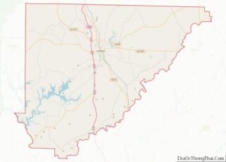
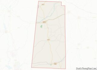
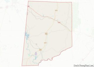
Nicholas County overview: Name: Nicholas County FIPS code: 54-067 State: West Virginia Founded: January 30, 1818 Named for: Wilson Cary Nicholas Seat: Summersville Largest city: Summersville Total Area: 654 sq mi (1,690 km²) Land Area: 647 sq mi (1,680 km²) Total Population: 24,604 Population Density: 38/sq mi (15/km²) Nicholas County location map. Where is Nicholas County? Nicholas County Road Map Geography According ... Read more
Map of Nicholas County, West Virginia
Map of Wayne County, West Virginia
Wayne County is the westernmost county in the U.S. state of West Virginia. As of the 2020 census, the population was 38,982. Its county seat is Wayne. The county was founded in 1842 and named for General “Mad” Anthony Wayne. Wayne County is part of the Huntington-Ashland, WV-KY-OH Metropolitan Statistical Area. Wayne County overview: Name: ... Read more
Map of Wayne County, West Virginia
Map of Columbia County, Wisconsin
Columbia County is a county located in the U.S. state of Wisconsin. As of the 2020 census, the population was 58,490. Its county seat and largest city is Portage. The county was created in 1846 as part of Wisconsin Territory. Columbia County is part of the Madison, WI Metropolitan Statistical Area as well as the ... Read more
Map of Columbia County, Wisconsin
Map of Jackson County, Wisconsin
Jackson County is a county located in the U.S. state of Wisconsin. As of the 2020 census, the population was 21,145. Its county seat is Black River Falls. Jackson County was formed from Crawford County in 1853. It was named for President Andrew Jackson. Jackson County overview: Name: Jackson County FIPS code: 55-053 State: Wisconsin ... Read more
Map of Jackson County, Wisconsin
Map of Milwaukee County, Wisconsin
Milwaukee County is located in the U.S. state of Wisconsin. At the 2020 census, the population was 939,489, down from 947,735 in 2010. It is both the most populous and most densely populated county in Wisconsin, and the 45th most populous county nationwide; Milwaukee, its eponymous county seat, is also the most populous city in ... Read more
Map of Milwaukee County, Wisconsin
Map of Sauk County, Wisconsin
Sauk County is a county in Wisconsin. It is named after a large village of the Sauk people. As of the 2020 census, the population was 65,763. Its county seat and largest city is Baraboo. The county was created in 1840 from Wisconsin Territory and organized in 1844. Sauk County comprises the Baraboo, WI Micropolitan ... Read more
Map of Sauk County, Wisconsin
Map of Albany County, Wyoming
Albany County (/ˈɔːlbəni/ (listen) AWL-bə-nee) is a county in the U.S. state of Wyoming. As of the 2020 United States Census, the population was 37,066. Its county seat is Laramie, the site of the University of Wyoming. Its south border lies on the northern Colorado state line. Albany County comprises the Laramie, WY Micropolitan Statistical ... Read more
Map of Albany County, Wyoming
Map of Sheridan County, Wyoming
Sheridan County is a county in the U.S. state of Wyoming. As of the 2020 United States Census, the population was 30,921. The county seat is Sheridan. Its northern boundary abuts the Montana state border. Sheridan County comprises the Sheridan, WY Micropolitan Statistical Area. Sheridan County overview: Name: Sheridan County FIPS code: 56-033 State: Wyoming ... Read more
Map of Sheridan County, Wyoming
Map of Bullock County, Alabama
Bullock County is a county of the U.S. state of Alabama. As of the 2020 census, the population was 10,357. Union Springs was chosen as the county seat in 1867, and presently is the county’s only incorporated city. The county was named for Confederate Army Colonel Edward C. Bullock who was a state senator and ... Read more
Map of Bullock County, Alabama
Map of Cullman County, Alabama
Cullman County is a county located in the north central portion of the U.S. state of Alabama. As of the 2020 census, the population was 87,866. Its county seat and largest city is Cullman. Its name is in honor of Colonel John G. Cullmann. Cullman County comprises the Cullman, AL Micropolitan Statistical Area, which is ... Read more
Map of Cullman County, Alabama
Map of Lamar County, Alabama
Lamar County (formerly Jones County and Sanford County) is a county in the U.S. state of Alabama. As of the 2020 census, the population was 13,972. Its county seat is Vernon and it is a dry county. It is named in honor of Lucius Quintus Cincinnatus Lamar, a former member of both houses of the ... Read more
Map of Lamar County, Alabama
Map of Pickens County, Alabama
Pickens County is a county located on the west central border of the U.S. state of Alabama. As of the 2020 census, the population was 19,123. Its county seat is Carrollton, located in the center of the county. It is a prohibition, or dry county, although the communities of Carrollton and Aliceville voted to become ... Read more
Map of Pickens County, Alabama