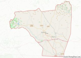
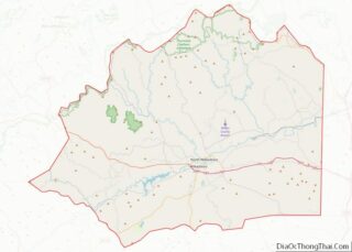
Map of Yazoo County, Mississippi
Yazoo County is a county located in the U.S. state of Mississippi. As of the 2020 census, the population was 26,743. The county seat is Yazoo City. It is named for the Yazoo River, which forms its western border. Its name is said to come from a Choctaw language word meaning “River of Death.” Yazoo ... Read more
Map of Yazoo County, Mississippi
Map of Cape Girardeau County, Missouri
Cape Girardeau County is located in the southeastern part of the U.S. state of Missouri; its eastern border is formed by the Mississippi River. At the 2020 census, the population was 81,710. The county seat is Jackson, the first city in the US to be named in honor of President Andrew Jackson. Officially organized on ... Read more
Map of Cape Girardeau County, Missouri
Map of DeKalb County, Missouri
DeKalb County is a county located in the northwest portion of the U.S. state of Missouri. As of the 2020 census, the population was 11,029. Its county seat is Maysville. The county was organized February 25, 1845 and named for General Johann de Kalb, Baron de Kalb, of the Revolutionary War. DeKalb County is part ... Read more
Map of DeKalb County, Missouri
Map of Jackson County, Missouri
Jackson County is located in the western portion of the U.S. state of Missouri, on the border with Kansas. As of the 2020 census, the population was 717,204. making it the second-most populous county in the state (after St. Louis County in the east). It is the most populated county in the Kansas City metropolitan ... Read more
Map of Jackson County, Missouri
Map of McDonald County, Missouri
McDonald County overview: Name: McDonald County FIPS code: 29-119 State: Missouri Founded: March 3, 1849 Named for: Sergeant Alexander McDonald, a soldier in the American Revolutionary War Seat: Pineville Largest city: Anderson Total Area: 540 sq mi (1,400 km²) Land Area: 539 sq mi (1,400 km²) Total Population: 23,083 Population Density: 43/sq mi (17/km²) Time zone: UTC−6 (Central) Summer Time Zone (DST): ... Read more
Map of McDonald County, Missouri
Map of Pettis County, Missouri
Pettis County is a county located in west central U.S. state of Missouri. As of the 2010 census, the population was 42,201. Its county seat is Sedalia. The county was organized January 24, 1833, and named after former U.S. Representative Spencer Darwin Pettis. Pettis County comprises the Sedalia, MO Micropolitan Statistical Area. The county is ... Read more
Map of Pettis County, Missouri
Map of Ste. Genevieve County, Missouri
Sainte Genevieve County, often abbreviated Ste. Genevieve County (French: Ste-Geneviève), is a county located in the eastern portion of the U.S. state of Missouri. As of the 2020 census, the population was 18,479. The largest city and county seat is Ste. Genevieve. The county was officially organized on October 1, 1812, and is named after ... Read more
Map of Ste. Genevieve County, Missouri
Map of Webster County, Missouri
Webster County is a county located in the U.S. state of Missouri. As of the 2010 census, the population was 36,202. Its county seat is Marshfield. The county was organized in 1855 and named for U.S. Senator and U.S. Secretary of State Daniel Webster. Webster County is part of the Springfield, MO Metropolitan Statistical Area. ... Read more
Map of Webster County, Missouri
Map of Fergus County, Montana
Fergus County is a county in the U.S. state of Montana. As of the 2020 census, the population was 11,446. Its county seat is Lewistown. The county was founded in 1885 and named for James Fergus, a Montana politician who was instrumental in creating the county. Fergus County overview: Name: Fergus County FIPS code: 30-027 ... Read more
Map of Fergus County, Montana
Map of Meagher County, Montana
Meagher County (/ˈmɑːr/ MARR) is a county located in the U.S. state of Montana. As of the 2020 census, the population was 1,927. Its county seat is White Sulphur Springs. According to the United States Census Bureau, the 2010 center of population of Montana is located in Meagher County at 46°47′N 111°18′W / 46.78°N 111.3°W ... Read more
Map of Meagher County, Montana
Map of Sheridan County, Montana
Sheridan County is a county in the U.S. state of Montana. As of the 2020 census, the population was 3,539. Its county seat is Plentywood. Its northern boundary is the Canada–United States border south of Saskatchewan. Sheridan County overview: Name: Sheridan County FIPS code: 30-091 State: Montana Founded: March 11, 1913 Named for: Philip Sheridan ... Read more
Map of Sheridan County, Montana
Map of Boone County, Nebraska
Boone County is a county in the U.S. state of Nebraska. As of the 2020 United States Census, the population was 5,386. Its county seat is Albion. The county was organized in 1871 and named after Daniel Boone. In the Nebraska license plate system, Boone County is represented by the prefix 23 (it had the ... Read more
Map of Boone County, Nebraska