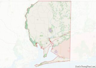
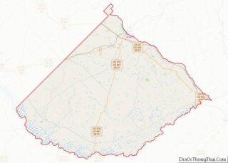
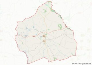
Map of Oldham County, Kentucky
Oldham County is a county located in the north central part of the U.S. state and commonwealth of Kentucky. As of the 2020 census, the population was 67,607. Its county seat is La Grange. The county is named for Colonel William Oldham. Oldham County is part of the Louisville/Jefferson County, KY–IN Metropolitan Statistical Area. Oldham ... Read more
Map of Oldham County, Kentucky
Map of Taylor County, Kentucky
Taylor County is a county located in the U.S. state of Kentucky. As of the 2020 census, the population was 26,023. Its county seat is Campbellsville. Settled by people from Virginia, Pennsylvania, Maryland, and North Carolina after the American Revolutionary War, the county was organized in 1848 in the Highland Rim region. It is named ... Read more
Map of Taylor County, Kentucky
Map of Avoyelles Parish, Louisiana
Avoyelles (French: Paroisse des Avoyelles) is a parish located in central eastern Louisiana on the Red River where it effectively becomes the Atchafalaya River and meets the Mississippi River. As of the 2020 census, the population was 39,693. The parish seat is Marksville. The parish was created in 1807, with the name deriving from the ... Read more
Map of Avoyelles Parish, Louisiana
Map of Franklin Parish, Louisiana
Franklin Parish overview: Name: Franklin Parish FIPS code: 22-041 State: Louisiana Founded: 1843 Named for: Benjamin Franklin Seat: Winnsboro Largest city: Winnsboro Total Area: 635 sq mi (1,640 km²) Land Area: 625 sq mi (1,620 km²) Total Population: 19,774 Population Density: 31/sq mi (12/km²) Time zone: UTC−6 (Central) Summer Time Zone (DST): UTC−5 (CDT) Franklin Parish location map. Where is Franklin Parish? ... Read more
Map of Franklin Parish, Louisiana
Map of Ouachita Parish, Louisiana
Ouachita Parish overview: Name: Ouachita Parish FIPS code: 22-073 State: Louisiana Founded: March 31, 1807 Named for: Ouachita people Seat: Monroe Total Area: 1,640 km² (632 sq mi) Land Area: 1,600 km² (610 sq mi) Total Population: 160,368 Population Density: 98/km² (250/sq mi) Time zone: UTC-6 (CST) Summer Time Zone (DST): UTC-5 (CDT) Website: Ouachita Parish Police Jury Ouachita Parish location map. ... Read more
Map of Ouachita Parish, Louisiana
Map of Tangipahoa Parish, Louisiana
Tangipahoa Parish overview: Name: Tangipahoa Parish FIPS code: 22-105 State: Louisiana Founded: March 6, 1869 Named for: Acolapissa word meaning ear of corn or those who gather corn Seat: Amite City Largest city: Hammond Total Area: 823 sq mi (2,130 km²) Land Area: 791 sq mi (2,050 km²) Total Population: 133,157 Population Density: 160/sq mi (62/km²) Time zone: UTC−6 (Central) Summer Time ... Read more
Map of Tangipahoa Parish, Louisiana
Map of Hancock County, Maine
Hancock County overview: Name: Hancock County FIPS code: 23-009 State: Maine Founded: June 25, 1789 Named for: John Hancock Seat: Ellsworth Largest city: Ellsworth Total Area: 2,345 sq mi (6,070 km²) Land Area: 1,587 sq mi (4,110 km²) Total Population: 55,478 Population Density: 24/sq mi (9.1/km²) Time zone: UTC−5 (Eastern) Summer Time Zone (DST): UTC−4 (EDT) Website: www.co.hancock.me.us Hancock County location map. ... Read more
Map of Hancock County, Maine
Map of Caroline County, Maryland
Caroline County is a rural county located in the U.S. state of Maryland on its Eastern Shore. As of the 2020 census, the population was 33,293. Its county seat is Denton. Caroline County is bordered by Queen Anne’s County to the north, Talbot County to the west, Dorchester County to the south, Kent County, Delaware, ... Read more
Map of Caroline County, Maryland
Map of Washington County, Maryland
Washington County is located in the western part of the U.S. state of Maryland. As of the 2020 census, the population was 154,705. Its county seat is Hagerstown. Washington County was the first county in the United States to be named for the Revolutionary War general (and later President) George Washington. Washington County is one ... Read more
Map of Washington County, Maryland
Map of Worcester County, Massachusetts
Worcester County overview: Name: Worcester County FIPS code: 25-027 State: Massachusetts Founded: April 2, 1731 Named for: Worcester, Massachusetts Seat: Worcester Largest city: Worcester Total Area: 1,579 sq mi (4,090 km²) Land Area: 1,511 sq mi (3,910 km²) Total Population: 862,111 Population Density: 570.7/sq mi (220.3/km²) Time zone: UTC−5 (Eastern) Summer Time Zone (DST): UTC−4 (EDT) Worcester County location map. Where is ... Read more
Map of Worcester County, Massachusetts
Map of Cheboygan County, Michigan
Cheboygan County (/ʃəˈbɔɪɡən/ shə-BOY-gən) is a county in the U.S. state of Michigan. As of the 2020 Census, the population was 25,579. The county seat is Cheboygan. The county boundaries were set off in 1840, with land partitioned from Mackinac County. The Cheboygan County government was organized in 1853. Cheboygan County overview: Name: Cheboygan County ... Read more
Map of Cheboygan County, Michigan
Map of Huron County, Michigan
Huron County (/ˈhjʊərɒn, -ən/ HURE-on, -⁠ən) is a county in the U.S. state of Michigan. As of the 2020 Census, the population was 31,407. The county seat is Bad Axe. Huron County is at the northern tip of the Thumb, which is a sub region of Mid Michigan. It is a peninsula, bordered by Saginaw ... Read more
Map of Huron County, Michigan