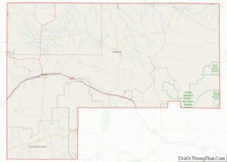
Map of Fisher County, Texas
Fisher County is a county located in the U.S. state of Texas. As of the 2020 census, its population was 3,672. The county seat is Roby. The county was created in 1876 and later organized in 1886. It is named for Samuel Rhoads Fisher, a signer of the Texas Declaration of Independence and a Secretary ... Read more
Map of Fisher County, Texas
Map of Gregg County, Texas
Gregg County is a county located in the eastern part of the U.S. state of Texas. As of the 2020 census, its population was 124,239. Its county seat is Longview. The county is named after John Gregg, a Confederate general killed in action during the American Civil War. Gregg County is part of the Longview, ... Read more
Map of Gregg County, Texas
Map of Hidalgo County, Texas
Hidalgo County (/hɪˈdælɡoʊ/; Spanish pronunciation: [iˈð̞alɣ̞o]) is located in the U.S. state of Texas. The county seat is Edinburg and the largest city is McAllen. The county is named for Miguel Hidalgo y Costilla, the priest who raised the call for Mexico‘s independence from Spain. It is located in the Rio Grande Valley of South Texas ... Read more
Map of Hidalgo County, Texas
Map of Jim Hogg County, Texas
Jim Hogg County overview: Name: Jim Hogg County FIPS code: 48-247 State: Texas Founded: 1913 Named for: James Stephen Hogg Seat: Hebbronville Total Area: 1,136 sq mi (2,940 km²) Land Area: 1,136 sq mi (2,940 km²) Total Population: 4,838 Population Density: 4.3/sq mi (1.6/km²) Time zone: UTC−6 (Central) Summer Time Zone (DST): UTC−5 (CDT) Website: www.co.jim-hogg.tx.us Jim Hogg County location map. Where ... Read more
Map of Jim Hogg County, Texas
Map of Lamar County, Texas
Lamar County (/ləˈmɑːr/) is a county located in the U.S. state of Texas, in the Northeast Texas region. As of the 2020 census, its population was 50,088. Its county seat is Paris. The county was formed by the Congress of the Republic of Texas on December 17, 1840, and organized the next year. It is ... Read more
Map of Lamar County, Texas
Map of Martin County, Texas
Martin County is a county in the U.S. state of Texas. As of the 2010 census, its population was 5,237. Its county seat is Stanton. The county was created in 1876 and organized in 1884. It is named for Wylie Martin, an early settler. Until November 2018, Martin County was one of six entirely dry ... Read more
Map of Martin County, Texas
Map of Morris County, Texas
Morris County is a county located near the eastern border of the U.S. state of Texas. As of the 2010 census, its population was 11,973. Its county seat is Daingerfield. Morris County is probably named for William Wright Morris, an early judge and planter from Henderson, also in northeast Texas. As of 2016, Morris County ... Read more
Map of Morris County, Texas
Map of Potter County, Texas
Potter County is a county located in the U.S. state of Texas. As of the 2020 census, its population was 118,525. Its county seat is Amarillo. The county was created in 1876 and organized in 1887. It is named for Robert Potter, a politician, signer of the Texas Declaration of Independence, and the Texas Secretary ... Read more
Map of Potter County, Texas
Map of San Jacinto County, Texas
San Jacinto County (/ˌsæn dʒəˈsɪntoʊ/ SAN jə-SIN-toh) is a county in the U.S. state of Texas. As of the 2020 census, its population was 27,402. Its county seat is Coldspring. The county’s name comes from the Battle of San Jacinto which secured Texas’ independence from Mexico and established a republic in 1836. San Jacinto County ... Read more
Map of San Jacinto County, Texas
Map of Tarrant County, Texas
Tarrant County is located in the U.S. state of Texas. As of 2020, it had a population of 2,110,640. It is Texas’ third-most populous county and the 15th-most populous in the United States. Its county seat is Fort Worth. Tarrant County, one of 26 counties created out of the Peters Colony, was established in 1849 ... Read more
Map of Tarrant County, Texas
Map of Walker County, Texas
Walker County is a county located in the east central section of the U.S. state of Texas. As of the 2020 census, its population was 76,400. Its county seat is Huntsville. Initially, Walker County was named for Robert J. Walker, a legislator from Mississippi who introduced into the United States Congress the resolution to annex ... Read more
Map of Walker County, Texas
Map of Young County, Texas
Young County is a county located in the U.S. state of Texas. As of the 2020 census, its population was 17,867. Its county seat is Graham. The county was created in 1856 and organized in 1874. It is named for William Cocke Young, an early Texas settler and soldier. Young County overview: Name: Young County ... Read more
Map of Young County, Texas