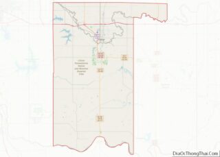
Valley County is a county in the U.S. state of Montana. Valley County was created in 1893 with area partitioned from Dawson County. As of the 2020 census, the population was 7,578. Its county seat is Glasgow. It is located on the Canada–United States border with Saskatchewan. Valley County overview: Name: Valley County FIPS code: ... Read more
Map of US Counties
Cass County is a county in the U.S. state of Nebraska. As of the 2010 United States Census, the population was 25,241. Its county seat and largest city is Plattsmouth. The county was formed in 1855, and was named for General Lewis Cass. Cass County is included in the Omaha–Council Bluffs, NE-IA Metropolitan Statistical Area. ... Read more
Dundy County is a county in the U.S. state of Nebraska. As of the 2020 United States Census, the population was 1,654. Its county seat is Benkelman. In the Nebraska license plate system, Dundy County is represented by the prefix 76 (it had the seventy-sixth-largest number of vehicles registered in the county when the license ... Read more
Holt County overview: Name: Holt County FIPS code: 31-089 State: Nebraska Founded: 1860 Named for: Joseph Holt Seat: O’Neill Largest city: O’Neill Total Area: 2,417 sq mi (6,260 km²) Land Area: 2,412 sq mi (6,250 km²) Total Population: 10,127 Population Density: 4.2/sq mi (1.6/km²) Time zone: UTC−6 (Central) Summer Time Zone (DST): UTC−5 (CDT) Website: www.co.holt.ne.us Holt County location map. Where is ... Read more
Merrick County overview: Name: Merrick County FIPS code: 31-121 State: Nebraska Founded: 1858 Named for: Elvira Merrick Seat: Central City Largest city: Central City Total Area: 494 sq mi (1,280 km²) Land Area: 485 sq mi (1,260 km²) Total Population: 7,665 Population Density: 16.3/sq mi (6.3/km²) Time zone: UTC−6 (Central) Summer Time Zone (DST): UTC−5 (CDT) Website: merrickcounty.ne.gov Merrick County location map. ... Read more
Sarpy County is a county located in the U.S. state of Nebraska. As of the 2020 United States Census, the population was 190,604, making it the third-most populous county in Nebraska. Its county seat is Papillion. Sarpy County is part of the Omaha–Council Bluffs, NE-IA Metropolitan Statistical Area. Sarpy County overview: Name: Sarpy County FIPS ... Read more
York County is a county in the U.S. state of Nebraska. As of the 2010 United States Census, the population was 13,665. Its county seat is York. In the Nebraska license plate system, York County is represented by the prefix 17 (it had the seventeenth-largest number of vehicles registered in the county when the license ... Read more
Washoe County (/ˈwɒʃoʊ/) is a county in the U.S. state of Nevada. As of the 2020 census, the population was 486,492, making it Nevada’s second-most populous county. Its county seat is Reno. Washoe County is included in the Reno, NV Metropolitan Statistical Area. Washoe County overview: Name: Washoe County FIPS code: 32-031 State: Nevada Founded: ... Read more
Cape May County overview: Name: Cape May County FIPS code: 34-009 State: New Jersey Founded: 1685 Named for: Cornelius Jacobsen Mey Seat: Cape May Court House Total Area: 620.42 sq mi (1,606.9 km²) Land Area: 251.42 sq mi (651.2 km²) Total Population: 95,263 Population Density: 378.9/sq mi (146.3/km²) Website: capemaycountynj.gov Cape May County location map. Where is Cape May County? History Etymology ... Read more
Warren County overview: Name: Warren County FIPS code: 34-041 State: New Jersey Founded: November 20, 1824 Named for: Joseph Warren Seat: Belvidere Largest city: Phillipsburg (population)Hardwick Township (area) Total Area: 362.86 sq mi (939.8 km²) Land Area: 356.92 sq mi (924.4 km²) Total Population: 109,632 Population Density: 307.2/sq mi (118.6/km²) Website: www.warrencountynj.gov Warren County location map. Where is Warren County? History Etymology ... Read more
Los Alamos County (English: “The Poplars” or “Cottonwoods”; Spanish: Condado de Los Álamos) is a county in the U.S. state of New Mexico. As of the 2010 census, the population was 17,950. The smallest county by area in the state, Los Alamos County was formerly administered exclusively by the U.S. federal government during the Manhattan ... Read more
Union County (Spanish: Condado de la Unión) is the northeasternmost county in the U.S. state of New Mexico. As of the 2010 census, the population was 4,549, making it the fourth-least populous county in New Mexico. Its county seat is Clayton. The county was formed in 1894. Union County borders Colorado to the north, and ... Read more