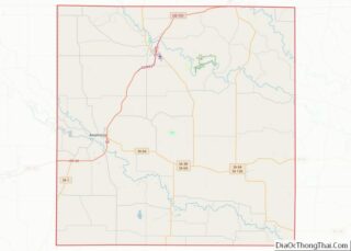
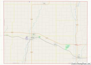
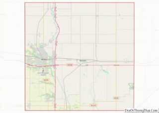
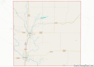
Map of Leflore County

Map of Leflore County, Mississippi

Leflore County is a county located in the U.S. state of Mississippi. As of the 2020 census, the population was 28,339. The county seat is Greenwood. The county is named for Choctaw leader Greenwood LeFlore, who signed a treaty to cede his people’s land to the United States in exchange for land in Indian Territory. … Read more

Map of Pontotoc County

Map of Pontotoc County, Mississippi

Pontotoc County is a county located in the U.S. state of Mississippi. It has been identified as one of the most corrupt counties in Northern Mississippi. As of the 2020 census, the population was 31,184. Its county seat is Pontotoc. It was created on February 9, 1836, from lands ceded to the United States under … Read more

Map of Walthall County

Map of Walthall County, Mississippi

Walthall County is a county located in the U.S. state of Mississippi. As of the 2020 census, the population was 13,884. Its county seat is Tylertown. The county is named after Civil War Confederate general and Mississippi Senator Edward C. Walthall. Walthall County overview: Name: Walthall County FIPS code: 28-147 State: Mississippi Founded: 1910 Named … Read more

Map of Benton County

Map of Benton County, Missouri

Benton County is a county located in the west central part of the U.S. state of Missouri. The population was 19,394 as of the 2020 Census. Its county seat is Warsaw. The county was organized January 3, 1835, and named for U.S. Senator Thomas Hart Benton of Missouri. Benton County overview: Name: Benton County FIPS … Read more

Map of Clay County

Map of Clay County, Missouri

Clay County is located in the U.S. state of Missouri and is part of the Kansas City metropolitan area. As of the 2020 census, the county had a population of 253,335, making it the fifth-most populous county in Missouri. Its county seat is Liberty. The county was organized January 2, 1822, and named in honor … Read more

Map of Grundy County

Map of Grundy County, Missouri

Grundy County is a county located in the U.S. state of Missouri. As of the 2020 census, the population was 9,808. Its county seat is Trenton. The county was organized January 2, 1841, from part of Livingston County, Missouri and named after U.S. Attorney General Felix Grundy. Grundy County overview: Name: Grundy County FIPS code: … Read more

Map of Lewis County

Map of Lewis County, Missouri

Lewis County overview: Name: Lewis County FIPS code: 29-111 State: Missouri Founded: January 2, 1833 Named for: Meriwether Lewis Seat: Monticello Largest city: Canton Total Area: 511 sq mi (1,320 km²) Land Area: 505 sq mi (1,310 km²) Total Population: 10,032 Population Density: 20/sq mi (7.6/km²) Time zone: UTC−6 (Central) Summer Time Zone (DST): UTC−5 (CDT) Website: lewiscountymo.org Lewis County location map. … Read more

Map of New Madrid County

Map of New Madrid County, Missouri

New Madrid County (/ˈmædrɪd/ MAD-rid; Spanish: Condado de Nueva Madrid; French: Comté de New Madrid) is a county located in the Bootheel of the U.S. state of Missouri. As of the 2020 census, the population was 16,434. The largest city and county seat is New Madrid, located on the northern side of the Kentucky Bend … Read more

Map of Randolph County

Map of Randolph County, Missouri

Randolph County is a county in the northern portion of the U.S. state of Missouri. As of the 2010 census, the population was 25,414. Its county seat is Huntsville. The county was organized January 22, 1829 and named for U.S. Representative and U.S. Senator John Randolph of Roanoke, Virginia. Randolph County comprises the Moberly, Missouri … Read more

Map of Stone County

Map of Stone County, Missouri

Stone County is located in the southwestern portion of the U.S. state of Missouri. As of the 2020 census, the population was 31,076. Its county seat is Galena. Stone County is part of the Branson, MO Micropolitan Statistical Area. Stone County overview: Name: Stone County FIPS code: 29-209 State: Missouri Founded: February 10, 1851 Named … Read more

Map of Carter County

Map of Carter County, Montana

Carter County overview: Name: Carter County FIPS code: 30-011 State: Montana Founded: 1917 Named for: Thomas H. Carter Seat: Ekalaka Largest town: Ekalaka Total Area: 3,348 sq mi (8,670 km²) Land Area: 3,341 sq mi (8,650 km²) Total Population: 1,415 Population Density: 0.42/sq mi (0.16/km²) Time zone: UTC−7 (Mountain) Summer Time Zone (DST): UTC−6 (MDT) Website: www.cartercountymt.info Carter County location map. Where … Read more

Map of Jefferson County

Map of Jefferson County, Montana

Jefferson County is a county in Montana, United States. As of the 2020 census, the population was 12,085. Its county seat is Boulder. The county was created in 1865 and named for President Thomas Jefferson. Jefferson County is part of the Helena, MT Micropolitan Statistical Area. Jefferson County overview: Name: Jefferson County FIPS code: 30-043 … Read more