Oneida County is a county located in the U.S. state of Idaho. As of the 2010 Census the county had a population of 4,286. The county seat and largest city is Malad City. Most of the county’s population lives in Malad City and the surrounding Malad Valley.
| Name: | Oneida County |
|---|---|
| FIPS code: | 16-071 |
| State: | Idaho |
| Founded: | January 22, 1864 |
| Named for: | Oneida Lake, New York |
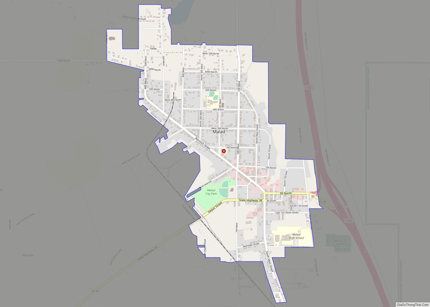
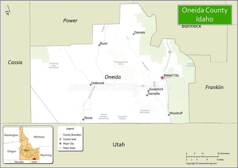
| Seat: | Malad City |
| Largest city: | Malad City |
| Total Area: | 1,202 sq mi (3,110 km²) |
| Land Area: | 1,200 sq mi (3,000 km²) |
| Total Population: | 4,564 |
| Population Density: | 3.8/sq mi (1.5/km²) |
| Time zone: | UTC−7 (Mountain) |
| Summer Time Zone (DST): | UTC−6 (MDT) |
| Website: | oneidacountyid.com |
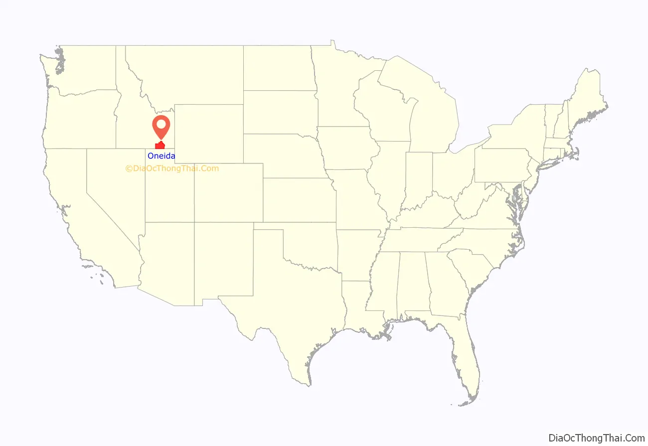
Oneida County location map. Where is Oneida County?
History
The county is named for Oneida Lake, New York, the area from which most of the early settlers had emigrated.
Oneida County was organized on January 22, 1864, with its county seat established at Soda Springs in present-day Caribou County. The county seat was moved to Malad City in 1866 because of its population growth and location on the freight road and stagecoach line between Corinne, Utah, and the mines in Butte, Montana.
Early in its lengthy history, Oneida County had the distinction of being Idaho’s largest county by both area and population. Its initial size was 32,708 mi making it the third largest of the 17 counties created by the first legislature of Idaho Territory in 1863 and early 1864. When the US Congress created Montana Territory on May 26, 1864, it also transferred a portion of Oneida County over to Dakota Territory. Even with the loss of territory, the act left Oneida County as Idaho’s largest remaining Idaho county at 20,621 mi. Alturas County exchanged territory with Boise County in 1866 to increase its land area above that of Oneida County. Oneida County lost significant territory to Wyoming Territory in 1868, to the creation of Bear Lake County in 1875, and to the creation of Cassia County in 1879. Minor adjustments to boundaries occurred in 1871, 1875, and 1877. Creation of Bingham County in 1885 left Oneida County with only 2,633 mi, while creation of Franklin and Power Counties further reduced the county’s area to 1,219 mi in 1913. Minor changes to boundaries occurred in 1917 and 1927 that gave Oneida County its present land area.
Early loss of territory had no impact on population growth of the county as some areas lost had almost no population or were offset by heavy migration of Mormons occurring along Idaho’s southern border. Oneida County was officially Idaho Territory’s 3rd most populous behind Boise and Ada counties at Idaho Territory’s first decennial census in 1870. However, the county’s actual population was severely undercounted as a result of its lack of a surveyed southern boundary. The survey of Idaho’s southern border by 1872 revealed that the 1870 Census had erroneously assigned eight Idaho settlements in the Bear Lake Valley to Rich County, Utah and five Idaho settlements in the Cache Valley to Cache County, Utah. Had the settlements been accurately assigned to Oneida County in 1870, the county would have been Idaho’s largest with 4,647 residents. Oneida County would go on to officially become Idaho’s most populous county at the 1880 Census with 6,964 residents even after it had lost populated territory to creation of Bear Lake and Cassia Counties. The loss of large population centers achieved through the creation of Bingham County resulted in the county’s first decline in population at the 1890 Census. While diminished in significance, the county was still one of the State’s more prominent counties at that time. Oneida County did retain developing population centers at Malad City, American Falls, and Preston. Their growth led to a peak in the county’s population at the 1910 Census. The county lost much of its prominence with the creation of Franklin and Power Counties in 1913. The loss in territory again caused a population decline while Malad City and even outlying areas experienced growth through the 1920 Census. After the 1920 Census, Oneida County experienced fifty years of population decline, losing more than half of its 1920 population by the 1970 Census. The county has regained less than 40% of its lost population as of the 2016 Census estimate.
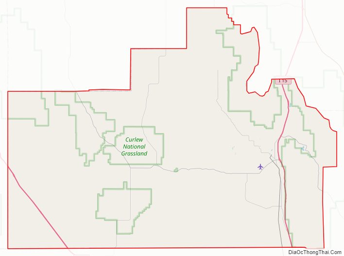
Oneida County Road Map
Geography
According to the U.S. Census Bureau, the county has a total area of 1,202 square miles (3,110 km), of which 1,200 square miles (3,100 km) is land and 1.5 square miles (3.9 km) (0.1%) is water.
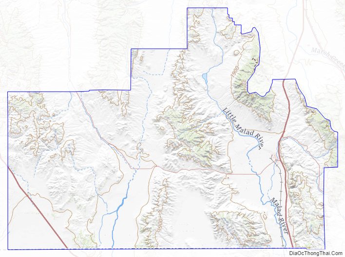
Oxford Peak is the highest point in the county at 9,285 ft (2830.2 m) above sea level. Alternating valleys and ridges of mountains or hills typify the topography, with grassland and sagebrush covering most areas. The Curlew National Grassland lies within the county.
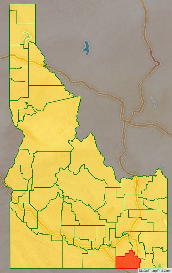
Adjacent counties
- Power County – north
- Bannock County – northeast
- Franklin County – east
- Cache County, Utah – southeast
- Box Elder County, Utah – south
- Cassia County – west
Major highways
- Interstate 15
- Interstate 84
- SH-36
- SH-38
National protected areas
- Caribou National Forest (part)
- Curlew National Grassland (part)
- Sawtooth National Forest (part)
Oneida County Topographic Map
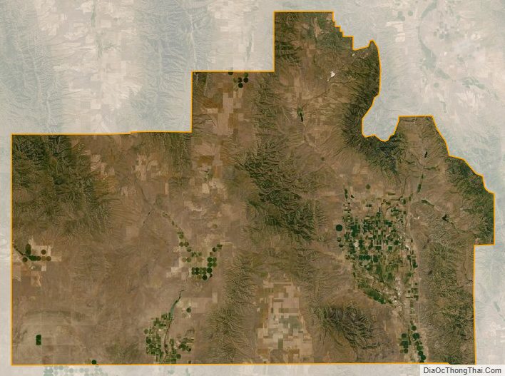
Oneida County Satellite Map
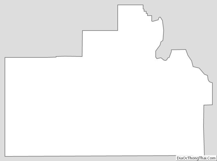
Oneida County Outline Map