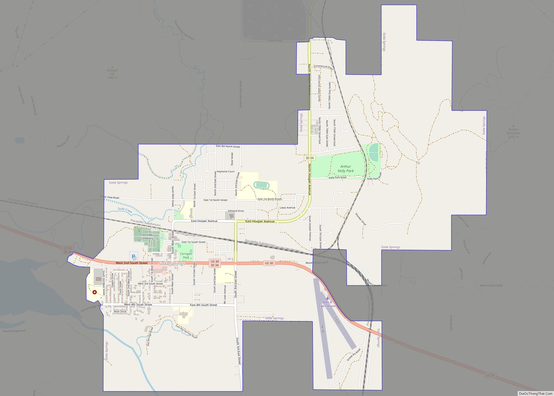
Soda Springs is a city in Caribou County, Idaho, United States. Its population was 3,058 at the time of the 2010 census. The city has been the county seat of Caribou County since the county was organized in 1919. In the 1860s, Soda Springs served as the seat of Oneida County.
| Name: | Soda Springs city |
|---|---|
| LSAD Code: | 25 |
| LSAD Description: | city (suffix) |
| State: | Idaho |
| County: | Caribou County |
| Elevation: | 5,774 ft (1,760 m) |
| Total Area: | 4.47 sq mi (11.58 km²) |
| Land Area: | 4.43 sq mi (11.47 km²) |
| Water Area: | 0.05 sq mi (0.12 km²) |
| Total Population: | 3,058 |
| Population Density: | 682.86/sq mi (263.63/km²) |
| ZIP code: | 83230, 83276, 83285 |
| Area code: | 208 |
| FIPS code: | 1675195 |
| GNISfeature ID: | 0400099 |
| Website: | www.sodaspringsid.com |
Online Interactive Map
Click on ![]() to view map in "full screen" mode.
to view map in "full screen" mode.
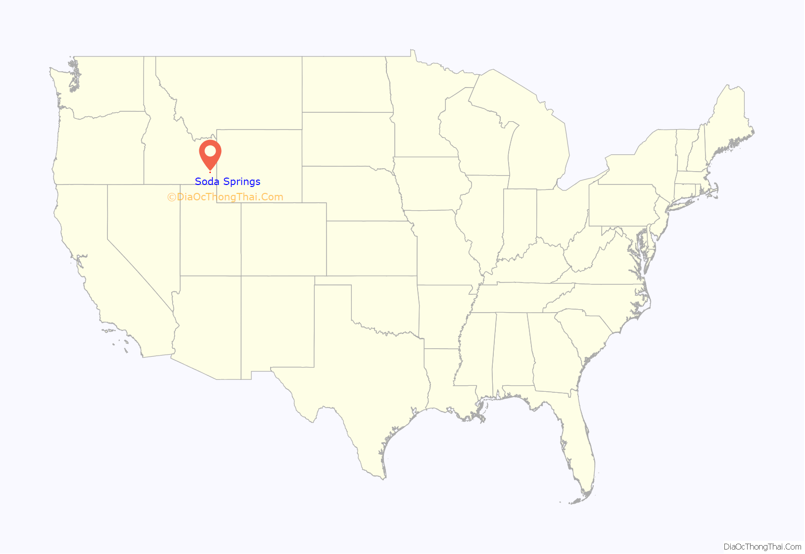
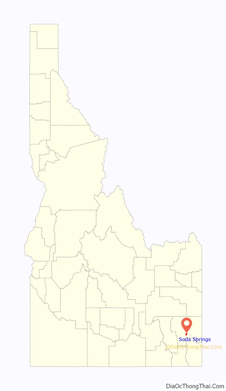
Soda Springs location map. Where is Soda Springs city?
History
The city is named for the hundreds of natural springs of carbonated water that are located in and around the city. The springs were known to Native Americans, and were a landmark along the Oregon Trail in the middle 19th century. Today the city is also known as the location of the Soda Springs Geyser, which was unleashed in 1934 when town fathers were seeking hot water for a hot pool bathing attraction. They drilled into a chamber of highly pressurized carbon dioxide gas and cold water, and the geyser was released. After running for weeks and flooding the downtown area, it was capped and manually released upon request as a tourist attraction. Currently a timed release valve opens every hour on the hour. Its height and volume have not decreased after many years. Viewing platforms are located at either end of the travertine mound where the geyser erupts. Interpretive signs are located on the platforms explaining this phenomenon.
Soda Springs is also the location of one of the Ground Observer Corps sites.
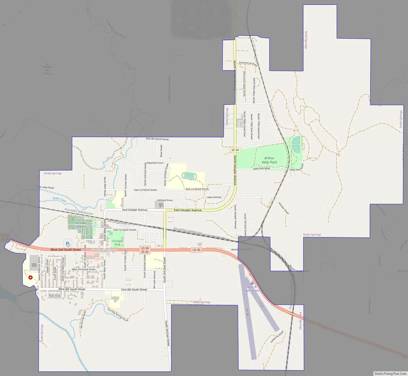
Soda Springs Road Map
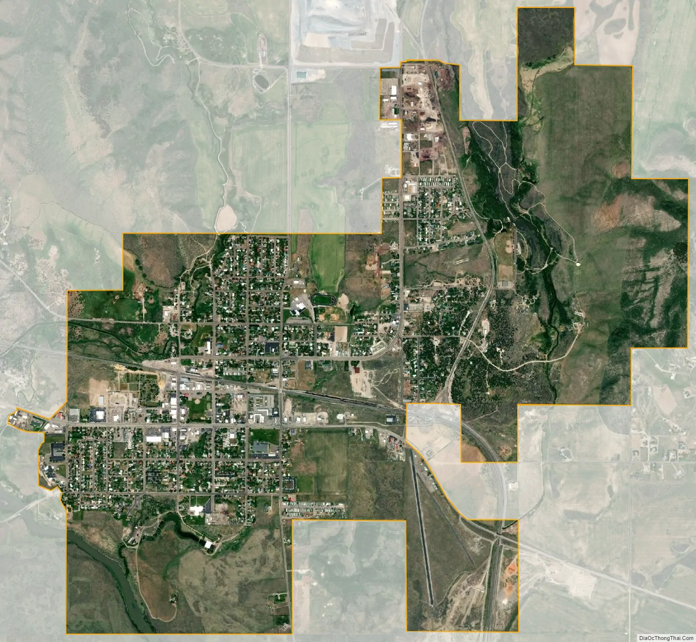
Soda Springs city Satellite Map
Geography
According to the United States Census Bureau, the city has a total area of 4.59 square miles (11.89 km), of which, 4.54 square miles (11.76 km) is land and 0.05 square miles (0.13 km) is water.
Soda Springs experiences a continental climate (Köppen Dfb) with long, cold, snowy winters and cool summers.
See also
Map of Idaho State and its subdivision:- Ada
- Adams
- Bannock
- Bear Lake
- Benewah
- Bingham
- Blaine
- Boise
- Bonner
- Bonneville
- Boundary
- Butte
- Camas
- Canyon
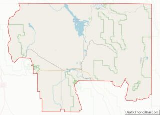
- Caribou
- Cassia
- Clark
- Clearwater
- Custer
- Elmore
- Franklin
- Fremont
- Gem
- Gooding
- Idaho
- Jefferson
- Jerome
- Kootenai
- Latah
- Lemhi
- Lewis
- Lincoln
- Madison
- Minidoka
- Nez Perce
- Oneida
- Owyhee
- Payette
- Power
- Shoshone
- Teton
- Twin Falls
- Valley
- Washington
- Alabama
- Alaska
- Arizona
- Arkansas
- California
- Colorado
- Connecticut
- Delaware
- District of Columbia
- Florida
- Georgia
- Hawaii
- Idaho
- Illinois
- Indiana
- Iowa
- Kansas
- Kentucky
- Louisiana
- Maine
- Maryland
- Massachusetts
- Michigan
- Minnesota
- Mississippi
- Missouri
- Montana
- Nebraska
- Nevada
- New Hampshire
- New Jersey
- New Mexico
- New York
- North Carolina
- North Dakota
- Ohio
- Oklahoma
- Oregon
- Pennsylvania
- Rhode Island
- South Carolina
- South Dakota
- Tennessee
- Texas
- Utah
- Vermont
- Virginia
- Washington
- West Virginia
- Wisconsin
- Wyoming