Carson City is an independent city and the capital of the U.S. state of Nevada. As of the 2020 census, the population was 58,639, making it the sixth largest city in Nevada. The majority of the city’s population lives in Eagle Valley, on the eastern edge of the Carson Range, a branch of the Sierra Nevada, about 30 miles (50 km) south of Reno. The city is named after the mountain man Kit Carson. The town began as a stopover for California-bound immigrants, but developed into a city with the Comstock Lode, a silver strike in the mountains to the northeast. The city has served as Nevada’s capital since statehood in 1864; for much of its history it was a hub for the Virginia and Truckee Railroad, although the tracks were removed in 1950.
Before 1969, Carson City was the county seat of Ormsby County. That year the state legislature abolished the county and included its territory into a revised city charter for a Consolidated Municipality of Carson City. With the consolidation, the city limits extend west across the Sierra Nevada to the California state line in the middle of Lake Tahoe. Like other independent cities in the United States, it is treated as a county-equivalent for census purposes.
| Name: | Carson City |
|---|---|
| FIPS code: | 32-510 |
| State: | Nevada |
| Founded: | 1858 |
| Named for: | Kit Carson |
| Total Area: | 157.12 sq mi (406.94 km²) |
| Land Area: | 144.53 sq mi (374.34 km²) |
| Total Population: | 58,639 |
| Population Density: | 405.71/sq mi (156.65/km²) |
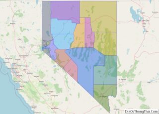
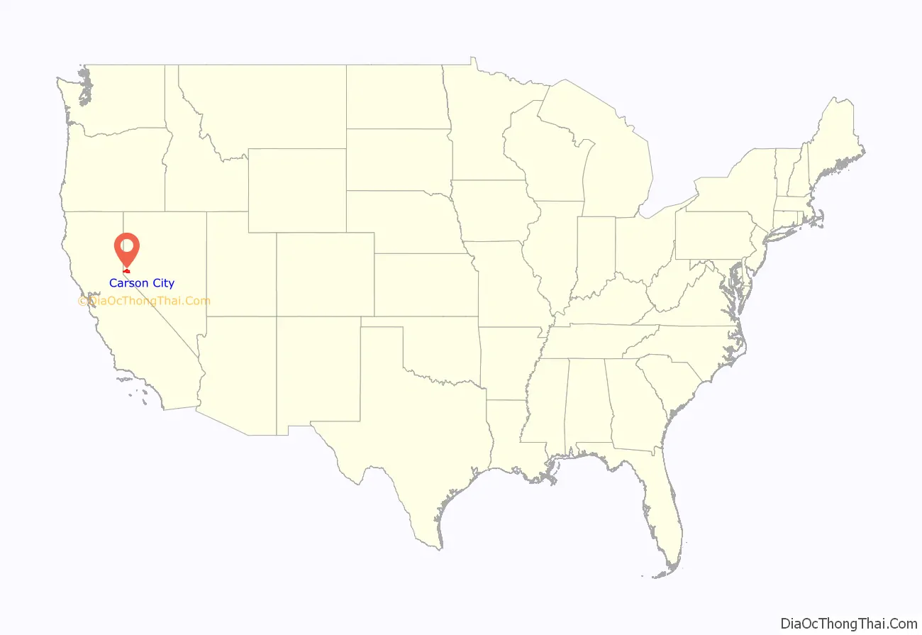
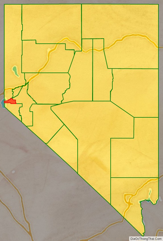
Carson City location map. Where is Carson City?
History
The Washoe people have inhabited the valley and surrounding areas for about 6,000 years.
The first European Americans to arrive in what is now known as Eagle Valley were John C. Frémont and his exploration party in January 1843. Fremont named the river flowing through the valley Carson River in honor of Kit Carson, the mountain man and scout he had hired for his expedition. Later, settlers named the area Washoe, in reference to the indigenous people.
By 1851, the Eagle Station ranch along the Carson River was a trading post and stopover for travelers on the California Trail’s Carson Branch, which ran through Eagle Valley. The valley and trading post received their name from a bald eagle that was hunted and killed by one of the early settlers and was featured on a wall inside the post.
As the area was part of the Utah Territory, it was governed from Salt Lake City, where the territorial government was headquartered. Early settlers bristled at the control by Mormon-influenced officials and desired the creation of the Nevada territory. A vigilante group of influential settlers, headed by Abraham Curry, sought a site for a capital city for the envisioned territory. In 1858, Abraham Curry bought Eagle Station and the settlement was thereafter renamed Carson City. Curry and several other partners had Eagle Valley surveyed for development. Curry decided Carson City would someday serve as the capital city and left a 10-acre (40,000 m) plot in the center of town for a capitol building.
After gold and silver were discovered in 1859 on nearby Comstock Lode, Carson City’s population began to grow. Curry built the Warm Springs Hotel a mile to the east of the city center. When territorial governor James W. Nye traveled to Nevada, he chose Carson City as the territorial capital, influenced by Carson City lawyer William Stewart, who escorted him from San Francisco to Nevada. As such, Carson City bested Virginia City and American Flat. Curry loaned the Warm Springs Hotel to the territorial Legislature as a meeting hall. The Legislature named Carson City to be the seat of Ormsby County and selected the hotel as the territorial prison, with Curry serving as its first warden. Today, the property is still part of the state prison.
When Nevada became a state in 1864 during the American Civil War, Carson City was confirmed as Nevada’s permanent capital. Carson City’s development was no longer dependent on the mining industry and instead became a thriving commercial center. The Virginia and Truckee Railroad was built between Virginia City and Carson City. A log flume was also built from the Sierra Nevada into Carson City. The current capitol building was constructed from 1870 to 1871. The United States Mint operated the Carson City Mint between the years 1870 and 1893, which struck gold and silver coins. People came from China during that time, many to work on the railroad. Some of them owned businesses and taught school. By 1880, almost a thousand Chinese people, “one for every five Caucasians”, lived in Carson City.
Carson City’s population and transportation traffic decreased when the Central Pacific Railroad built a line through Donner Pass, too far to the north to benefit Carson City. The city was slightly revitalized with the mining booms in Tonopah and Goldfield. The US federal building (now renamed the Paul Laxalt Building) was completed in 1890 as was the Stewart Indian School. Even these developments could not prevent the city’s population from dropping to just over 1,500 people by 1930. Carson City resigned itself to small city status, advertising itself as “America’s smallest capital”. The city slowly grew after World War II; by 1960, it had reached its 1880 boom-time population.
20th-century revitalization and growth
As early as the late 1940s, discussions began about merging Ormsby County and Carson City. By this time, the county was little more than Carson City and a few hamlets to the west. However, the effort did not pay off until 1966, when a statewide referendum approved the merger. The required constitutional amendment was passed in 1968. On April 1, 1969, Ormsby County and Carson City officially merged as the Consolidated Municipality of Carson City. With this consolidation, Carson City absorbed former town sites such as Empire City, which had grown up in the 1860s as a milling center along the Carson River and current U.S. Route 50. Carson City could now advertise itself as one of America’s largest state capitals with its 146 square miles (380 km) of city limits.
In 1991, the city adopted a downtown master plan, specifying no building within 500 feet (150 metres) of the capitol would surpass it in height. This plan effectively prohibited future high-rise development in the center of downtown. The Ormsby House is the tallest building in downtown Carson City, at a height of 117 feet (36 m). The structure was completed in 1972.
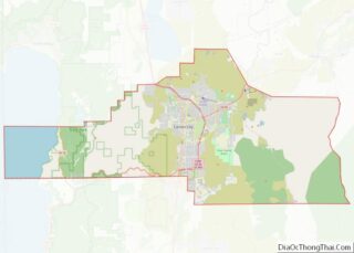
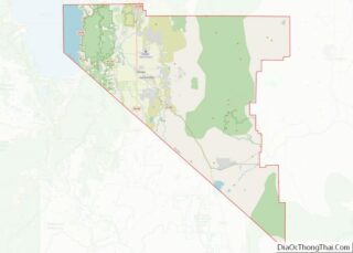
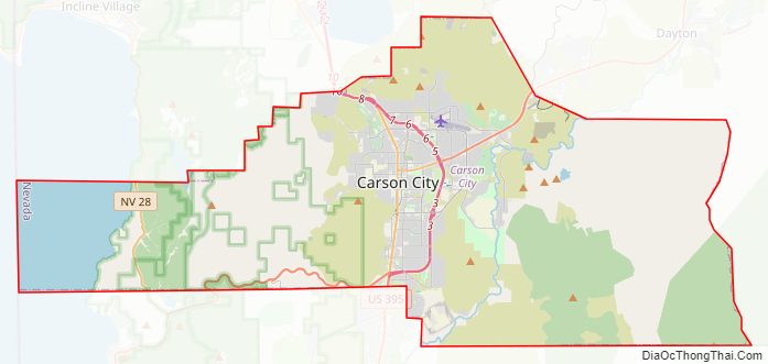
Carson City Road Map
Geography
Most of the city proper resides in the Eagle Valley. The Carson River flows from Douglas County through the southwestern edge of both the valley and Carson City. Since the consolidation, the city limits today include several small populated areas outside of this valley. Today the city limits include several peaks in the Sierra Nevada, small portions of both the Virginia Range and the Pine Nut Mountains and portions of Marlette Lake and Lake Tahoe. The highest elevation in city limits is Snow Valley Peak at an elevation of 9,214 feet (2,808 m). Carson City is one of two state capitals that border another state, the other being Trenton, New Jersey.
Climate
Carson City features a cold semi-arid climate (Koppen: BSk) with cold winters and hot summers. The city is in a high desert river valley approximately 4,802 feet (1,464 m) above sea level. There are four fairly distinct seasons. Winters see typically light to moderate snowfall, with an average of 14.0 inches (36 cm). Most precipitation occurs in winter and spring, with summer and fall being fairly dry, drier than neighboring California. There are 39.5 days of 90 °F (32 °C)+ highs annually, with 100 °F (38 °C)+ temperatures occurring 1.2 days per year.
The average temperature in Carson City increased by 4.1 °F (2.3 °C) between 1984 and 2014, a greater change than in any other city in the United States.
Places of interest
- Nevada State Capitol – original capitol still housing the governor’s offices with museum exhibits
- Nevada State Museum – former branch of the United States Mint featuring rock, mining and prehistoric exhibits, and a recreated Wild West village
- Nevada State Railroad Museum – featuring the Inyo locomotive and relocated Wabuska Railroad Station
- Stewart Indian School – museum collection includes items from former faculty, students and school
- Foreman-Roberts House Museum – Gothic Revival architecture, tours available.
- Sears–Ferris House (not open to public) – home of George Washington Gale Ferris Jr., inventor of the Ferris wheel
- Yesterday’s Flyers, an aviation museum in Carson City.
- Children’s Museum of Northern Nevada – Carson City
- Silver Saddle Ranch
- Mexican Dam – 1860s stone dam across the Carson River
- Prison Hill – California Trail historic markers, location of the Stewart “S”
- Carson Aquatic Trail
- Humboldt-Toiyabe National Forest (Carson Ranger District)
- Kings Canyon Falls
- Snow Valley Peak – 9,214 ft (2,808 m) – highest point within Carson City
- Tahoe Rim Trail
- Lake Tahoe–Nevada State Park
- Lake Tahoe beachfront (several beaches along Lake Tahoe lie within the city limits)
- Chimney Beach
- Secret Harbor
- Whale Beach
- Skunk Harbor
- Washoe Lake State Park – borders city to the north
- “C Hill” – hill featuring the Carson City “C” and giant American Flag
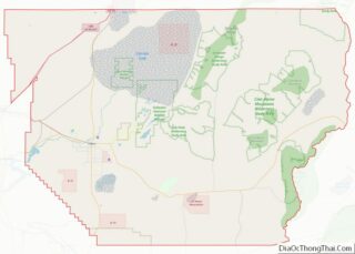
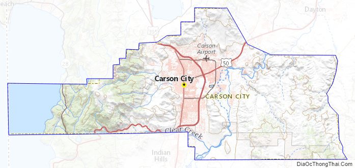
Carson City Topographic Map
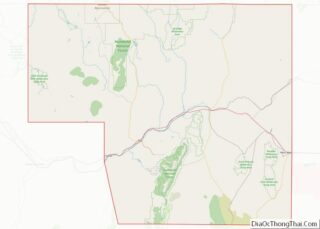
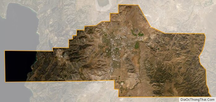
Carson City Satellite Map
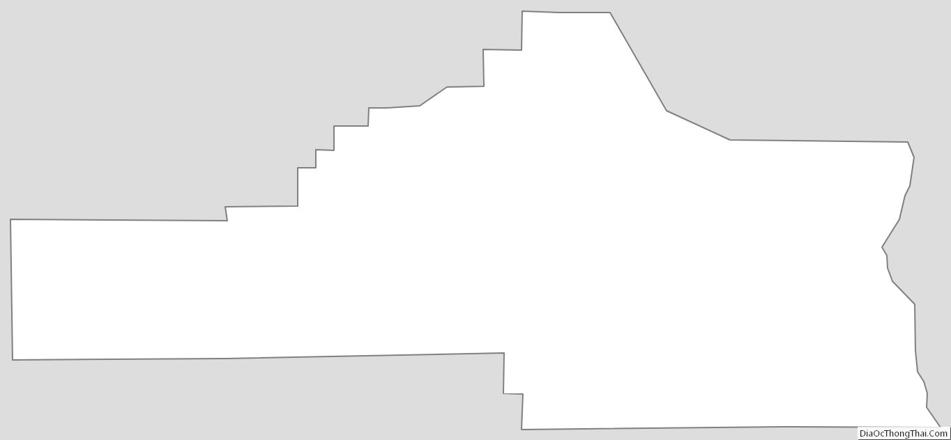
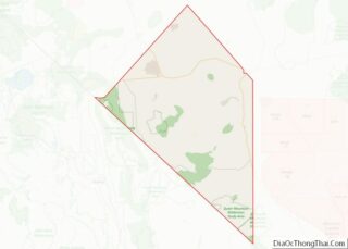
Carson City Outline Map