Tonopah (/ˈtoʊnəˌpɑː/ TOHN-ə-pah, Shoshoni language: Tonampaa) is an unincorporated town in, and the county seat of, Nye County, Nevada, United States. Nicknamed the Queen of the Silver Camps for its mining-rich history, it is now primarily a tourism-based resort city, notable for attractions like the Mizpah Hotel and the Clown Motel.
Tonopah is located at the junction of U.S. Routes 6 and 95, approximately midway between Las Vegas and Reno. In the 2010 census, the population was 2,478. The census-designated place (CDP) of Tonopah has a total area of 16.2 square miles (42 km), all land.
| Name: | Tonopah CDP |
|---|---|
| LSAD Code: | 57 |
| LSAD Description: | CDP (suffix) |
| State: | Nevada |
| County: | Nye County |
| Founded: | 1900; 123 years ago (1900) |
| Elevation: | 6,047 ft (1,843 m) |
| Total Area: | 9.26 sq mi (23.98 km²) |
| Land Area: | 9.26 sq mi (23.98 km²) |
| Water Area: | 0.00 sq mi (0.00 km²) |
| Total Population: | 2,179 |
| Population Density: | 235.34/sq mi (90.87/km²) |
| ZIP code: | 89049 |
| Area code: | 775 |
| FIPS code: | 3273600 |
| GNISfeature ID: | 0845985 |
| Website: | http://www.tonopahnevada.com/ |
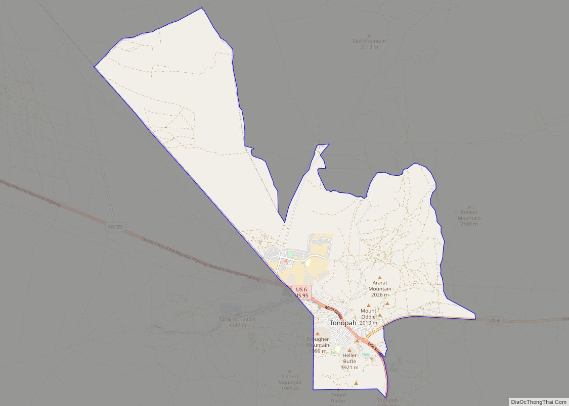
Online Interactive Map
Click on ![]() to view map in "full screen" mode.
to view map in "full screen" mode.
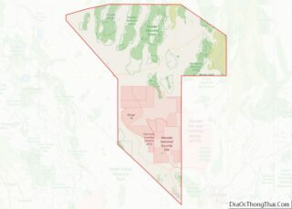
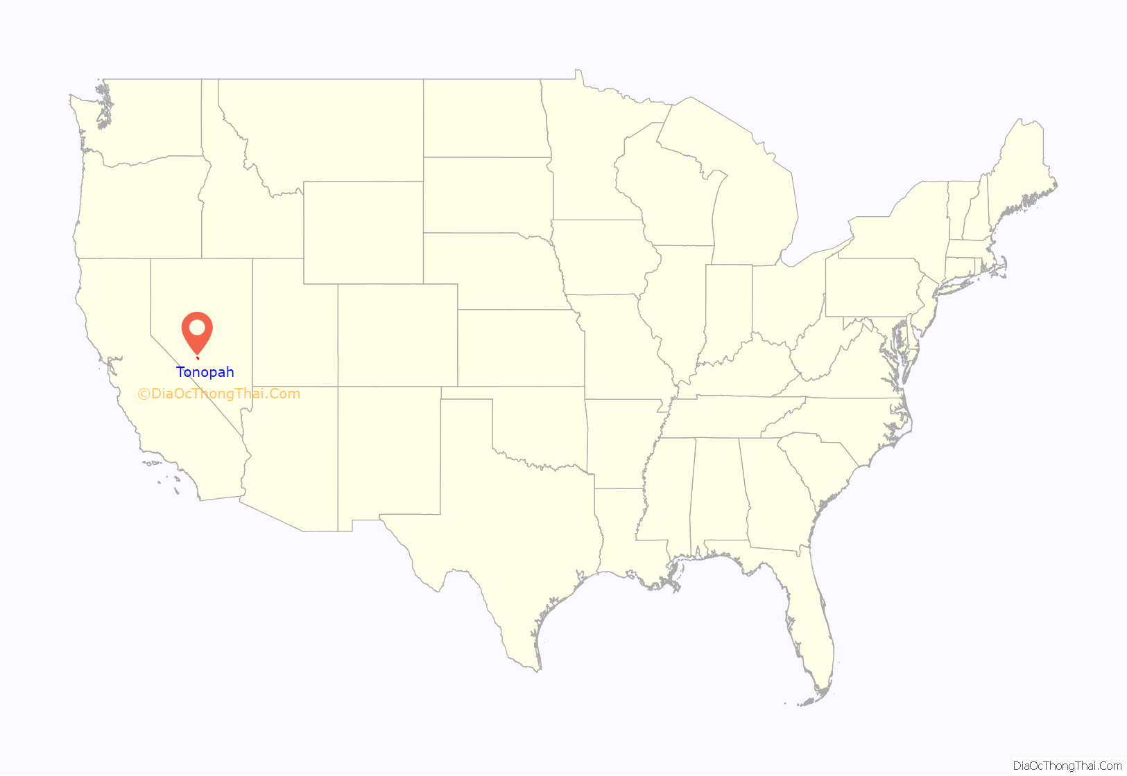
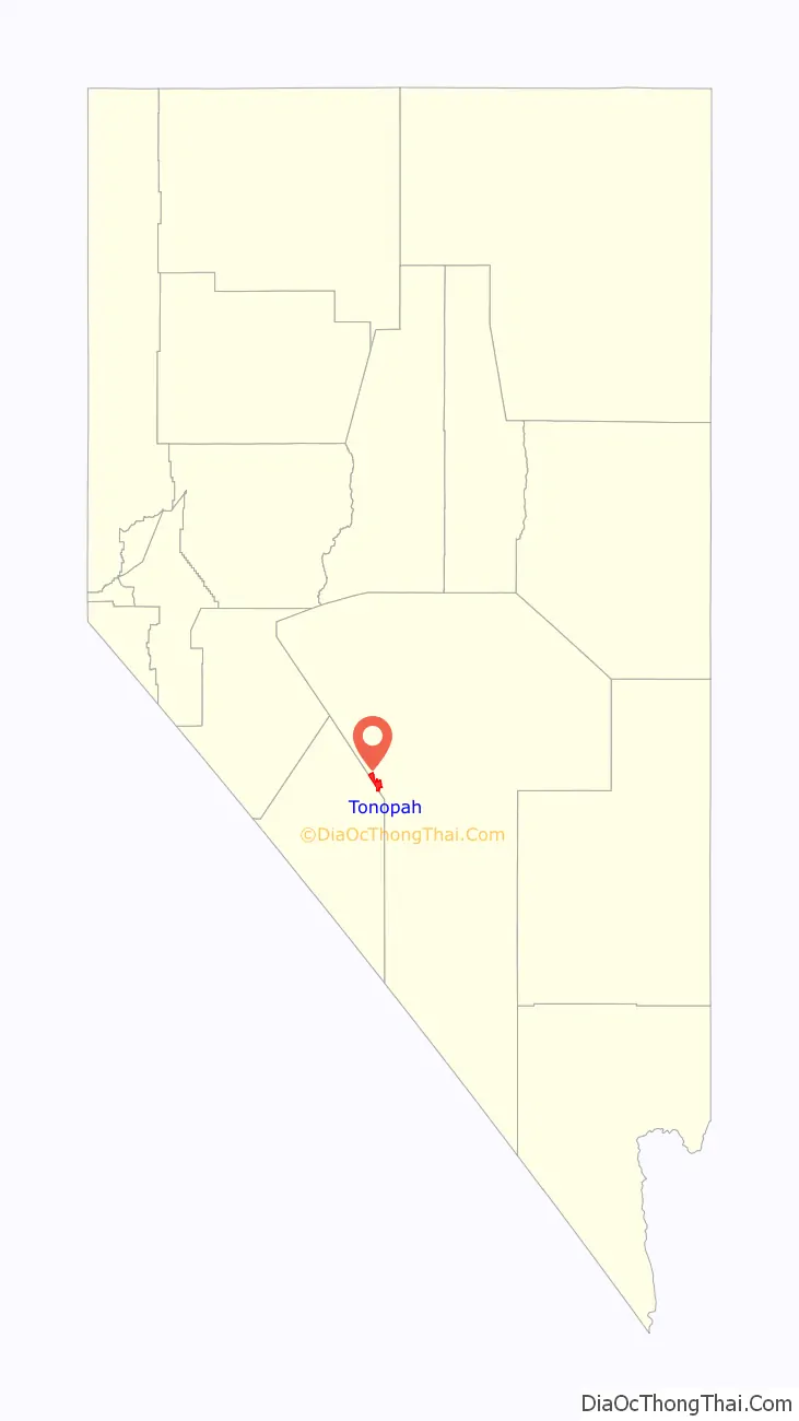
Tonopah location map. Where is Tonopah CDP?
History
The American community began circa 1900 with the discovery of silver-rich ore by prospector Jim Butler. The legendary tale of discovery says that he went looking for a burro that had wandered off during the night and sought shelter near a rock outcropping. When Butler discovered the animal the next morning, he picked up a rock to throw at it in frustration, noticing that the rock was unusually heavy. He had stumbled upon the second-richest silver strike in Nevada history.
Men of wealth and power entered the region to consolidate the mines and reinvest their profits into the infrastructure of the town of Tonopah. George Wingfield, a 24-year-old poker player when he arrived in Tonopah, played poker and dealt faro in the town saloons. Once he had a small bankroll, he talked Jack Carey, owner of the Tonopah Club, into taking him in as a partner and to file for a gaming license. In 1903, miners rioted against Chinese workers in Tonopah. This resulted in China enforcing a boycott in China of U.S. imported goods.
By 1904, after investing his winnings in the Boston-Tonopah Mining Company, Wingfield was worth $2 million. When old friend George S. Nixon, a banker, arrived in town, Wingfield invested in his Nye County Bank. They grub-staked (provided with food, supplies and tools in an exchange for a percentage of mine yield) miners with friend Nick Abelman, and bought existing mines. By the time the partners moved to Goldfield, Nevada and made their Goldfield Consolidated Mining Company a public corporation in 1906, Nixon and Wingfield were worth more than $30 million.
Wingfield believed that the end of the gold and silver mining production was coming and took his bankroll to Reno, where he invested heavily in real estate and casinos. Real estate and gaming became big business throughout Central Nevada. By 1910, gold production was falling and by 1920, the town of Tonopah had less than half the population it had fifteen years earlier.
Small mining ventures continued to provide income for local miners and the small town struggled on. Located about halfway between Reno and Las Vegas, it has supported travelers as a stopover and rest spot on a lonely highway. Today the Tonopah Station has slots and the Banc Club also offers some gaming.
Also in Nye County is the Yomba Band of the Yomba Shoshone Tribe of the Yomba Reservation, a federally recognized band of Western Shoshone people. The Western Shoshone dominated most of Nevada at the time of American settlement in the 1860s.
Since the late 20th century, Tonopah has relied on the nearby military Tonopah Test Range as its main source of employment. The military has used the range and surrounding areas as a nuclear bomb test site, a bombing range, and as a base of operations for the development of the F-117 Nighthawk.
In 2014, California-based solar energy company SolarReserve completed construction on a $980 million advanced solar energy project near Tonopah. The Crescent Dunes Solar Energy Project uses liquid sodium as a heat transfer medium for its solar energy storage technology. The plant began producing power in November 2015.
On May 15, 2020, a magnitude 6.5 earthquake struck 35 miles (56 km) west of Tonopah, followed by a series of aftershocks, the largest of which was a magnitude 5.1. However, no injuries were reported. It was the largest earthquake in Nevada since 1954.
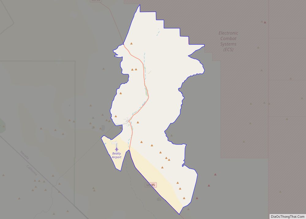
Tonopah Road Map
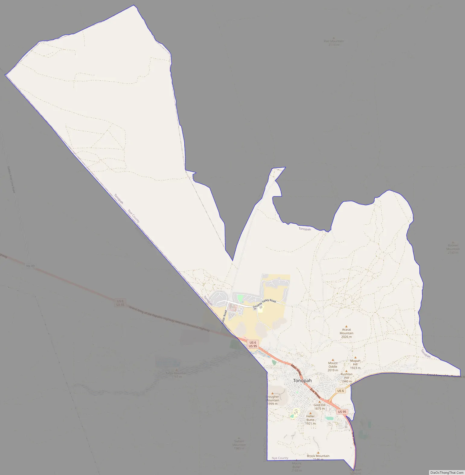
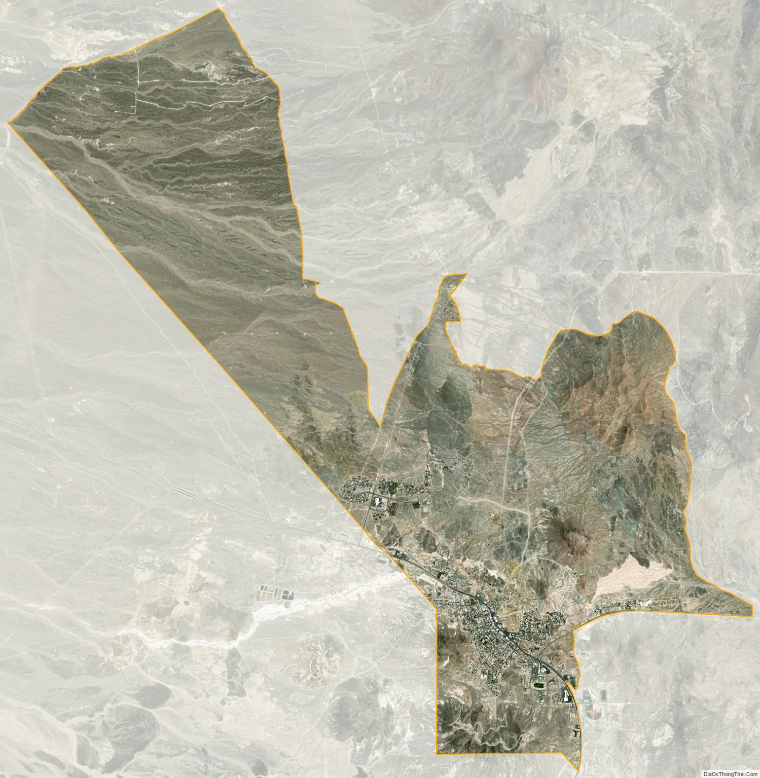
Tonopah city Satellite Map
See also
Map of Nevada State and its subdivision: Map of other states:- Alabama
- Alaska
- Arizona
- Arkansas
- California
- Colorado
- Connecticut
- Delaware
- District of Columbia
- Florida
- Georgia
- Hawaii
- Idaho
- Illinois
- Indiana
- Iowa
- Kansas
- Kentucky
- Louisiana
- Maine
- Maryland
- Massachusetts
- Michigan
- Minnesota
- Mississippi
- Missouri
- Montana
- Nebraska
- Nevada
- New Hampshire
- New Jersey
- New Mexico
- New York
- North Carolina
- North Dakota
- Ohio
- Oklahoma
- Oregon
- Pennsylvania
- Rhode Island
- South Carolina
- South Dakota
- Tennessee
- Texas
- Utah
- Vermont
- Virginia
- Washington
- West Virginia
- Wisconsin
- Wyoming