Garden County is a county in the U.S. state of Nebraska. As of the 2010 United States Census, the population was 2,057. Its county seat is Oshkosh.
In the Nebraska license plate system, Garden County is represented by the prefix 77 (it had the seventy-seventh-largest number of vehicles registered in the state when the license plate system was established in 1922).
| Name: | Garden County |
|---|---|
| FIPS code: | 31-069 |
| State: | Nebraska |
| Founded: | 1909 |
| Named for: | Garden of Eden |
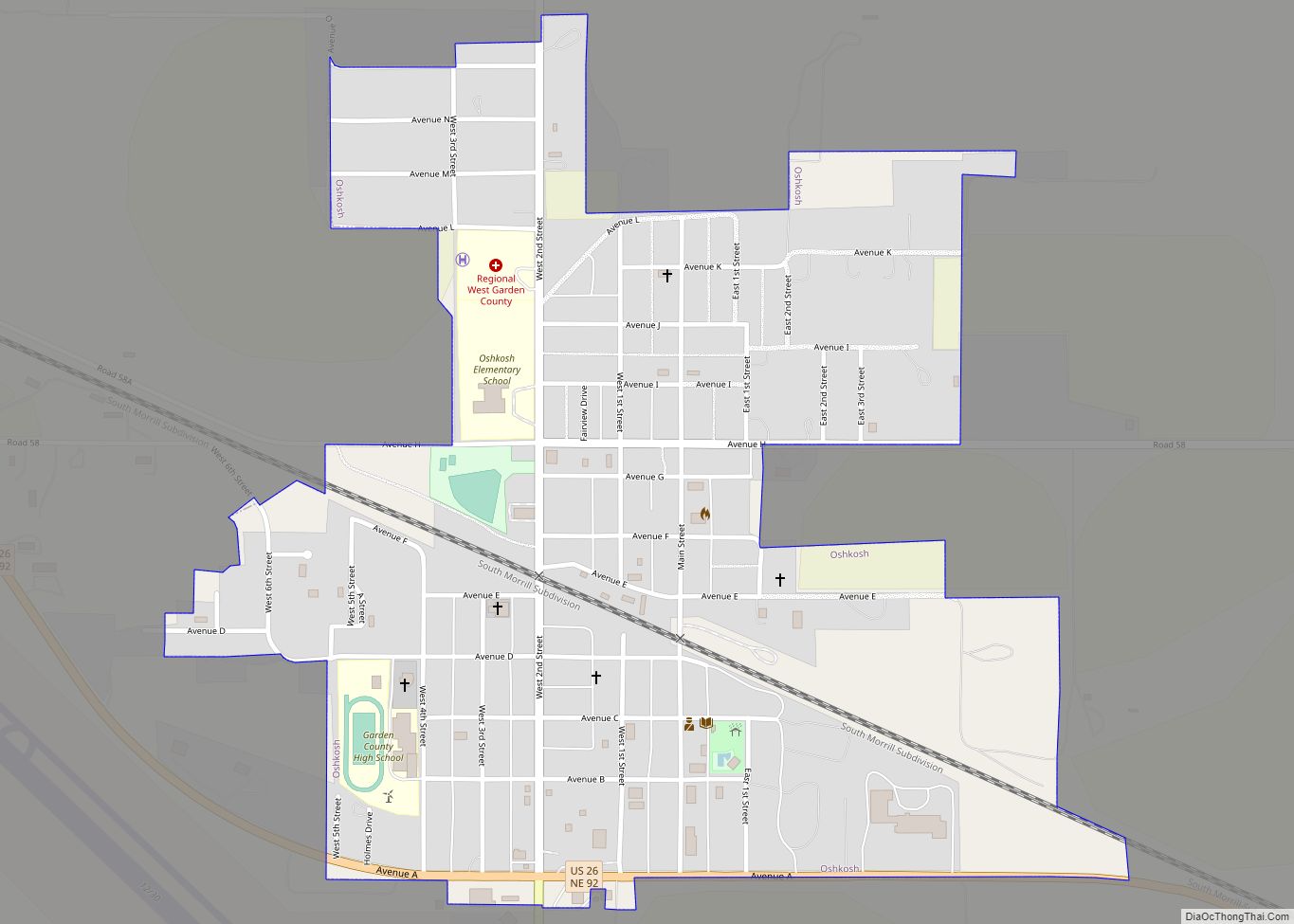
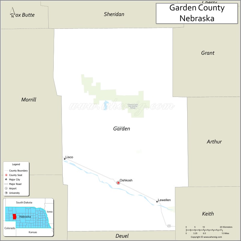
| Seat: | Oshkosh |
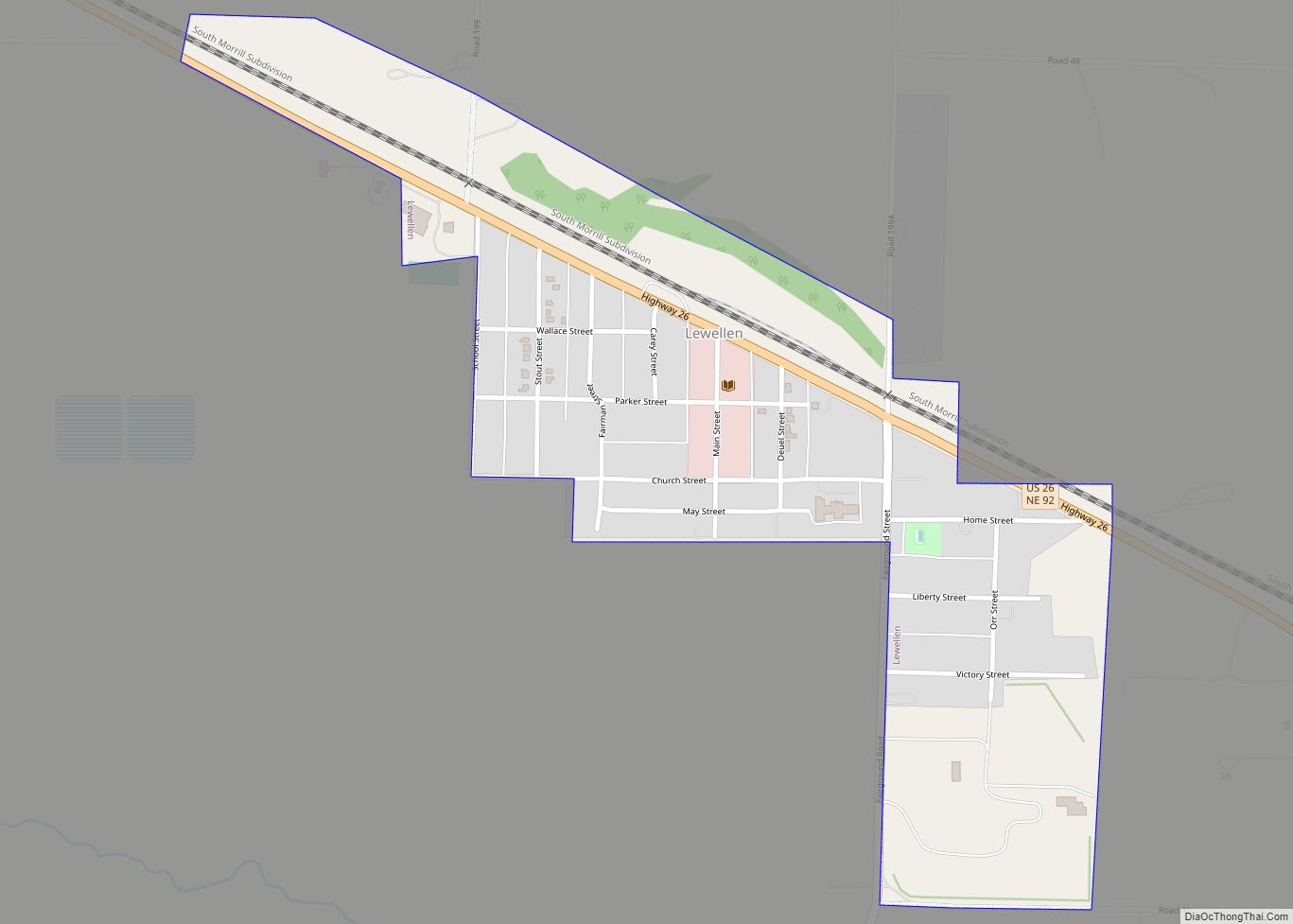
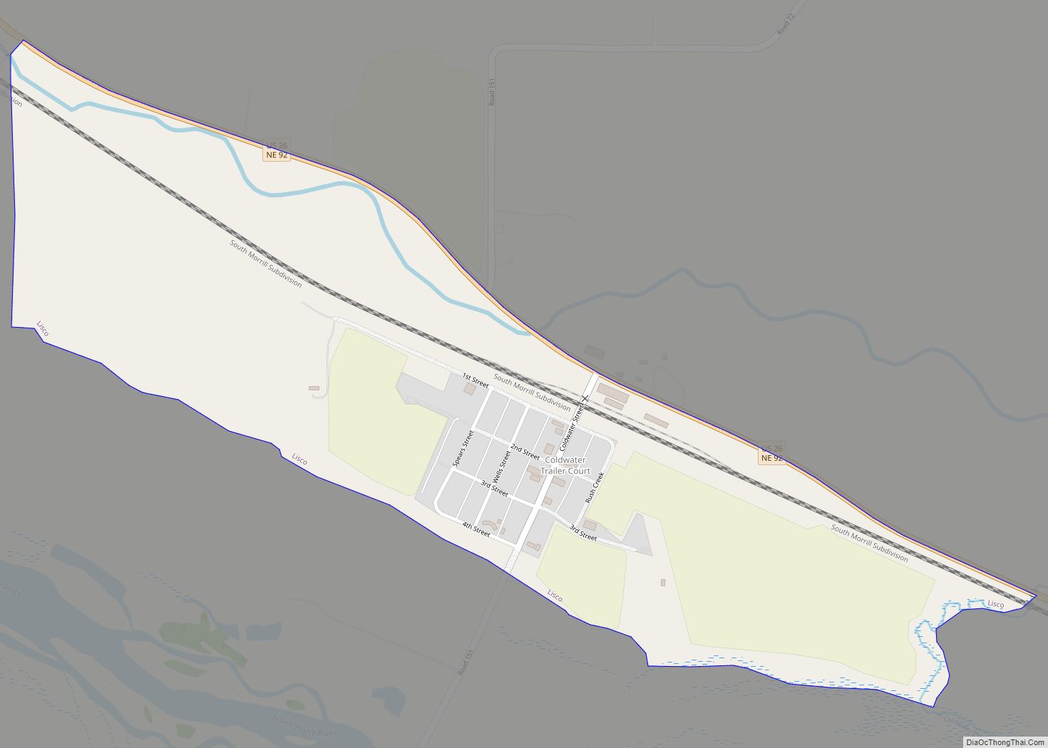
| Largest city: | Oshkosh |
| Total Area: | 1,731 sq mi (4,480 km²) |
| Land Area: | 1,704 sq mi (4,410 km²) |
| Total Population: | 1,847 |
| Population Density: | 1.1/sq mi (0.4/km²) |
| Time zone: | UTC−7 (Mountain) |
| Summer Time Zone (DST): | UTC−6 (MDT) |
| Website: | gardencounty.ne.gov |
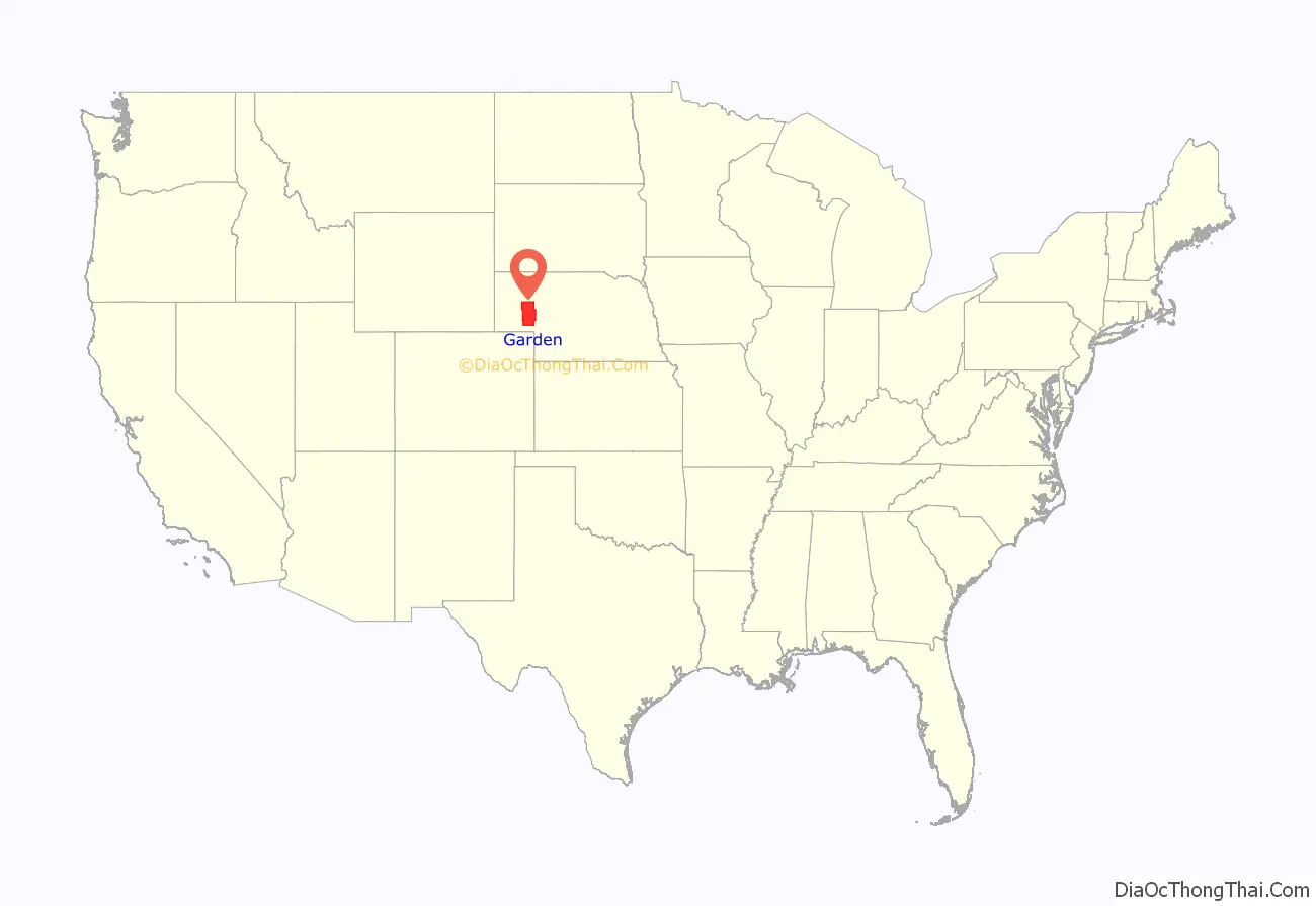
Garden County location map. Where is Garden County?
History
Garden County was formed in 1909 by popular vote. Voters in the general election of November 2, 1909 approved making the northern part of Deuel County into its own county. It is said the county was so named in the hope that this land should become the garden of the West or with allusion to the “Garden of Eden”.
The county has lost population since the Great Depression and Dust Bowl of the 1930s. The land was homesteaded for family farms that often turned out to be too small for subsistence farming under the arid conditions of the region. In the early decades of settlement by immigrants and migrants from the East, farmers did not know how to work the land on the prairies. Tons of topsoil were lost after droughts.
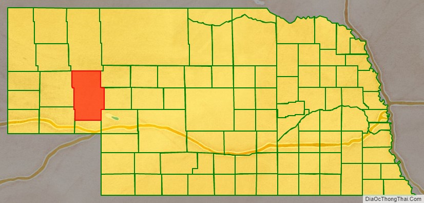
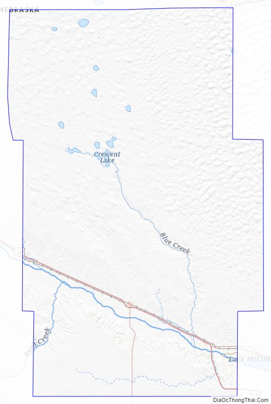
Garden County Road Map
Geography
The North Platte River runs ESE through the south part of Garden County. Since the county is in the western portion of Nebraska, its residents observe Mountain Time. The eastern two-thirds portion of the state observes Central Time.
According to the US Census Bureau, the county has a total area of 1,731 square miles (4,480 km), of which 1,704 square miles (4,410 km) is land and 27 square miles (70 km) (1.5%) is water.
Major highways
- U.S. Highway 26
- Nebraska Highway 27
- Nebraska Highway 92
Adjacent counties
- Sheridan County – north
- Grant County – east
- Arthur County – east
- Keith County – southeast
- Deuel County – south
- Cheyenne County – southwest
- Morrill County – west
Protected areas
- Ash Hollow State Historical Park
- Clear Creek State Waterfowl Management Area (partial)
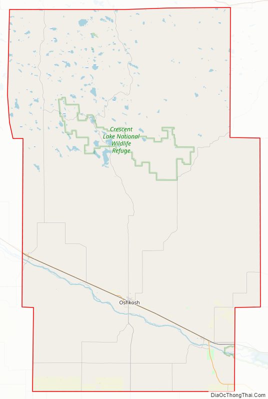
- Crescent Lake National Wildlife Refuge
Garden County Topographic Map
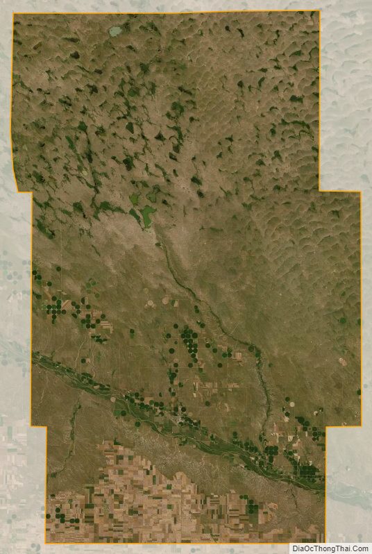
Garden County Satellite Map
Garden County Outline Map