Hardee County is a county located in the Florida Heartland, Central Florida region U.S. state of Florida. As of the 2020 census, the population was 25,327. Its county seat is Wauchula.
Hardee County comprises the Wauchula, FL Micropolitan Statistical Area.
| Name: | Hardee County |
|---|---|
| FIPS code: | 12-049 |
| State: | Florida |
| Founded: | April 23, 1921 |
| Named for: | Cary A. Hardee |
| Seat: | Wauchula |
| Largest city: | Wauchula |
| Total Area: | 638 sq mi (1,650 km²) |
| Land Area: | 638 sq mi (1,650 km²) |
| Total Population: | 25,327 |
| Population Density: | 43/sq mi (17/km²) |
| Time zone: | UTC−5 (Eastern) |
| Summer Time Zone (DST): | UTC−4 (EDT) |
| Website: | www.hardeecounty.net |
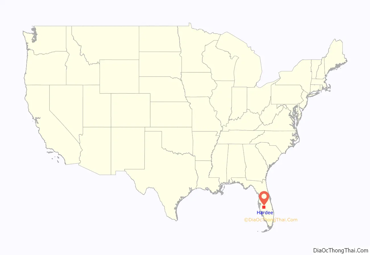
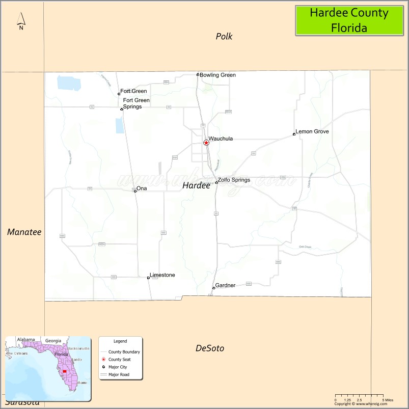
Hardee County location map. Where is Hardee County?
History
It was named for Cary A. Hardee, Governor of Florida from 1921 to 1925. Hardee County was created in 1921.
On August 13, 2004, Hurricane Charley went directly through Hardee County. Maximum sustained winds in downtown Wauchula were clocked at 149 mph (240 km/h) with higher gusts. Most buildings in the county sustained damage, and many were totally destroyed.
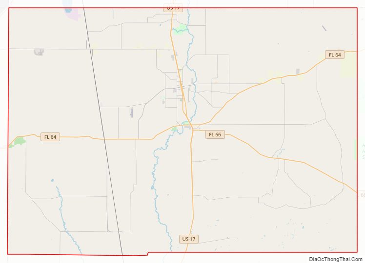
Hardee County Road Map
Geography
According to the U.S. Census Bureau, the county has a total area of 638 square miles (1,650 km), of which 638 square miles (1,650 km) is land and 0.6 square miles (1.6 km) (0.1%) is water.
Hardee County is located in what is known as the “Bone Valley” which contains most of North America’s phosphate deposits and a large portion of the world’s deposits. Phosphate is mined in large open pit mines with massive settling ponds that contain many harmful byproducts of the mining process and its disposal and use are restricted thus leaving the settling ponds in place indefinitely and rendering the land unfit for agriculture The Mosaic company currently owns all mining land in Hardee County with around 10,000 acres near Fort Green and is proposing an expansion of around 27,000 acres in a new mine near Ona, FL. There is much controversy over the mining practice, the rezoning and conversion of agricultural land into open pit mines. Land is “reclaimed” after mining but leaves areas of mostly artificially created lakes and wetlands in addition to the slightly poisonous and radioactive settling ponds. The proposed Ona mine would surround Horse Creek, a tributary to the Peace River, thus threatening the very pristine and largely untouched natural waterway as well as the Peace River watershed.
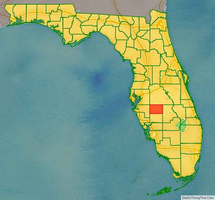
Adjacent counties
- Polk County, Florida – north
- Highlands County, Florida – east
- DeSoto County, Florida – south
- Manatee County, Florida – west
- Hillsborough County, Florida – northwest
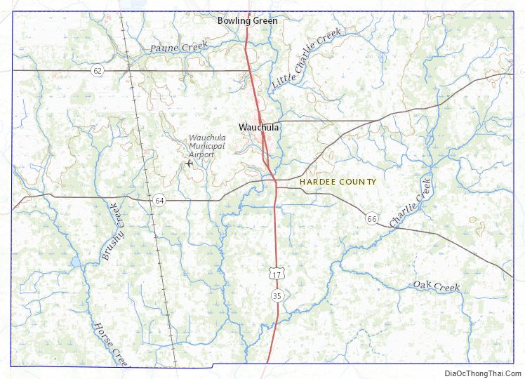
Hardee County Topographic Map
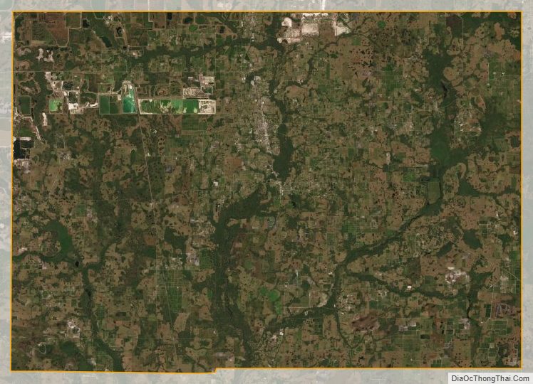
Hardee County Satellite Map
Hardee County Outline Map