Polk County is located in the central portion of the U.S. state of Florida. The county population was 725,046, as of the 2020 census. Its county seat is Bartow, and its largest city is Lakeland.
Polk County comprises the Lakeland–Winter Haven Metropolitan Statistical Area. This MSA is the 81st-most populous metropolitan statistical area and the 89th-most populous primary statistical area of the United States as of July 1, 2012.
The center of population of Florida is located in Polk County, near the city of Lake Wales. Polk County is home to one public university, one state college, and four private universities.
| Name: | Polk County |
|---|---|
| FIPS code: | 12-105 |
| State: | Florida |
| Founded: | February 8, 1861 |
| Named for: | James K. Polk |
| Seat: | Bartow |
| Largest city: | Lakeland |
| Total Area: | 2,011 sq mi (5,210 km²) |
| Land Area: | 1,798 sq mi (4,660 km²) |
| Total Population: | 725,046 |
| Population Density: | 403/sq mi (156/km²) |
| Time zone: | UTC−5 (Eastern) |
| Summer Time Zone (DST): | UTC−4 (EDT) |
| Website: | www.polk-county.net |
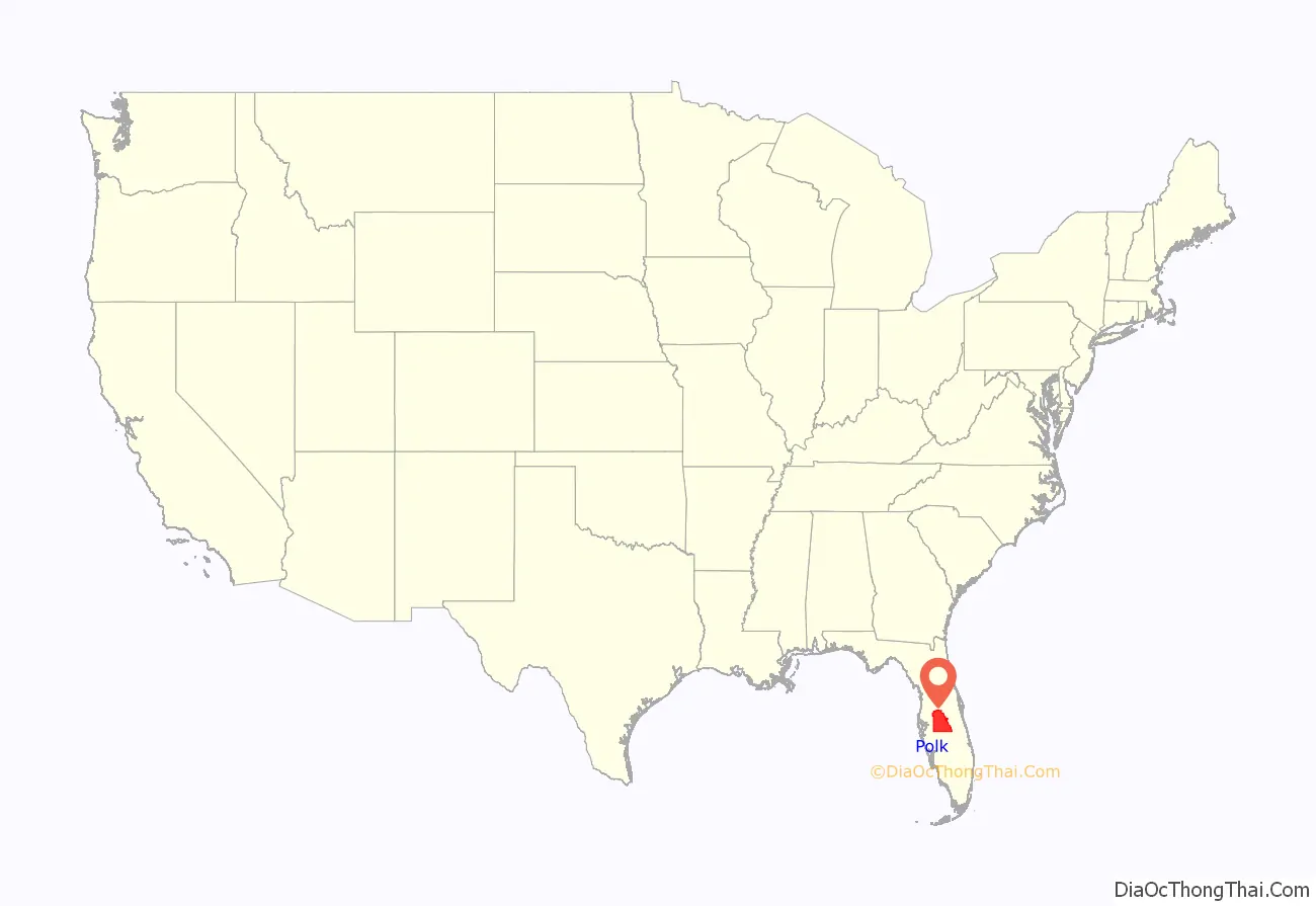
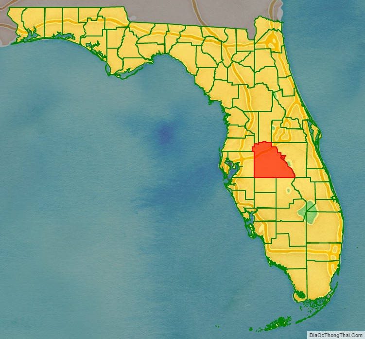
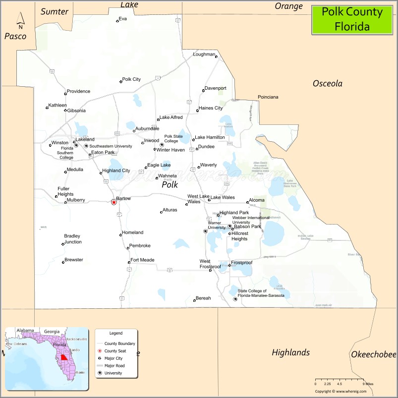
Polk County location map. Where is Polk County?
History
Early history
The first people to inhabit the area now called Polk County were the Paleoindians who arrived in Florida at least 12,000 years ago, late in the last ice age. With large amounts of water locked up in continental ice caps, the sea level was more than 150 feet (46 m) lower than at present. The Florida peninsula was twice as wide as it is today, and Florida was cooler and much drier, with few, if any, flowing rivers. Both animals and humans were dependent on scattered water holes, such as sinkholes, deep holes in otherwise dry river beds, and rain-fed lakes perched on impervious clay. Most Paleoindian campsites found in Florida have been found at water holes. The largest collection of late (more than 9,500 years ago) Paleoindian microlithic tools known from Florida were found in Lake Weohyakapka, near Nalcrest in Polk County.
As sea levels rose and Florida became warmer and wetter, the Paleoindian period was followed by the Archaic period. The Archaic period ended 2,500 to 3,000 years ago, with the emergence of recognizable archaeological cultures in Florida. In eastern Polk County, the Kissimmee River valley was occupied by people of the Belle Glade culture, which persisted from about 3,000 years ago until the collapse of the Native American population in Florida after 1700. Native American people in western Polk County were part of, or influenced by, the Manasota culture, which flourished from 2,500 years ago until c. 800, when it was replaced by the Safety Harbor culture, from c. 800 until after 1700. The Peace River valley may have hosted a distinct culture during the Safety Harbor period.
In 1539, Ponce De Leon sent a detachment (between 80 and 180 men) of his expedition from his landing place on Tampa Bay across northern Polk County to visit Urriparacoxi, a powerful chief based in southern Lake County or eastern Orange County. For the next 280 years, the Spanish (and, between 1763 and 1783, the British) ruled Florida, but did not venture into the interior of the Florida peninsula south of the Oklawaha River valley (Acuera Province). The indigenous peoples of the Florida peninsula declined in numbers, and the people who became known as the Seminole moved into central Florida.
United States control
In 1821, Florida became a U.S. territory as a result of the Adams-Onis Treaty. In 1823 the Treaty of Moultrie Creek created a reservation in central Florida for the Seminoles and other Native Americans in Florida. What is now Polk County was within the boundaries of that reservation. An attempt to remove all Native Americans in Florida to west of the Mississippi River, starting in 1832, led to the Second Seminole War. Most of the fighting in the early years of the war occurred north of Polk County. By 1837, the Seminoles were being pushed south, and late that year Colonel Zachary Taylor, as part of a coordinated push against the Seminoles, led a column east from Fort Brooke (today’s Tampa) into what is now Polk County, and then south between the Kissimmee and Peace river valleys, culminating in the Battle of Lake Okeechobee. By 1843 the few Seminoles remaining in Florida were confined to an informal reservation in southern Florida.
While Florida gained statehood in 1845, it was not until 1861, a month after Florida had seceded from the Union, that Polk County was created. It was formed from the eastern part of Hillsborough County and named in honor of former US President James K. Polk, who had been popular with Southerners for supporting the expansion of slavery and whose 1845 inauguration was on the day after Florida became a state.
Following the Civil War, the county commission established the county seat on 120 acres (0.49 km) donated in the central part of the county. Bartow, the county seat, was named after Francis S. Bartow, a Confederate colonel from Georgia who was the first Confederate brigade commander to die in battle. Colonel Bartow was buried in Savannah, Georgia with military honors, and promoted posthumously to the rank of Brigadier General. The original name of the town was Fort Blount. Several other towns and counties in the South changed their name to Bartow. The first courthouse built in Bartow was constructed in 1867. It was replaced twice, in 1884 and in 1908. As the third courthouse to stand on the site, the present structure houses the Polk County Historical Museum and Genealogical Library. After the Civil War, some 400 Confederate veterans settled here with families before the end of the century.
Post-Reconstruction era to World War II
In the post-Reconstruction period, black railway workers were among the first African Americans to settle in Polk County, in 1883 south of Lake Wire. The following year they founded St. John’s Baptist Church, which also served as the first school for freedmen’s children. Other workers arrived for jobs in the phosphate industry. This area became the center of a predominately African-American community later known as Moorehead, after Rev. H.K. Moorehead, called to St. John’s in 1906. The community developed its own businesses, professional class, and cultural institutions. Its students had to go to other cities for high school until 1928, when the first upper school to serve blacks was established here.
White violence rose against blacks in the late 19th century in a regionwide effort to establish and maintain white supremacy as Southern states disenfranchised most blacks and imposed Jim Crow. Whites lynched 20 African Americans in Polk County from 1895 to 1921; Three black men, whose names were not recorded, were murdered in a mass lynching on May 25, 1895, accused of rape. While others were killed for alleged crimes (never proven), one black man was lynched for supposedly insulting a white woman. The man, Henry Scott was a porter on a train from Lakeland to Bartow. While he was preparing a berth for one woman on May 20, 1920, another white woman became angry that he made her wait. She sent a telegram to the next station where he was met by a sheriff, arrested, and then turned over to a mob that shot him 40-50 times. Columbia County also had 20 such lynching murders; these two counties had the second-highest total of lynchings of African Americans of any county in the state.
In the first few decades of the 1900s, thousands of acres of land around Bartow were purchased by the phosphate industry. The county seat became the hub of the largest phosphate industry in the United States, attracting both immigrants and African-American and white workers from rural areas.
Polk County was the leading citrus county in the United States for much of the 20th century, and even the county seat Bartow has had several large groves. In 1941, the city built an airport northeast of town in the county. The airport was taken over by the federal government during World War II and was the training location for many Army Air Corps pilots during the war. The airport was returned to the city in 1967 and renamed as Bartow Municipal Airport.
Mid-20th century to present
In the 20th century, the Ku Klux Klan revived and was active in Polk County, even after World War II. Klansmen were photographed in hoods and robes in 1958 in a church in Mulberry. During the 1960s violence related to civil rights movement was attributed to the Klan. In 1967, a white man shot and severely wounded a popular African-American high school football player who was integrating Lake Ariana Beach. A Klan group marched in Lakeland in full regalia in 1979, their last public march by the Confederate monument in Munn Park.
Fred Rochelle, 16, was burned alive in a public spectacle lynching before thousands in Polk County, Florida, in 1901.
Since the late 20th century, growth in Polk County has been driven by its proximity to both the Tampa and Orlando metropolitan areas along the Interstate 4 corridor. Recent growth has been heaviest in Lakeland (closest to Tampa) and the Northeast areas near Haines City (nearest to Orlando). From 1990 to 2000, unincorporated areas grew 25%, while incorporated areas grew only 11%. In addition to cottage communities that have developed for commuters, Haines City has suburban sprawl into unincorporated areas. Despite the impressive growth rate, the unemployment rate of Polk has typically been higher than that of the entire state. For example, in August 2010, the county had an unemployment rate of 13.4%, compared to 11.7% for the entire state.
During the 2004 Atlantic hurricane season, three hurricanes, Charley, Frances and Jeanne, all tracked over Polk County, intersecting in a triangle that includes the city of Bartow.
Winter Haven was best known as the home of the Cypress Gardens theme park, which operated from 1936 to September 23, 2009. Legoland Florida has since been built on the site of former Cypress Gardens, and has preserved the botanical garden section. Winter Haven was the location of the first Publix supermarket circa 1930; today Publix’s corporate offices are located in Lakeland.
In 2018, the Lakeland City Commission voted to move the Confederate monument from Munn Park, where it was installed in 1910, to Veterans Memorial Park. What is now Veterans Memorial Park was first settled in 1883 as the community of Moorehead, the original African-American community in the area. Owners were bought out in 1967 by eminent domain for county civic development of a conference center and the later Veterans Memorial Park. Some members of the Black community have objected to the Confederate monument being relocated to the site of what had been their historic community in Lakeland, saying it would be more appropriate to be located in the cemetery with numerous Confederate graves.
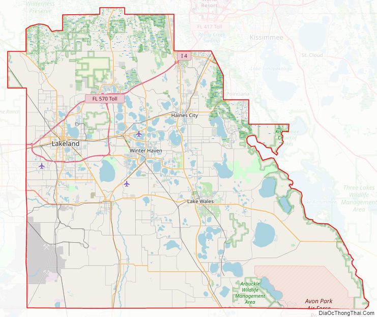
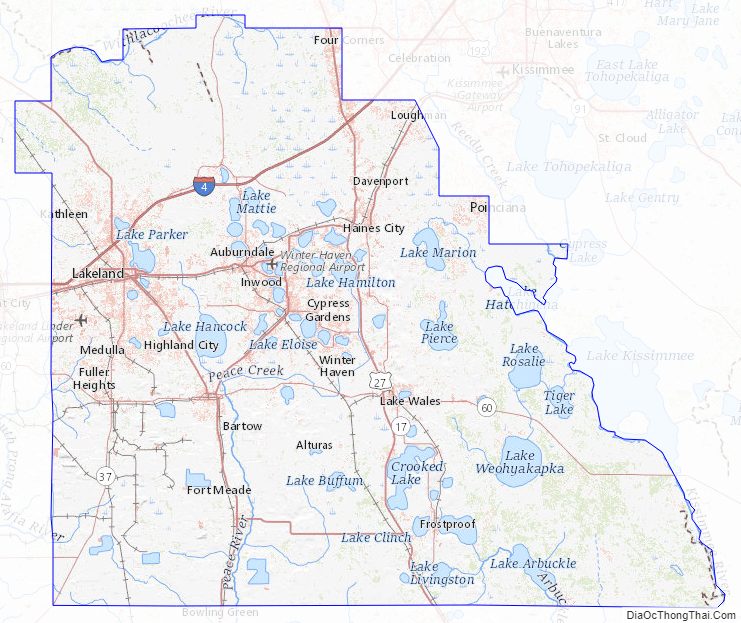
Polk County Road Map
Geography
According to the U.S. Census Bureau, the county has a total area of 2,011 square miles (5,210 km), of which 1,798 square miles (4,660 km) is land and 213 square miles (550 km) (10.6%) is water. It is the fourth-largest county in Florida by land area and fifth-largest by total area.
Polk County is within the Central Florida Highlands area of the Atlantic coastal plain, with a terrain consisting of flatland interspersed with gently rolling hills. Part of the Lake Wales Ridge runs through eastern Polk County, which is known for its rolling hills, unique wildlife and plants. The highest elevation in the county is Crooked Lake Sandhill at 305 feet, with the second highest being Iron Mountain, the location of Bok Tower at 295 feet. Several artificial raised phosphate tailings ponds in the center of the county rise up to 375 feet.
Adjacent counties
In addition, at its northeast corner, Polk County touches Orange County at a quadripoint called Four Corners, Florida; Lake and Osceola counties lie between.
Climate
Polk County, like most of Florida, has a humid subtropical climate (Köppen Cfa). It lies in the USDA Plant Hardiness Zone 9b, where the average annual minimum temperature is 25-30 °F (-3.9 °C to -1.1 °C). The last measurable snow in the county fell in 1977, but snow flurries and sleet fell on January 8, 2010 over the course of an hour on an exceptionally cold day.
During the summer rainy season from June to September, sea breezes from both coasts move inland, where the moist air is heated and rises to form thunderstorms. On many days, the sea breeze thunderstorms from both coasts will move inland, colliding in Polk County to form especially strong thunderstorms. Polk County is located in the middle of “lightning alley”, which has more lightning annually than any region in the United States. Largely due to its size, the county receives the overall highest number of lightning strikes in the area.
The Green Swamp is prone to fog in winter. In the pre-dawn hours of January 8, 2008, smoke from a prescribed burn contributed to especially dense fog on Interstate 4 that caused a major pileup involving 70 vehicles in ten separate crashes that resulted in five deaths.
The eyes of 12 hurricanes have passed through the county at hurricane strength in recorded history, including Hurricane Irma (2017, category 1), Hurricane Jeanne (2004, category 1), Hurricane Charley (2004, category 2), Hurricane Donna (1960, category 2), Hurricane King (1950, category 1), the 1949 Florida hurricane (category 2), the 1945 Homestead hurricane (category 1), the 1933 Treasure Coast hurricane (category 1), the 1928 Okeechobee hurricane (category 2), Hurricane Four of the 1894 season (category 1), and Hurricane Three of the 1871 season, and Hurricane Eight of the 1859 season (category 1). Additionally, four storms were downgraded from hurricane strength at a location outside the county to tropical storm force at some point within the county and, given the hours between National Hurricane Center updates (modern era) or earlier estimates, it is not clear whether these brought hurricane-force sustained winds to Polk County: Hurricane Frances (2004), Hurricane Erin (1995) Hurricane Two of the 1939 season, and the 1910 Cuba hurricane (category 1). Numerous tropical storms have passed through the county.
Hurricane Charley in 2004—the first of three hurricanes to hit the county in six weeks—is the strongest storm in recent history to pass through the county, mainly impacting the eastern half of the county. The Lake Wales Fire Department recorded an unofficial maximum wind speed of 95 mph (153 km/h) sustained and a gust of 101 mph (163 km/h). The hurricane entered the county south of Fort Meade, shortly after it passed Wauchula (in Hardee County), where a maximum wind gust of 109 mph (175 km/h) was recorded by emergency management officials. The hurricane-force wind field was relatively narrow, with the most intense wind damage being within 10 mi (16 km) of the center of the eye. For example, maximum recorded winds were only 41 kn (76 km/h; 47 mph) sustained and a gust of 54 kn (100 km/h; 62 mph) at Gilbert Airport on the northwest side of the city.
Polk County Topographic Map
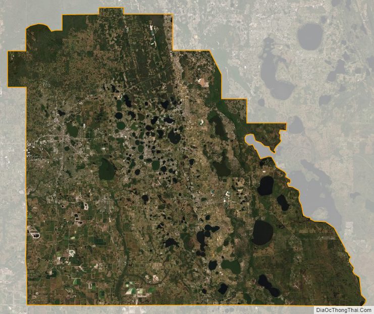
Polk County Satellite Map
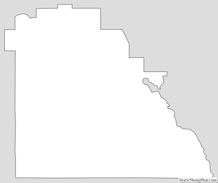
Polk County Outline Map