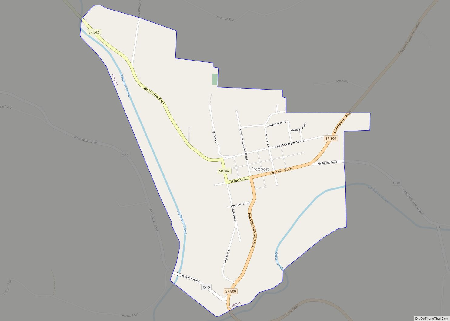
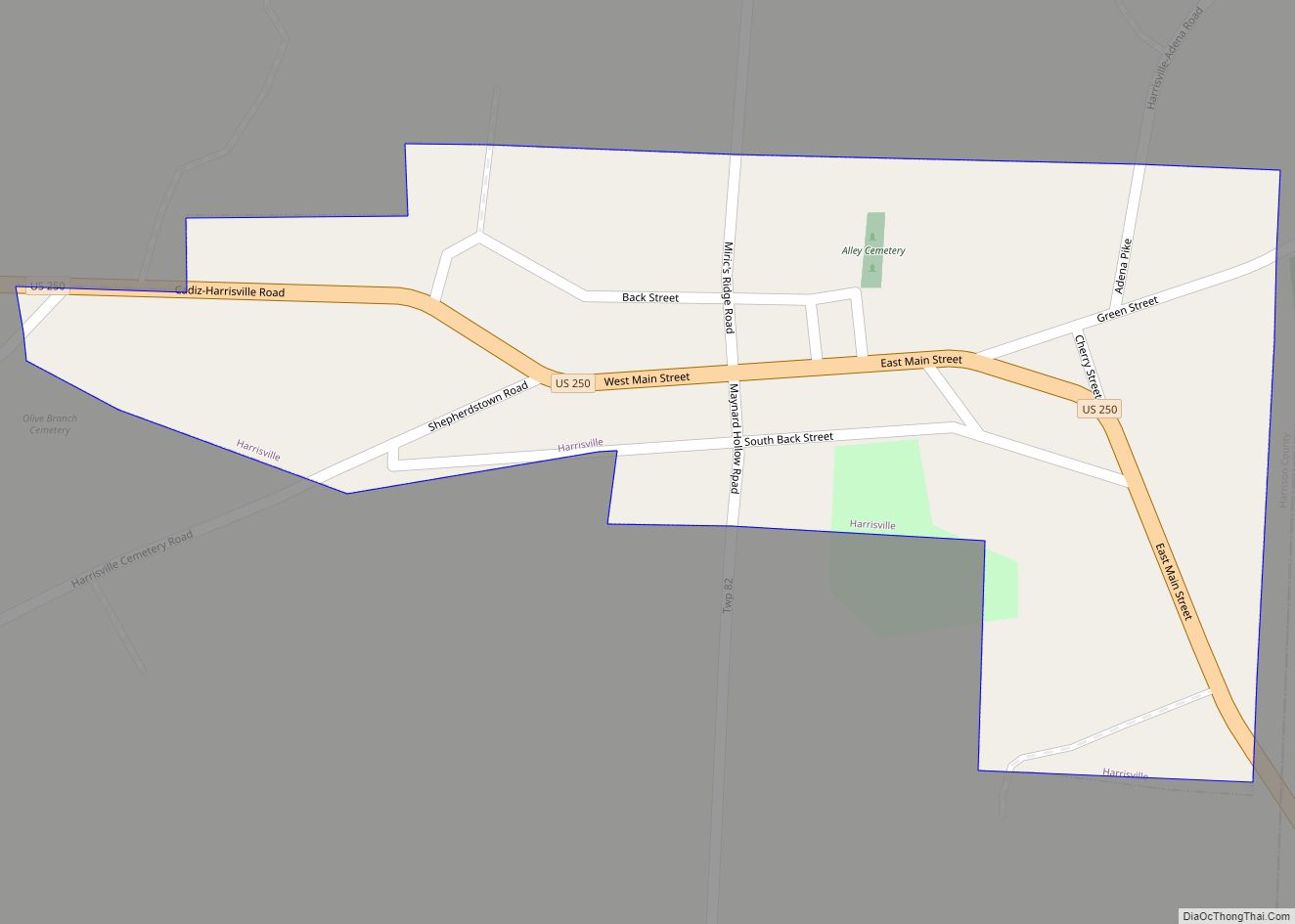
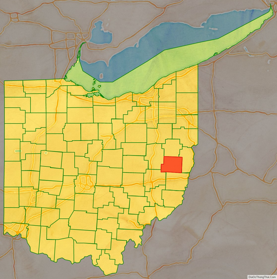
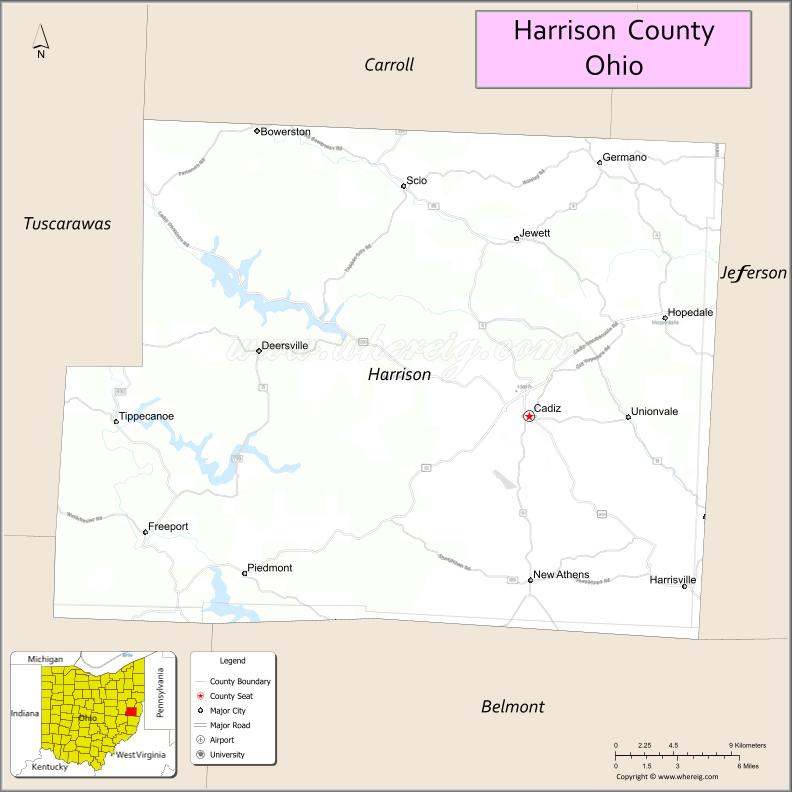
Harrison County is a county located in the U.S. state of Ohio. As of the 2020 census, the population was 14,483, making it the fifth-least populous county in Ohio. Its county seat and largest village is Cadiz. The county is named for General William Henry Harrison, who was later President of the United States.
| Name: | Harrison County |
|---|---|
| FIPS code: | 39-067 |
| State: | Ohio |
| Founded: | February 1, 1813 |
| Named for: | William Henry Harrison |
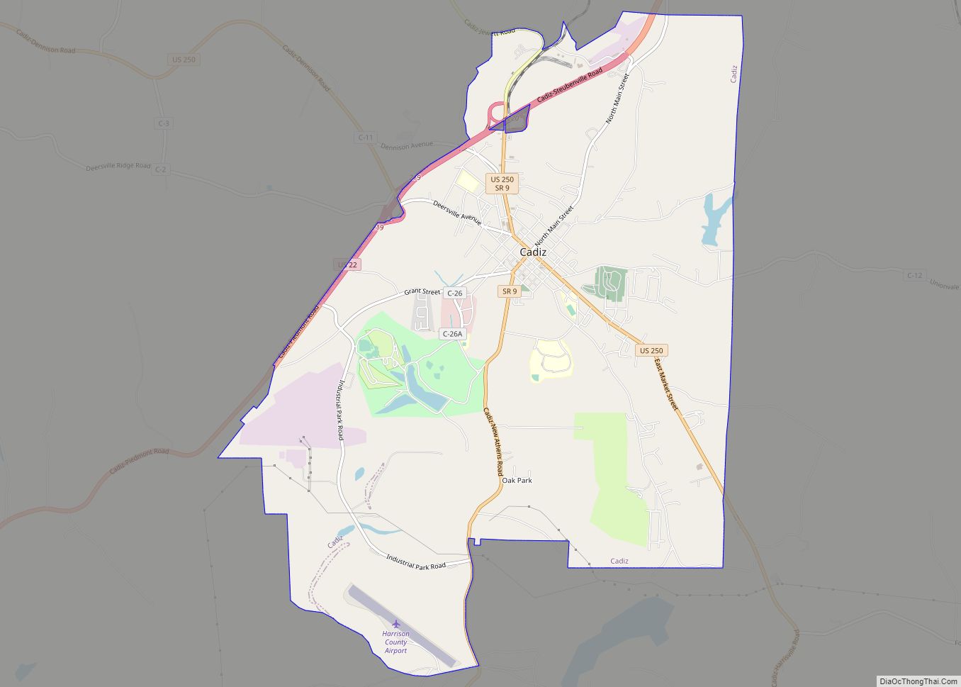
| Seat: | Cadiz |
| Total Area: | 411 sq mi (1,060 km²) |
| Land Area: | 402 sq mi (1,040 km²) |
| Total Population: | 14,483 |
| Population Density: | 35/sq mi (14/km²) |
| Time zone: | UTC−5 (Eastern) |
| Summer Time Zone (DST): | UTC−4 (EDT) |
| Website: | www.harrisoncountyohio.org |
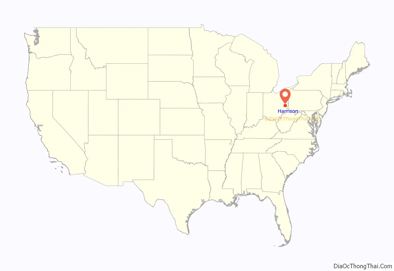
Harrison County location map. Where is Harrison County?
History
Harrison County was formed from parts of Jefferson and Tuscarawas Counties in 1813. The county was named after General William Henry Harrison, the hero of the battle of Tippecanoe in the War of 1812 (and later to become the 9th US president).
Oil was discovered near Jewett, Ohio in 1895, and then in the Scio, Ohio area in 1898. However, by 1901, the Scio oil boom had essentially ceased.
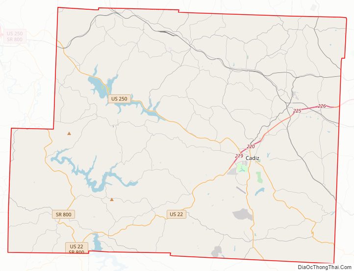
Harrison County Road Map
Geography
According to the U.S. Census Bureau, the county has a total area of 411 square miles (1,060 km), of which 402 square miles (1,040 km) is land and 8.4 square miles (22 km) (2.1%) is water.
On May 16, 2013, the Chicago Tribune Business section reported that the Utica Shale underlying Harrison County shows promise as a tight oil production zone. To produce tight oil in large quantities would require horizontal drilling and fracturing of the shale formation as is being done in North Dakota and Texas.
Adjacent counties
- Carroll County (north)
- Jefferson County (east)
- Belmont County (south)
- Guernsey County (southwest)
- Tuscarawas County (west)
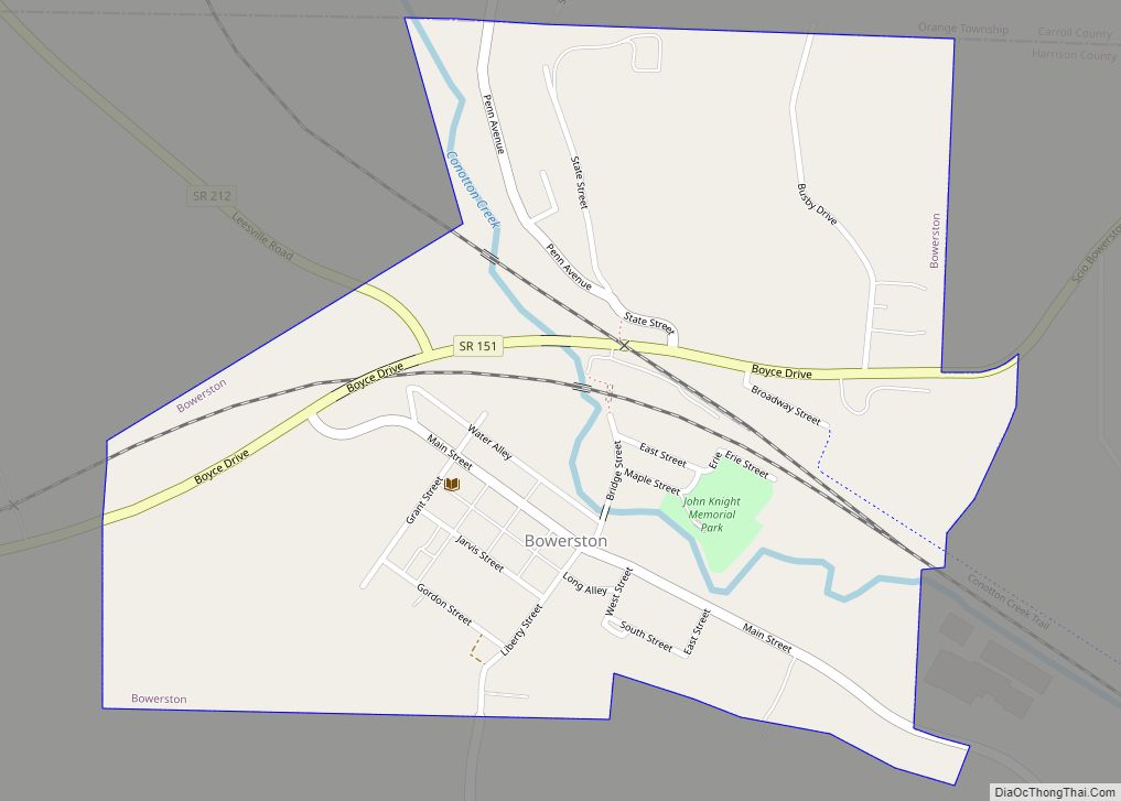
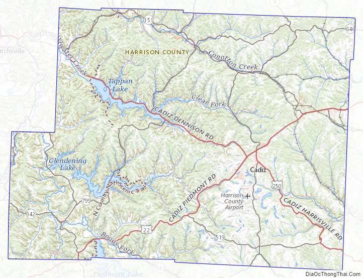
Conotton Creek Trail
The Conotton Creek Trail is a rails-to-trails path that runs along Conotton Creek from Bowerston to Jewett in northern Harrison County, Ohio. The paved multi-use trail is 11.4 miles (18.3 km) long.
Harrison County Topographic Map
Harrison County Satellite Map

Harrison County Outline Map