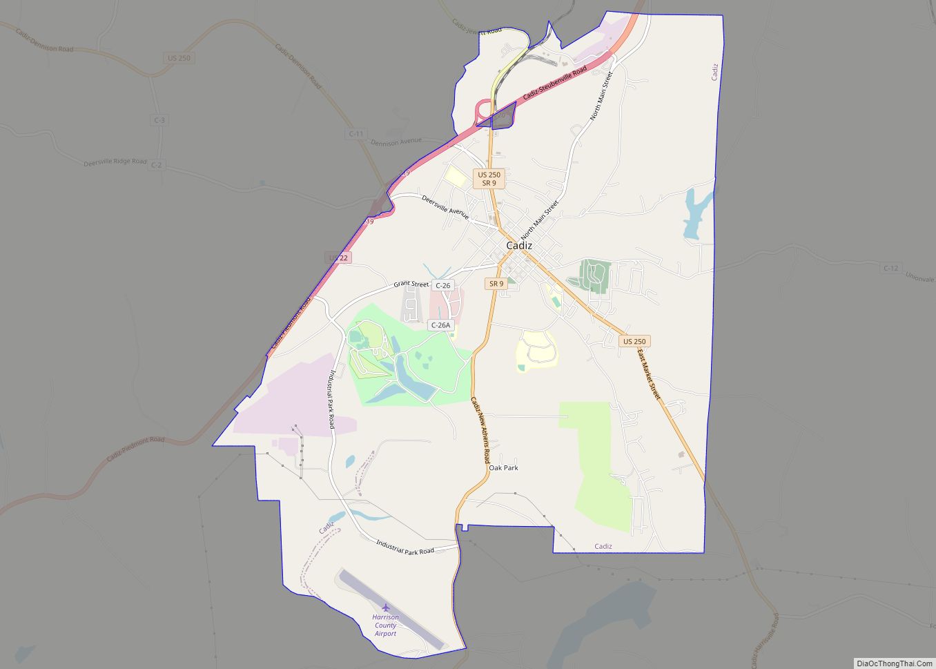
Cadiz (/ˈkædɪs/ KAD-iss) is a village in and the county seat of Harrison County, Ohio, United States, located about 20 miles southwest of Steubenville. The population was 3,051 at the 2020 census.
| Name: | Cadiz village |
|---|---|
| LSAD Code: | 47 |
| LSAD Description: | village (suffix) |
| State: | Ohio |
| County: | Harrison County |
| Elevation: | 1,263 ft (385 m) |
| Total Area: | 8.95 sq mi (23.17 km²) |
| Land Area: | 8.78 sq mi (22.75 km²) |
| Water Area: | 0.16 sq mi (0.42 km²) |
| Total Population: | 3,051 |
| Population Density: | 347.34/sq mi (134.10/km²) |
| ZIP code: | 43907 |
| Area code: | 740 |
| FIPS code: | 3910800 |
| GNISfeature ID: | 1038598 |
Online Interactive Map
Click on ![]() to view map in "full screen" mode.
to view map in "full screen" mode.
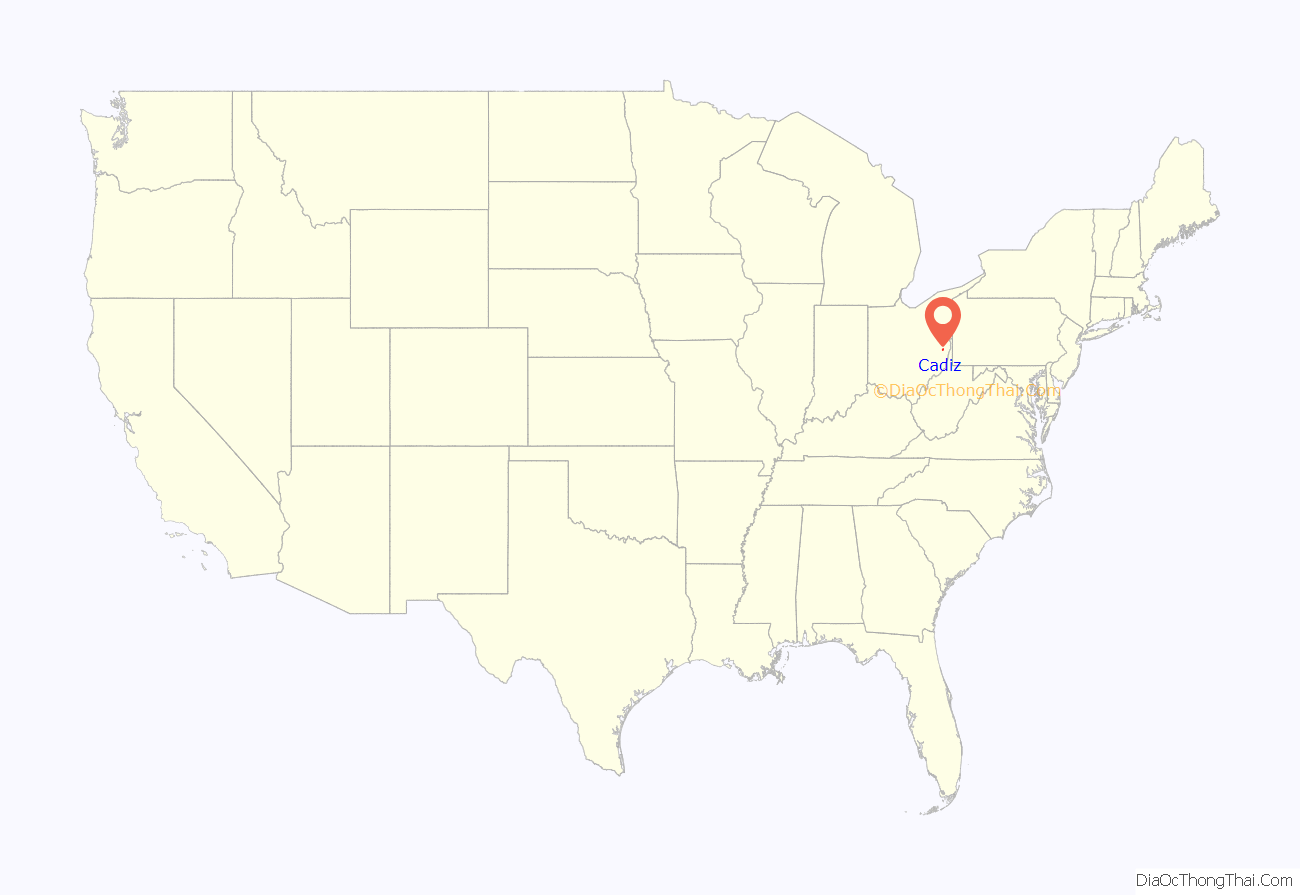
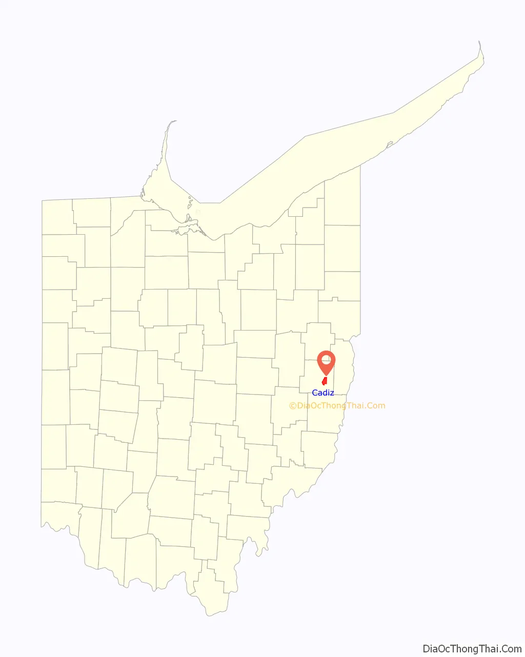
Cadiz location map. Where is Cadiz village?
History
Cadiz was founded in 1803 at the junction of westward roads from Pittsburgh and Washington, Pennsylvania, and named after Cádiz, Spain. The town became the county seat of newly formed Harrison County in 1813. By 1840, Cadiz had 1,028 residents; by 1846, the town had four churches and 21 stores. The Steubenville and Indiana Railroad, a predecessor of the Pennsylvania Railroad, opened to Cadiz June 11, 1854.
In the early and mid nineteenth century, several local families operated stations and served as conductors in the Underground Railroad, helping runaway slaves escape to Canada.
By 1880 population had nearly doubled and the town had three newspapers and three banks.
Early industry was based on agriculture and processing farm products. In 1889, a brief oil boom began with the shipment of 120 barrels of oil produced in nearby Green Township. Coal mining, both underground and surface, became the prominent industry through most of the twentieth century. More recently the development of the Marcellus Shale in the surrounding area has made Cadiz a center for natural gas production. The MarkWest Complex, opened in 2012, processes more than 180 million cubic feet of natural gas per day for shipment via pipeline to Mont Belvieu, Texas.
Cadiz Road Map
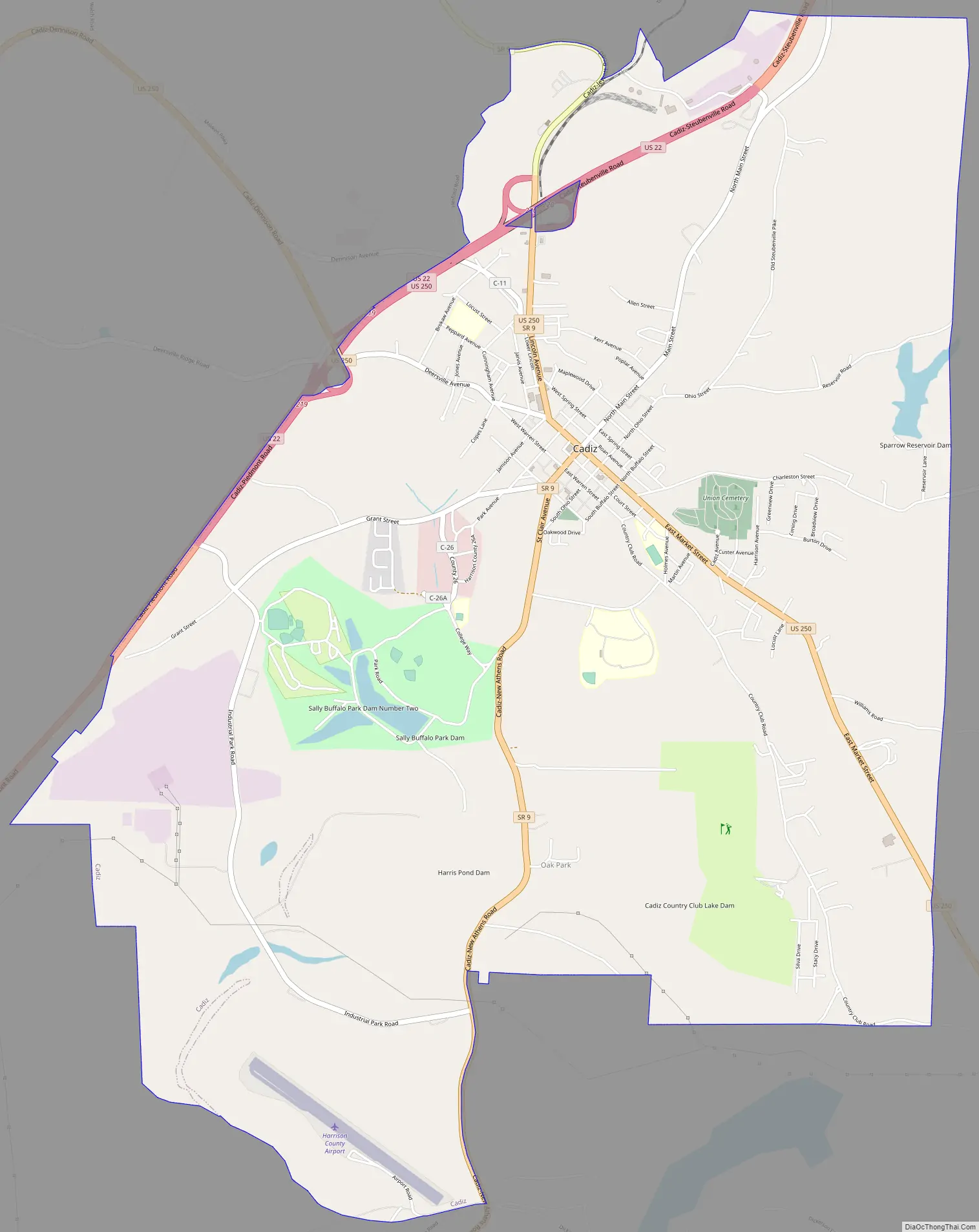
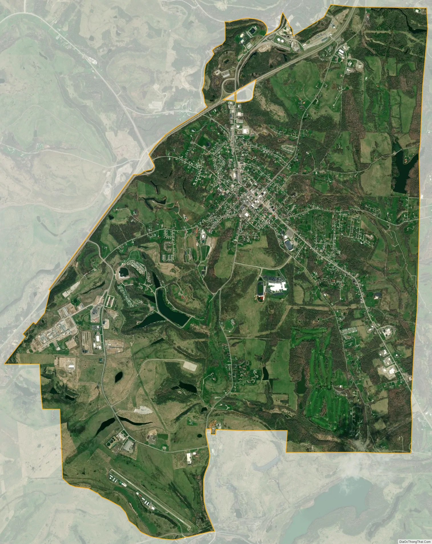
Cadiz city Satellite Map
Geography
According to the United States Census Bureau, the village has a total area of 8.94 square miles (23.15 km), of which 8.78 square miles (22.74 km) is land and 0.16 square miles (0.41 km) is water.
Climate
See also
Map of Ohio State and its subdivision:- Adams
- Allen
- Ashland
- Ashtabula
- Athens
- Auglaize
- Belmont
- Brown
- Butler
- Carroll
- Champaign
- Clark
- Clermont
- Clinton
- Columbiana
- Coshocton
- Crawford
- Cuyahoga
- Darke
- Defiance
- Delaware
- Erie
- Fairfield
- Fayette
- Franklin
- Fulton
- Gallia
- Geauga
- Greene
- Guernsey
- Hamilton
- Hancock
- Hardin
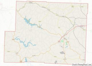
- Harrison
- Henry
- Highland
- Hocking
- Holmes
- Huron
- Jackson
- Jefferson
- Knox
- Lake
- Lake Erie
- Lawrence
- Licking
- Logan
- Lorain
- Lucas
- Madison
- Mahoning
- Marion
- Medina
- Meigs
- Mercer
- Miami
- Monroe
- Montgomery
- Morgan
- Morrow
- Muskingum
- Noble
- Ottawa
- Paulding
- Perry
- Pickaway
- Pike
- Portage
- Preble
- Putnam
- Richland
- Ross
- Sandusky
- Scioto
- Seneca
- Shelby
- Stark
- Summit
- Trumbull
- Tuscarawas
- Union
- Van Wert
- Vinton
- Warren
- Washington
- Wayne
- Williams
- Wood
- Wyandot
- Alabama
- Alaska
- Arizona
- Arkansas
- California
- Colorado
- Connecticut
- Delaware
- District of Columbia
- Florida
- Georgia
- Hawaii
- Idaho
- Illinois
- Indiana
- Iowa
- Kansas
- Kentucky
- Louisiana
- Maine
- Maryland
- Massachusetts
- Michigan
- Minnesota
- Mississippi
- Missouri
- Montana
- Nebraska
- Nevada
- New Hampshire
- New Jersey
- New Mexico
- New York
- North Carolina
- North Dakota
- Ohio
- Oklahoma
- Oregon
- Pennsylvania
- Rhode Island
- South Carolina
- South Dakota
- Tennessee
- Texas
- Utah
- Vermont
- Virginia
- Washington
- West Virginia
- Wisconsin
- Wyoming