Kalawao County (Hawaiian: Kalana o Kalawao) is a county in the U.S. state of Hawaii. It is the smallest county in the 50 states by land area and the second-smallest county by population, after Loving County, Texas. The county encompasses the Kalaupapa or Makanalua Peninsula, on the north coast of the island of Molokaʻi. The small peninsula is isolated from the rest of Molokaʻi by cliffs over a quarter-mile high; the only land access is a mule trail.
Because of the small population, Kalawao County does not have the same functions as other Hawaii counties. Instead, it is a judicial district of Maui County, which includes the rest of the island of Molokaʻi. The county has no elected government.
It was developed and used from 1866 to 1969 for settlements for treatment of quarantined persons with Hansen’s disease (leprosy).
| Name: | Kalawao County |
|---|---|
| FIPS code: | 15-005 |
| State: | Hawaii |
| Founded: | 1905 |
| Named for: | Kalawao |
| Seat: | none (administered by Hawaii Dept. of Health) |
| Total Area: | 53 sq mi (140 km²) |
| Land Area: | 12 sq mi (30 km²) |
| Total Population: | 82 |
| Population Density: | 1.5/sq mi (0.60/km²) |
| Time zone: | UTC−10 (Hawaii–Aleutian) |
| Summer Time Zone (DST): | HADT |
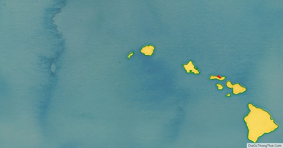
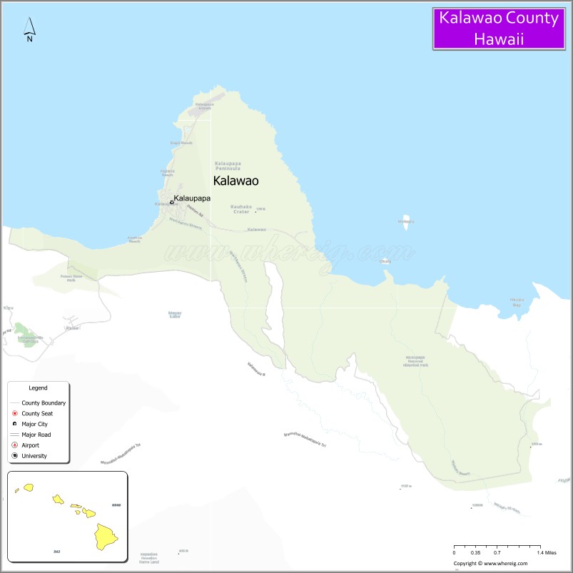
Kalawao County location map. Where is Kalawao County?
History
The Kingdom of Hawaiʻi, the Republic of Hawaiʻi, the Territory of Hawaii, and the state of Hawaii all exiled persons suffering from Hansen’s disease to the peninsula, from 1866 to 1969. The quarantine policy was only lifted after effective antibiotic treatments were developed that could be administered on an outpatient basis and patients could be rendered non-contagious.
Many of the residents nonetheless chose to remain on the peninsula, as they believed their disfigurements from the illness would make reintegration into society impossible. The state promised that they could live there for the rest of their lives. No new patients, or other permanent residents, were later admitted. Visitors are permitted only as part of official tours. State law prohibits anyone under the age of 16 from visiting or living there, although exceptions have been made for children visiting their relatives.
In 1980, the Kalaupapa National Historical Park was established to preserve the county’s history and environment. It is coterminous with the boundaries of Kalawao County.
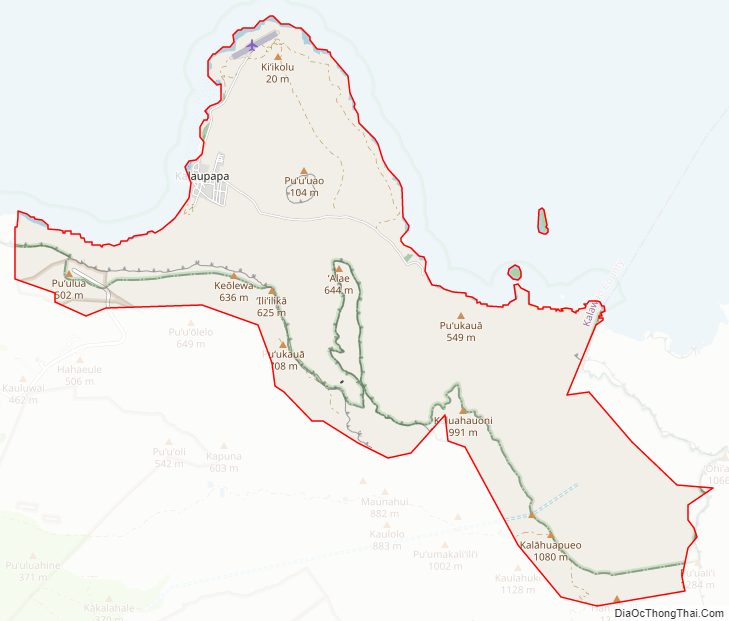
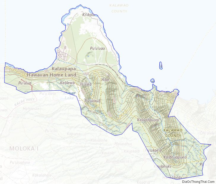
Kalawao County Road Map
Geography
According to the U.S. Census Bureau, the county has a total area of 53 square miles (140 km), of which 12 square miles (31 km) is land and 41 square miles (110 km) (77.3%) is water. By land area, it is the smallest true county in the United States; some independent cities in Virginia are smaller and are sometimes considered to be “county equivalents” for statistical purposes such as with the US Census Bureau.
Kalaupapa Peninsula
Kalaupapa Peninsula contains the county’s only settlement, Kalaupapa. The Kalaupapa Peninsula developed from lava that erupted from the ocean floor near Kauhakō Crater and spread outward, forming a low shield volcano. This was the most recent volcanic episode on the island and of the larger East Molokaʻi shield volcano, occurring after the formation of the cliffs by erosion.
Subdivisions
Kalawao County is composed of four ahupuaʻa. From west to east:
Kalawao County Topographic Map
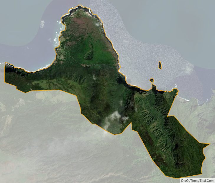
Kalawao County Satellite Map
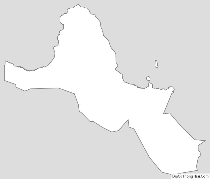
Kalawao County Outline Map