Hawaii (/həˈwaɪi/ (listen) hə-WY-ee; Hawaiian: Hawaiʻi [həˈvɐjʔi] or [həˈwɐjʔi]) is a state in the Western United States, about 2,000 miles (3,200 km) from the U.S. mainland in the Pacific Ocean. It is the only U.S. state outside North America, the only state that is an archipelago, and the only state in the tropics.
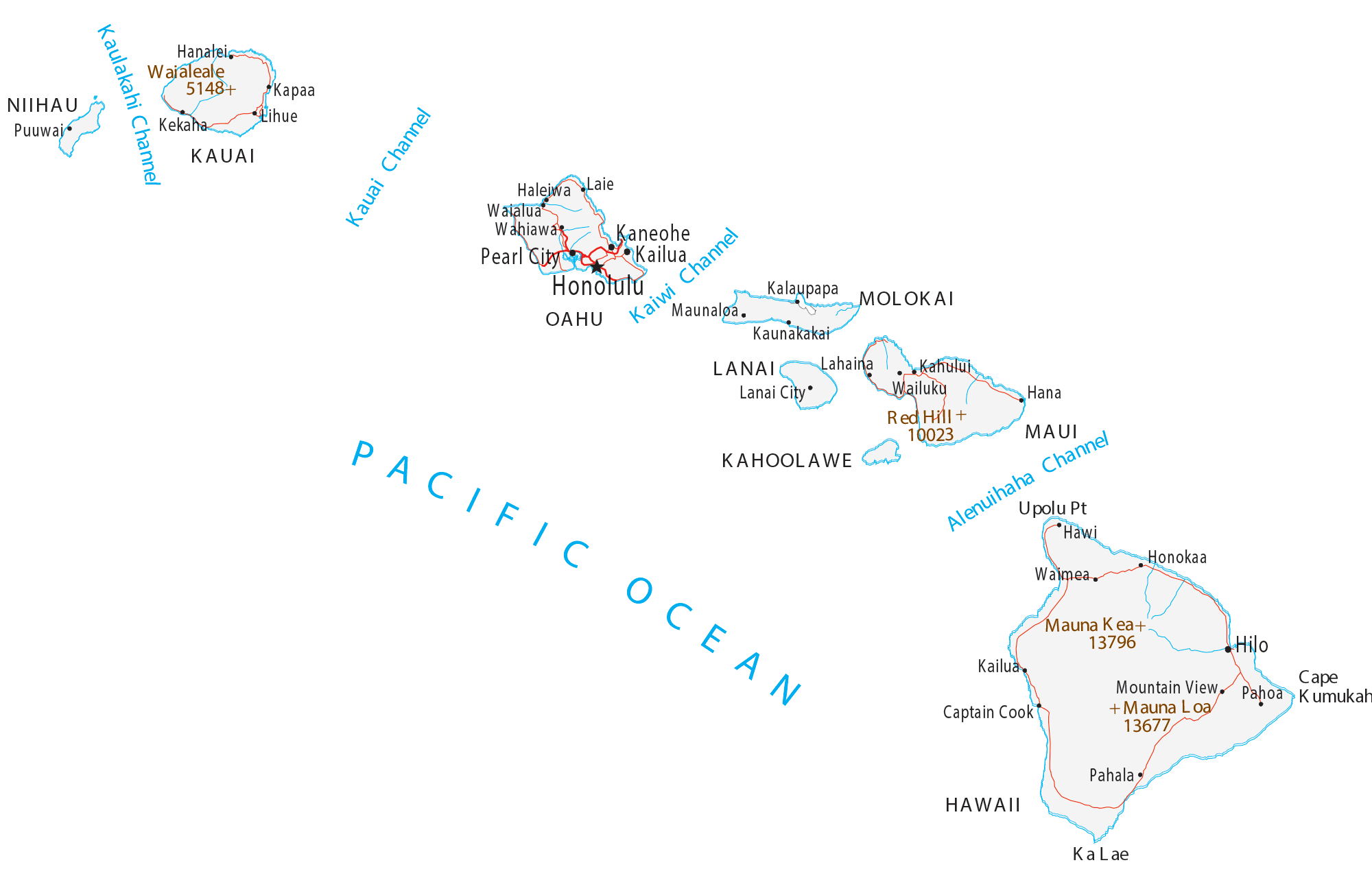
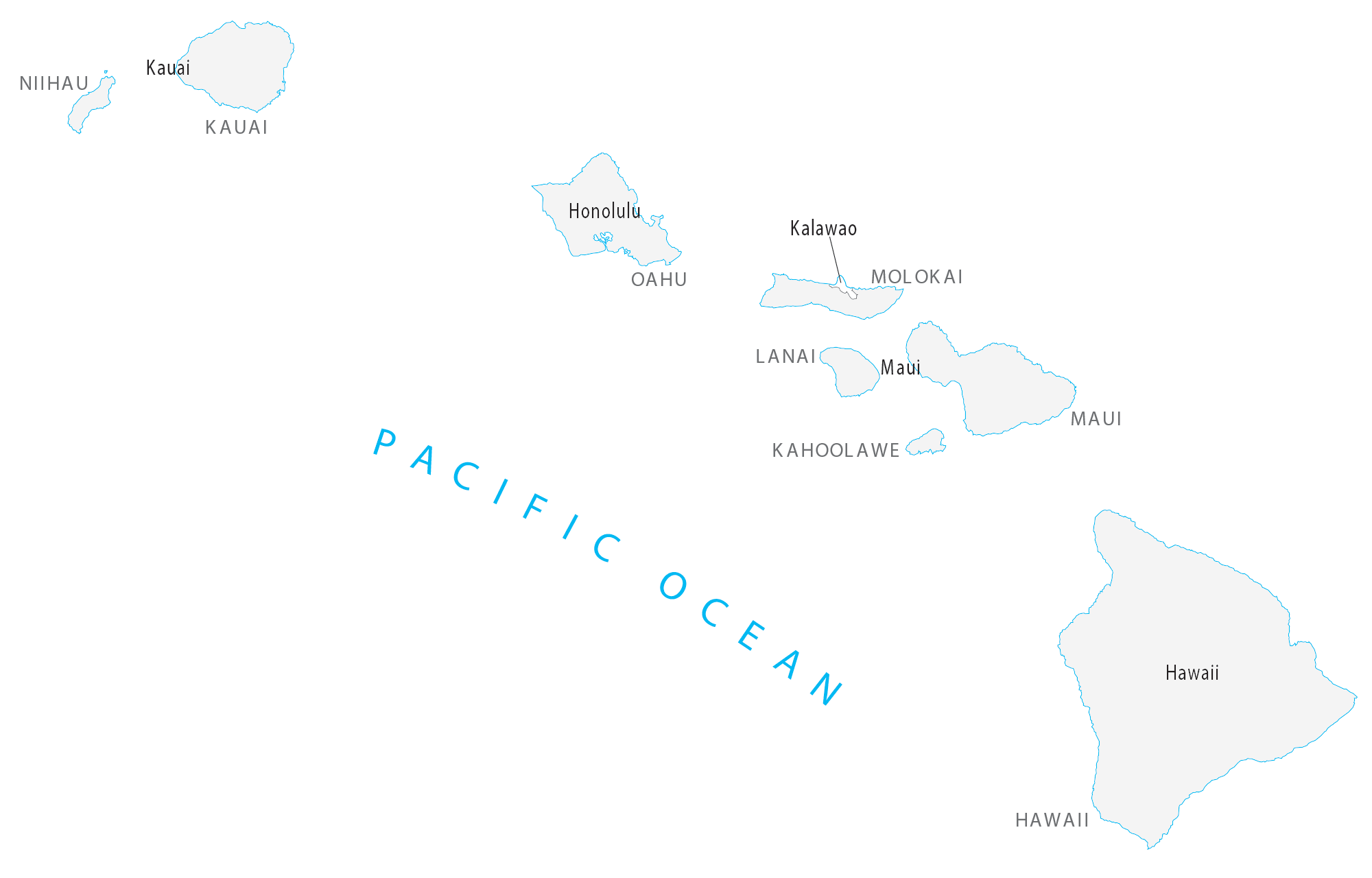
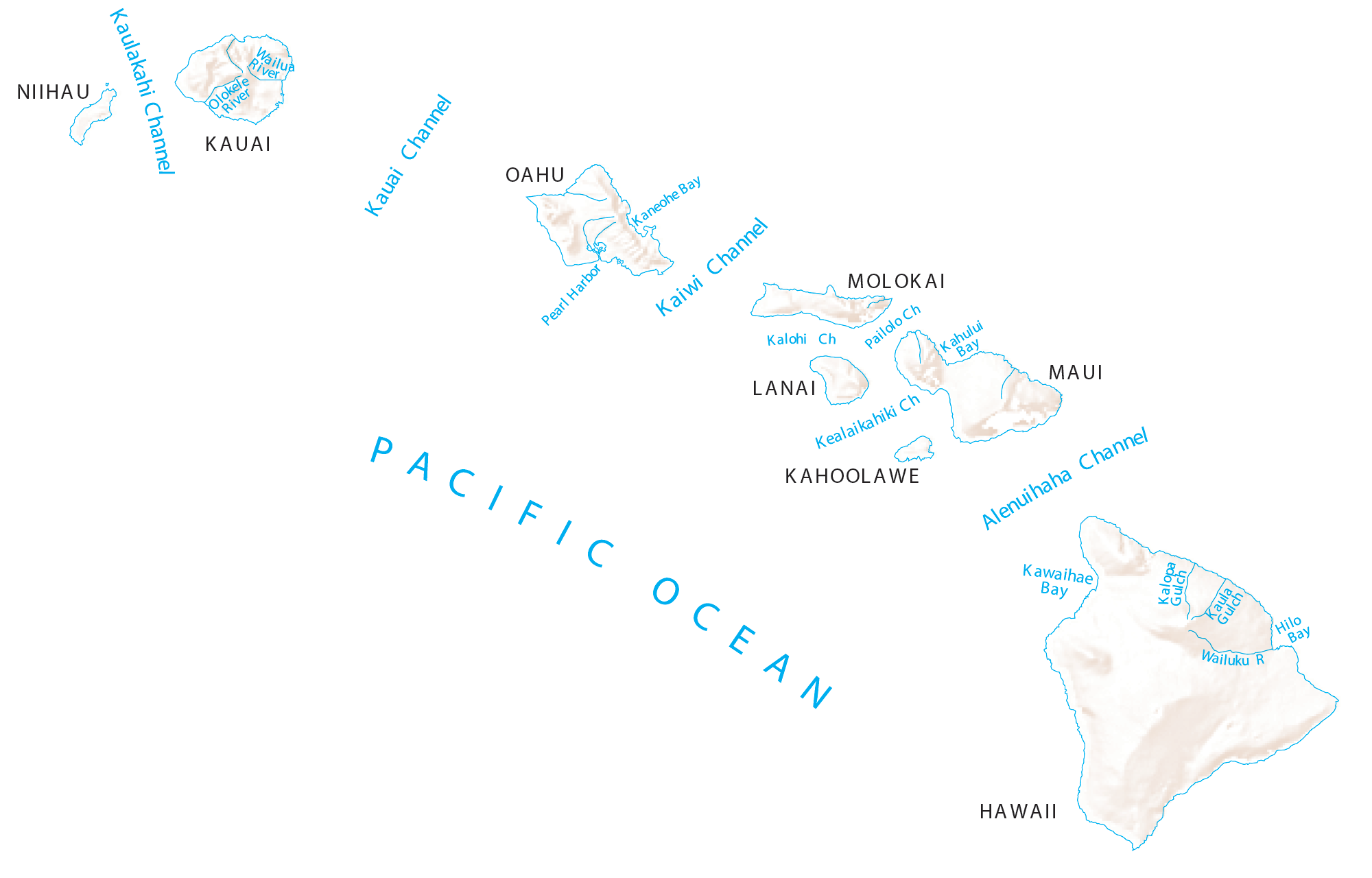
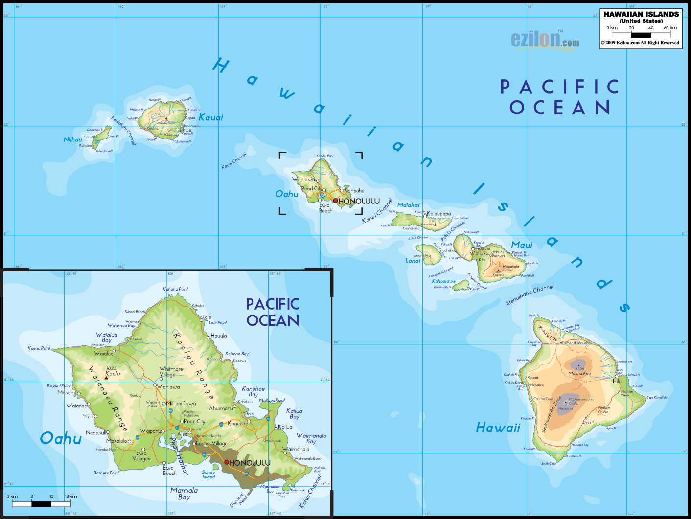
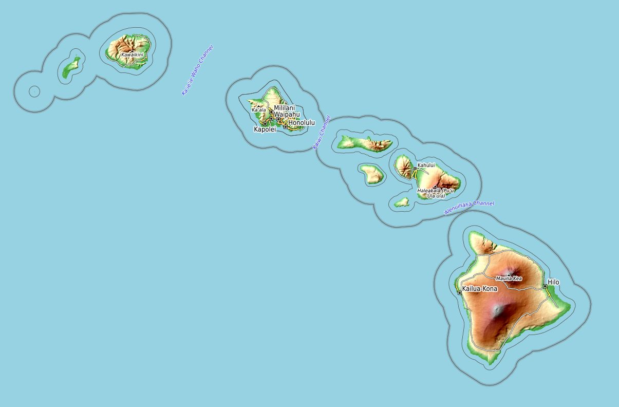
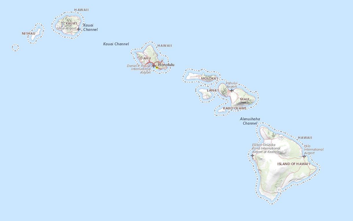
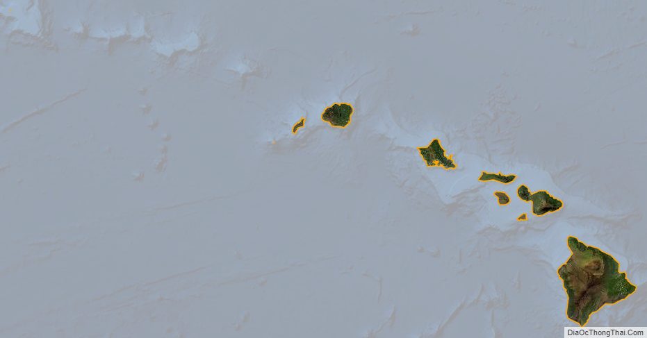
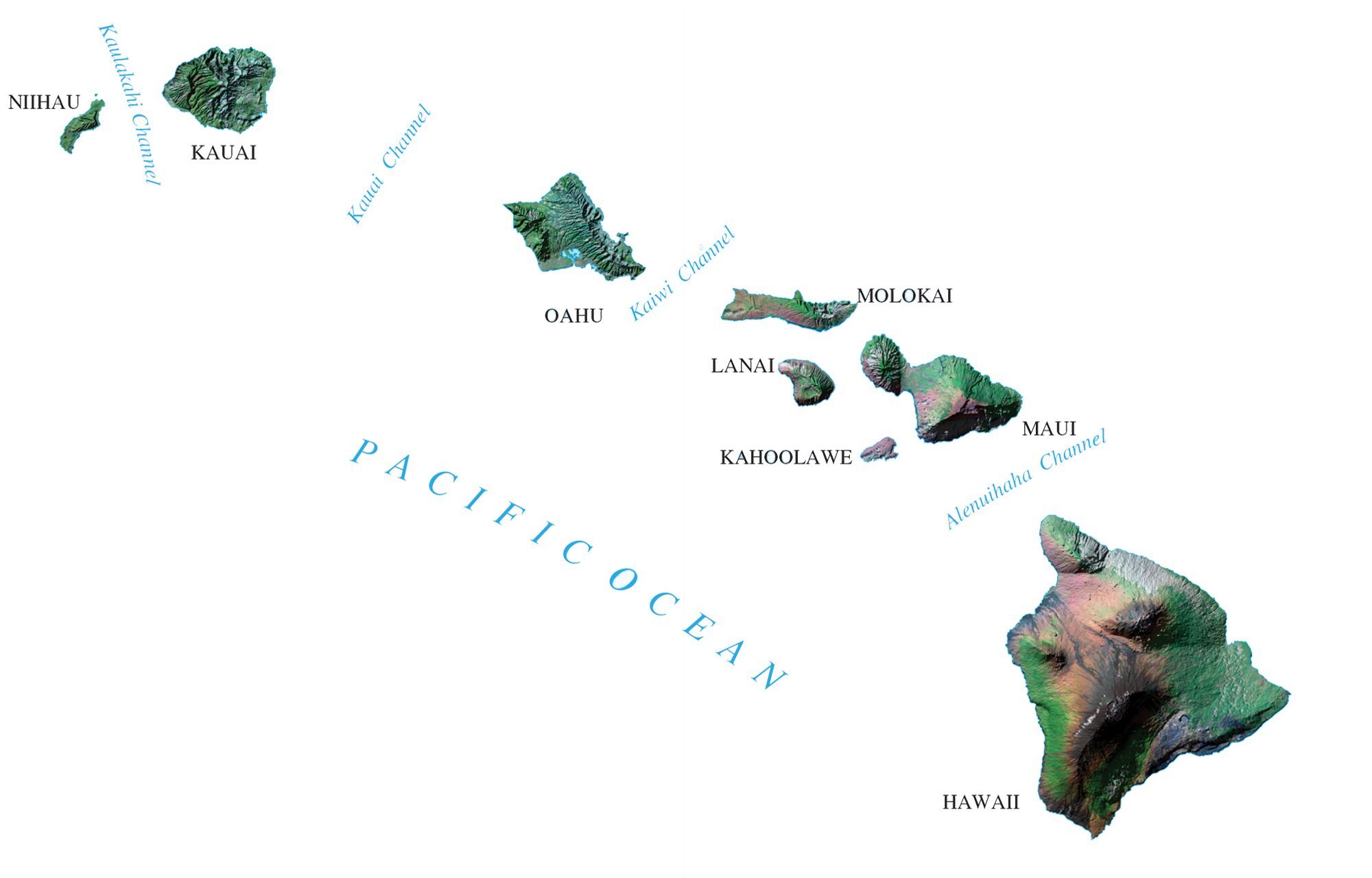
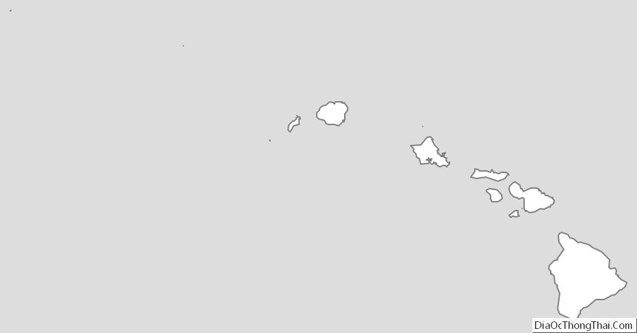
Hawaii comprises nearly the entire Hawaiian archipelago, 137 volcanic islands spanning 1,500 miles (2,400 km) that are physiographically and ethnologically part of the Polynesian subregion of Oceania. The state’s ocean coastline is consequently the fourth-longest in the U.S., at about 750 miles (1,210 km). The eight main islands, from northwest to southeast, are Niʻihau, Kauaʻi, Oʻahu, Molokaʻi, Lānaʻi, Kahoʻolawe, Maui, and Hawaiʻi—the last of these, after which the state is named, is often called the “Big Island” or “Hawaii Island” to avoid confusion with the state or archipelago. The uninhabited Northwestern Hawaiian Islands make up most of the Papahānaumokuākea Marine National Monument, the United States’ largest protected area and the fourth-largest in the world.
Of the 50 U.S. states, Hawaii is the eighth-smallest in land area and the 11th-least populous, but with 1.4 million residents ranks 13th in population density. Two-thirds of the population lives on O’ahu, home to the state’s capital and largest city, Honolulu. Hawaii is among the country’s most diverse states, owing to its central location in the Pacific and over two centuries of migration. As one of only six majority-minority states, it has the country’s only Asian American plurality, its largest Buddhist community, and the largest proportion of multiracial people. Consequently, it is a unique melting pot of North American and East Asian cultures, in addition to its indigenous Hawaiian heritage. As of 2020, Hawaii has the longest life expectancy of any U.S. state, at 80.7 years.
Settled by Polynesians some time between 1000 and 1200 CE, Hawaii was home to numerous independent chiefdoms. In 1778, British explorer James Cook was the first known non-Polynesian to arrive at the archipelago; early British influence is reflected in the state flag, which bears a Union Jack. An influx of European and American explorers, traders, and whalers soon arrived, leading to the decimation of the once isolated Indigenous community by introducing diseases such as syphilis, gonorrhea, tuberculosis, smallpox, measles, leprosy, and typhoid fever, reducing the native Hawaiian population from between 300,000 and one million to less than 40,000 by 1890.
Hawaii became a unified, internationally recognized kingdom in 1810, remaining independent until American and European businessmen overthrew the monarchy in 1893; this led to annexation by the U.S. in 1898. As a strategically valuable U.S. territory, Hawaii was attacked by Japan on December 7, 1941, which brought it global and historical significance, and contributed to America’s decisive entry into World War II. Hawaii is the most recent state to join the union, on August 21, 1959. In 1993, the U.S. government formally apologized for its role in the overthrow of Hawaii’s government, which spurred the Hawaiian sovereignty movement.
Historically dominated by a plantation economy, Hawaii remains a major agricultural exporter due to its fertile soil and uniquely tropical climate in the U.S. Its economy has gradually diversified since the mid-20th century, with tourism and military defense becoming the two largest sectors. The state attracts tourists, surfers, and scientists with its diverse natural scenery, warm tropical climate, abundance of public beaches, oceanic surroundings, active volcanoes, and clear skies on the Big Island. Hawaii hosts the U.S. Pacific Fleet, the world’s largest naval command, as well as 75,000 employees of the Defense Department.
Its relative isolation results in one of the highest costs of living in the United States, and Hawaii is the third-wealthiest state.
| Before statehood: | Territory of Hawaii |
|---|---|
| Admitted to the Union: | August 21, 1959; 63 years ago (1959-08-21) (50th) |
| Capital: | Honolulu |
| Capital – largest city: | largest city |
| Largest metro and urban areas: | Honolulu |
| Elevation: | 3,030 ft (920 m) |
| Total Area: | 10,931 sq mi (28,311 km) |
| Area Rank: | 43rd |
| Total Population: | 1,455,271 |
| Population Rank: | 40th |
| Population Density: | 221/sq mi (82.6/km) |
| Population Density Rank: | 13th |
| Median Household Income: | $83,200 |
| Income Rank: | 4th |
| Demonym(s): | Hawaii resident, Hawaiian |
| USPS abbreviation: | HI |
| ISO 3166 code: | US-HI |
| Website: | portal.ehawaii.gov |
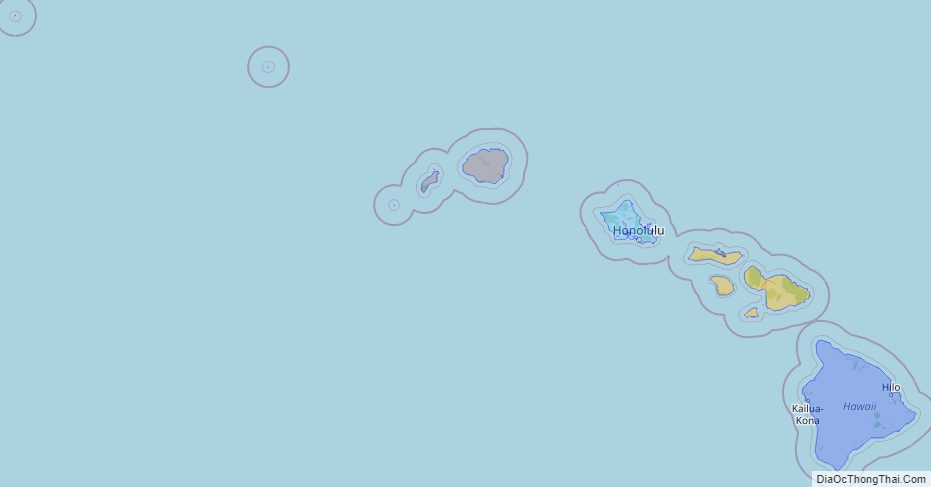
Online Interactive Map
Click on ![]() to view map in "full screen" mode.
to view map in "full screen" mode.
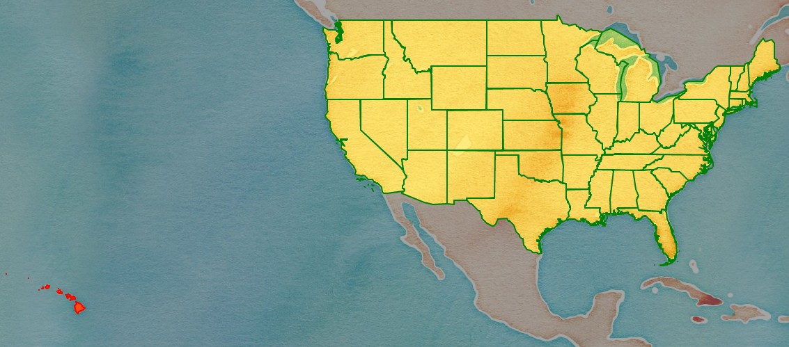
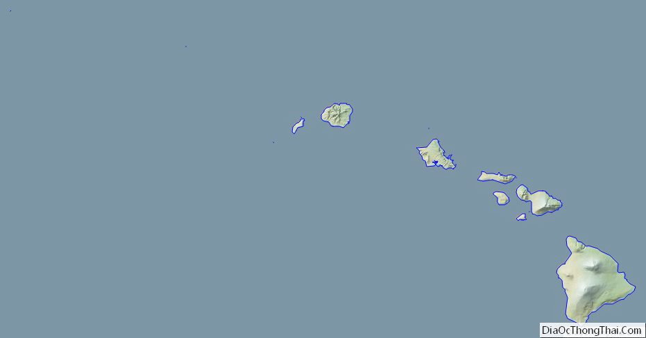
Hawaii location map. Where is Hawaii state?
Hawaii Road Map
Hawaii Map – Roads & Cities
Hawaii Street Map
Hawaii State Map – Places and Landmarks
Hawaii Political Map
Hawaii Lakes and Rivers Map
Geography
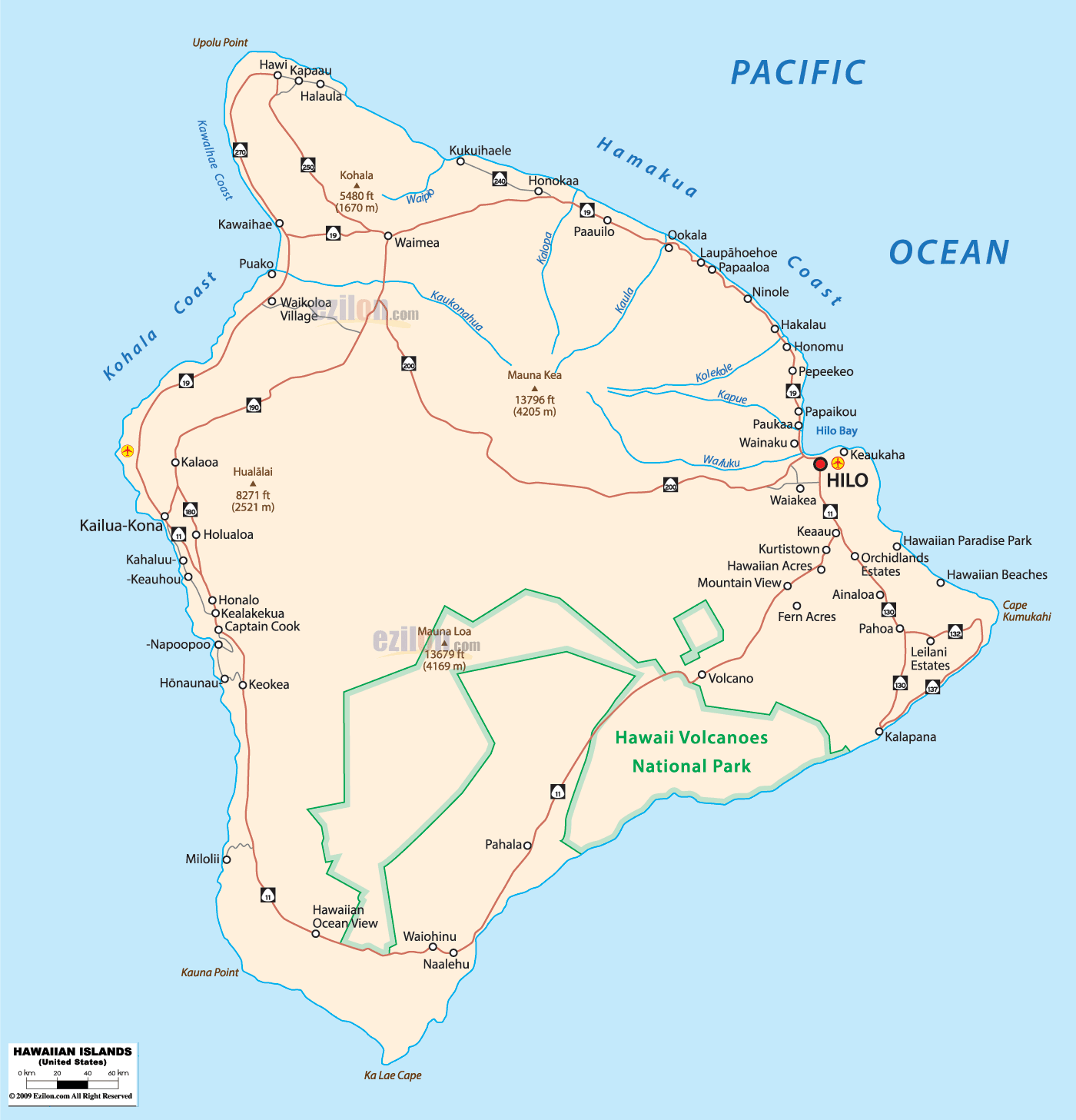
There are eight main Hawaiian islands. Seven are inhabited, but only six are open to tourists and locals. Niʻihau is privately managed by brothers Bruce and Keith Robinson; access is restricted to those who have their permission. This island is also home to native Hawaiians. Access to uninhabited Kahoʻolawe island is also restricted and anyone who enters without permission will be arrested. This island may also be dangerous since it was a military base during the world wars and could still have unexploded ordnance.
Topography
The Hawaiian archipelago is 2,000 mi (3,200 km) southwest of the contiguous United States. Hawaii is the southernmost U.S. state and the second westernmost after Alaska. Like Alaska, Hawaii borders no other U.S. state. It is the only U.S. state not in North America, and the only one completely surrounded by water and entirely an archipelago.
In addition to the eight main islands, the state has many smaller islands and islets. Kaʻula is a small island near Niʻihau. The Northwestern Hawaiian Islands is a group of nine small, older islands northwest of Kauaʻi that extends from Nihoa to Kure Atoll; these are remnants of once much larger volcanic mountains. Across the archipelago are around 130 small rocks and islets, such as Molokini, which are made up of either volcanic or marine sedimentary rock.
Hawaiʻi’s tallest mountain Mauna Kea is 13,796 ft (4,205 m) above mean sea level; it is taller than Mount Everest if measured from the base of the mountain, which lies on the floor of the Pacific Ocean and rises about 33,500 feet (10,200 m).
Geology
The Hawaiian islands were formed by volcanic activity initiated at an undersea magma source called the Hawaiʻi hotspot. The process is continuing to build islands; the tectonic plate beneath much of the Pacific Ocean continually moves northwest and the hotspot remains stationary, slowly creating new volcanoes. Because of the hotspot’s location, all active land volcanoes are on the southern half of Hawaiʻi Island. The newest volcano, Kamaʻehuakanaloa (formerly Lōʻihi), is south of the coast of Hawaiʻi Island.
The last volcanic eruption outside Hawaiʻi Island occurred at Haleakalā on Maui before the late 18th century, possibly hundreds of years earlier. In 1790, Kīlauea exploded; it was the deadliest eruption known to have occurred in the modern era in what is now the United States. Up to 5,405 warriors and their families marching on Kīlauea were killed by the eruption. Volcanic activity and subsequent erosion have created impressive geological features. Hawaii Island has the second-highest point among the world’s islands.
On the volcanoes’ flanks, slope instability has generated damaging earthquakes and related tsunamis, particularly in 1868 and 1975. Catastrophic debris avalanches on the ocean island volcanoes’ submerged flanks have created steep cliffs.
Kīlauea erupted in May 2018, opening 22 fissure vents on its eastern rift zone. The Leilani Estates and Lanipuna Gardens are within this territory. The eruption destroyed at least 36 buildings and this, coupled with the lava flows and the sulfur dioxide fumes, necessitated the evacuation of more than 2,000 inhabitants from their neighborhoods.
Flora and fauna
The islands of Hawaiʻi are distant from other land habitats, and life is thought to have arrived there by wind, waves (i.e., by ocean currents), and wings (i.e., birds, insects, and any seeds that they may have carried on their feathers). Hawaiʻi has more endangered species and has lost a higher percentage of its endemic species than any other U.S. state. The endemic plant Brighamia now requires hand pollination because its natural pollinator is presumed to be extinct. The two species of Brighamia—B. rockii and B. insignis—are represented in the wild by around 120 individual plants. To ensure that these plants set seed, biologists rappel down 3,000-foot (910 m) cliffs to brush pollen onto their stigmas.
Terrestrial ecology
The archipelago’s extant main islands have been above the surface of the ocean for less than 10 million years, a fraction of the time biological colonization and evolution have occurred there. The islands are well known for the environmental diversity that occurs on high mountains within a trade winds field. Native Hawaiians developed complex horticultural practices to utilize the surrounding ecosystem for agriculture. Cultural practices developed to enshrine values of environmental stewardship and reciprocity with the natural world, resulting in widespread biodiversity and intricate social and environmental relationships that persist to this day. On a single island, the climate around the coasts can range from dry tropical (less than 20 inches or 510 millimeters annual rainfall) to wet tropical; on the slopes, environments range from tropical rainforest (more than 200 inches or 5,100 millimeters per year), through a temperate climate, to alpine conditions with a cold, dry climate. The rainy climate impacts soil development, which largely determines ground permeability, affecting the distribution of streams and wetlands.
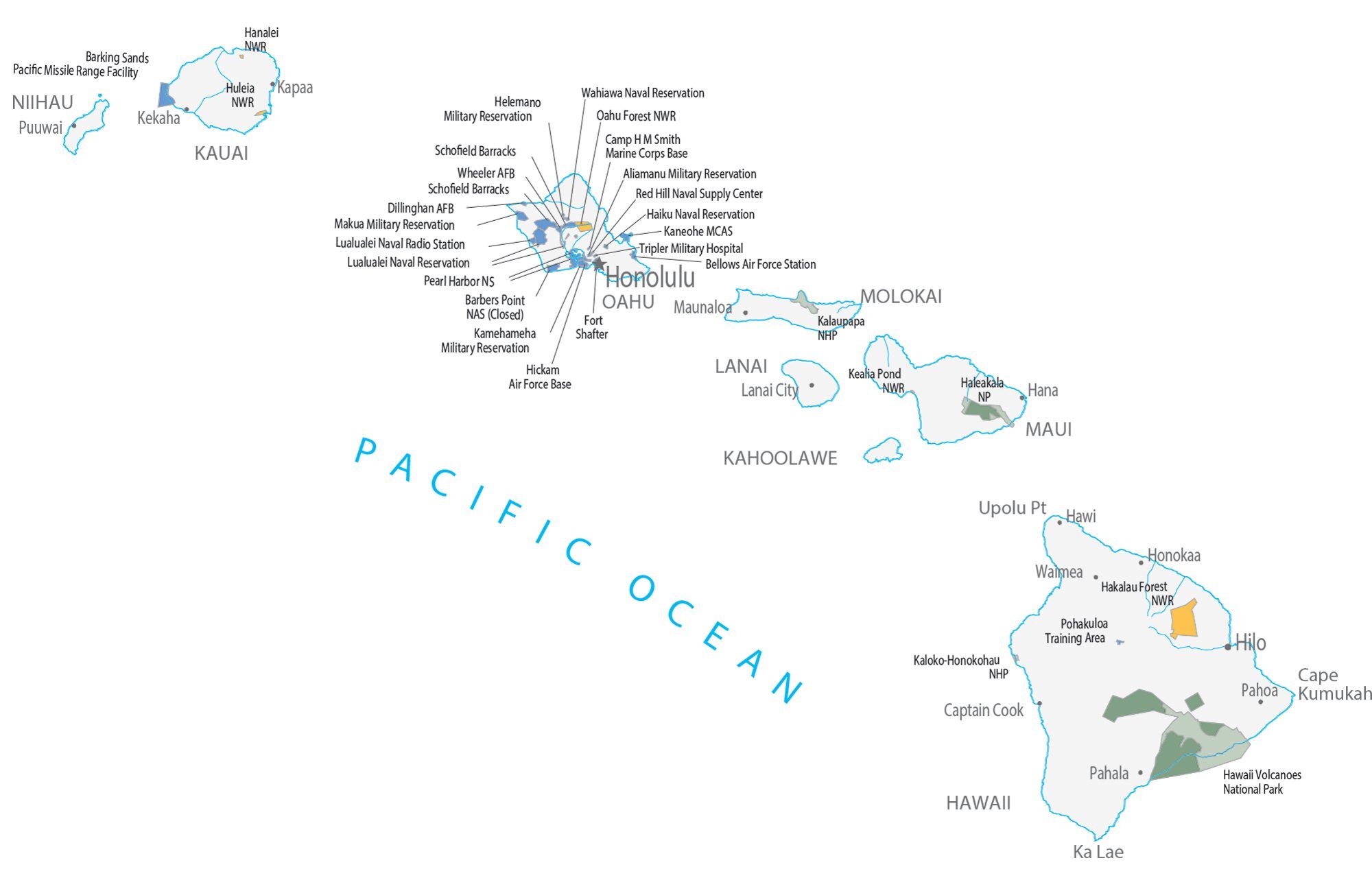
Protected areas
Several areas in Hawaiʻi are under the National Park Service’s protection. Hawaii has two national parks: Haleakalā National Park, near Kula on Maui, which features the dormant volcano Haleakalā that formed east Maui; and Hawaii Volcanoes National Park, in the southeast region of Hawaiʻi Island, which includes the active volcano Kīlauea and its rift zones.
There are three national historical parks: Kalaupapa National Historical Park in Kalaupapa, Molokaʻi, the site of a former leper colony; Kaloko-Honokōhau National Historical Park in Kailua-Kona on Hawaiʻi Island; and Puʻuhonua o Hōnaunau National Historical Park, an ancient place of refuge on Hawaiʻi Island’s west coast. Other areas under the National Park Service’s control include Ala Kahakai National Historic Trail on Hawaiʻi Island and the USS Arizona Memorial at Pearl Harbor on Oʻahu.
President George W. Bush proclaimed the Papahānaumokuākea Marine National Monument on June 15, 2006. The monument covers roughly 140,000 square miles (360,000 km) of reefs, atolls, and shallow and deep sea out to 50 miles (80 km) offshore in the Pacific Ocean—an area larger than all the national parks in the U.S. combined.
Climate
Hawaiʻi has a tropical climate. Temperatures and humidity tend to be less extreme because of near-constant trade winds from the east. Summer highs reach around 88 °F (31 °C) during the day, with lows of 75 °F (24 °C) at night. Winter day temperatures are usually around 83 °F (28 °C); at low elevation they seldom dip below 65 °F (18 °C) at night. Snow, not usually associated with the tropics, falls at 13,800 feet (4,200 m) on Mauna Kea and Mauna Loa on Hawaii Island in some winter months. Snow rarely falls on Haleakalā. Mount Waiʻaleʻale on Kauaʻi has the second-highest average annual rainfall on Earth, about 460 inches (12,000 mm) per year. Most of Hawaii experiences only two seasons; the dry season runs from May to October and the wet season is from October to April.
The warmest temperature recorded in the state, in Pahala on April 27, 1931, is 100 °F (38 °C), tied with Alaska as the lowest record high temperature observed in a U.S. state. Hawaiʻi’s record low temperature is 12 °F (−11 °C) observed in May 1979, on the summit of Mauna Kea. Hawaiʻi is the only state to have never recorded subzero Fahrenheit temperatures.
Climates vary considerably on each island; they can be divided into windward and leeward (koʻolau and kona, respectively) areas based upon location relative to the higher mountains. Windward sides face cloud cover.
Environmental issues
Hawaii has a decades-long history of hosting more military space for the United States than any other territory or state. This record of military activity has taken a sharp toll on the environmental health of the Hawaiian archipelago, degrading its beaches and soil, and making some places entirely unsafe due to unexploded ordnance. According to scholar Winona LaDuke: “The vast militarization of Hawaii has profoundly damaged the land. According to the Environmental Protection Agency, there are more federal hazardous waste sites in Hawaii – 31 – than in any other U.S. state.” Hawaii State Representative Roy Takumi writes in “Challenging U.S. Militarism in Hawai’i and Okinawa” that these military bases and hazardous waste sites have meant “the confiscation of large tracts of land from native peoples” and quotes late Hawaiian activist George Helm as asking: “What is national defense when what is being destroyed is the very thing the military is entrusted to defend, the sacred land of Hawaiʻi?” Contemporary Indigenous Hawaiians are still protesting the occupation of their homelands and environmental degradation due to increased militarization in the wake of 9/11.
After the rise of sugarcane plantations in the mid 19th century, island ecology changed dramatically. Plantations require massive quantities of water, and European and American plantation owners transformed the land in order to access it, primarily by building tunnels to divert water from the mountains to the plantations, constructng reservoirs, and digging wells. These changes have made lasting impacts on the land and continue to contribute to resource scarcity for Native Hawaiians today.
According to Stanford scientist and scholar Sibyl Diver, Indigenous Hawaiians engage in a reciprocal relationship with the land, “based on principles of mutual caretaking, reciprocity and sharing”. This relationship ensures the longevity, sustainability, and natural cycles of growth and decay, as well as cultivating a sense of respect for the land and humility towards one’s place in an ecosystem.
The tourism industry’s ongoing expansion and its pressure on local systems of ecology, cultural tradition and infrastructure is creating a conflict between economic and environmental health. In 2020, the Center for Biological Diversity reported on the plastic pollution of Hawaii’s Kamilo beach, citing “massive piles of plastic waste”. Invasive species are spreading, and chemical and pathogenic runoff is contaminating groundwater and coastal waters.
Hawaii Physical Map
Hawaii Topographic Map
Hawaii Satellite Map
Others printable maps
Hawaii Outline Map
Blank Hawaii County Map
See also
Map of Hawaii State and its subdivision: Map of other states:- Alabama
- Alaska
- Arizona
- Arkansas
- California
- Colorado
- Connecticut
- Delaware
- District of Columbia
- Florida
- Georgia
- Hawaii
- Idaho
- Illinois
- Indiana
- Iowa
- Kansas
- Kentucky
- Louisiana
- Maine
- Maryland
- Massachusetts
- Michigan
- Minnesota
- Mississippi
- Missouri
- Montana
- Nebraska
- Nevada
- New Hampshire
- New Jersey
- New Mexico
- New York
- North Carolina
- North Dakota
- Ohio
- Oklahoma
- Oregon
- Pennsylvania
- Rhode Island
- South Carolina
- South Dakota
- Tennessee
- Texas
- Utah
- Vermont
- Virginia
- Washington
- West Virginia
- Wisconsin
- Wyoming


