Pike County is a county located on the southwestern border of the U.S. state of Mississippi. As of the 2020 census, the population was 40,324. The county seat is Magnolia. Pike County is named for explorer Zebulon Pike.
Pike County is part of the McComb, MS Micropolitan Statistical Area.
| Name: | Pike County |
|---|---|
| FIPS code: | 28-113 |
| State: | Mississippi |
| Founded: | 1815 |
| Named for: | Zebulon Pike |
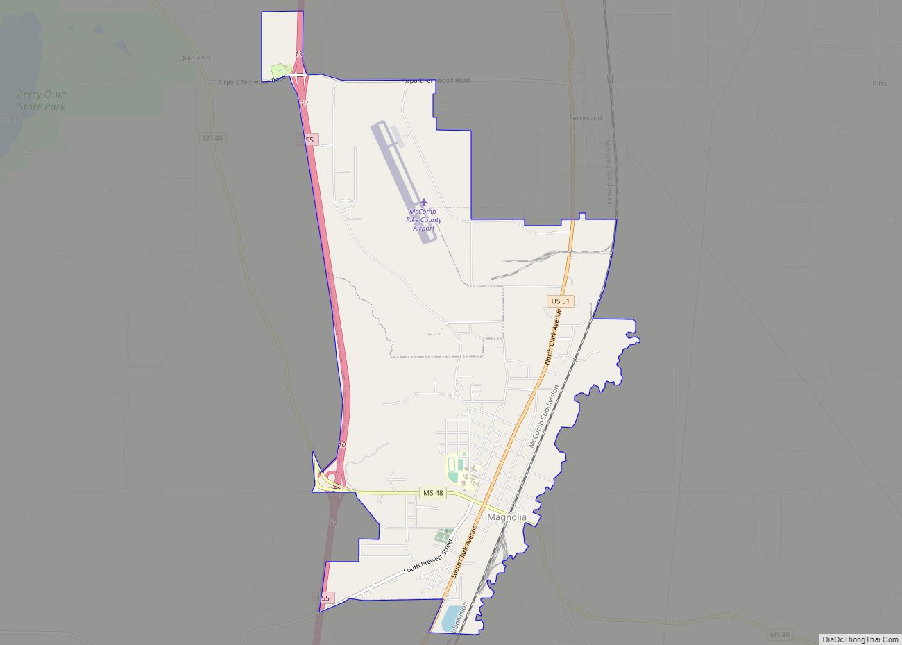
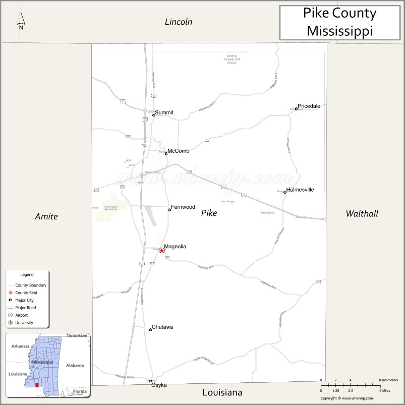
| Seat: | Magnolia |
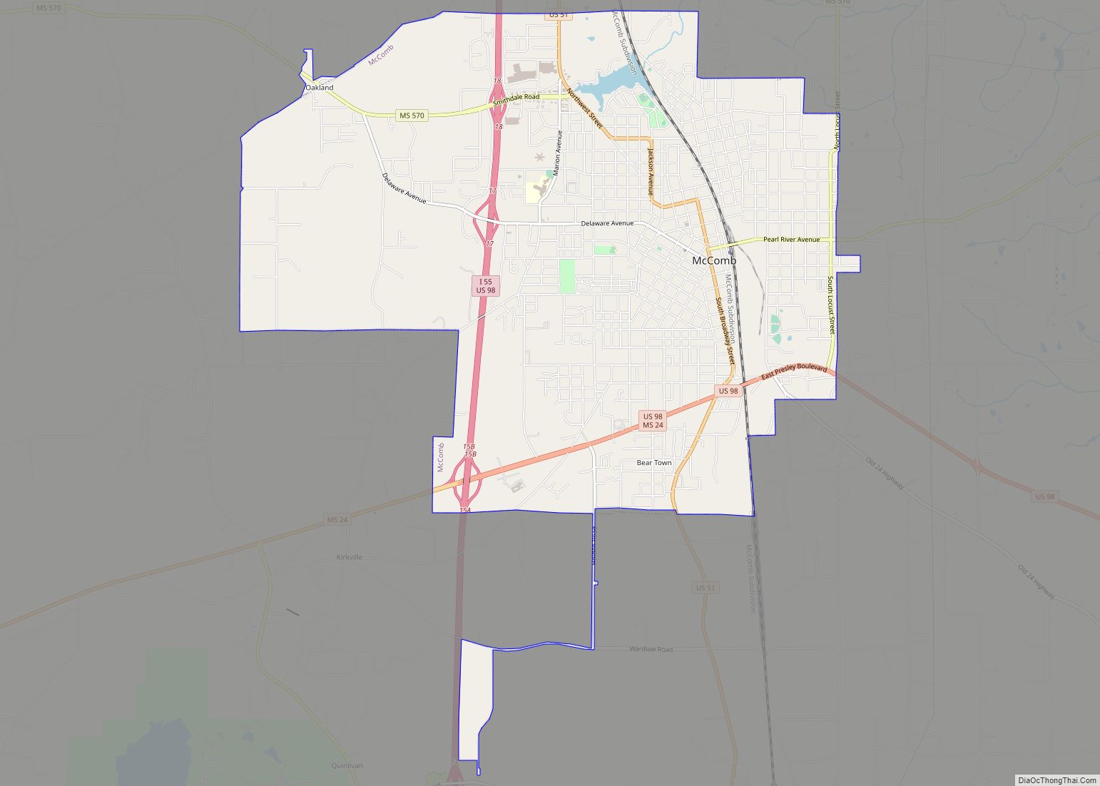
| Largest city: | McComb |
| Total Area: | 411 sq mi (1,060 km²) |
| Land Area: | 409 sq mi (1,060 km²) |
| Total Population: | 40,324 |
| Population Density: | 98/sq mi (38/km²) |
| Time zone: | UTC−6 (Central) |
| Summer Time Zone (DST): | UTC−5 (CDT) |
| Website: | www.co.pike.ms.us |
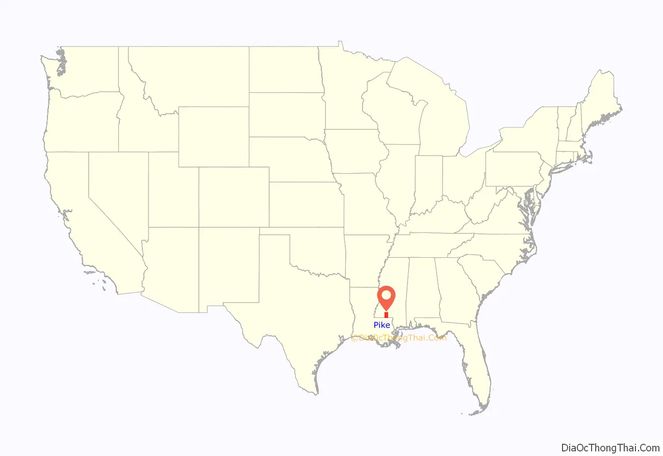
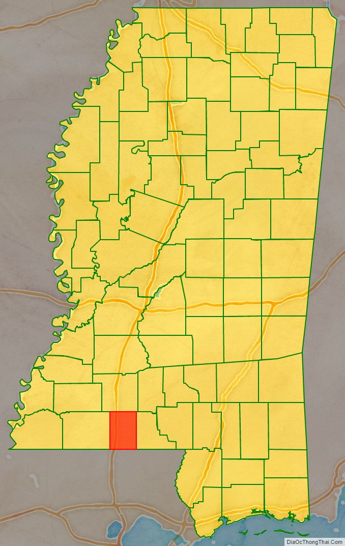
Pike County location map. Where is Pike County?
History
Pike County was formed from Marion County by an act of the Territorial General Assembly on December 9, 1815. Holmesville was selected as the county seat on December 11, 1816; it was named in honor of Major Andrew Hunter Holmes, an army officer killed in the War of 1812. In 1873 Magnolia was voted in as the new county seat. The county was devoted to agriculture and is still mostly rural.
Pike County Road Map
Geography
According to the U.S. Census Bureau, the county has a total area of 411 square miles (1,060 km), of which 409 square miles (1,060 km) is land and 1.7 square miles (4.4 km) (0.4%) is water.
Major highways
- Interstate 55
- U.S. Highway 51
- U.S. Highway 98
- Mississippi Highway 24
- Mississippi Highway 44
- Mississippi Highway 48
- Mississippi Highway 570
- Mississippi Highway 584
Adjacent counties
- Lincoln County (north)
- Walthall County (east)
- Washington Parish, Louisiana (southeast)
- Tangipahoa Parish, Louisiana (south)
- Amite County (west)
Pike County Topographic Map

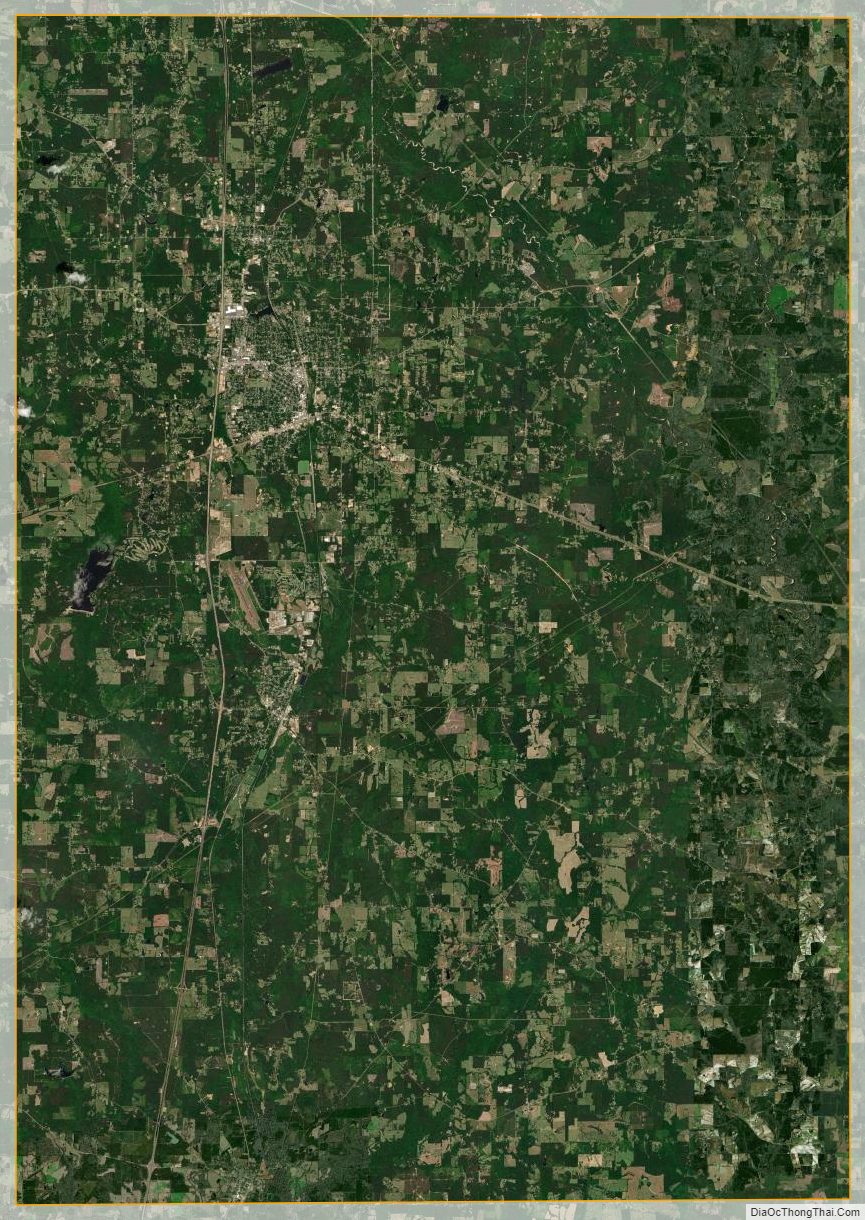
Pike County Satellite Map
Pike County Outline Map