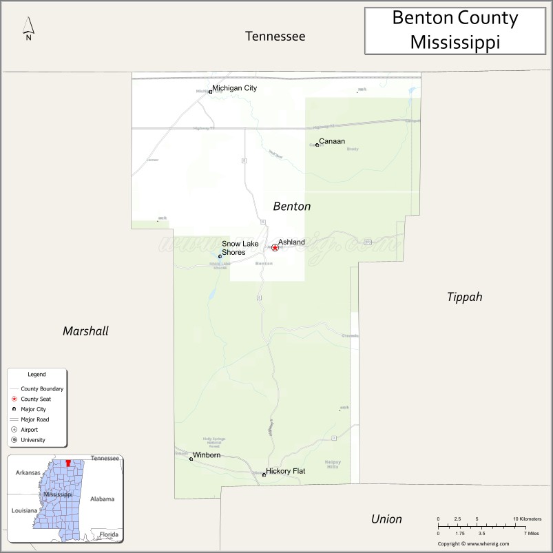
Benton County is a county located in the U.S. state of Mississippi. As of the 2020 census, the population was 7,646. Its county seat is Ashland.
It is locally believed that residents convinced the post-Civil War Reconstruction government that Benton County was named after U.S. Senator Thomas Hart Benton, but the name actually honored Confederate Brigadier General Samuel Benton of nearby Holly Springs in Marshall County, nephew of the senator.
Benton County is included in the Memphis, TN-MS-AR Metropolitan Statistical Area.
| Name: | Benton County |
|---|---|
| FIPS code: | 28-009 |
| State: | Mississippi |
| Founded: | 1870 |
| Named for: | Samuel Benton |
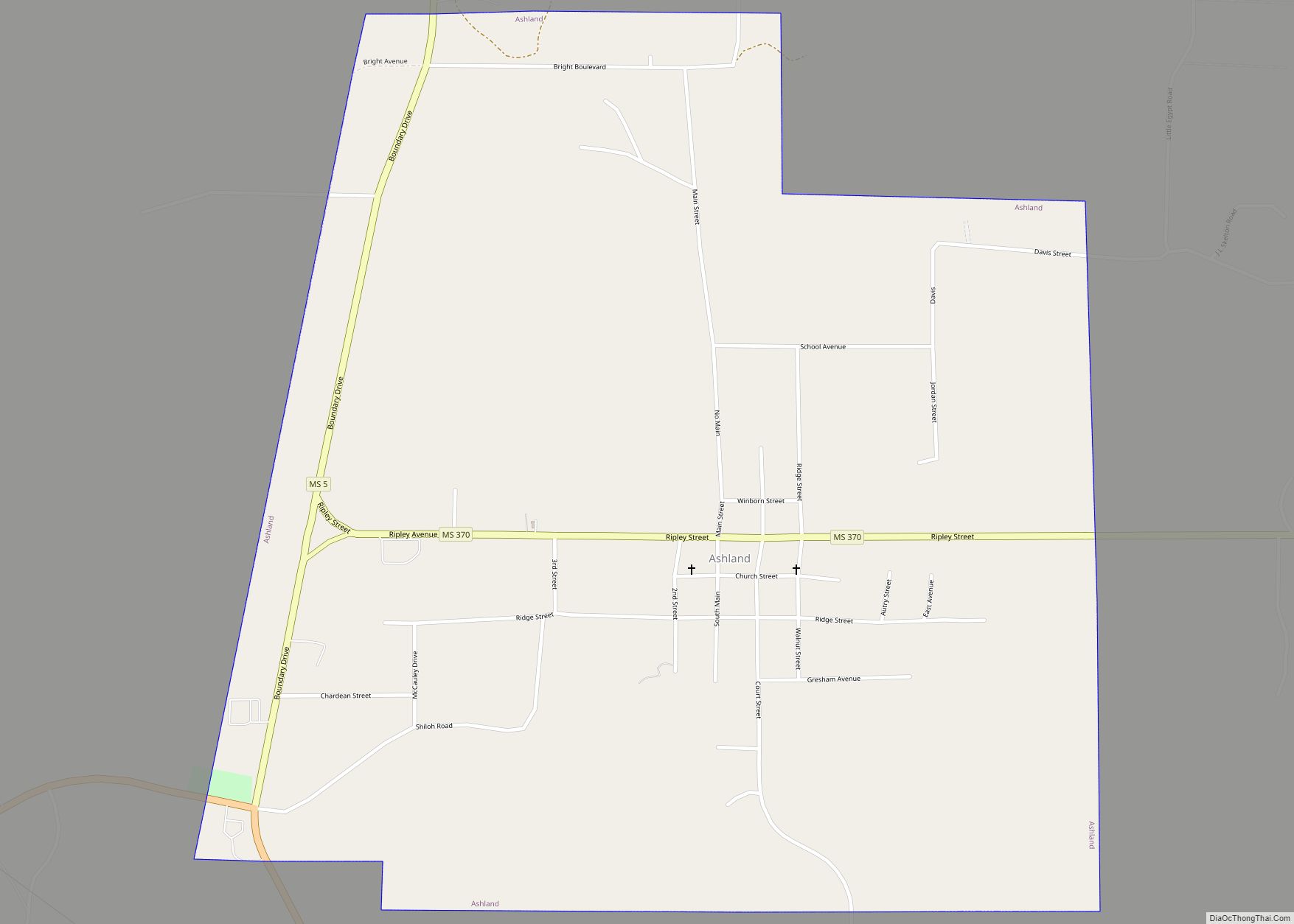
| Seat: | Ashland |
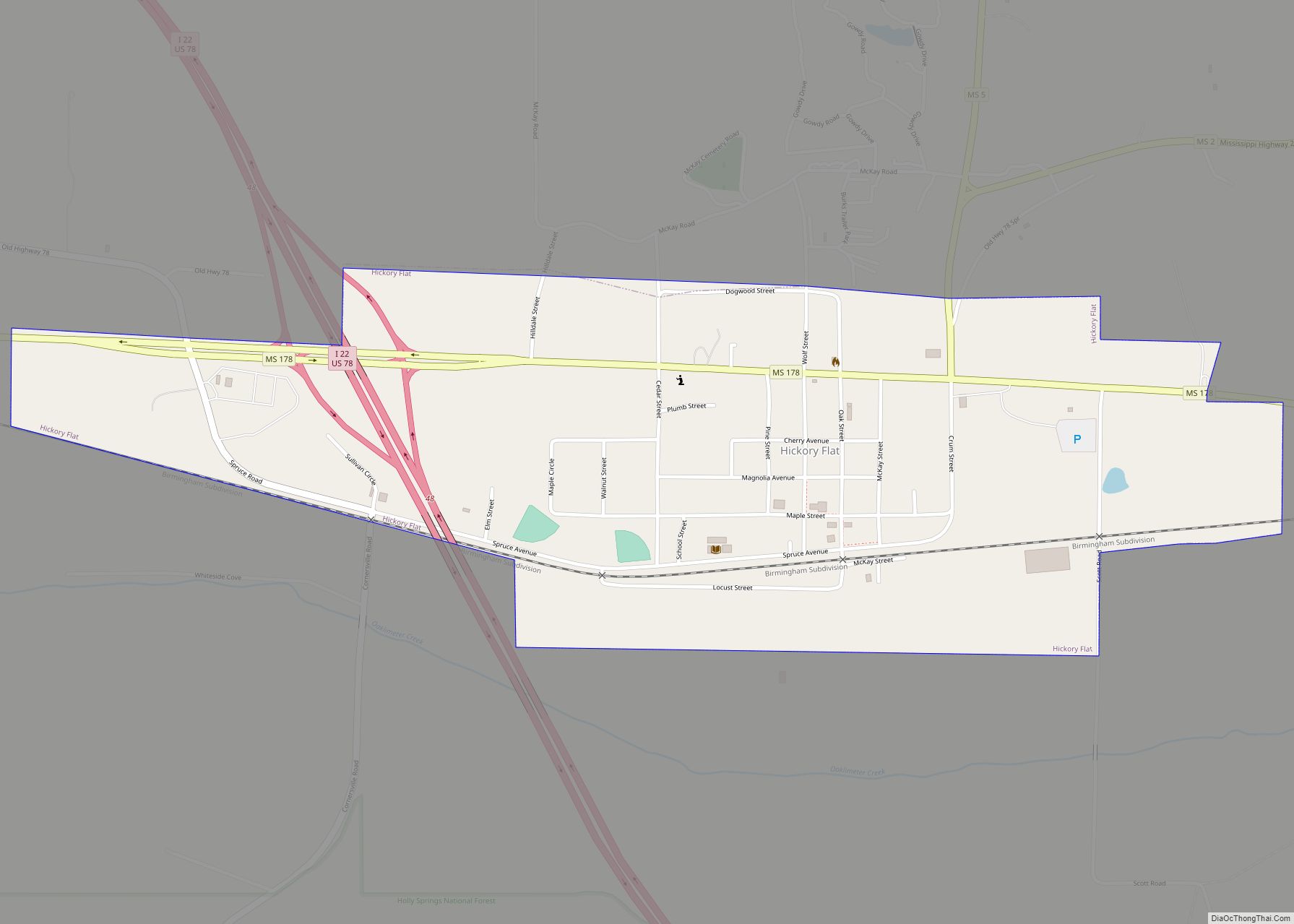
| Largest town: | Hickory Flat |
| Total Area: | 409 sq mi (1,060 km²) |
| Land Area: | 407 sq mi (1,050 km²) |
| Total Population: | 7,646 |
| Population Density: | 19/sq mi (7.2/km²) |
| Time zone: | UTC−6 (Central) |
| Summer Time Zone (DST): | UTC−5 (CDT) |
| Website: | bentoncountyms.gov |
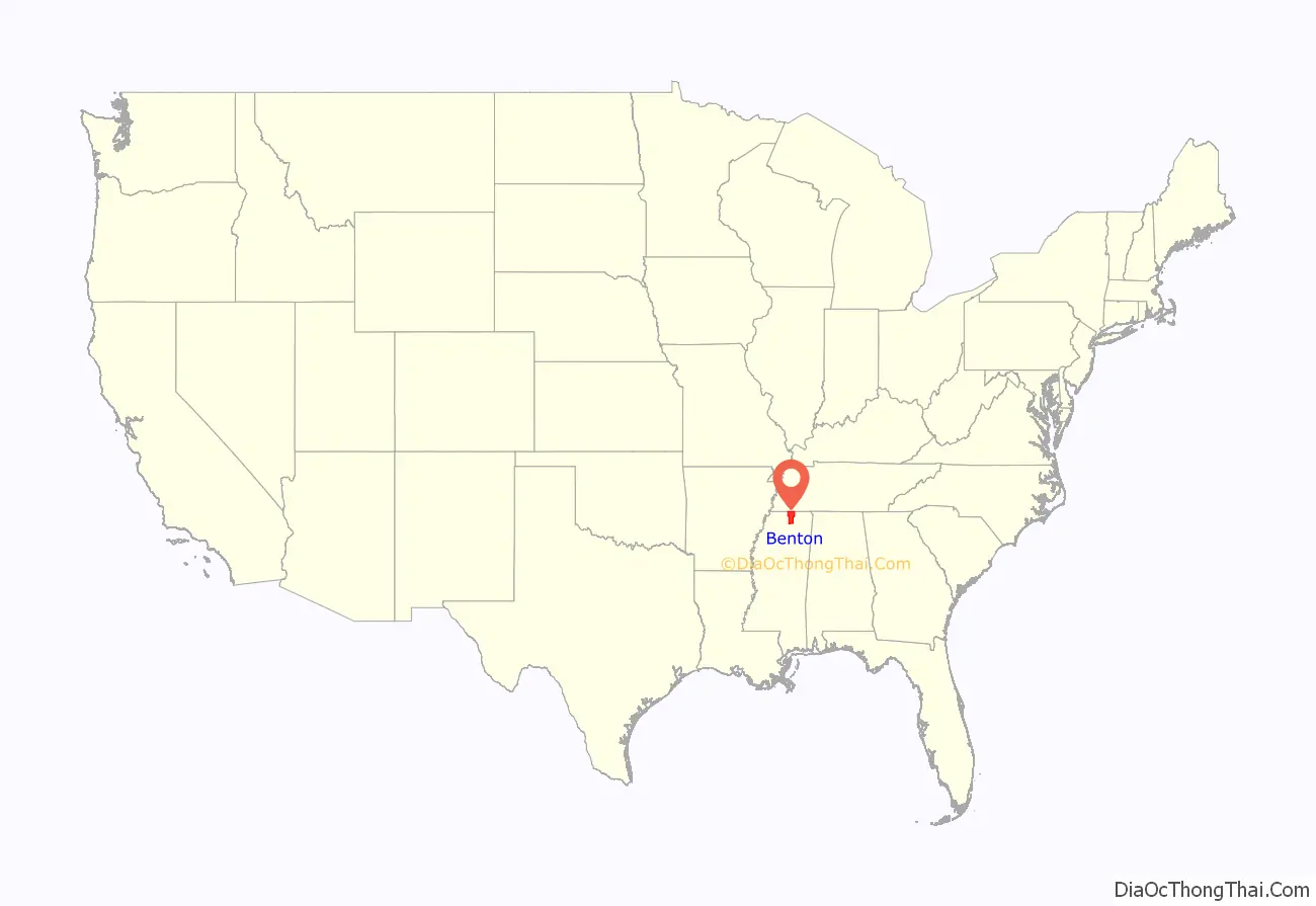
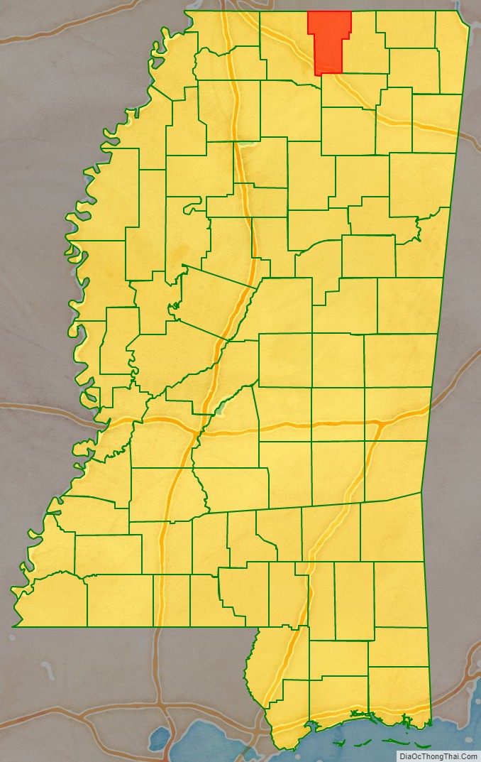
Benton County location map. Where is Benton County?
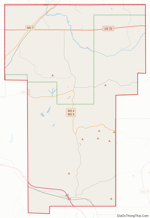
Benton County Road Map
Geography
According to the U.S. Census Bureau, the county has a total area of 409 square miles (1,060 km), of which 407 square miles (1,050 km) is land and 2.0 square miles (5.2 km) (0.5%) is water. It is the fifth-smallest county by area in Mississippi.
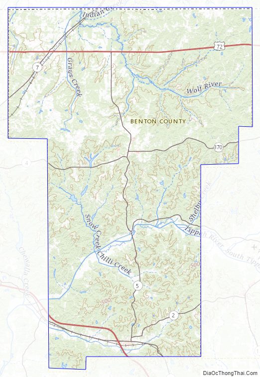
The headwaters of the Wolf River meander and braid their way north and west across northern Benton County from Baker’s Pond, the river’s source spring (highest origin of continuous flow) in the Holly Springs National Forest approximately one mile southwest of where U.S. Highway 72 passes into Tippah County, Mississippi. The Wolf River passes into Fayette County, Tennessee between Michigan City (on the Mississippi side) and La Grange, Tennessee.
Major highways
- Interstate 22
- U.S. Route 72
- U.S. Route 78
- Mississippi Highway 2
- Mississippi Highway 4
- Mississippi Highway 5
- Mississippi Highway 7
- Mississippi Highway 178
- Mississippi Highway 370
Adjacent counties
- Hardeman County, Tennessee (northeast)
- Tippah County (east)
- Union County (south)
- Marshall County (west)
- Fayette County, Tennessee (northwest)
National protected area
- Holly Springs National Forest (part)
Benton County Topographic Map
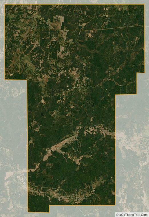
Benton County Satellite Map
Benton County Outline Map