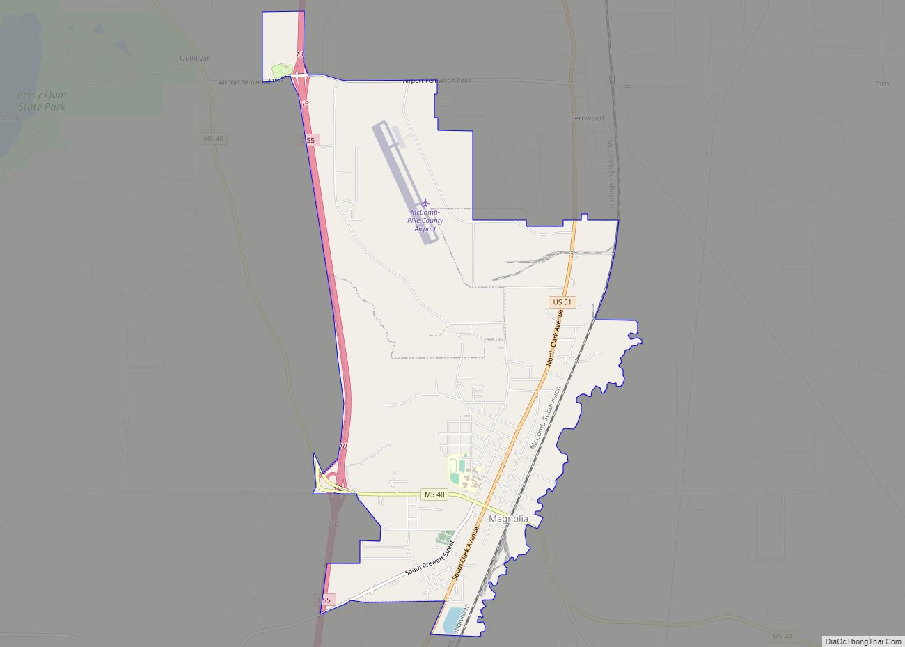
Magnolia is a city in Pike County, Mississippi, United States. The population was 2,420 at the 2010 census. It is the county seat of Pike County, which lies within the McComb, Mississippi Micropolitan Statistical Area.
| Name: | Magnolia city |
|---|---|
| LSAD Code: | 25 |
| LSAD Description: | city (suffix) |
| State: | Mississippi |
| County: | Pike County |
| Elevation: | 305 ft (93 m) |
| Total Area: | 6.19 sq mi (16.03 km²) |
| Land Area: | 6.14 sq mi (15.91 km²) |
| Water Area: | 0.04 sq mi (0.12 km²) |
| Total Population: | 1,883 |
| Population Density: | 306.53/sq mi (118.36/km²) |
| ZIP code: | 39652 |
| Area code: | 601 |
| FIPS code: | 2844680 |
| GNISfeature ID: | 0673065 |
Online Interactive Map
Click on ![]() to view map in "full screen" mode.
to view map in "full screen" mode.
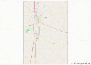
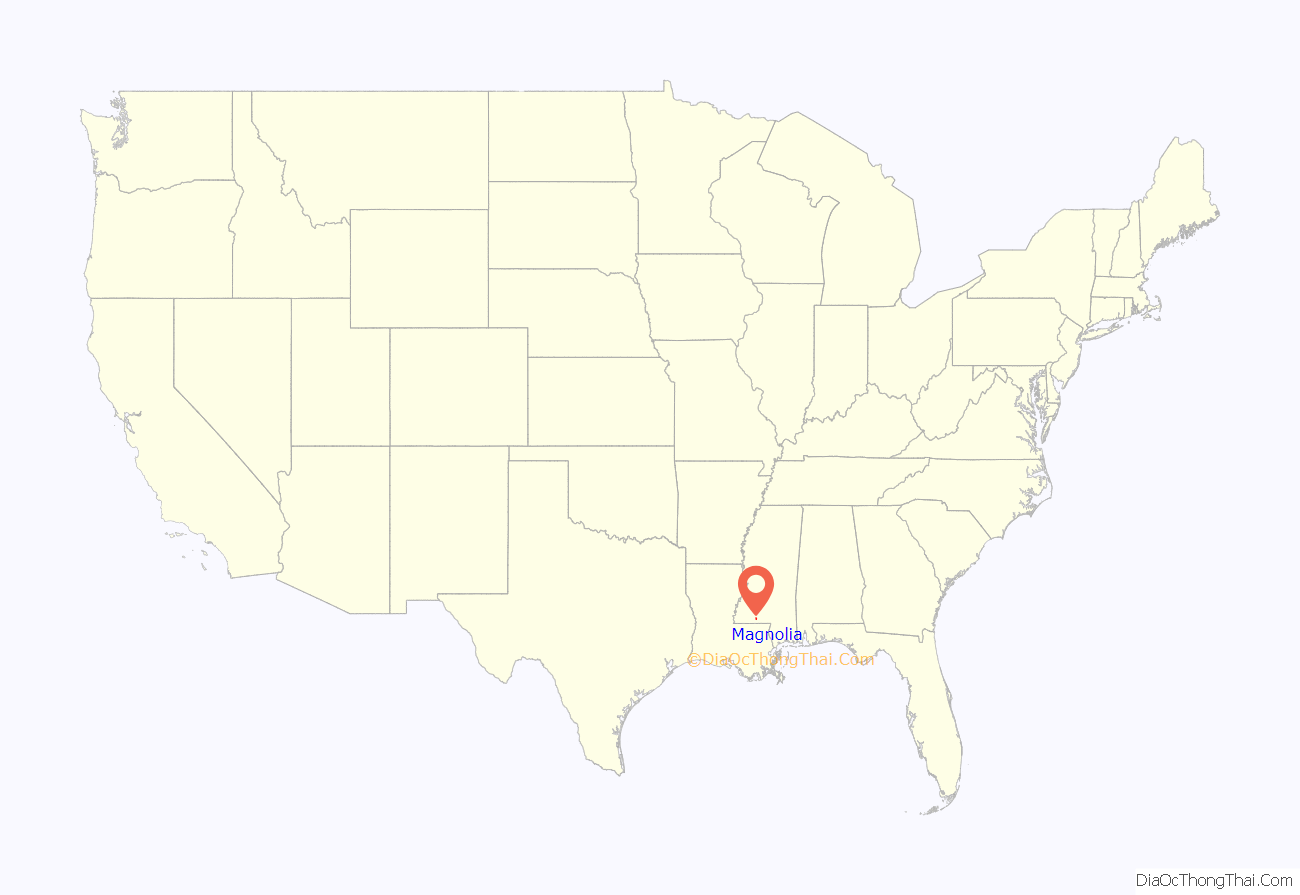
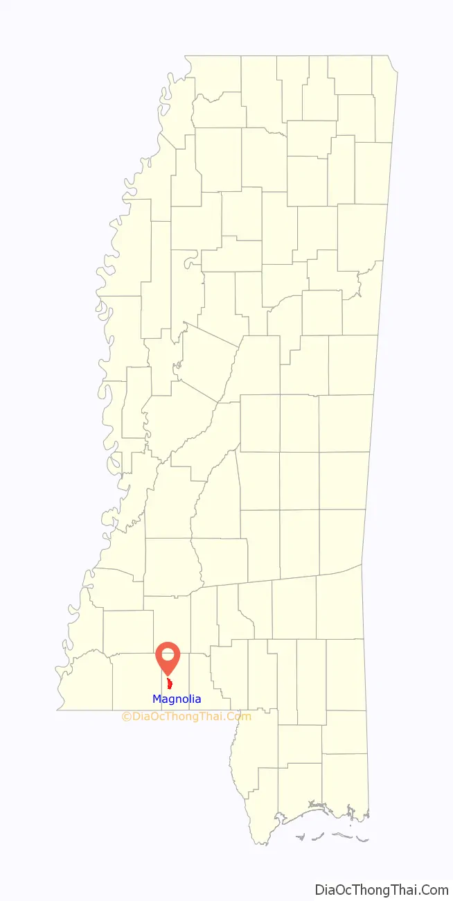
Magnolia location map. Where is Magnolia city?
History
Magnolia was founded in 1856 by Ansel H. Prewett, a local civic leader and cotton planter. Knowing that the approaching New Orleans, Jackson, and Great Northern Railroad (now the Illinois Central Railroad) would need a station for water and fuel, Prewett sold a right-of-way to the railroad company – for one dollar, according to legend – and divided a section of his plantation into town lots, which he sold to investors. Prewett, while serving as temporary sheriff of Pike County, was killed by outlaws in the early 1870s escorting a prisoner on the very railroad that made Magnolia a viable community.
Magnolia grew rapidly in the 1860s, and in the late nineteenth century Magnolia served as a popular small-town resort for wealthy New Orleanians, who took trains north from New Orleans to enjoy Magnolia’s fresh air and sparkling creeks. At one time early Magnolia boasted an opera house, skating rink, and several hotels that catered largely to these tourists.
In 1860 Magnolia’s first newspaper, the Grand Trunk Magnolian, was established by John Waddill. It did not last the war and was succeeded by the establishment of the Magnolia Gazette by J.D. Burke in 1872. The Magnolia Herald was established by Luke W. Conerly in 1875 and he continued as its proprietor and editor until 1878.
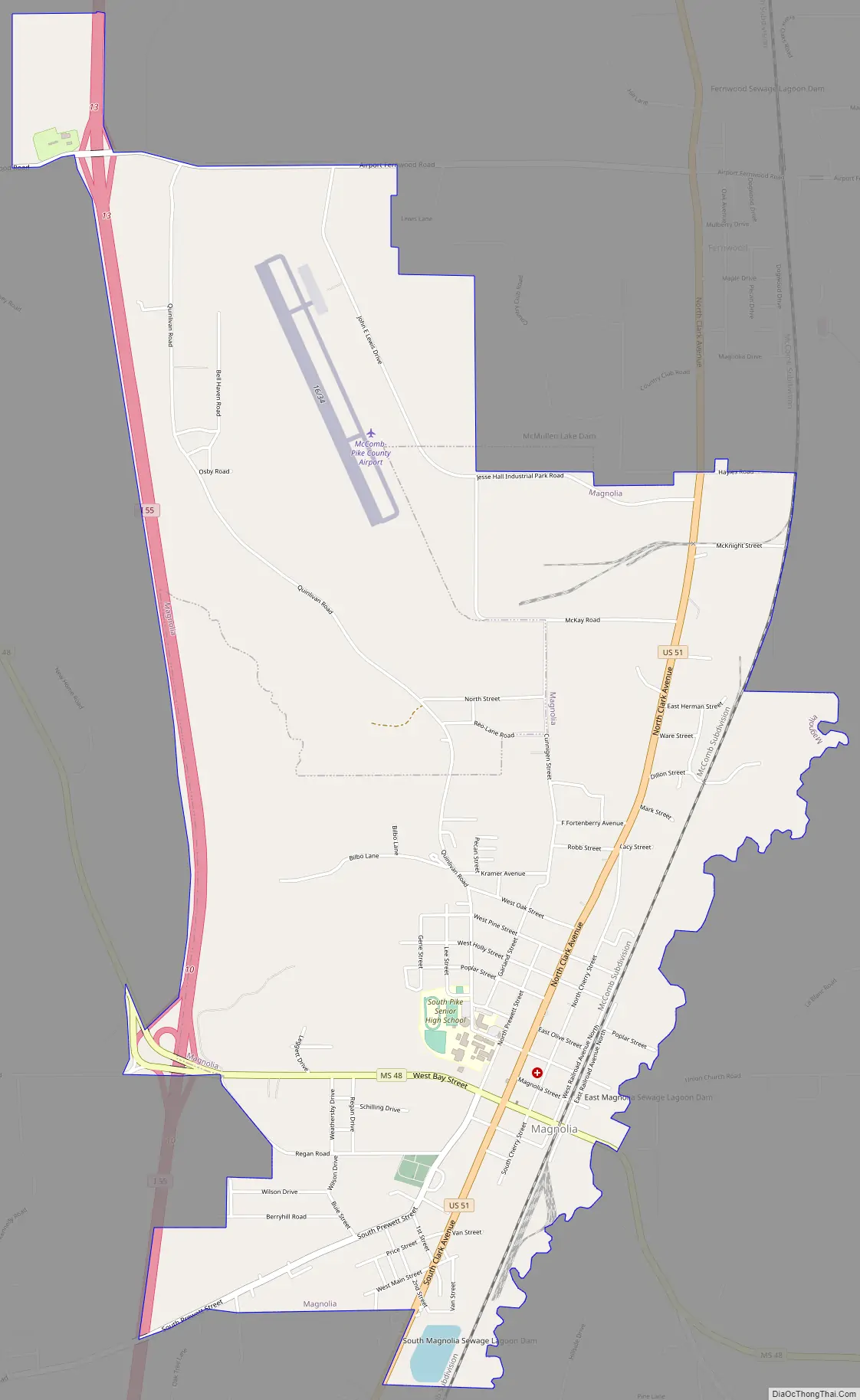
Magnolia Road Map
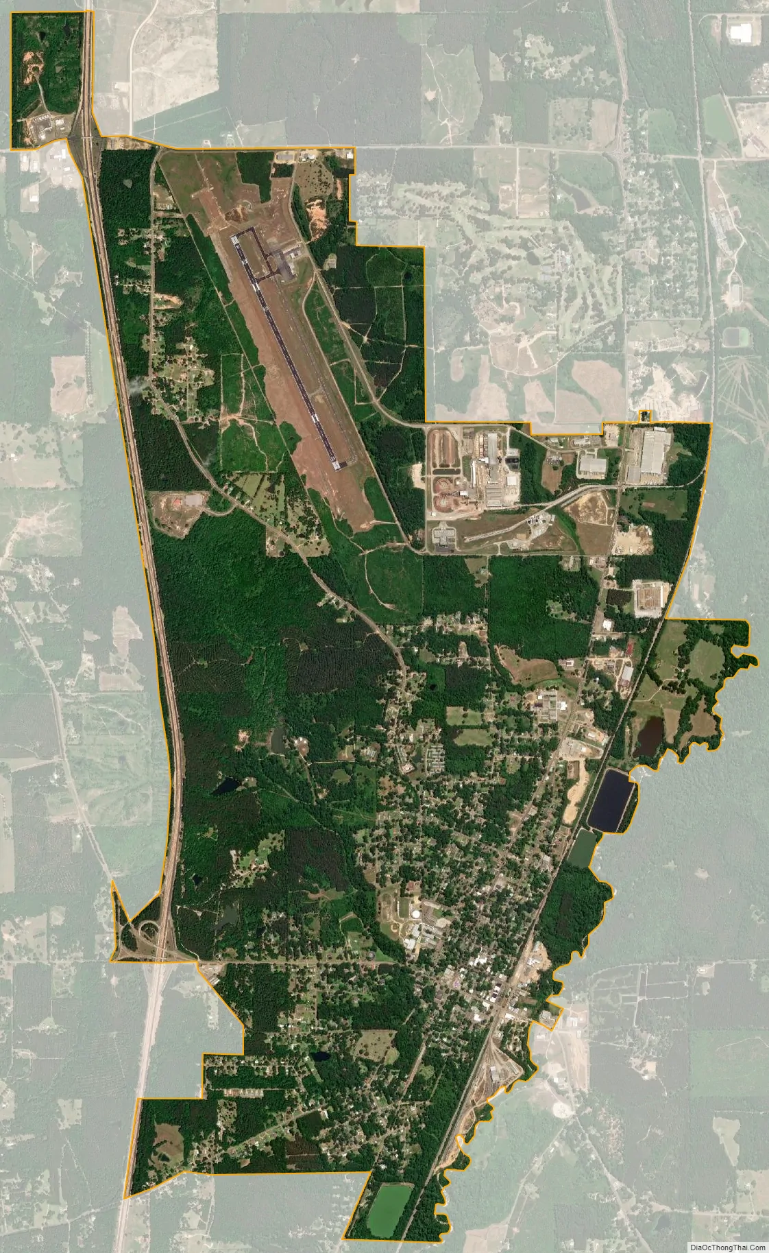
Magnolia city Satellite Map
Geography
According to the United States Census Bureau, the city has a total area of 3.3 square miles (8.5 km), of which 3.2 square miles (8.3 km) is land and 0.1 square miles (0.26 km) (1.52%) is water.
Within the city limits there is the confluence of the Minnehaha River and the Little Tangipahoa River.
See also
Map of Mississippi State and its subdivision:- Adams
- Alcorn
- Amite
- Attala
- Benton
- Bolivar
- Calhoun
- Carroll
- Chickasaw
- Choctaw
- Claiborne
- Clarke
- Clay
- Coahoma
- Copiah
- Covington
- Desoto
- Forrest
- Franklin
- George
- Greene
- Grenada
- Hancock
- Harrison
- Hinds
- Holmes
- Humphreys
- Issaquena
- Itawamba
- Jackson
- Jasper
- Jefferson
- Jefferson Davis
- Jones
- Kemper
- Lafayette
- Lamar
- Lauderdale
- Lawrence
- Leake
- Lee
- Leflore
- Lincoln
- Lowndes
- Madison
- Marion
- Marshall
- Monroe
- Montgomery
- Neshoba
- Newton
- Noxubee
- Oktibbeha
- Panola
- Pearl River
- Perry
- Pike
- Pontotoc
- Prentiss
- Quitman
- Rankin
- Scott
- Sharkey
- Simpson
- Smith
- Stone
- Sunflower
- Tallahatchie
- Tate
- Tippah
- Tishomingo
- Tunica
- Union
- Walthall
- Warren
- Washington
- Wayne
- Webster
- Wilkinson
- Winston
- Yalobusha
- Yazoo
- Alabama
- Alaska
- Arizona
- Arkansas
- California
- Colorado
- Connecticut
- Delaware
- District of Columbia
- Florida
- Georgia
- Hawaii
- Idaho
- Illinois
- Indiana
- Iowa
- Kansas
- Kentucky
- Louisiana
- Maine
- Maryland
- Massachusetts
- Michigan
- Minnesota
- Mississippi
- Missouri
- Montana
- Nebraska
- Nevada
- New Hampshire
- New Jersey
- New Mexico
- New York
- North Carolina
- North Dakota
- Ohio
- Oklahoma
- Oregon
- Pennsylvania
- Rhode Island
- South Carolina
- South Dakota
- Tennessee
- Texas
- Utah
- Vermont
- Virginia
- Washington
- West Virginia
- Wisconsin
- Wyoming