Stanton County is a county in the U.S. state of Nebraska. As of the 2010 United States Census, the population was 6,129. Its county seat is Stanton. The county was formed in 1856 and organized in 1867. It was first called Izard County until 1862, when it was renamed for Edwin M. Stanton, Secretary of War during the administration of President Abraham Lincoln.
Stanton County is part of the Norfolk, NE Micropolitan Statistical Area.
In the Nebraska license plate system, Stanton County is represented by the prefix 53 (it had the 53rd-greatest number of vehicles registered in the county when the license plate system was established in 1922).
| Name: | Stanton County |
|---|---|
| FIPS code: | 31-167 |
| State: | Nebraska |
| Founded: | 1855 |
| Named for: | Edwin M. Stanton |
| Seat: | Stanton |
| Largest city: | Stanton |
| Total Area: | 431 sq mi (1,120 km²) |
| Land Area: | 428 sq mi (1,110 km²) |
| Total Population: | 5,816 |
| Population Density: | 14/sq mi (5/km²) |
| Time zone: | UTC−6 (Central) |
| Summer Time Zone (DST): | UTC−5 (CDT) |
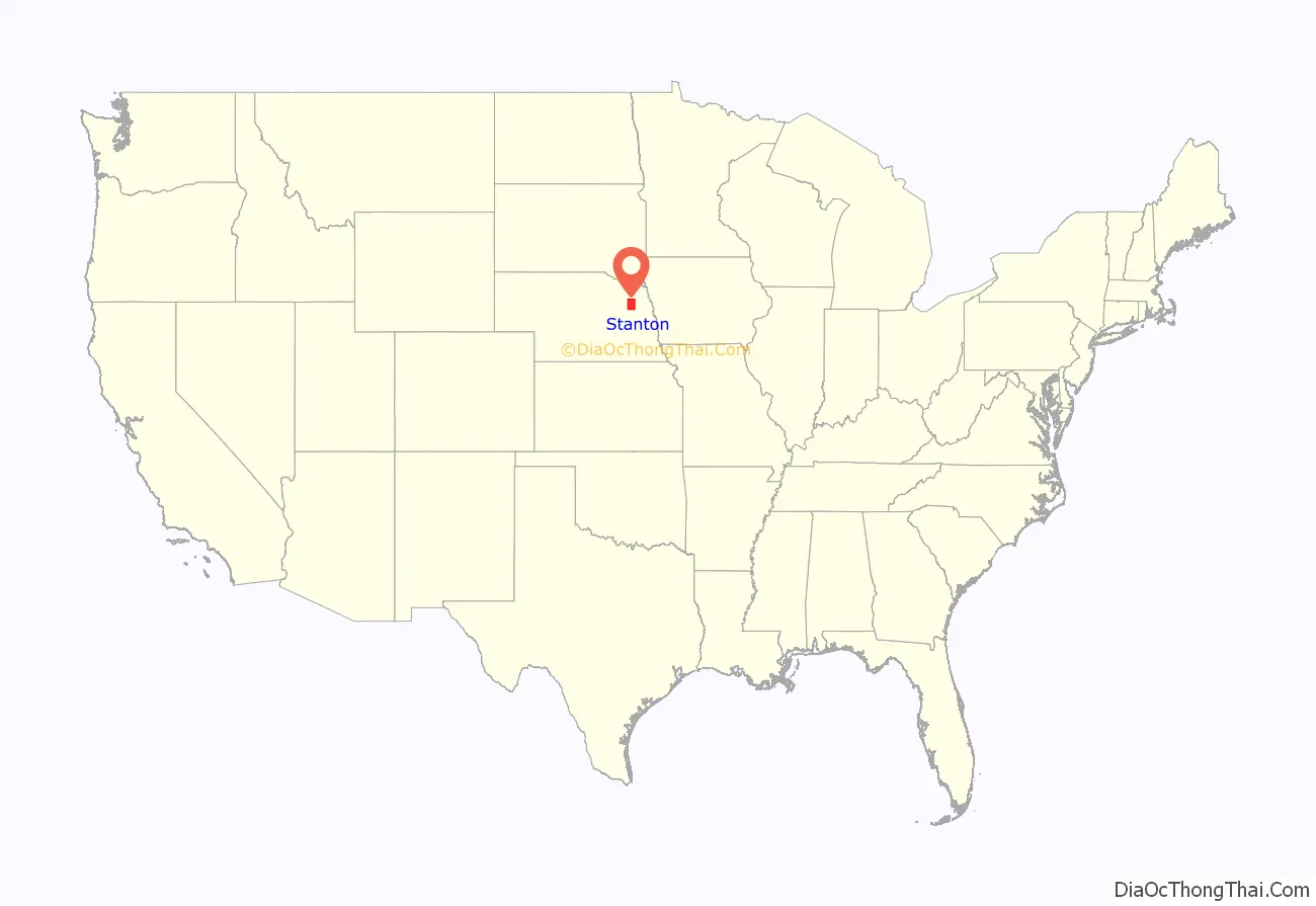
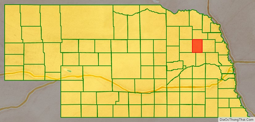
Stanton County location map. Where is Stanton County?
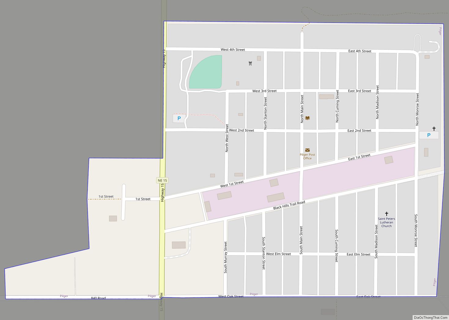
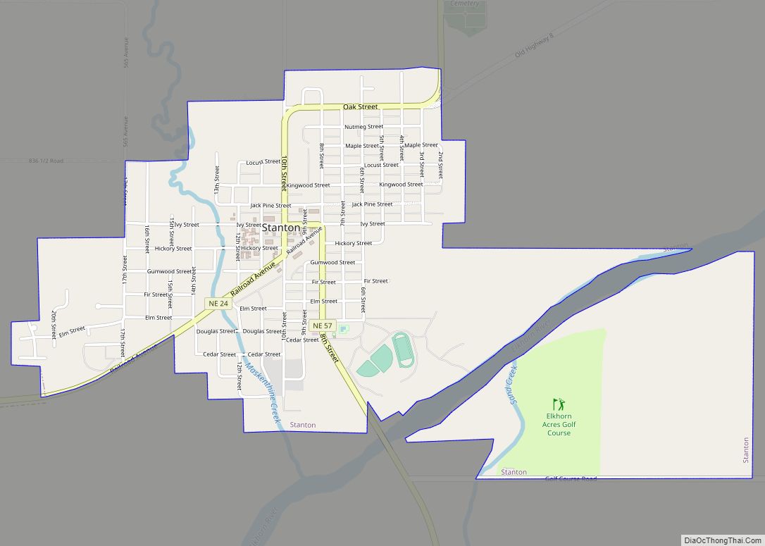
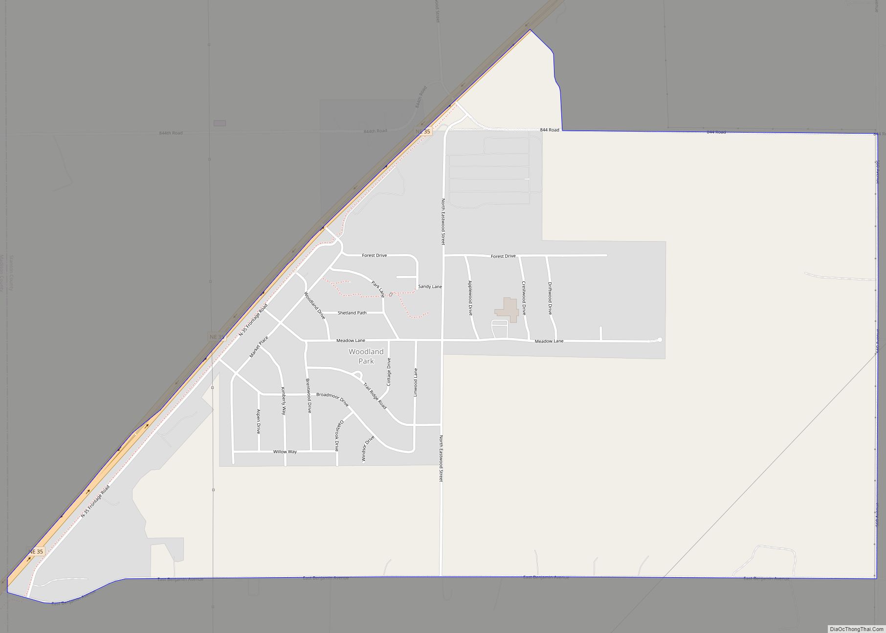
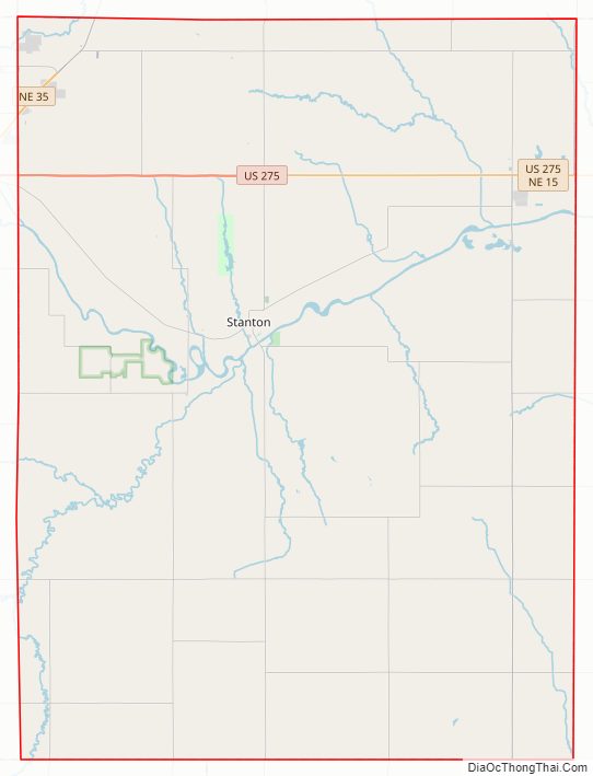
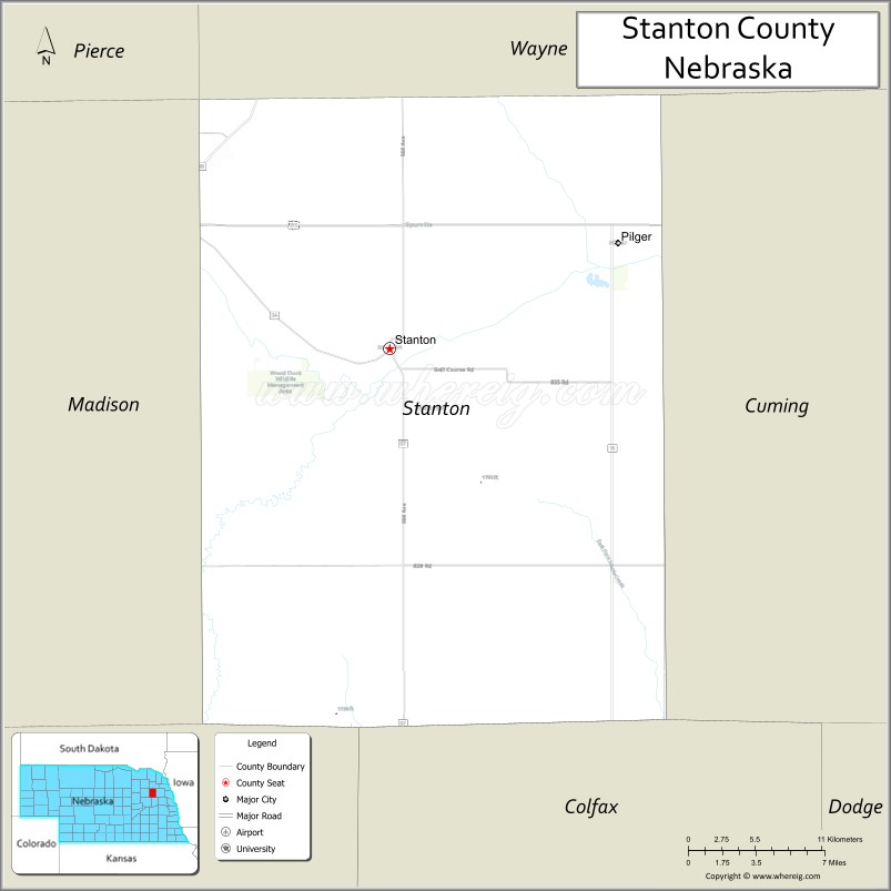
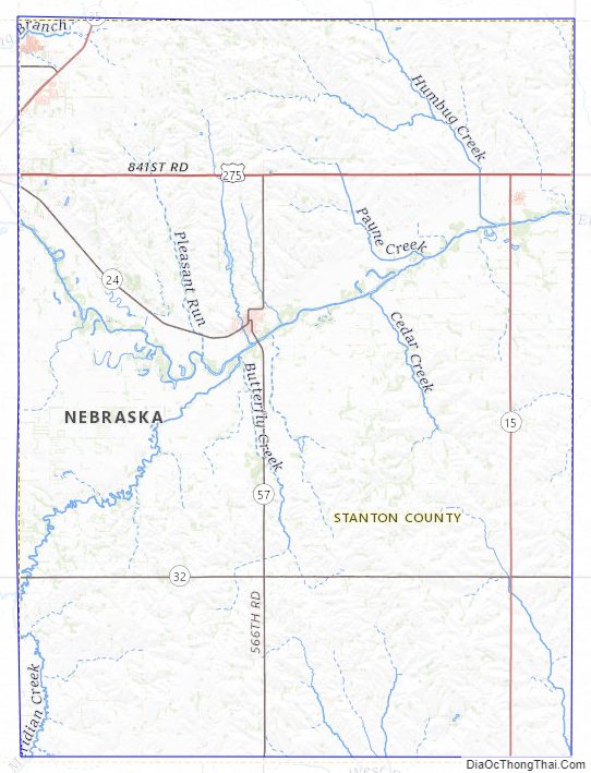
Stanton County Road Map
Geography
The terrain of Stanton County consists of low rolling hills, sloped toward the east. The Elkhorn River flows easterly through the upper central part of the county. The county has a total area of 431 square miles (1,120 km), of which 428 square miles (1,110 km) is land and 3.1 square miles (8.0 km) (0.7%) is water.
Major highways
- U.S. Highway 275
- Nebraska Highway 15
- Nebraska Highway 24
- Nebraska Highway 32
- Nebraska Highway 35
- Nebraska Highway 57
Adjacent counties
- Cuming County – east
- Colfax County – south
- Platte County – southwest
- Madison County – west
- Pierce County – northwest
- Wayne County – north
Protected areas
- Black Island State Wildlife Management Area (partial)
- Maskenthine Lake Recreation Area
- Red Fox State Wildlife Management Area
- Wood Duck State Wildlife Management Area
Stanton County Topographic Map
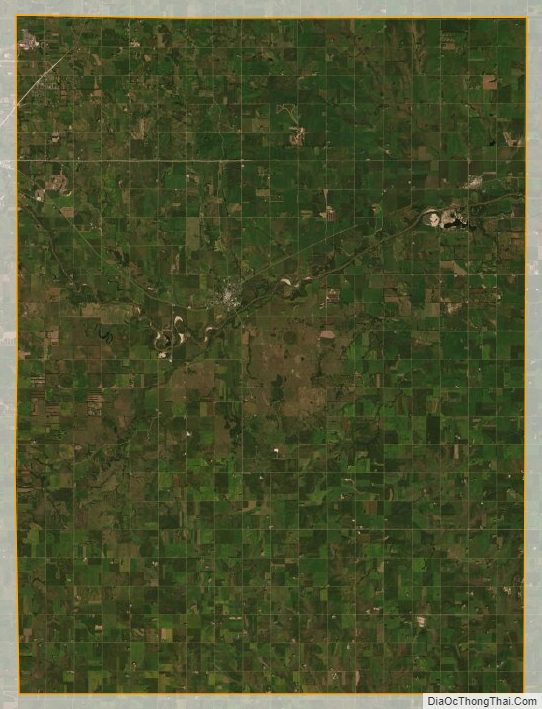
Stanton County Satellite Map
Stanton County Outline Map